
Home » Posts tagged 'Pasig' (Page 5)
Tag Archives: Pasig
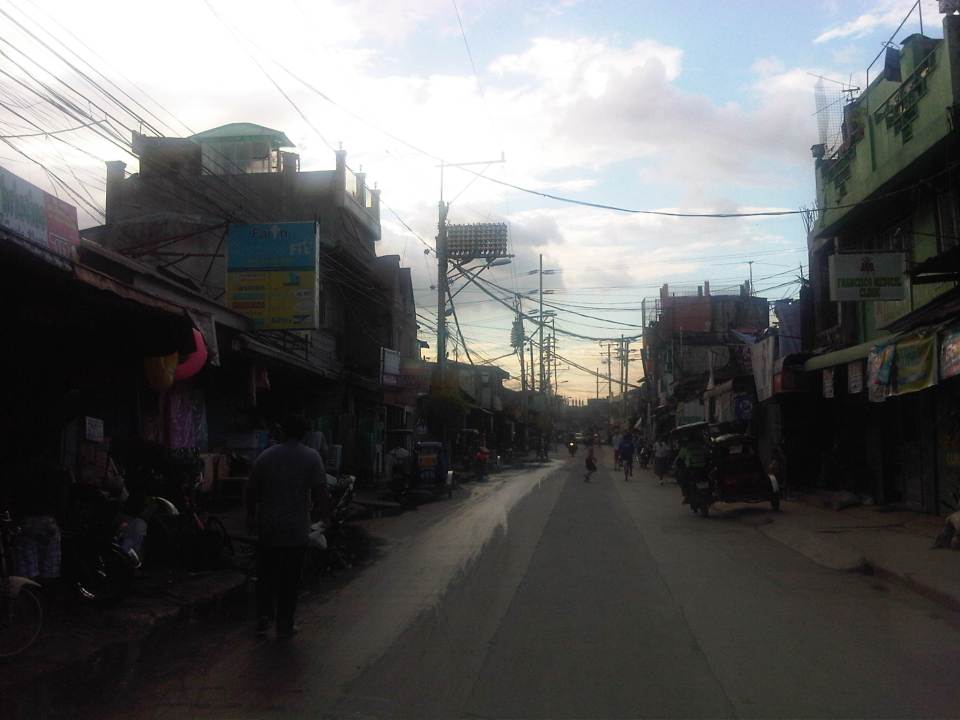
Floods and traffic
Transport and traffic problems take a backseat to the flooding problem during this time of the year in the Philippines. Since there are practically only two seasons (dry and wet) in the country, floods become a genuine concern once monsoon rains arrive and these are usually complicated by a high frequency of typhoons between August and November. Many major roads in Metro Manila are prone to flooding including Espana Avenue, Araneta Avenue, Gil Fernando Avenue, Ortigas Avenue, and EDSA. Flash floods often lead to traffic congestion and commuters and motorists alike would have a hell of a time traveling yet it seems very little has been done to address a situation that’s been here since the Spanish period. This is a perception by many people and a reasonable one given the historical evidence of flooding in the area and elsewhere in the country.
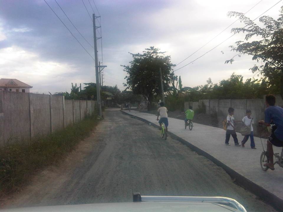
 Pedicab ferrying passengers in a flooded residential area
There are many images on the current floods in Mega Manila that one can find in various reports online and on TV. The Telegraph provides good photos for describing the situation around Metro Manila and the surrounding areas, and especially in the low-lying areas like Marikina, Malabon, Rodriguez and Cainta. These images could have been taken in any other year in the past and the images would probably be the same with slight changes in some buildings that could have been improved (e.g., additional floor?) in response to the flood experience.
Floods and possible solutions have been the topics of discussions every year and usually during this rainy season. While there have been efforts to address this problem, these are usually and obviously not enough and a more comprehensive approach is needed. Quite obviously, too, solutions that tend to dig up faults in urban planning throughout Metro Manila have led nowhere as legitimate residents and other locators in these areas are not in a position to give up their properties just like that. Relocating informal settlers and others who have encroached from waterways and other critical areas is a start but will have limited impacts in part because Mega Manila does not have a good drainage system in the first place.
Expensive as they are, engineering solutions like perhaps what Tokyo has done in this underground wonder. Of course, this example is a kind of ultimate solution and would require tremendous resources to realize. But then this is also like the transport and traffic problems we are experiencing where years (or decades) of inaction and hesitation due to resource and technical questions have led to the despicable transportation we have now The reality is that solutions will not get cheaper as we continue to balk at the cost of the required solutions. Floods and traffic will not be solved overnight. It will take years to improve the lives of many people in flood prone areas and implementing solutions should have started yesterday.
More bikeways please!
After the construction of a bikeways network in Marikina City, the city became a poster child for sustainable transport in the Philippines. The bikeways was initiated with assistance from the World Bank for the pilot route and was later expanded by the city under the leadership of its Mayors, the former MMDA Chair Bayani Fernando and his wife Marides Fernando. The bikeways were promoted as a good practice example for non-motorized transport (NMT), with the National Center for Transportation Studies (NCTS) of the University of the Philippines Diliman involving the Marikina City Bikeways Office (MCBO) in its studies and advocacy work on Environmentally Sustainable Transport (EST).
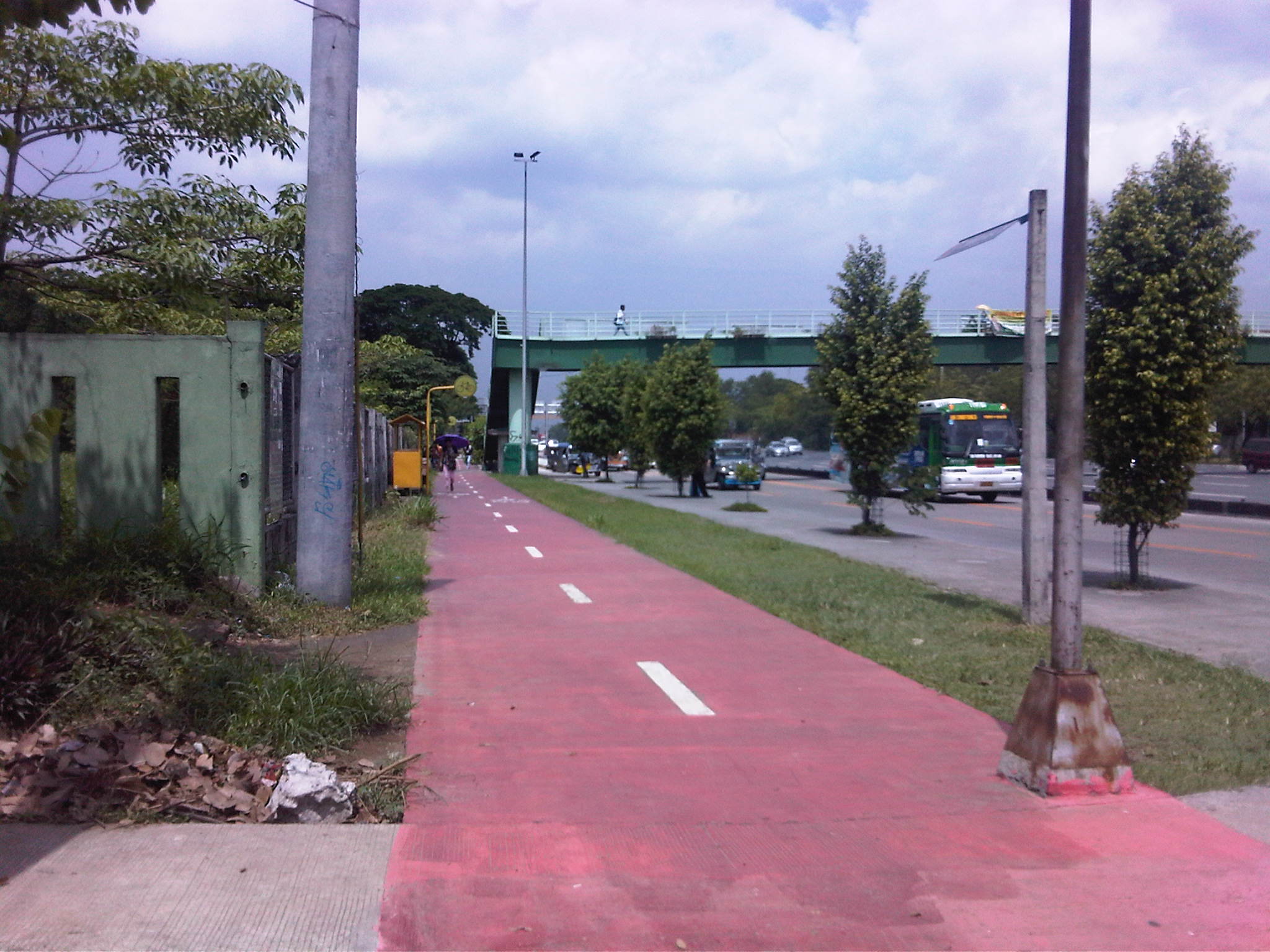
 Bikeways between pedestrian walkway (red pavement) and parking slots in Marikina City.
 Bike lane along the Academic Oval at UP Diliman in Quezon City.
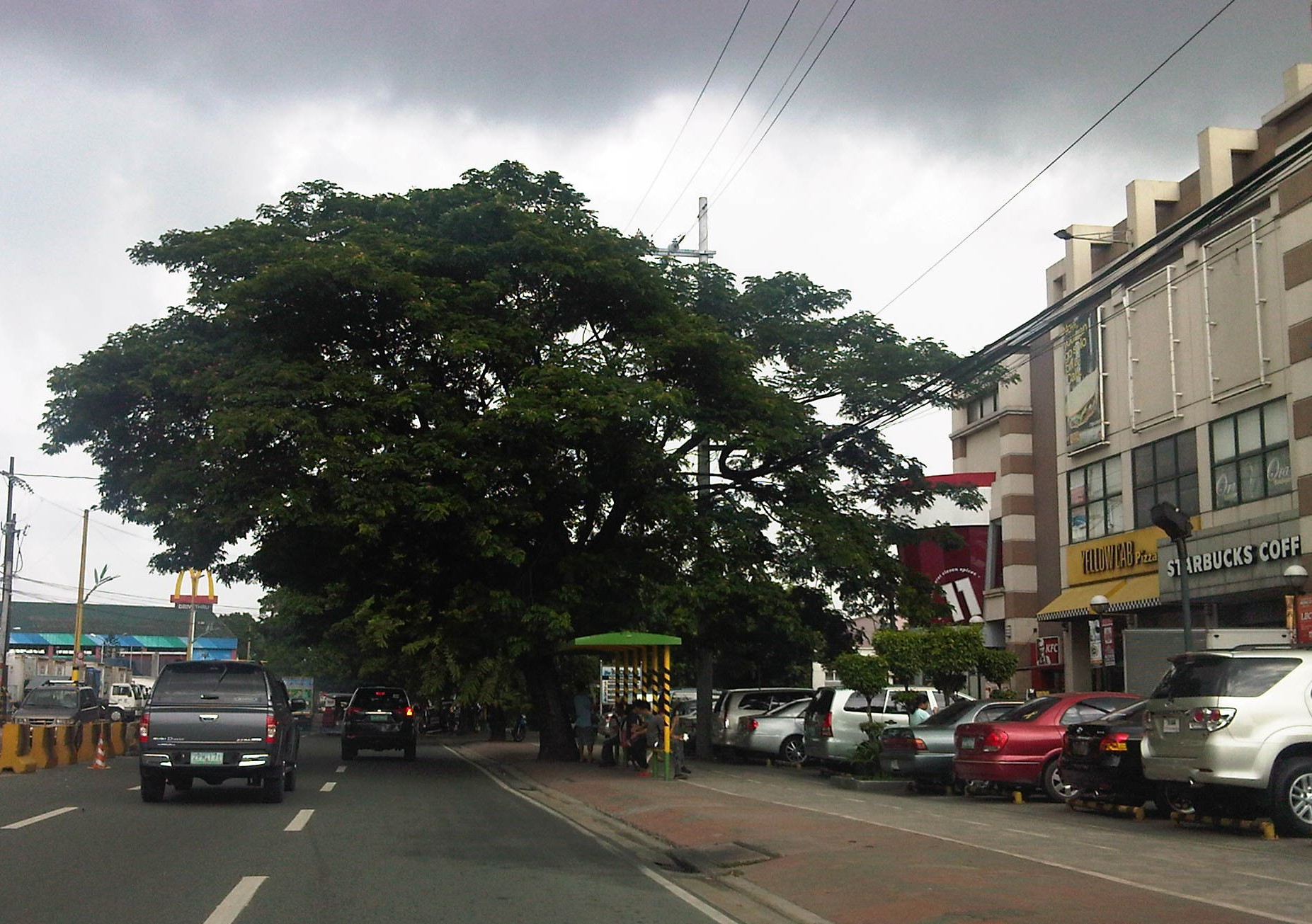
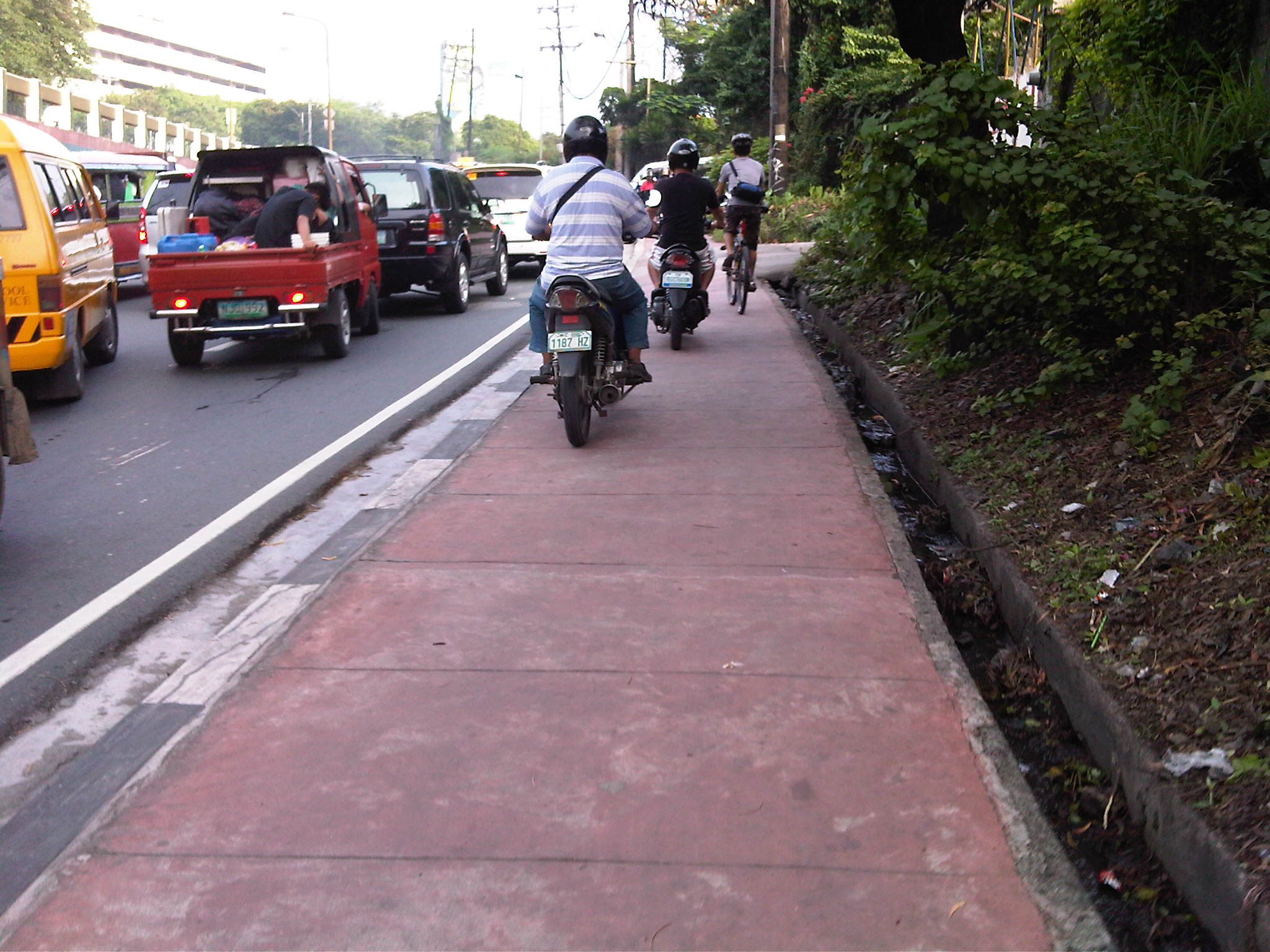
 Bike lane integrated into the sidewalks along Marcos Highway in the cities of Marikina, Pasig and Antipolo.
 Bike lanes (red pavement) in Malate, Manila.
 Bike lanes integrated with the sidewalks along Commonwealth Avenue in Quezon City.
 Bike lanes integrated with the sidewalks along Commonwealth Avenue in Quezon City.
This is obviously not a comprehensive list of bike lanes and bike ways in the Philippines. I am sure there are similar projects in other cities and I am aware that cycling is becoming more popular around the country. These are but examples of what has been accomplished so far and it is clear that we need to do more to promote cycling not just as a sport or for recreation but, more importantly, as a means for commuting. Integrating cycling into one’s daily routine is a healthy and money-saving option, and segregated bikeways and bike lanes ensure the safe travels for cyclists. This, of course, is in consideration of the little respect cyclists (and pedestrians) get from motorists who believe road space is theirs alone.
–
More pedestrian facilities please!
I took a couple of photos one late afternoon on a weekday on my way home. I wanted to have a picture of typical jeepney overloading during the afternoon peak. Typically, jeepneys would allow “sabit” or passengers hanging from behind the jeepney. This practice is actually prohibited and carries a fine if jeepney drivers are apprehended. And that is usually a big “if” considering enforcers turn a blind eye to the practice especially during peak periods when it is difficult to get a ride.
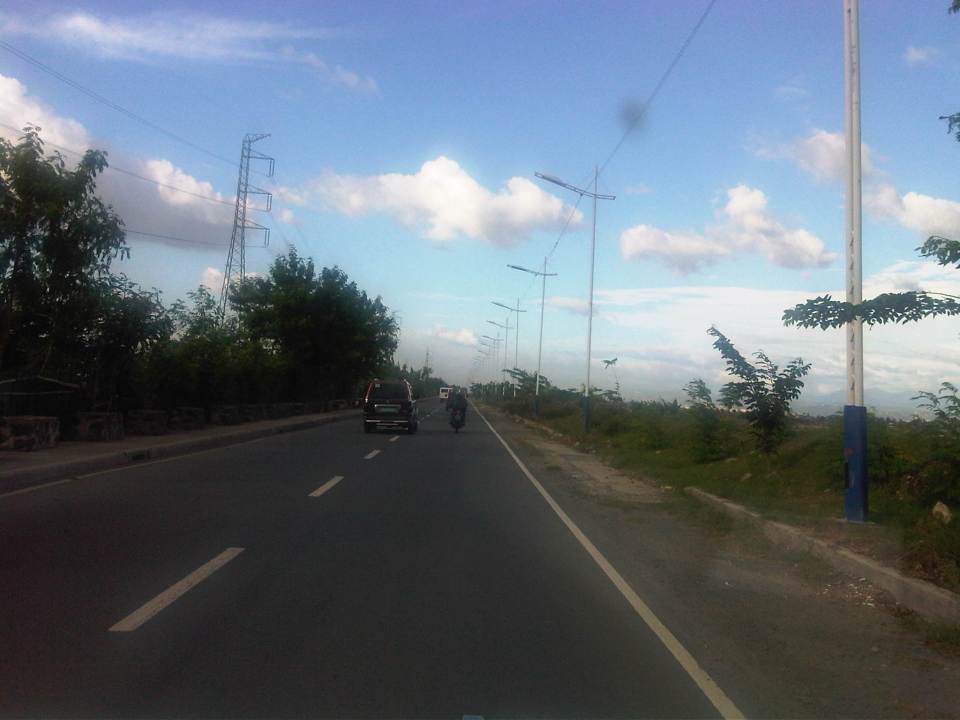
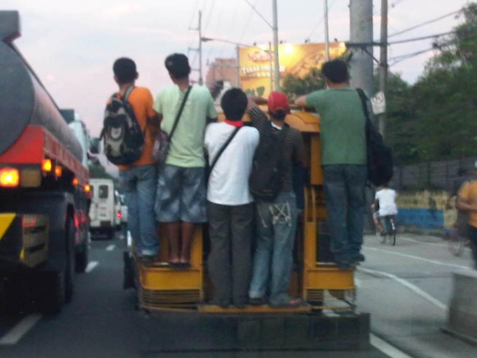 Jeepney full of sabit or hangers-on in heavy traffic along the eastbound side of a major highway
I also happened upon an opportunity to take a photo of the overloaded jeepney together with pedestrians walking along the walkway at the roadside. Though the photo was not so clear, it captured the image I wanted with people opting to walk while others took a risky ride on a jeepney. The cyclists in the photos were just bonuses and added to the visual of alternatives for mobility.
 Pedestrians and a cyclist along the widened walkway/bikeway along Marcos Highway
Walking remains as the mode of transport with the highest share when all modes, motorized or non-motorized, are compared. While there is a strong clamor from cyclists for bikeways and for cycling to be taken up by more people as an option for commuting, the reality is that cycling is not really for everyone. It is a viable and healthy mode but should also fit in a hierarchy of modes. Most people walk and walking should be encouraged over distances where it is most suitable. Facilities for walking need to be provided and properly designed so that people can walk safely and most efficiently like the example in the following photo taken during another weekday late afternoon.
 People walking along Marcos Highway
Local governments help promote walking by making sure sidewalks are provided and clear of obstructions. Perhaps walkability can be used as an indicator or parameter for a city to be qualified as livable and true to the advocacy of sustainable transport. Walking should be encouraged to promote healthy living as it incorporates exercise in our daily routines. More people walking should also increase awareness for the advocacy for clean air and help initiatives to improve air quality, particularly efforts to reduce harmful emissions by motorized vehicles. Thus, it is not difficult to understand how investing in pedestrian facilities and promoting walking is not a smart move and a beneficial one for any politician’s constituency.
–
Swapang! or the perils of walking
Walking to the jeepney terminal for a ride to the university, I was irritated by the constant honking behind me as motorcycles rode up the sidewalk to avoid the weaving into congested traffic along Aurora Boulevard. And so I tried to stand my ground allowing only half the space of the sidewalk for these motorcycles to pass through. As far as I’m concerned, I was already too generous giving part of the space that is for pedestrians and not for motorized traffic. Still, there were a few motorcyclists who seem to think they had the right of way as they attempted to convince me give up more space so they could practically take over the sidewalk. I didn’t give way and assumed they were cursing me inside their helmets. Manigas sila! I thought that in the end, sila ang asar at talo in this situation, not me.
 Motorcycles dominating space for pedestrians
At one point, I held my ground and didn’t give way to the motorcycles behind me [Advisory: This is not for everyone especially those who are “pikon” or who are looking for a fight.]. I knew my rights and I was walking on the pedestrian sidewalk. Unfortunately, a bicycle came along and I gave way only because I also appreciated cycling and understood that pedestrians and cyclists are sort of “kindred spirits” in a world dominated by motorized transport. The bicycle was immediately followed by two motorcycles including one that almost sideswiped the cyclist. I took the photo above to better show the situation.
The other day, I chanced upon a similar situation as I was driving in heavy traffic along Amang Rodriguez in Pasig City. What little space was available for pedestrians along a narrow sidewalk along this road connecting Marikina and Pasig cities.
 Motorcycles using a narrow pedestrian sidewalk to avoid traffic congestion along Amang Rodriguez
These cases are clear examples of swapang attitude or behavior that is prevalent among many road users. Unfortunately, these are not apprehended or accosted by traffic enforcers. The latter seem to be more engrossed with number coding and swerving violations, anyway, that they seem to have forgotten all the other traffic violations that included this brazen behavior of motorcyclists. Perhaps enforcers should go back to the basics and take more notice of all those other violations (e.g., speeding, counter flowing, beating the red light, beating the green light, etc.) to improve and promote discipline on our roads.
–
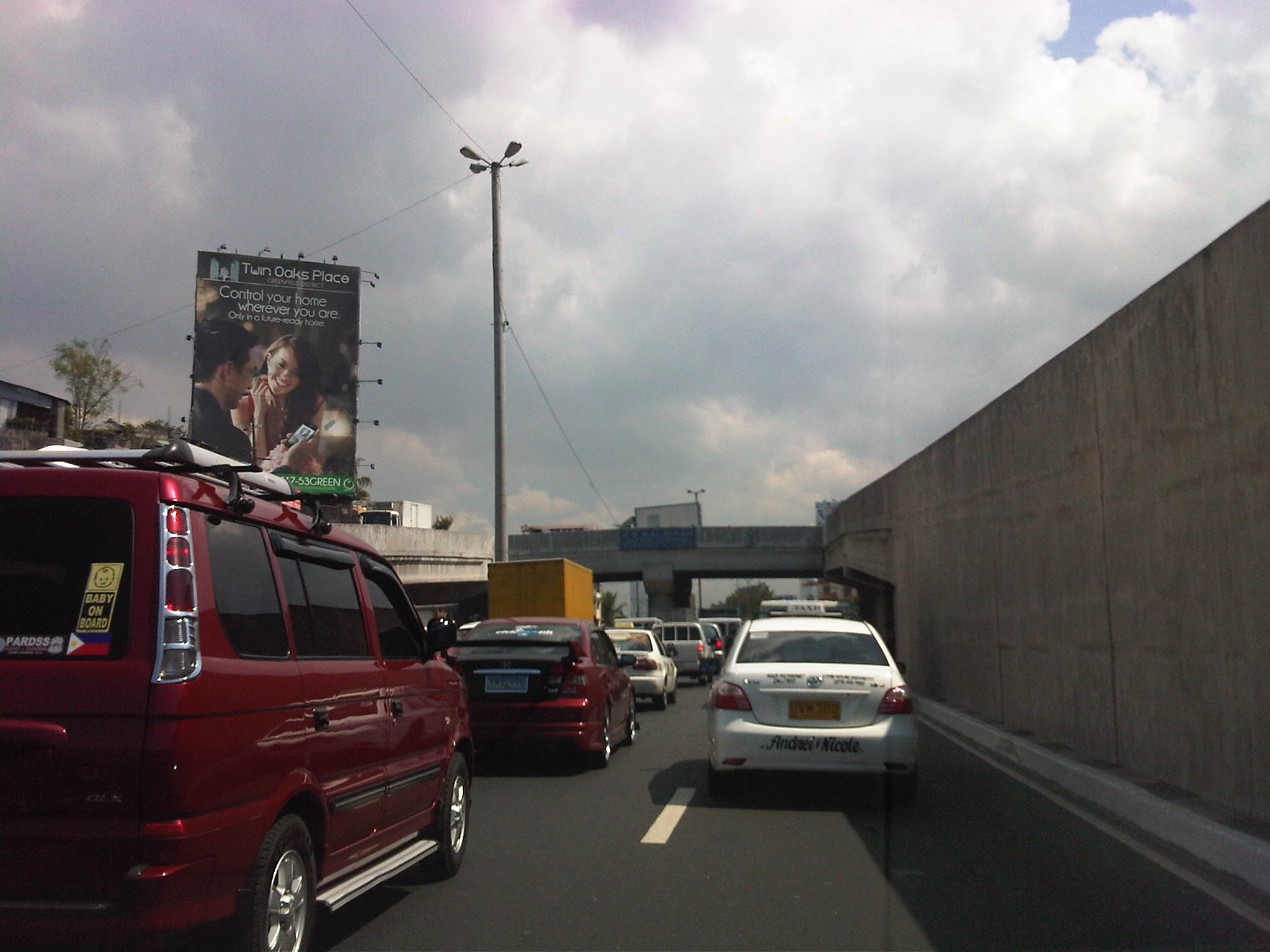
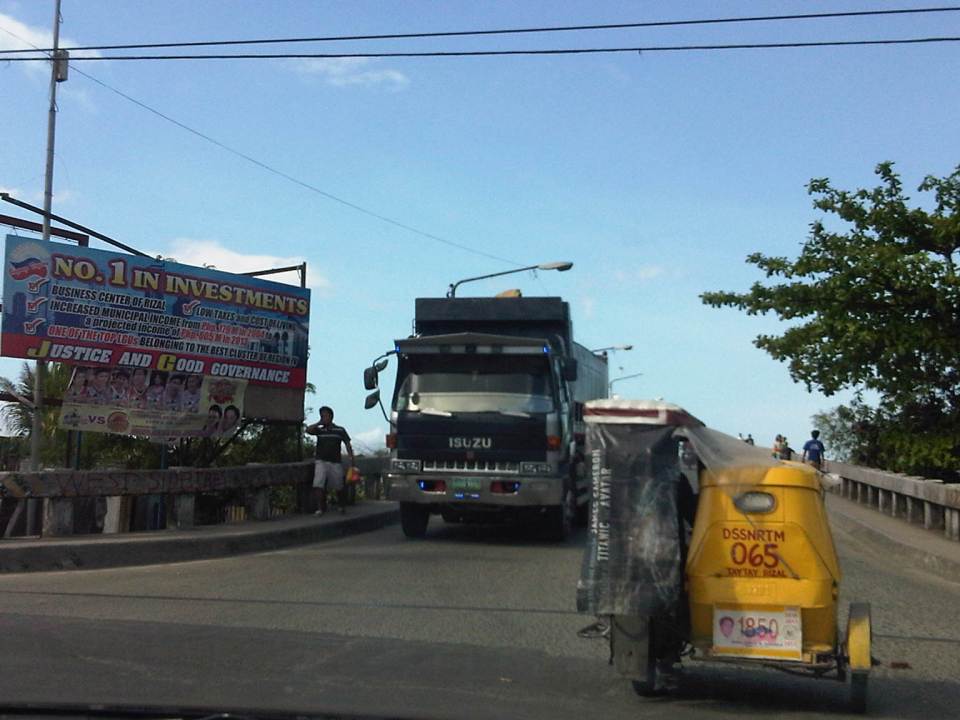
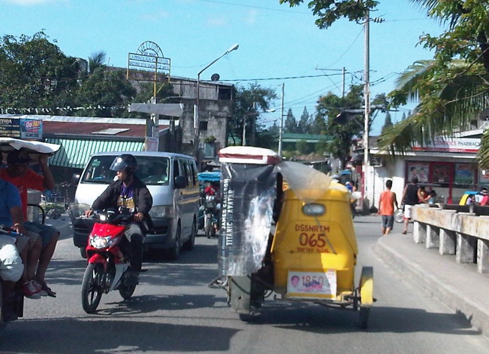
Common causes of traffic congestion along Philippine roads
As a follow-up to a previous post on traffic congestion, I am writing on some of the most basic causes of congestion along Philippine roads. I say most basic because these are the usual situations we see along the road as we commute. And these are also supposed to be easily solved or addressed by the most basic approaches – enforcement. Here are a couple of photos and commentaries on this matter.
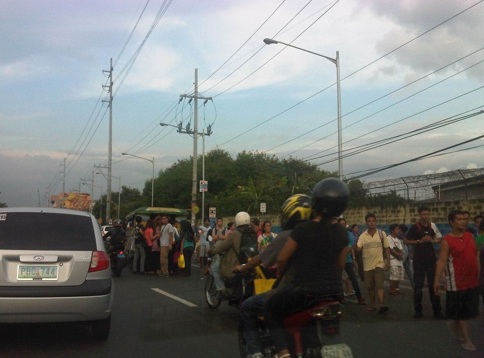 Commuters occupying two lanes of the road as they wait for public transport along Marcos Highway in Pasig – PUVs like the jeepney in the photo stop in the middle of the road to load/unload passengers. Were there traffic enforcers/aides in the area? Sometimes. Were they doing their jobs? Definitely not. In many cases, I’ve seen enforcers using the congestion (i.e., slowed traffic) to apprehend number coding violators. Now, number coding is premised on motorists being discouraged from traveling during certain times of the day to reduce congestion from vehicle volume. In the photo above, it’s pretty clear that the problem isn’t number coding violators but the mayhem caused by public transport and commuters. Something that traffic enforcers/aides could have acted on and with regularity and persistence so that they can positively influence jeepney driver and commuters towards orderly conduct.
 On-street parking and pedestrian activity along Manila roads – many cities such as Manila are guilty of not having any serious initiatives to address on-street parking. In many cases, its tolerated particularly in commercial areas as local governments don’t like to engage business in what they assume to be the small issue (or non-issue) of parking. In the case of pedestrians, it is a behavioral thing that requires a bit more effort than police or enforcer visibility (or the occasional apprehension). As a result, people will generally cross wherever they want and walk along the carriageway, not minding their safety. Of course, such behavior is encouraged by the absence of space for walking as vehicles, merchandise and other stuff occupy space that’s supposed to be for pedestrians.
–
Night time congestion along C-5
Traffic congestion along Circumferential Road 5 is experienced practically throughout the day with the worst congestion along the southbound direction during the mornings between the Riverbanks Road in Quezon City and Kalayaan Avenue in Makati City, and the northbound direction between Bonifacio Global City and Eastwood from noon to nighttime. The following photos taken by my wife as I fetched her one night from her office shows the traffic jam along C-5 as we turned from the flyover past Market! Market! towards the highway.
 Congestion along the C-5 northbound is a regular thing during the weekdays from the afternoon to late at night. While apps like the MMDA’s Traffic Navigator and Waze allow us to have an idea of how congested C-5 is during such periods, the actual experience is much worse than what many of us can just imagine from the apps.
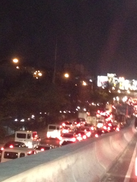
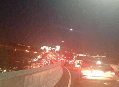 As far as the eye could see – congestion in the form of the taillights of vehicles along the northbound side of C-5 indicate just how many people are caught in traffic from Taguig all the way to Pasig and beyond. The giant billboards from Kalayaan Avenue to Pasig Boulevard including those seen along the bridge crossing the Pasig River. Most of these people are office workers coming from Makati and Global City and heading home to Quezon City, Pasig, and the towns of Rizal. After 7 PM, trucks add to the traffic
Many people are asking if there is a solution in sight for congestion along C-5. To be frank, there is none in the immediate future. There are proposals to introduce a public transport system along the corridor with one option being a Bus Rapid Transit (BRT) and another an elevated rail transit line. The BRT line is a recommendation of a Pre-FS for Metro Manila BRT conducted around 6 years ago though there was a proposal for a bus system (Philtrak) along the same corridor back in the late 80’s and pursued for some time during the 90’s. Not much have been done towards realizing any of these proposals. An efficient mass transit system along the corridor could encourage people to shift from private to public transport and help reduce vehicular traffic along C-5 considering that even as I write this post, vehicle ownership is increasing in Metro Manila and its environs and this could only mean more congestion along C-5 and other roads.
–
Daily penance: traffic congestion along C-5
People have been telling me about the traffic congestion along Circumferential Road 5 (C-5) and I am quick to reply that I know the feeling as I’m one of those who have driven or traveled along C-5 and experienced first hand the traffic congestion, which is worst during the mornings (southbound) and late afternoons and evenings (northbound). Midday traffic jams are not uncommon as C-5 is a truck route and large vehicles contribute to clogging especially at bottlenecks like the U-turns slots along the highway and bridge crossing the Pasig River. C-5 has been this way since its opening (or more appropriately the completion of missing links along the main alignment).
It will not get better. It will only get worse. I say so because of the annual increase in vehicle ownership, including motorcycles, in what is now termed as Mega Manila. I dare say so because of the backlog of public transport infrastructure in the metropolis (or megalopolis?). It is well established that efficient public transport infra and services are good incentives for people to commute rather than drive. This means there will be less vehicles on the road and therefore there will be less congestion as basically only those who really need to drive would be using their cars on a regular basis. Of course, it is not as easy at it seems considering trip making and mode choices are in reality complicated matters. But then the availability of viable, acceptable choices for travel, especially in the urban setting allows for people to have better mobility and more equitable use of the transport system than a car-oriented city. Until then, when we do have the public transport system that our cities require, it will be a daily penitensya for many of us traveling and not just along C-5.
 Congestion along the southbound side of C-5 approaching the flyover crossing Ortigas Ave. The flyover can be seen in the horizon.
 Congestion along C-5 southbound in the Bo. Ugong area approaching the junction with Lanuza Avenue. An overpass was proposed for construction along this section but now it doesn’t look like it will do any good considering the bottleneck is the Pasig Flyover and the bridge across Pasig River.
 Congestion along C-5 southbound at the Pasig flyover. The flyover has 2 lanes per direction and vehicle breakdowns or road crashes have resulted in terrible traffic jams.
 Congestion along C-5 northbound at the C-5/Kalayaan junction. The north U-turn flyover, one of two in the area, is shown in the photo. An underpass was initially proposed, designed and approved (with budget from a JBIC loan) at the junction. A previous MMDA Chair, however, didn’t agree and successfully maneuvered for the twin U-turn flyovers to be constructed instead.
–
Highway 2000 and Barkadahan Bridge
There is an alternate route from the towns of Rizal Province to Taguig and Makati. The route will allow people to avoid the congested Ortigas Avenue, C-5 and EDSA, which is the typical route between the Makati CBD and Bonifacio Global City and the Rizal Province towns along Ortigas Avenue Extension and the Manila East Road including Cainta, Taytay, Antipolo, Angono and Binangonan. The alternate route utilizes a road that was constructed as part of a network of roads intended to encourage development in idle lands in Taytay that came out of the reclamation that was part of the Manggahan Floodway project.
 One-way section beside the Taytay Public Market
 Parts of the market were under renovation
 Past the market, Highway 2000 becomes a 2-way road. There are no lane markings and the pavement shown in the photo indicates a poorly maintained road.
 Along the road are subdivisions, a few commercial establishments, a columbarium under construction, informal settlers and much open space.
 Junction with the Manggahan East Bank Road and approach to the Barkadahan Bridge
 Crossing the East Bank Road to the 2-lane Barkadahan Bridge, you can immediately notice the narrow sidewalks along each side of the bridge. I think they should have designed this to be wider considering the significant number of people crossing the bridge on foot.
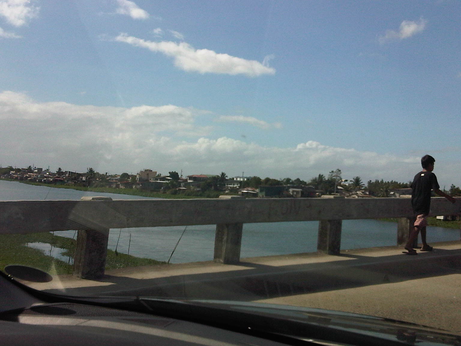
 One can have a good view of the southernmost end of the Manggahan Floodway from the bridge.
 The view shows a lot of informal settlers along both the west and east banks of the floodway and a lot of water lily and kangkong on the waters, which lead to the Laguna de Bay.
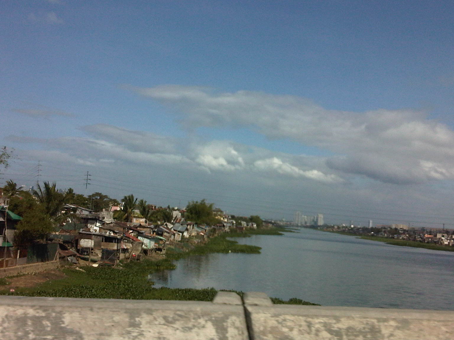
 Shanties along the west bank of the floodway. The tall buildings in the horizon and downstream from the bridge are located in Quezon City’s Eastwood along Circumferential Road 5. Behind Eastwood is the Marikina River, which connects to the Manggahan Floodway via the Rosario Weir.
 The other end of the Barkadahan Bridge is a junction with the Manggahan West Bank Road and a generally residential area that is still part of Taytay, Rizal.
The same route can also be used by those residing in Pasig and Marikina cities to the east of the Manggahan Floodway as there is a direct connection to Highway 2000 and the Barkadahan Bridge via the East Bank Road of the Floodway.
–
C6: Bicutan to Napindan
I wrote about Circumferential Road 6 (C-6) in a previous post where I featured some photos taken while we were en route to the DOST compound in Bicutan, Taguig City. It was originally constructed as a dike road, an access road along the barrier constructed along the coast of Laguna de Bay to provide additional protection to Taguig City against the lake waters breaching the banks during incidence of heavy rains. Once the link between Taytay, Pasig, Pateros and Taguig was completed, however, traffic significantly increased as C-6 provided a very convenient alternate route for people residing in the east who had to go to Makati, Taguig or southern Metro Manila mostly for work trips. Following are photos showing C-6 from Bicutan to Napindan, before crossing to Pasig City.
 Tree-lined – one can imagine how the highway will look like once the trees planted along either side are full-grown
 C-6 is a two-lane, undivided highway with a sidewalk along the Taguig side and a shoulder along the dike along the coast of Laguna de Bay
 Approach to the intersection with Seagull Ave., which connects M.L. Quezon Ave. and Taguig proper in the west and Bay Breeze Subdivision in what appears to be a small peninsula on the bay.
 Most sections of the existing C-6 have no pavement markings.
 The entire road is of asphalt concrete pavement.
 There are several pumping stations along C-6, which reminds people of the flood control aspect of the dike and the road. The photo shows the Taguig Pumping Station operated by the MMDA.
 While C-6 provides an alternative route for travelers from the eastern towns of Rizal wanting no part of the traffic congestion along Ortigas Avenue and C-5 en route to Makati or Taguig (or back from these areas), peak traffic is usually predictable and at other times of the day, volumes are quite low as shown in the photos.
 There aren’t any significant developments or establishments for most part of C-6.
 The undeveloped lands are mainly due to these areas being flood prone, and requiring extensive improvements to raise elevations and provide for adequate drainage.
 Labasan pumping station – is practically the only building for a long stretch of the highway.
 Past the Labasan Pumping Station, are more undeveloped areas along the highway. At right in the photos is the dike that serves as
  The bridge across the Napindan channel of the Pasig River is further ahead (downstream), which travelers can use to cross to Pasig City.
The stretch of C-6 from M.L. Quezon to Napindan is currently subject to studies for widening as traffic steadily increases due to the very strategic position of the road. However, there should be a more direct link between C-6 and C-5 so as to maximize the benefits of the road, particularly as an alternative route between Rizal province, and Bonifacio Global City and Makati CBD. I estimate that travels times can be reduced significantly for people traveling between their homes in Antipolo and Taytay to the offices in Makati and Taguig (Fort Bonifacio). On a normal day, this trip can take easily more than 60 minutes due to congestion along Ortigas and C-5, the usual route for most people. With the alternate route, it might just be possible to reduce it to say 45 minutes, give and take some congestion. Of course, once this alternate route is discovered by more people (and UV Express vehicles are already using this route), then it would attract more traffic and necessitate an increase in capacity for it to handle such traffic. But then the result may well be an easing in traffic along Ortigas and C-5 so that should be good until perhaps we finally have a good public transport system in place along Ortigas and C-5. BRT? That deserves another post…
–
Roads in Pasig: Ejercito Avenue
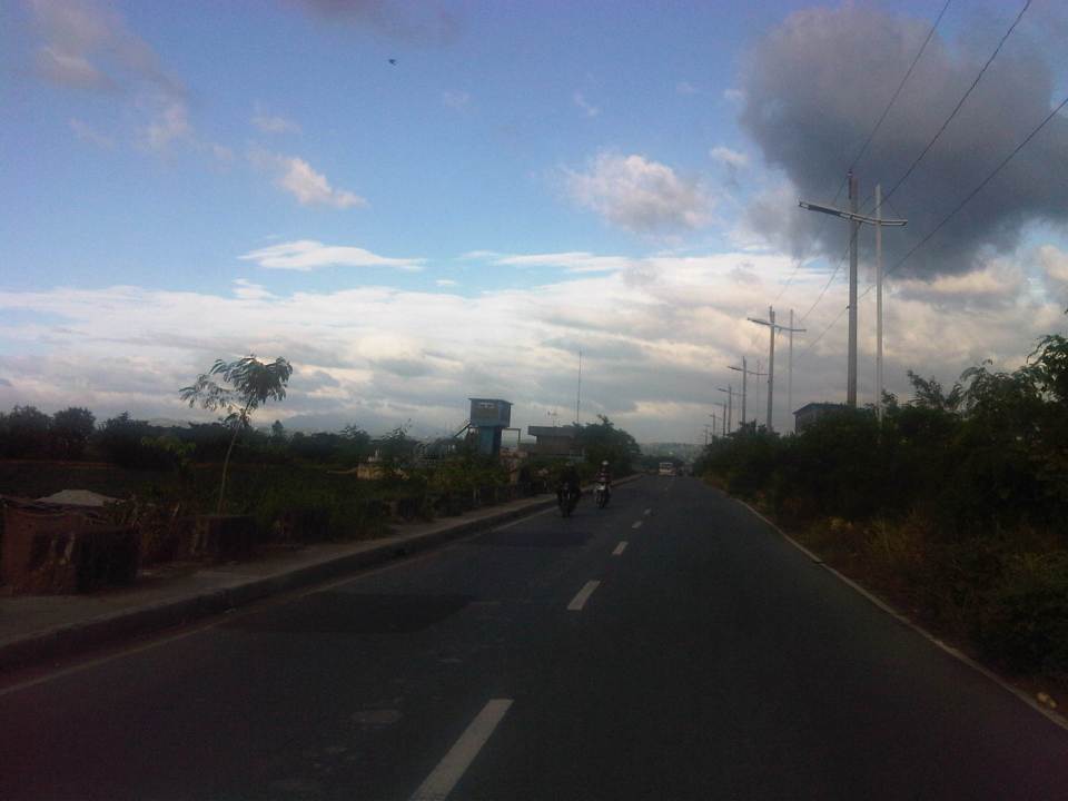
Upon reaching the end of the existing C-6, travelers encounter an intersection at the mouth of the Manggahan Floodway that leads to Taytay, Rizal via the Barkadahan Bridge. Turning right leads to Taytay while turning left leads the traveler to Pasig City via Sandoval Avenue. C-6 and Sandoval Avenue are linked by a short road named Ejercito Avenue.
 Turning left from C-6, travelers are greeted by the walls of exclusive residential subdivisions.
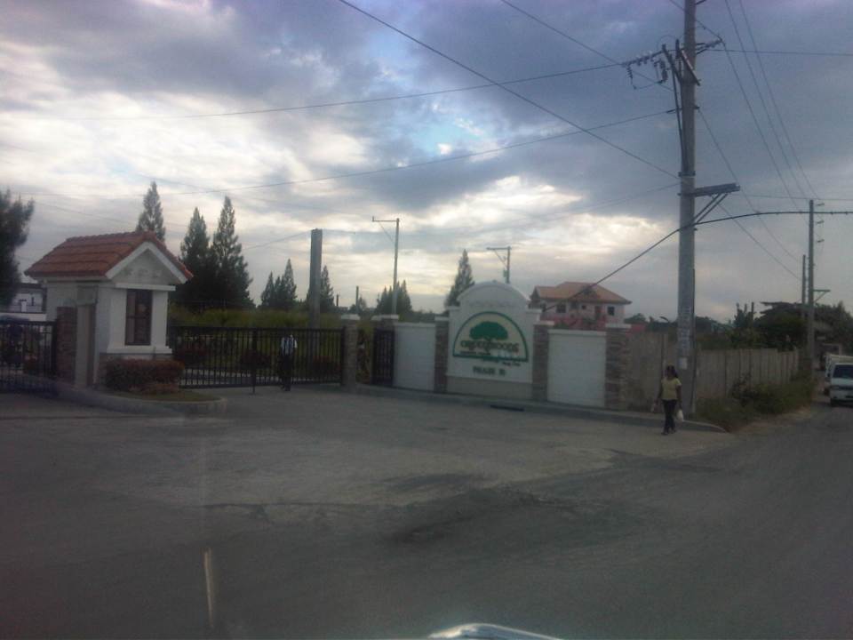 Among these subdivisions is Greenwoods, whose Phase 10 is located near C-6 and the Manggahan Floodway to Taytay, Rizal.
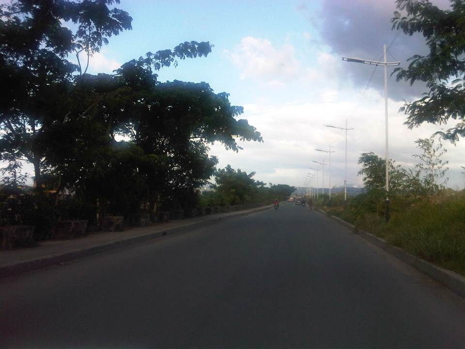
 The easternmost section of Ejercito avenue was under rehabilitation when we passed the road. Only one lane, the one where the sub-base was exposed, was available to motorized traffic. The other lane is presumably still in the curing stage but is used by pedestrians and cyclists.
 Past the section under repair is a section that’s showing a lot of pavement distresses that appear to be partly due to patch-up work by a water concessionaire (note the features of the concrete slab in the middle of the road where an excavation for waterworks used to be).
 Rehabilitated section of Ejercito Avenue features what appears to be properly cured pavement but with curb only along one side.
  Open residential area in Pinagbuhatan, Pasig where one can see that the pavement is higher in elevation compared to the ground floors of most houses. This us usually an indication that the area is prone to flooding.
 Some parts of the road pass through what appears to be unplanned developments typical of informal settlements or resettlement areas for people from Pasig and other cities of Metro Manila. Notice the bunch of meters installed by the Meralco on the post in the middle of photo? That’s another indicator associated with crowded, unplanned areas. I always wonder how Meralco staff are able to read the meters and collect payments due. I assume there are still significant losses here due to jumpers that are eventually subsidized by those who do pay their bills.
 Noticeable in this photo, the previous one and the next one are indications of previous waterworks in the area. The pipes are laid out under the middle of the road and so requires excavations in cases when maintenance works need to be undertaken.
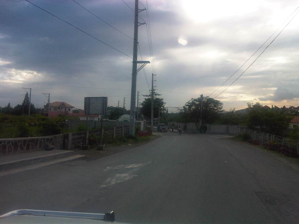
 Ejercito Street ends where P. Sandoval Avenue begins. From what we observed this transition from one road to another is not a clear one except perhaps to those who are familiar with the area such as residents of Pinagbuhatan, Pasig City.
–
