
Home » Highways and Streets (Page 22)
Category Archives: Highways and Streets
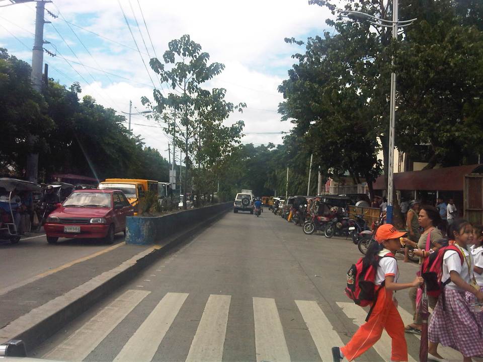
Roads in Pasig: Ejercito Avenue
Upon reaching the end of the existing C-6, travelers encounter an intersection at the mouth of the Manggahan Floodway that leads to Taytay, Rizal via the Barkadahan Bridge. Turning right leads to Taytay while turning left leads the traveler to Pasig City via Sandoval Avenue. C-6 and Sandoval Avenue are linked by a short road named Ejercito Avenue.
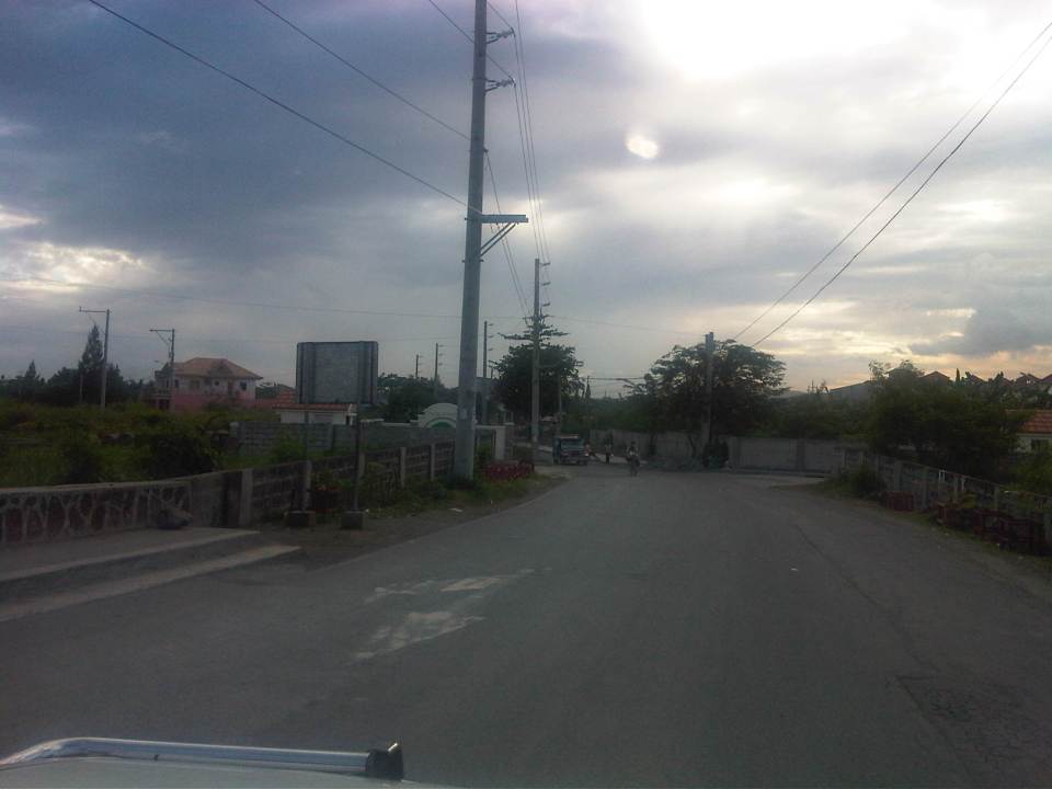 Turning left from C-6, travelers are greeted by the walls of exclusive residential subdivisions.
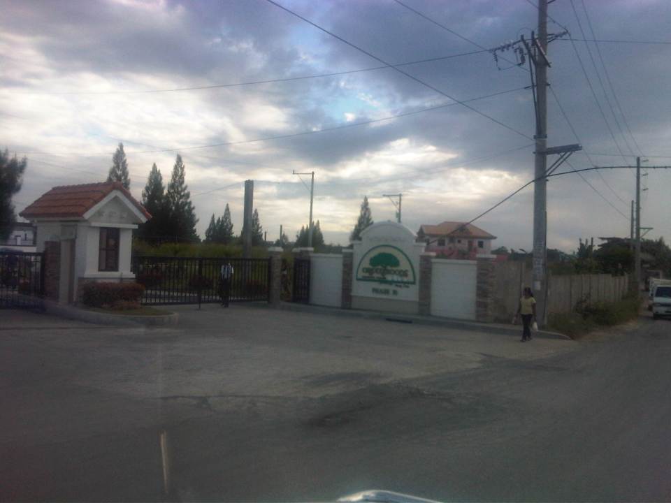 Among these subdivisions is Greenwoods, whose Phase 10 is located near C-6 and the Manggahan Floodway to Taytay, Rizal.
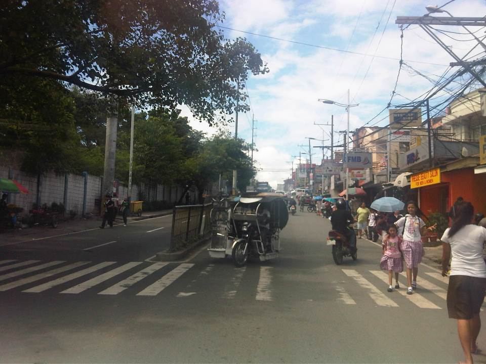
 The easternmost section of Ejercito avenue was under rehabilitation when we passed the road. Only one lane, the one where the sub-base was exposed, was available to motorized traffic. The other lane is presumably still in the curing stage but is used by pedestrians and cyclists.
 Past the section under repair is a section that’s showing a lot of pavement distresses that appear to be partly due to patch-up work by a water concessionaire (note the features of the concrete slab in the middle of the road where an excavation for waterworks used to be).
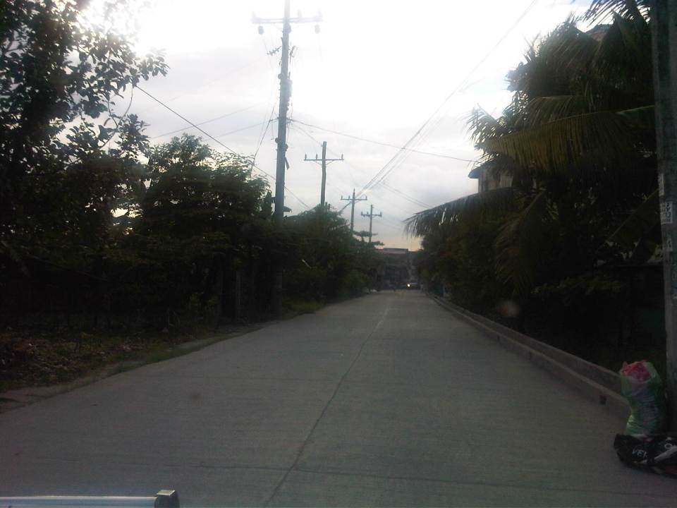 Rehabilitated section of Ejercito Avenue features what appears to be properly cured pavement but with curb only along one side.
 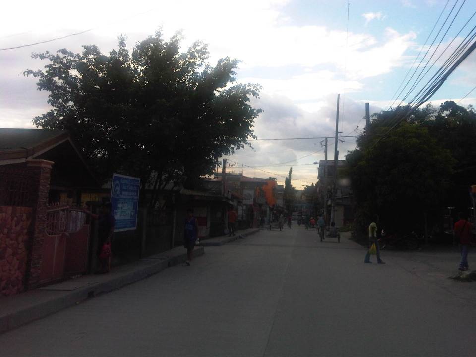 Open residential area in Pinagbuhatan, Pasig where one can see that the pavement is higher in elevation compared to the ground floors of most houses. This us usually an indication that the area is prone to flooding.
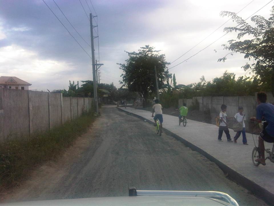
 Some parts of the road pass through what appears to be unplanned developments typical of informal settlements or resettlement areas for people from Pasig and other cities of Metro Manila. Notice the bunch of meters installed by the Meralco on the post in the middle of photo? That’s another indicator associated with crowded, unplanned areas. I always wonder how Meralco staff are able to read the meters and collect payments due. I assume there are still significant losses here due to jumpers that are eventually subsidized by those who do pay their bills.
 Noticeable in this photo, the previous one and the next one are indications of previous waterworks in the area. The pipes are laid out under the middle of the road and so requires excavations in cases when maintenance works need to be undertaken.
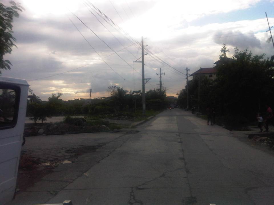
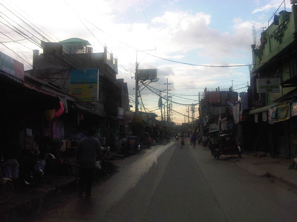
 Ejercito Street ends where P. Sandoval Avenue begins. From what we observed this transition from one road to another is not a clear one except perhaps to those who are familiar with the area such as residents of Pinagbuhatan, Pasig City.
–
Shaw Boulevard: Kapitolyo to St. Francis
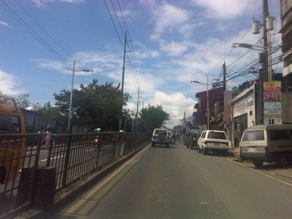
I have not been to Shaw Boulevard for quite some time so I decided to take photos en route to a speaking engagement at my alma mater, a school located along the major thoroughfare. Though I have commuted between my parents’ home in Cainta to school using this route and some landmarks remain, a lot has definitely changed in the area including the skyline along the boulevard. I have memories of vast grasslands where the buildings of Ortigas Center now stand. One could see EDSA traffic from the balcony of St. Francis Church in the 1970’s and the 1980’s as there were still no SM Megamall, Shangri-la or ADB along EDSA. The old provincial capitol site (Pasig used to be part and the capital of Rizal Province) is now being redeveloped into a commercial center after it was bidded out and the capital moved to Antipolo City. It was the Rizal provincial capitol which gave Barrio Kapitolyo in Pasig its name.
 Turning from Meralco Ave, one is greeted by the view of tall buildings along Shaw Boulevard.
 Shaw Blvd is a six-lane, two-way highway with a median island separating opposing traffic flows
 The signalized intersection leads to Kapitolyo and an area that was generally called United (as seen in the jeepney sign boards). United stands for United Laboratories or Unilab, which had its main offices and plant in the area (They still have property there even after moving to their plant in Laguna.).
 It seems more crowded now along the street because of the high rise buildings that have been constructed.
 It doesn’t help that there are also more electric wires, telephone cables and posts/poles along the boulevard.
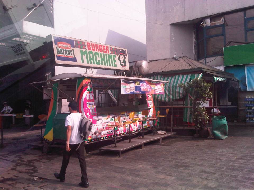 There used to be a lot of these burger stands around Metro Manila. Usually installed at gasoline stations, they provided inexpensive fast food while the big boys (Jollibee, McDo, etc.) were not yet into their aggressive expansions. The one at the former gas station where One San Miguel now stands was a Minute Burger stand. I think only Burger Machine survived from that era though there are others like that ubiquitous Big Mak that flourished in the provinces.
 Intersection with San Miguel Ave. – right after the intersection is Lourdes School of Mandaluyong and St. Francis of Assisi Church. There was a time when the school and the church were the only major structures in the area. Most of the surrounding lands were unoccupied including what is now Shangri-la, SM Megamall, ADB and all the lands in Ortigas Center where there are now tall buildings housing offices and residential units.
 Despite the sign stating that boarding and alighting is prohibited along the area, many commuters continue to defy authorities. Jeepney drivers usually oblige if they see that there are no traffic enforcers around to apprehend them. There used to be substantial sidewalk space in front of Lourdes Mandaluyong but perhaps the space was sacrificed when Shaw was widened to allow for more space in relation to the ramp of the overpass/flyover along Shaw that crossed EDSA. It doesn’t help that what little space remained is blocked by posts such as the one shown at the right in the photo. Pedestrians are forced to walk on the carriageway where they are exposed to the risks of being hit by motor vehicles.
 Pedestrians walk along the carriageway due to the narrow space of the sidewalk. Notice that the ramp of the Shaw flyover is practically in the middle of the intersection with St. Francis Avenue (which is in front of St. Francis of Assisi Church). The configuration of the ramp prevents vehicles coming from St. Francis from getting on the flyover and all traffic must turn right towards the at-grade, signalized intersection with EDSA. The area is usually a bottleneck as jeepneys congregate along Shangri-la mall to load/unload passengers at what becomes an informal terminal at the Crossing area.
–
Roads in Pasig: Eagle Avenue
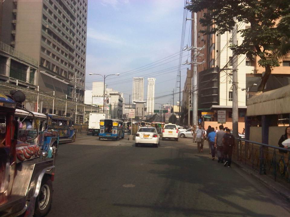
There are a few options for travelers heading to/from the eastern part of Pasig from/to other parts of Metro Manila. The usual routes are via Ortigas Avenue, Marcos Highway and Pasig Boulevard, all crossing the Pasig River or the Marikina River via Rosario Bridge, Marcos Bridge and Vargas Bridge, respectively. I am featuring in this post an alternative route that also crosses the Marikina/Pasig River – Eagle Avenue. Following are a few photos for this road, which connects E. Rodriguez, Jr. Ave. (C-5) and Sixto Antonio Avenue.
 Sandoval Bridge along Eagle Avenue – the road and the bridge is a two-lane, undivided street connecting C-5 in the west and Sixto Antonio Ave. in the east. The latter connects to a network of roads leading to the what is generally regarded as the center of Pasig City, including City Hall.
 The Grove – a major high density residential development along the Marikina River with access via C-5 (E. Rodriguez Avenue) is visible from the bridge.
 Towards C-5 – the perspective shown in the photo is for westbound travelers. There is only a short distance between Sixto Antonio and Sandoval Bridge. Most of Eagle Ave. is from the west end of the bridge until C-5, which used to have mostly industrial land use on either side of the road.
 Re-development – the lands on the left are currently used by industries while the lands on the right used to be industrial, too (PIMECO). These lands east of C-5 are now being re-developed into residential areas like the development mentioned in a previous photo. Others are currently being advertised by developers.
I can imagine that this road can become congested during the peak periods as many residents of Pasig City would opt to use this route instead of Vargas Bridge or Rosario Bridge to get to or from Pasig town proper. During the morning, most traffic would be westbound and this direction can be congested due to vehicles merging with C-5 traffic. During the late afternoon to evening period, the eastbound direction is congested and traffic can spill into C-5 due to the limited capacity of the intersection at Sixto Antonio. There are limited options to improve this intersection as both sides of Sixto Antonio are generally built-up and land acquisition for widening the road will have prohibitive costs. There’s just too many cars?
–
Gen. Santos Avenue
Connecting Circumferential Road 6 (C-6), M.L. Quezon Street and the South Luzon Expressway (SLEX) is the stretch of road known as Gen. Santos Avenue. The following photos taken during one trip to the Department of Science and Technology (DOST) in Bicutan, Taguig City describes the road and adjacent areas.
 Junction with M.L. Quezon St. where C-6 becomes Gen. Santos Ave.
 Counterflow – tricycles traveling against the flow of traffic
 The avenue is a four-lane, two-way road with opposing traffic separated by a narrow median island with a steel fence. Most of the road had faded or no pavement markings.
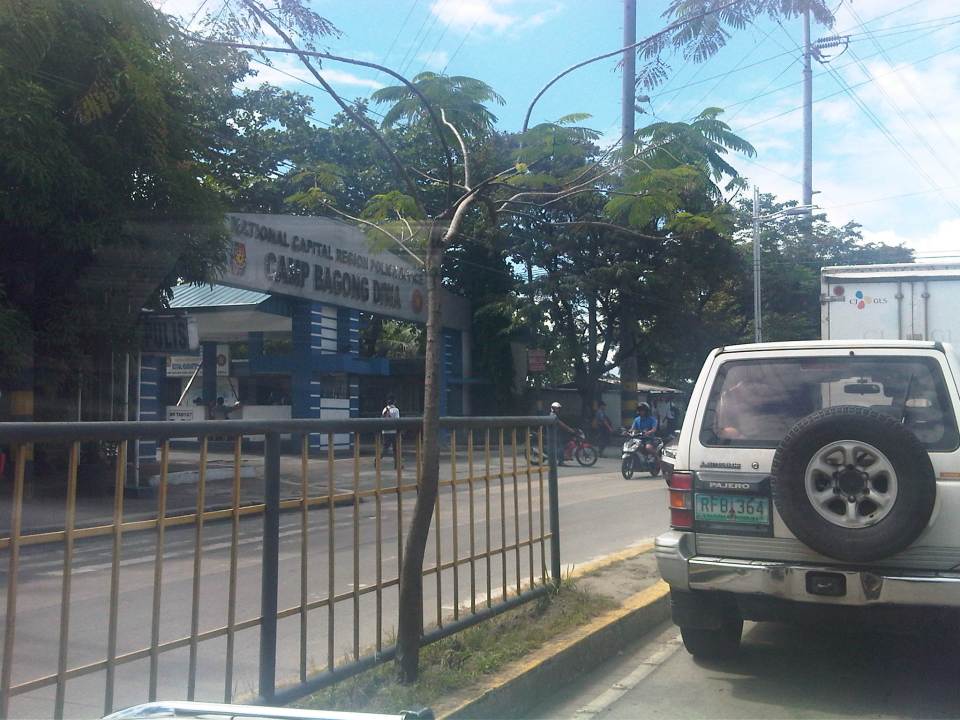 Along the road are several government facilities including Camp Bagong Diwa, the NCRPO’s
headquarters and host to suspects to some of the most celebrated cases such as those involved in a massacre in Mindanao. The camp is located along the south side of the avenue.
 There are also public schools along the avenue including the Pamantasan ng Lungsod ng Taguig (Taguig City University). The University shares a compound along the north side of the avenue with other city institutions like the city’s Hall of Justice (pictured above) and, surprisingly, the City Jail.
 Students crossing the street in front of one of the gates leading to the Pamantasan. Further on, after Camp Bagong Diwa is a branch of the Polytechnic University of the Philippines (PUP), which is a state university.
 There are wider median islands with plant boxes along the stretch of the avenue fronting the DOST compound.
 Sag vertical curve section leading to the DOST compound’s main gate
 Jeepneys plying routes in Bicutan are lined up at an informal terminal occupying the pedestrian sidewalk in front of the DOST compound. Such practice denies pedestrians of safe walking space.
 Main gate of the DOST compound – further on to the west at the end of Gen. Santos Ave. is the Bicutan interchange with the SLEX.
–
Let there be light
Driving home after our office’s Christmas Party, I couldn’t help but notice the difference in illuminations between sections of Marcos Highway from Santolan in Pasig City until Masinag in Antipolo City. The stretch from Santolan until Sta. Lucia Mall is relatively dark with the only light coming from vehicles or the establishments along the roadside. The vicinity of the LRT 2 Santolan Station benefits from the lighting of the elevated station, the pedestrian overpass and the medium-rise residential development nearby. It is actually quite dark right after the LRT 2 Station where vehicles stand along the roadside waiting for passengers coming out of the trains terminating at station. Some sections benefit from the presence of 24-hour gas stations and the Robinson’s and Sta. Lucia Malls near the intersection with Imelda Avenue. But for most sections, it is quite dark, which tends to discourage walking and cycling along the highway. The photo below that I quickly took with my phone pretty much describes the lighting conditions along Marcos Highway along a section that’s supposed to be a shared responsibility among the Cities of Pasig and Marikina. There are lamp posts along both sides of the road, courtesy of the rehabilitation works for Marcos Highway that was completed earlier this year. But all seem to be switched off.
 Typical dark section of Marcos Highway from Santolan to Imelda Avenue.
Meanwhile, quite noticeable is the illuminated stretch from Imelda Avenue to Masinag, where Marcos Highway intersects with Sumulong Highway. Lights from the lamp posts along both sides of the highway are all switched on, giving travelers (motorists, pedestrians and cyclists) the benefit of a well-lighted facility through which they could travel safely, at least from the perspective of illumination. One can actually turn off his headlights (though I don’t recommend it) and you won’t really notice the difference because of the lights from the lamp posts. The following photo is another quick shot taken right after the U-turn slot across from the Burger King branch along the highway. The section is within the limits of the Municipality of Cainta and further on, the City of Antipolo, both in Rizal Province and technically outside Metro Manila.
 Typical illuminated section of Marcos Highway
It has already been established that poorly lighted roads lead to road crashes even as it has been established that nighttime crash rates are higher than daytime rates (AASHTO, 2003). There is also evidence that fixed-source lighting can reduce the incidence of crashes particularly along urban streets where there are many intersections and major arterials such as Marcos Highway. In the Philippine setting, illumination also enhances safety and security for pedestrians and cyclists and would definitely encourage the development of a culture of walking. In the case of Marcos Highway, there are already pedestrian and cycling lanes separate from the carriageway. However, these are poorly illuminated along significant sections such as the Santolan to Imelda sections where perhaps people can have the option to walk to and from the LRT station. They are discouraged though because of the risks associated with dark places and so end up waiting for a jeepney ride instead of walking what is actually an acceptable (walkable) distance. Perhaps Pasig and Marikina, two cities currently advocating walking and cycling, should look into this issue in coordination with the DPWH, which has jurisdiction over the national highway. If Rizal’s Antipolo and Cainta can do it, I don’t see why Marikina and Pasig can’t.
–
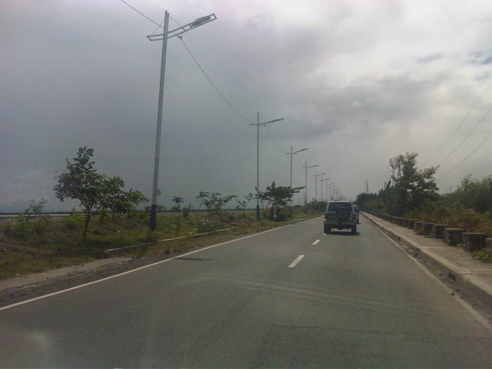
Circumferential Road 6: a first look
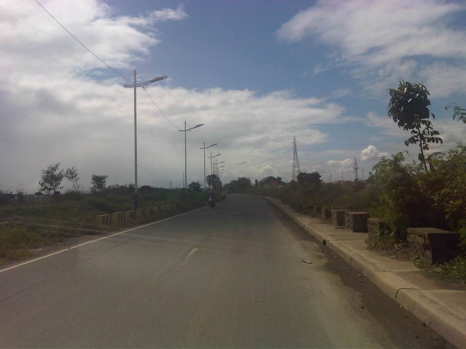
I got my first look at a road section that’s part of what is supposed to be Circumferential Road 6. C-6 would probably be the last of the circumferential roads to be conceptualized and, sometime in the far future, to be completed. It is not mentioned in the original plan for Manila that had major roads arranged in what is called a “wheel and spoke” layout that the architect Daniel Burnham was supposed to have applied in planning Manila. Many years later and the transformation of the area into a metropolis comprised of many cities that is now called Metro Manila (some already consider the area a megalopolis and use the term Mega Manila to include cities and municipalities in adjacent provinces), there are 10 radial roads (R-1 to R-10) and 6 circumferential roads (C-1 to C-6).
 An old map showing one of the possible alignments of C-6 – the current alignment being considered will be closer to the the coast of Laguna de Bay and will be to the east and north of the La Mesa reservoir rather than to the south and west of the latter.
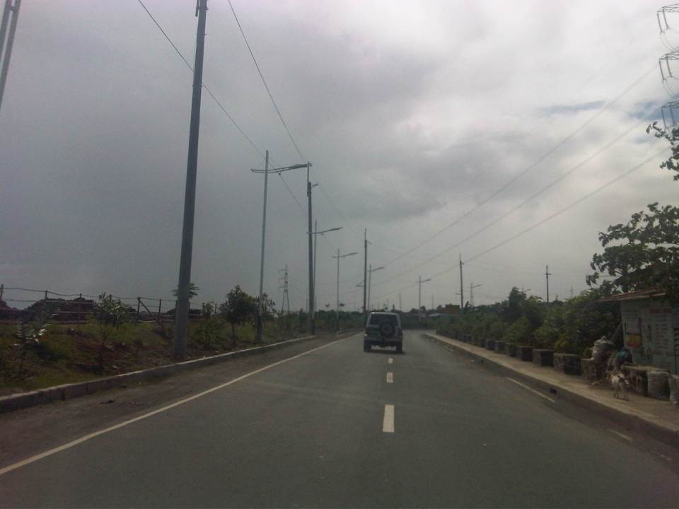
While most of these have practically been completed with only a few segments here and there that need to be constructed or connected like C-5’s, C-6 is somewhat a latecomer whose alignment, while laid out on paper and mentioned in several plans and reports, is still being discussed considering its location in the fringes of Metro Manila. In fact, much of it will probably be constructed outside Metro Manila and not on the most favorable of terrains. There are even proposals for sections of C-6 to be elevated and tolled. Toll fees would probably make sense if the intention is to have a circumferential expressway with limited access (ramps and interchanges). Following are photos taken from Seagull Avenue to Gen. Santos Avenue in Taguig City.
 Approach to the intersection with Seagull Avenue, which is connected to M.L. Quezon Avenue, which is in turn connected to Gen. Luna Street.
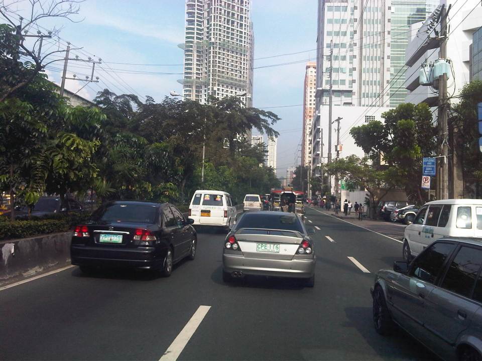
 Turning right towards Bicutan, we found that C-6 is a two-lane, undivided road. At this section, there are no road markings although pavement is of good condition.
 Noticeable along the roadside are concrete barriers similar to those found along highways in Central Luzon that are in areas prone to flooding. Flood waters are allowed to go through or across the section and the barriers keep large debris away from the roads while also keeping vehicles from “drifting” out of the highway.
 Pavement markings finally appear along C-6. While many motorists don’t seem to mind their absence, they are actually important from the perspective of road safety as they serve to guide motorists along the road, particularly to stay within their lanes.
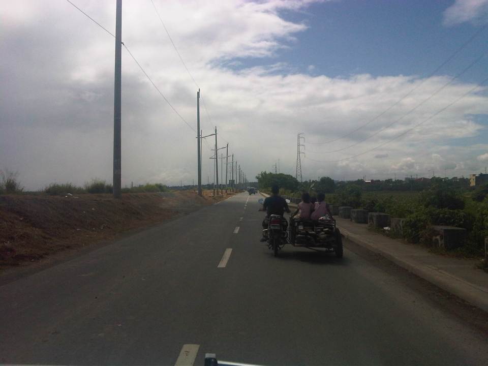 Tricycles, like the one in the photo don’t seem to be in significant numbers along C-6. This is probably because there are few developments along the road. Most developments are along M.L. Quezon Ave., which is an old road that stretches along parallel to the Laguna de Bay coast.
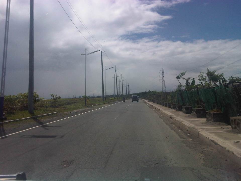
 There are several pumping stations located along C-6 and these are used mainly for flood control (i.e., pumping water from the waterways in Taguig to the Laguna de Bay, which is just across the road). Laguna de Bay is on the other side of the dike along the left of the highway in the photo.
 Power lines and street lamps along C-6. The lamps remind of similar designs in Cebu City and Pasay City. I’m not so sure about the aesthetics but they do seem a little flimsy for lamps located along the lakeshore. I do hope they illuminate well at night time and during inclement weather.
 There is a dike along this entire length of the section of C-6. Once in a while, one will see fishermen walking atop the dike towards their bancas that are moored or grounded along the shore.
 We noticed light traffic as we traveled along the entire length of road from Seagull Ave. to Gen. Santos Ave. Not so many people seem to be using the road despite it being a direct route from Rizal Province to Taguig. I have to try driving from Antipolo or Taytay and crossing the bridges at the mouth of the Pasig River and the Manggahan Floodway to Fort Bonifacio one of these days.
 I mentioned that most lands along C-6 are undeveloped. This probably explains why traffic is quite light. At present there seems to be no direct/straightforward route connecting C-6 with C-5. In our case, we had to go through a maze of sorts between the two roads via Levi Mariano Ave., Gen. Luna Street, M.L. Quezon Avenue, and Seagull Avenue. The shortest path seems to be one through the DMCI developments in Taguig but roads there are private and presently for the exclusive use of their residents.
 At present, C-6’s southern end is at its junction with M.L. Quezon Avenue in Bicutan, where C-6 turns and becomes Gen. Santos Avenue. Traveling through the road shown above will lead people to the Bicutan interchange of SLEX.
–
V. Luna Extension
V. Luna Extension starts from the intersection with Kalayaan Avenue runs until the boundary with Bgy. Botocan in Teachers Village where it becomes Maginhawa Street. It was mainly a residential street being practically part of the Teachers Village/Sikatuna Village area in Quezon City. The street has been widened to 4 lanes from its wide 2-lane carriageway. However, the additional lanes are not fully utilized for traffic. Rather, they are occupied by parked vehicles and, at some sections, informal tricycle terminals. Following are photos taken one weekday afternoon showing typical conditions along the road.
 Section in front of SaveMore – while there are off-street parking spaces available at the supermarket side of the road and reducing on-street parking there, the other side’s curbside lane is occupied by a tricycle queue.
 The tricycle queue extends well beyond the head shown in the previous photo. In the picture above, on-street parking in front of residential buildings along the street are shown. There is a yellow line painted on the pavement that seems to be a guide for the tricycles. While I am sure they try their best to park close to the curbside, these 3-wheelers still end up occupying significant road space, thereby reducing traffic capacity.
 Further down the street one starts to realize that the tricycle queue seems to go on and as far as the eye could see in the photo. Note the tricycles parked on the other side of the road, probably just coming back or going around to get fares.
 End of the line – still further down the street and quire near the end of the section designated as V. Luna Extension one can already see the end of the tricycle queue. One can just imagine how many more of these tricycles are going around the village and just how much drivers take home as their net income at the end of a very competitive day. I say competitive here because for the numbers alone at the informal terminal, you get the idea that demand is quite limited and that there is an over-supply of 3-wheelers in the area. Unfortunately, these transport modes are the source of livelihood for many people and to many, a career operating these vehicles seem to be targets for many who have limited opportunities to study and eventually find better-paying jobs.
 Pedestrian crossings – from the previous photos, it is not hard to see that there are few places designated for crossings. In fact, along the entire length of this street (and others like it) people cross just about anywhere. This is possible since traffic is still typically not so heavy along this street.
 Fork in the road – V. Luna Extension continues to the left but as Maginhawa Street in UP Teachers Village. The street on the right is also a part of a residential area, Bgy. Botocan, along which is the ROW of Meralco’s power transmission lines.
–
Another look at Imelda Avenue traffic
A reader brought to my attention some traffic problems encountered along a section of Imelda Avenue in the vicinity of a major retail chain’s branch. There are experiences of traffic congestion along the section fronting the SM Hypermarket from across the Village East subdivision. However, the commercial development and the traffic generated is not really new since the hypermarket replaced another similar establishment (Makro). Arguably though, the trip generation rates of SM developments can be higher than their competitors considering their branding and customer preferences based on traffic experience around SM malls. Following are some specific observations and comments for the case of Imelda Ave. in the vicinity of the SM Hypermarket along the highway.
 Slow-moving traffic in front of the SM Hypermarket along Imelda Avenue in Cainta, Rizal
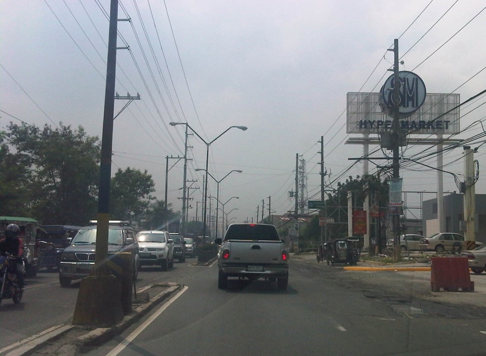 Congestion in the previous photo turned out to be caused by jeepneys loading and unloading passengers in front of the commercial development. Jeepneys tend to occupy the outer lane of the highway, significantly reducing road capacity thereby causing a bottleneck leading to congestion propagating upstream. There is actually a loading/unloading bay on the Hypermarket side of the road but jeepneys do not use this and almost always stop in the middle of the road.
 There are also tricycles using Imelda Ave. despite the regulations prohibiting them from national roads. The tricycles serve the residential subdivisions along the highway but used to be the main mode of transport along an unfinished Imelda Ave. from the 1970’s and competed directly with the jeepneys from the 1980’s one the connection between Ortigas Ave. and Marcos Highway had been made, leading to the opening of new jeepney routes through Imelda Avenue.
 The bottleneck for this section is along both directions as jeepneys stop not only for the Hypermarket but also for the residential subdivision (Village East) that is located just across from SM. The gate of the village opens toward SM with traffic generated significant enough to create a 3-leg intersection at the subdivision access/egress. This is an unsignalized intersection that has no enforcer to manage traffic, leaving it up to the motorists to determine acceptable gaps for conflicting movements. Compounding the situation are pedestrians crossing just about anywhere along the road like the people shown in the photo above.
The issues mentioned above are not all unique to the location but are often the case for many other places where there are major traffic generators such as malls, supermarkets and even residential developments. In fact, middle class villages are major traffic generators due to the car ownership but they are usually predictable in terms of peak periods. That is, the morning and afternoon/evening peak are well-defined according to office or school hours associated with residents (i.e., “to school,” “to work,” and “to home” trips). The solution, of course, is quite basic though not so simple – traffic management in the form of personnel who will enforce traffic and manage intersection flow. It is basic because it is a solution that’s definitely “in the box” and traditional or conventional. It is not simple because often, there is a lack of qualified personnel who can manage traffic full-time, and competent to firmly enforce traffic rules and regulations in order to effect behavioral change (for the better) among motorists and pedestrians. Granted, the commercial development should take the initiative to manage traffic and these may be recommendations already made when a traffic/transport impact assessment was conducted prior to the construction of the Hypermarket. Such assessments should have included traffic forecasting (estimating future traffic) in order to determine potential traffic congestion in the area and the formulation of site specific and appropriate mitigation measures. Perhaps there is a document somewhere (EMB?) that Cainta may use as a guide for how to address transport and traffic problems in the area due to the presence of the supermarket. If none, then the burden will be on the local government to study the traffic and come up with a strategy on how to lessen the detrimental traffic impacts of development in the area.
–
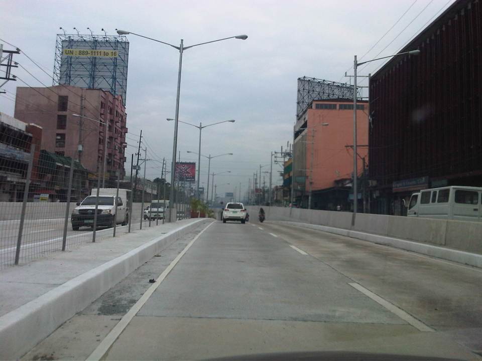
Completed Quezon Avenue-Araneta Avenue underpass
The underpass along Quezon Avenue at its intersection with Araneta Avenue was finally completed and opened to traffic last September 28, 2012. It is perhaps one of the most anticipated inaugurations of infrastructure for Metro Manila and not an anti-climactic one like what was hyped as the completion of the loop formed by MRT3 and LRT1 a few years ago. That didn’t turn out well as we now know there is no loop at all with real connection of the two rail lines. But that, as they say, is another story worth another post or two.
Based on reports from different people including our office’s drivers and some colleagues, traffic has significantly improved in the area. The only joke going around is if the underpass will not be a catchment for floodwaters should there be strong rains considering that it was flooded during construction due to its proximity to the San Juan River and the perennially flooded areas of Talayan and Espana. There are, of course, pumps that have already been installed for the underpass to reduce if not eliminate the possibility of flooding. Following are a few photos taken one Saturday mid-morning when I passed along the area.
 A view of the approach to the underpass from Banawe. The pedestrian overpass is across Sto. Domingo Church.
 The section has 4 lanes with opposing traffic physically separated by a median island. The fence is likely to prevent jaywalking as well as maybe dissipate glare from headlights during night time.
 Potted plants have been placed along the median and though perhaps more are needed, I am glad there are no concrete balls that look like goat poop used to “decorate” the underpass. Columns and girders support the underpass walls at near the junction with Araneta Ave.
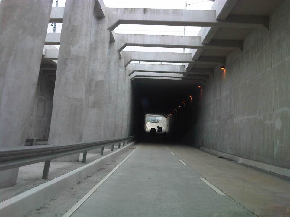 Approaching the section directly under Araneta Avenue, the first impression is that it is quite dark though motorists can see the end of the underpass. Pumps have been installed to drain water from this lowest parts of the underpass and prevent it (or reduced) from being flooded during times of strong rains.
 The end of the tunnel is practically a mirror image of the other. There are few potted plants as shown and perhaps more are needed to soften the look of the underpass as well as to reduce headlight glares.
 Back at-grade – emerging from the underpass, motorists will eventually merge with the traffic along the wide sections of Quezon Avenue. On the opposite direction, I noticed some congestion for vehicle emerging from the underpass as there is a U-turn slot a few meters from the ramp at the Banawe area.
There are traffic signals to manage flows at the at-grade junction of Quezon Ave. and Araneta Ave. It is expected that by reducing the volume of through traffic along Quezon Ave., the signals would be able to handle the remaining traffic and that the intersection will not be as congested as the case prior to the construction of the underpass. Of course, I would also like to see for myself how traffic is in the area during the regular weekdays, particularly on the typically busy days of Monday and Friday.
–
Quezon Ave. underpass at Araneta Ave.: some expectations and issues
The underpass along Quezon Ave. at its junction with Araneta Ave. is set to open to general traffic this coming week. I got this from a reliable source who was involved in the project as well as friends from the DPWH and the MMDA. If the opening pushes through, the underpass is expected, based on analysis, to ease traffic along both major roads with Quezon Avenue’s through traffic having the most benefit from the uninterrupted flow provided by the underpass. At-grade traffic management at the intersection will still be provided mainly by traffic signals but the substantial reduction of traffic attributed to the through movements along Quezon Ave. The reduction of congestion comes as a relief to a lot of travelers as well as businesses affected by the construction of the underpass in the last year. Fortunately, there has been little delay in the construction and so it seems that lost times due to construction-related congestion (translated here as sacrifices for those who had to endure daily traffic congestion and had to adapt to the situation) will finally be compensated for. Many, indeed, have been anticipating the eventual opening of the underpass, expecting the facility to solve congestion in the area.
The area has been subject to flooding considering its proximity to the San Juan River. Official data for flood occurrences in the area can be accessed through the Department of Science and Technnology’s (DOST’s) Nationwide Operational Assessment of Hazards website where it is clear that flooding will be an enduring problem for the underpass and surrounding areas. Recent reports (from last week until today) indicate that there is still the specter of flooding that will have to be addressed given that prior to the construction of the overpass, this issue had already been flagged by various stakeholders including the Quezon City Government. It is for this reason that the underpass will have pumps to ensure that water will not accumulate and lead to the closure of the facility in times of heavy rains resulting in flash or regular flooding.
–
