
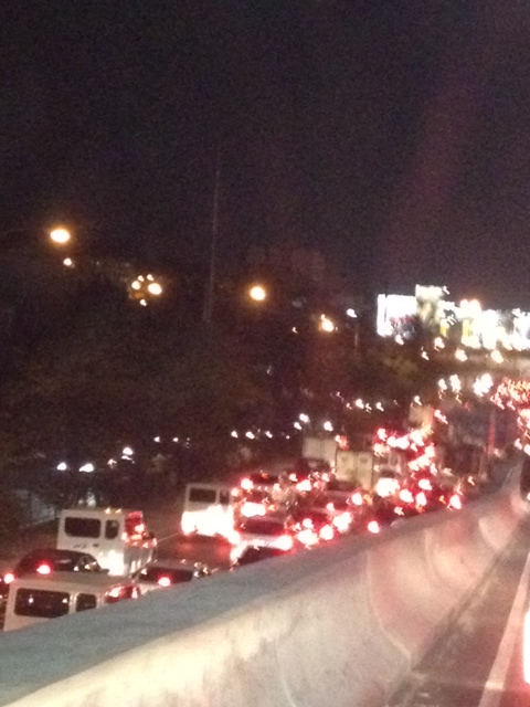
Night time congestion along C-5
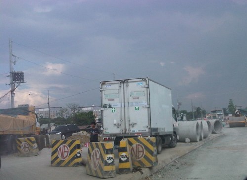
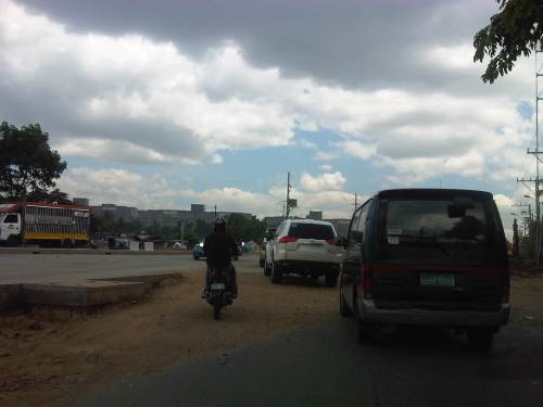
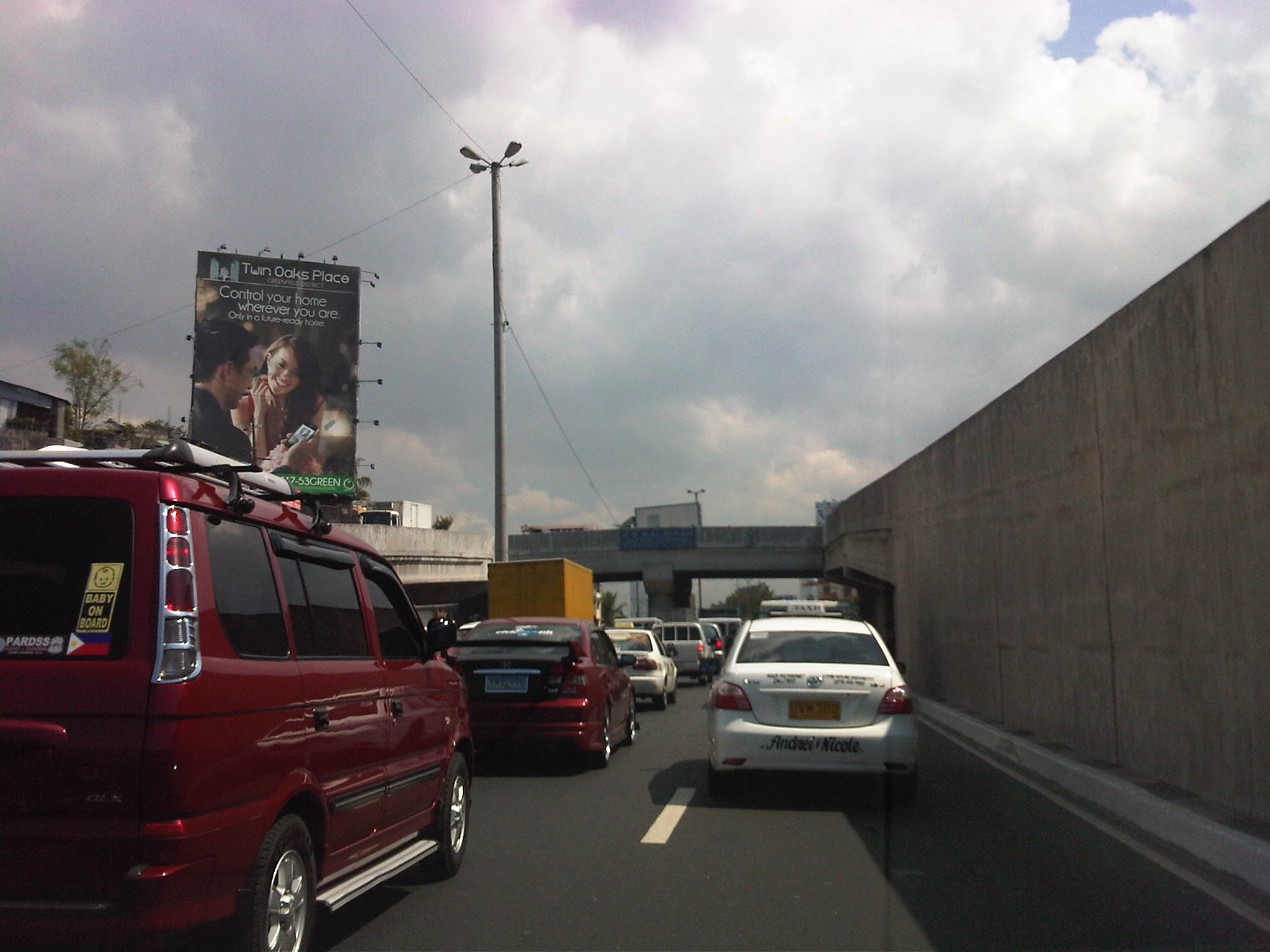
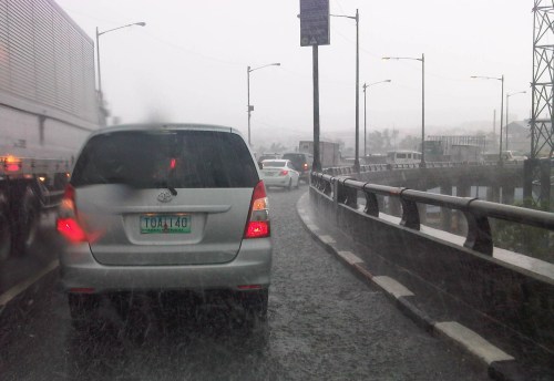
Traffic congestion along Circumferential Road 5 is experienced practically throughout the day with the worst congestion along the southbound direction during the mornings between the Riverbanks Road in Quezon City and Kalayaan Avenue in Makati City, and the northbound direction between Bonifacio Global City and Eastwood from noon to nighttime. The following photos taken by my wife as I fetched her one night from her office shows the traffic jam along C-5 as we turned from the flyover past Market! Market! towards the highway.
 Congestion along the C-5 northbound is a regular thing during the weekdays from the afternoon to late at night. While apps like the MMDA’s Traffic Navigator and Waze allow us to have an idea of how congested C-5 is during such periods, the actual experience is much worse than what many of us can just imagine from the apps.
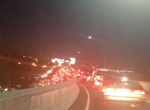 As far as the eye could see – congestion in the form of the taillights of vehicles along the northbound side of C-5 indicate just how many people are caught in traffic from Taguig all the way to Pasig and beyond. The giant billboards from Kalayaan Avenue to Pasig Boulevard including those seen along the bridge crossing the Pasig River. Most of these people are office workers coming from Makati and Global City and heading home to Quezon City, Pasig, and the towns of Rizal. After 7 PM, trucks add to the traffic
Many people are asking if there is a solution in sight for congestion along C-5. To be frank, there is none in the immediate future. There are proposals to introduce a public transport system along the corridor with one option being a Bus Rapid Transit (BRT) and another an elevated rail transit line. The BRT line is a recommendation of a Pre-FS for Metro Manila BRT conducted around 6 years ago though there was a proposal for a bus system (Philtrak) along the same corridor back in the late 80’s and pursued for some time during the 90’s. Not much have been done towards realizing any of these proposals. An efficient mass transit system along the corridor could encourage people to shift from private to public transport and help reduce vehicular traffic along C-5 considering that even as I write this post, vehicle ownership is increasing in Metro Manila and its environs and this could only mean more congestion along C-5 and other roads.
–
Ferry to Marinduque
A friend, Dr. Jonathan Salvacion, posted some photos of a trip he made to Marinduque. I noticed a couple of photos showing the ferry their group took between the Port of Lucena and Marinduque Island. After getting his permission to use the photos, I am post both here to show the typical ferry used in inter-island, roll-on roll-off (RORO) transport in the Philippines. Being an archipelago, providing safe and efficient inter-island transport is a continuing challenge for the country. A lot of progress, though, has been made regarding infrastructure and services. The improvements include the nautical highway system comprised of highways and seaports where the past and present administrations have invested heavily during the past decade.
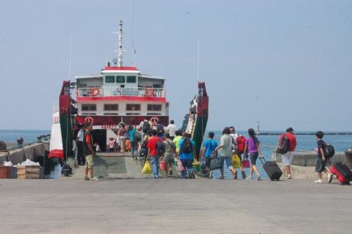 Passengers boarding the ferry to Marinduque – the port is designed with a ramp for vehicles to easily “roll-on/roll-off” the vessel [Photo credit: Jonathan Salvacion]
 Inside the ferry, vehicles are parked while passengers are seated above on deck. [Photo credit: Jonathan Salvacion]
–
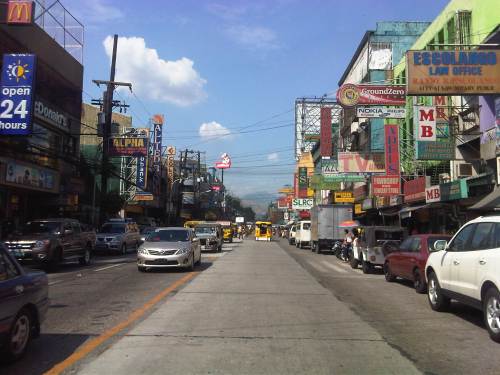
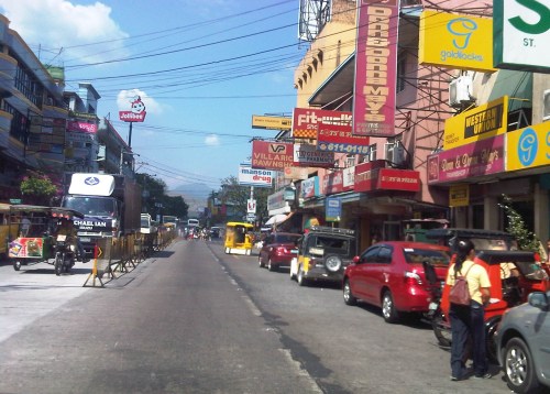
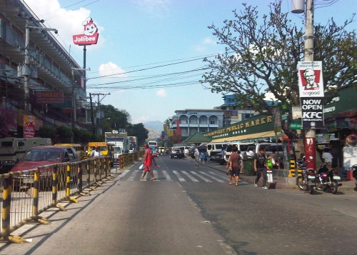
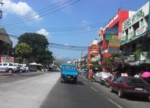
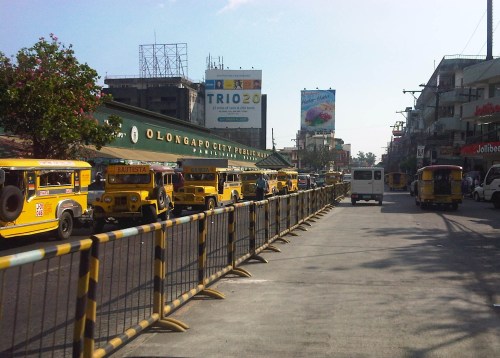
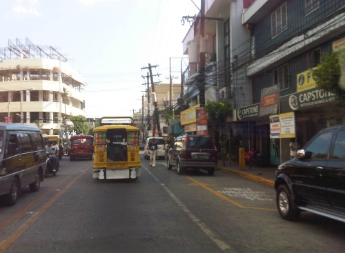
Streets of Olongapo: Rizal Avenue
Olongapo City is located in the Province of Zambales, the only city in that province, and beside the Subic Freeport. It is a pioneer in public transport service innovations in the form of the first initiative on the color-coding of jeepneys according to their routes. Despite what seemed to be forever being linked to the Freeport in terms of economic development, the city has enjoyed continued growth and is currently experiencing more challenges attributed to this growth. Among these challenges are those pertaining to traffic congestion and public transport services for the city. A Transportation and Traffic Management Plan Study was conducted by UP Diliman through the National Center for Transportation Studies and is up for formal adoption of the city.
Following are photos taken along the city’s main street, Rizal Avenue, where many of the city’s transport and traffic problems are manifested.
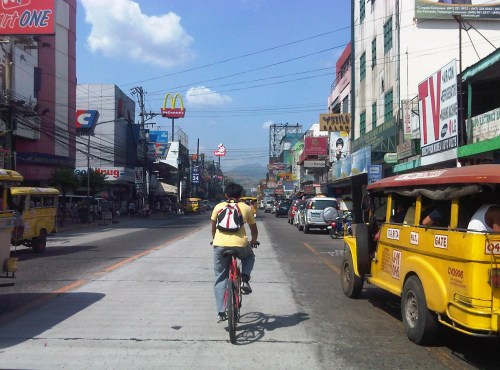 Cyclist pedaling along Rizal Avenue beside a yellow jeepney taking passengers at the designated stop at curbside. Downstream are parked vehicles along the road.
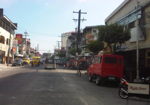
 More parked vehicles at either side of Rizal Avenue effectively reducing road capacity for the 4-lane street.
 On-street parking is a problem for the city as there are few, if any, off-street parking facilities in the city. On-street parking turnover is quite low since many of the parked vehicles are not clients or customers but establishment owners or managers.
 Most of Rizal Avenue is undivided but there are median barriers along the section in front of the public market to reduce jaywalking among pedestrians.
 The section in front of city hall – just across are many commercial establishments and on-street parking.
 Another view of the Rizal Avenue, this time along the westbound side, with the the market on the left side. The yellow jeepneys are quite conspicuous and remind me of the UP Ikot jeepneys.
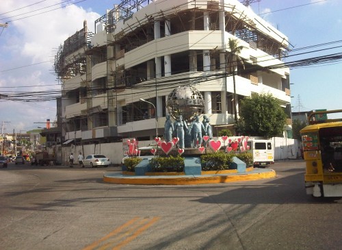
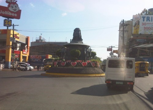 A monument to the Ulo ng Apo, from which the name of the city is said to be derived from, is right in the middle of a rotunda at a major intersection along Rizal Avenue. Around the rotunda are commercial establishments and a major provincial bus terminal.
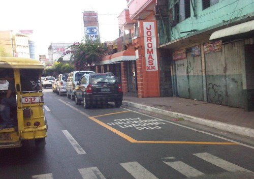 There are designated stops for jeepneys along the avenue but these are often crowded out by parked vehicles. As a result, jeepneys could not maneuver properly and end up unloading/loading passengers in the middle of the road.
 On-street parking along curves tend to impede the flow of traffic. There are also issues where electric posts like the one shown in the photo have not been transferred, posing risks to vehicular traffic.
 Another example of a designated jeepney stop along the avenue where parked vehicles constrict maneuvering space for jeepneys.
 A monument to the volunteers of Olongapo during the Mt. Pinatubo episode after the closure of the U.S. Naval Base in what is now a Freeport. I wonder if the building under construction in the photo has enough parking spaces for the traffic it generates.
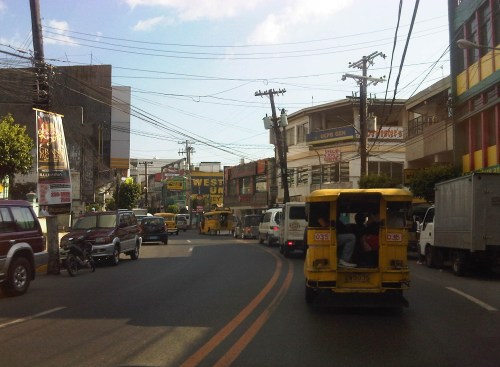
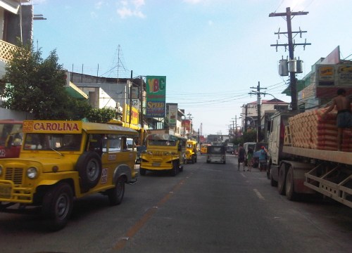 More jeepneys and more on-street parking – there is a perception that there are too many (oversupply) of jeepneys. Note though that most PUJs in Olongapo are not the bigger 20 to 24 seater jeepneys we see in Metro Manila but the older, 16 to 18 seaters like the ones shown in the photo.
 Some on-street parking spaces are “reserved” by establishments. I didn’t mention that on-street parking is free of charge and such situation probably encourages longer parking durations. Perhaps the city should seriously consider parking fees to reduce long-term parking and ensure smoother flow of traffic along its streets. There are examples of these parking schemes in other cities including Makati City that Olongapo can adopt and adjust.
–
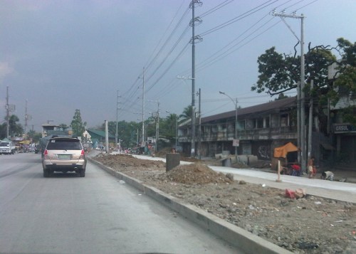
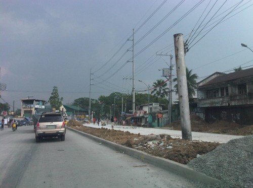
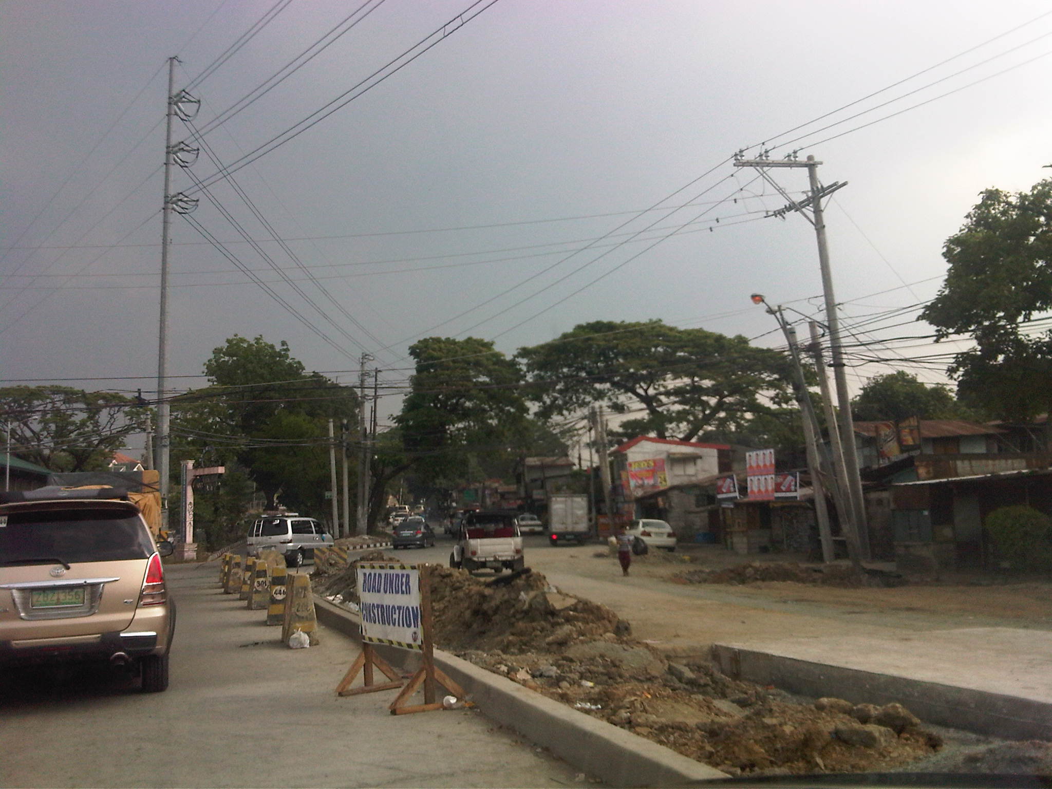
Tandang Sora Avenue road widening
The stretch of Tandang Sora Avenue between Commonwealth Avenue (Luzon Avenue Flyover) and Capitol Hills Drive is currently being widened as part of the Luzon Avenue project. Work here has been delayed by not a few glitches including the issues regarding the right-of-way acquisition. This area used to be home to a lot of informal settlers, including many who have lived in the area for decades as they were tolerated by the land owners. Many had to be relocated and were compensated to give way to the section of Tandang Sora that connects to the also unfinished Luzon Avenue.
The following photos were from a month ago when work was still ongoing along the southbound side of the road. This southbound side is actually the old 2-lane, 2-way section of Tandang Sora that was rehabilitated following completion of work on the expansion northbound lanes.
 Heavy equipment are everywhere along the section like the roller (pison) on the right side of the photo working on base layer of the pavement. The concrete barriers are used to prevent vehicles from entering the work zone.
 Both northbound and southbound traffic were using the northbound side of the road. The median island separating NB and SB sides of the the road is shown in the photo. The building on the right is actually a condemned structure.
 Concrete pavement has been laid out along the SB lanes but was still undergoing curing.
 Approach to the intersection with Capitol Hills Drive
Yesterday, I was able to take a few photos of the same section and found that the rehabilitated southbound lanes were already usable to traffic.
 Tandang Sora junction with Luzon Avenue
 Newly opened southbound lanes – 3 lanes are of PCCP but there are still construction work ongoing including drainage and sidewalk construction.
 Sidewalk and median barriers are in various stages of construction along the section. I think they built barriers to anticipate problems regarding jaywalking.
 Approach to the intersection with Capitol Hill Drive – one problem that needs to be solved along Tandang Sora is roadside parking. Informal settlers who own vehicles park these along the road. There are also stores, eateries and vehicle repair shops along the section that occupy sidewalks and encourage parking by customers.
Once the section is completed and with the future completion of Luzon Avenue, it is expected that traffic will increase along this section. The improved capacity of the road is also expected to ease traffic along the Capitol Hills Driver-Zuzuaregi Street route, which has become congested due to vehicles traveling between Commonwealth and C-5 whose drivers want to bypass the usually constricted Tandang Sora section.
–
The commute to the airport
Traveling from our home in Antipolo to the airport in Clark, I decided to take the MRT to the Quezon City Air Terminal (QCAT) from where I would be taking the Clark Airport Rail Express (CARE) to the sparkling new terminal at what is a fast growing aerotropolis north of Metro Manila. It was an easy commute from the station near my home and a convenient one considering the e-Pasahe integrated commute card that I could also use for the C5 subway line or the Quezon Avenue BRT. Soon, all the jeepneys and buses would be accepting the card for fares. 100% of taxis were already accepting the card for payments and the electric tricycles were surprisingly ahead with 90% accepting the e-Pasahe card. I made sure my card was topped up when I left the university yesterday so I could also use it to buy a drink or a meal while at the airport. The convenience of the card reminded me of the Suica and Pasmo cards I used while traveling in Japan.
Upon arriving at the QCAT, I proceeded to the check-in counters to drop-off my luggage. I had already checked-in online so I just had to leave my bag at the express lane. I was already excited about the direct trip to New York, on board Cebu Pacific’s newly delivered A380, where I would be meeting up with the wife who’s already there for a conference. Unfortunately, we won’t be on the same flight home as she was taking the PAL’s non-stop Dreamliner service to NAIA.
On-board the CARE train to the airport, I had a quick but good view of Metro Manila as the train emerged from the underground tunnel for its surface run from Bocaue, Bulacan. It was still early in the morning and the sun was just rising. It felt good to see that there was much less smog covering the metropolis. All those electric and hybrid vehicles have made a significant impact on reducing air pollution and improving air quality. I decided to have a power nap for the rest of the trip and awoke minutes later to find out everything was just a dream.
🙂
Happy April Fool’s Day!
Buses speeding along Commonwealth Avenue
Traveling along Commonwealth Avenue last Holy Thursday, we couldn’t help but notice the buses racing against each other along the wide highway. One bus speeding along the motorcycle lane almost hit a motorcycle along that lane. Traffic was free flowing and speed limits obviously were not being enforced or followed. Running at 60 kph, our vehicle was always passed by buses and cars alike, their drivers probably enjoying the wide space and the knowledge that there will be few if any traffic enforcers along Commonwealth. We saw a few underneath the Tandang Sora flyover but they were relaxed and seem to turn a blind eye over speeding violations along the highway. The video below was taken last Thursday and showed three buses speeding along Commonwealth, occupying lanes that they are not supposed to be using (Note: Public transport are supposed to run along the two outermost lanes of the highway marked with yellow lines.)
–
Daily penance: traffic congestion along C-5
People have been telling me about the traffic congestion along Circumferential Road 5 (C-5) and I am quick to reply that I know the feeling as I’m one of those who have driven or traveled along C-5 and experienced first hand the traffic congestion, which is worst during the mornings (southbound) and late afternoons and evenings (northbound). Midday traffic jams are not uncommon as C-5 is a truck route and large vehicles contribute to clogging especially at bottlenecks like the U-turns slots along the highway and bridge crossing the Pasig River. C-5 has been this way since its opening (or more appropriately the completion of missing links along the main alignment).
It will not get better. It will only get worse. I say so because of the annual increase in vehicle ownership, including motorcycles, in what is now termed as Mega Manila. I dare say so because of the backlog of public transport infrastructure in the metropolis (or megalopolis?). It is well established that efficient public transport infra and services are good incentives for people to commute rather than drive. This means there will be less vehicles on the road and therefore there will be less congestion as basically only those who really need to drive would be using their cars on a regular basis. Of course, it is not as easy at it seems considering trip making and mode choices are in reality complicated matters. But then the availability of viable, acceptable choices for travel, especially in the urban setting allows for people to have better mobility and more equitable use of the transport system than a car-oriented city. Until then, when we do have the public transport system that our cities require, it will be a daily penitensya for many of us traveling and not just along C-5.
 Congestion along the southbound side of C-5 approaching the flyover crossing Ortigas Ave. The flyover can be seen in the horizon.
 Congestion along C-5 southbound in the Bo. Ugong area approaching the junction with Lanuza Avenue. An overpass was proposed for construction along this section but now it doesn’t look like it will do any good considering the bottleneck is the Pasig Flyover and the bridge across Pasig River.
 Congestion along C-5 southbound at the Pasig flyover. The flyover has 2 lanes per direction and vehicle breakdowns or road crashes have resulted in terrible traffic jams.
 Congestion along C-5 northbound at the C-5/Kalayaan junction. The north U-turn flyover, one of two in the area, is shown in the photo. An underpass was initially proposed, designed and approved (with budget from a JBIC loan) at the junction. A previous MMDA Chair, however, didn’t agree and successfully maneuvered for the twin U-turn flyovers to be constructed instead.
–
The rains and traffic
Last Friday, the midday downpours resulted in flash floods around Metro Manila. The rains were not really a surprise given that PAGASA and other weather reports already stated the high probability of rain that day. It was the volume of rains that day in most parts of Metro Manila and the surrounding areas that caught a lot of people unprepared as many areas including streets experienced flash floods. Most cases were due to drainage systems unable to take in the rainwater because many were ill-designed or were clogged by debris (e.g., garbage, leaves, soil/dirt, etc.). The rains caused or worsened traffic congestion along many roads including C-5, Quezon Ave., and other flood prone streets in the metropolis. It was reported that some areas had zero visibility and so a lot of motorists were forced to slow down in order to avoid being involved in a road crash. It is good practice for all to turn on their headlights or hazard lights during times of heavy rains. If a driver has difficulty driving under such conditions, it is recommended that the driver pull off from the road and wait until the rains have weakened for safer driving.
 Atop the C-5 flyover from the Blue Ridge area and moving towards Eastwood, we couldn’t help but quip about the overpass being transformed into an elevated waterway (aqueduct?) as the drainage couldn’t handle the amount of water pouring in from the skies.
 Caught this scene of a boat on a trailer apparently en route for delivery. I thought is was at the same time humorous and ironic as rain was pouring around us and some parts of C-5 was already flooded. Perhaps we’ll need these boats to go around Metro Manila in the future during the wet seasons when heavy rains cause deluges in many areas. My colleague noted that the trailer didn’t have a license plate (Note: Trailers are required to have their own registration with the LTO.) and so wasn’t supposed to be on the road.
–
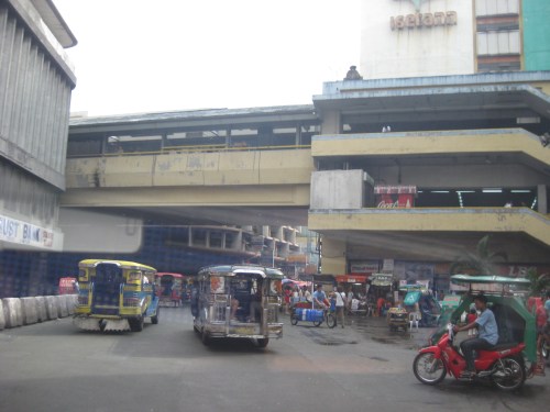
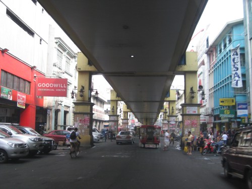
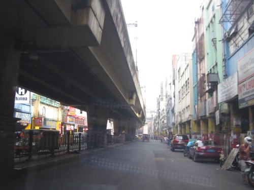
Rizal Avenue – Part 1: Carriedo – Bambang
Rizal Avenue stretches from Manila northward to Caloocan city from Carriedo to Monumento. What used to be one of the more cosmopolitan streets in Manila was transformed (some say blighted) by the construction of the elevated LRT Line in the early 1980’s. Carriedo, for example, used to be a popular shopping street along with Escolta. Those were times when there were none of the huge shopping malls now scattered in Metro Manila and people came to Manila to shop.
The following photos were taken while we traversed Rizal Avenue as part of a recon we were conducting for a project with the Department of Transportation and Communications (DOTC) back in 2011. I’m not sure if there have been any significant changes along Rizal Avenue and I am not aware of any recent programs to improve conditions under the LRT Line 1.
 Approaching the LRT Line 1 Carriedo Station from the McArthur Bridge
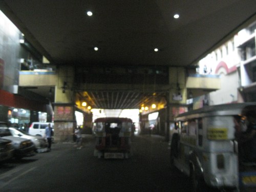 Under Carriedo Station, one experiences first-hand what people have been saying about the area being blighted by the LRT 1 structure
 Poorly lighted? It was broad daylight outdoors when we conducted the recon but underneath an LRT 1 Station it can get quite dark. Of course, aside from the need to improve illumination, perhaps authorities can also improve the environment including the cleanliness of the area under the station. A common complaint is garbage and there are those saying the area smells of piss (i.e., mapanghi).
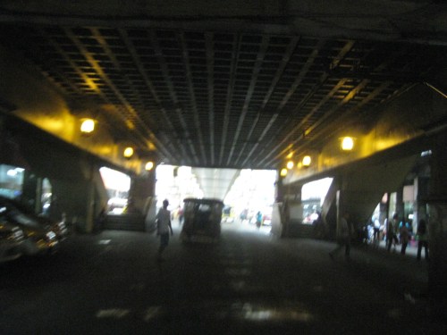
 Past Carriedo Station, it was brighter and perhaps the area can be developed so that stretches can be pedestrian friendly. Maybe there should also be restrictions on vehicle parking, which tends to make the area look congested. It would be good to have a strategically located multilevel facility in the area where most vehicles can park instead of along the streets as shown in the photo.
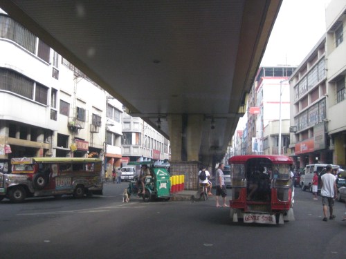 5More roadside parking plus the presence of tricycles contribute to traffic congestion in the area. People are everywhere walking and crossing anywhere. The arcades where they are supposed to walk along are mainly occupied by vendors or merchandise of stores/shops occupying the ground floors of the buildings along the street.
 Each side of Rizal Avenue is surprisingly wide with 3 lanes per direction. One lane is effectively used for on-street parking while the other two are for general traffic. There are no lane markings at the time we passed by the area so there can be confusion as to lane assignments.
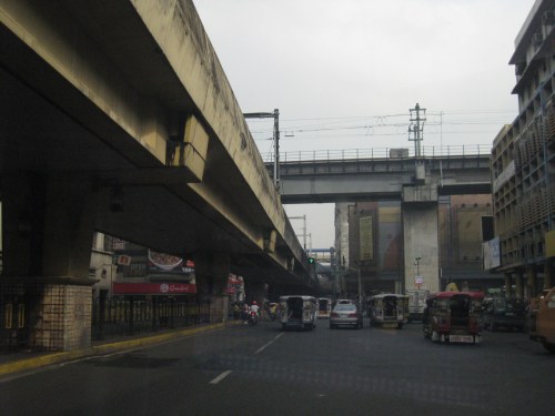 Approach to the junction with Recto Ave. and the LRT Line 2, which is also elevated and at the 3rd level as shown in the photo.
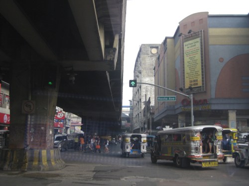 Rizal Ave.-Recto Ave. intersection – visible downstream in the photo is Doroteo Jose Station
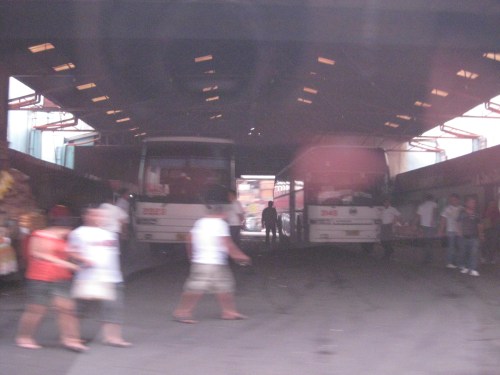 Provincial bus terminal between Doroteo Jose and Bambang Stations
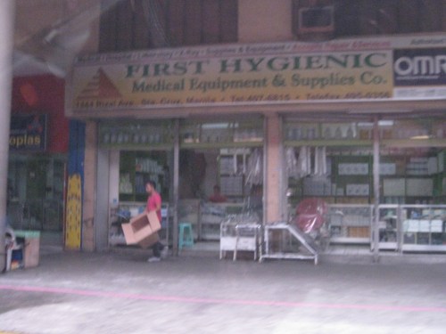 The Sta. Cruz district and particularly the Bambang area is well-known for shops selling medical equipment and supplies. Medical, nursing and other students of allied medical professions as well as professionals come to Bambang to purchase equipment and supplies from these shops, which offer items at lower prices.
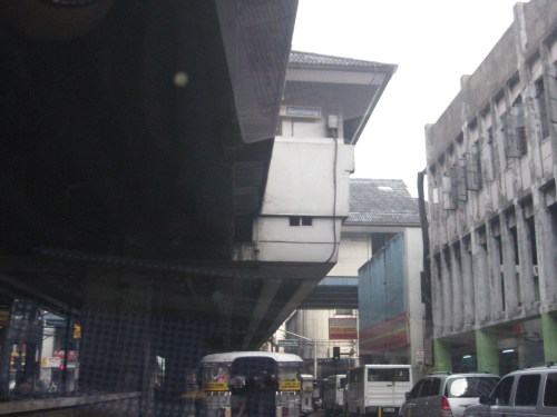 LRT 1 Bambang Station
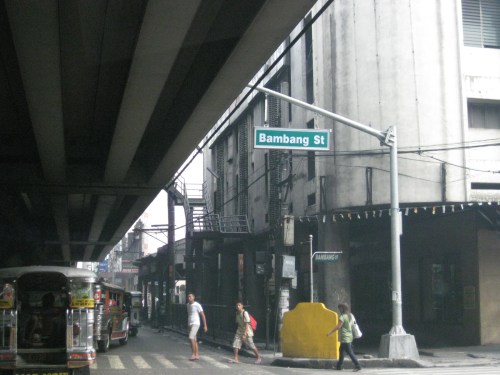 Rizal Ave.-Bambang St. intersection beneath the station
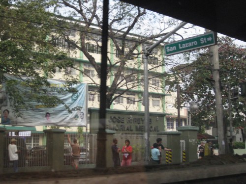 Two large government hospitals are located in the area between Bambang Station and Tayuman Station – San Lazaro Hospital and Jose Reyes Memorial Medical Center. Both are run by the Department of Health (DOH), which is located beside Jose Reyes.
–
Informal transport at PNR Bicutan Station
On our way to a meeting at the Department of Science and Technology (DOST) in Bicutan, Taguig City, we crossed the PNR line running parallel to the SLEX. I quickly took a photo of the scene to the right of our vehicle that showed an informal market and terminal. The informal market or talipapa is one you would usually finally elsewhere in many other places in the city and likely caters to mostly informal settlers residing along the PNR ROW. On our return trip from the DOST, we took the same route and again I quickly took a photo of what was on the other side of the road along the same PNR line. On the other side was the PNR Bicutan Station and what appears to be a clear ROW northbound towards Manila. Much has been accomplished in the clearing of the PNR’s ROW over the past years and the efforts included the relocation of many informal settlers in coordination with the local governments along the PNR line.
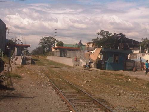 The PNR Bicutan Station on the north side of Gen. Santos Ave. near the SLEX Bicutan interchange
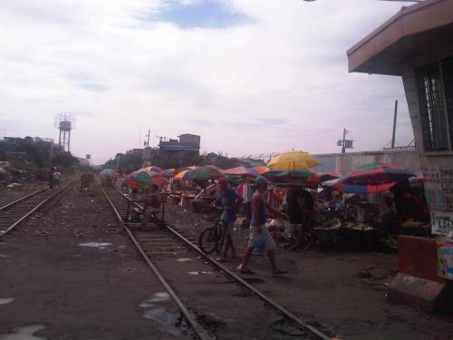 Non-motorized trolleys on the south side of Gen. Santos Ave. near the SLEX Bicutan Exit
The trolleys are informal transport vehicles serve people living along the PNR ROW including many informal settlements within and without the PNR property. Some of the buildings or structures of these informal settlers are visible in the photo downstream of the railroad crossing. There are similar cases in Manila and elsewhere along the PNR ROW including motorized trolley services in the provinces of Quezon and Camarines Sur, where trolleys are also utilized for public transport and are the means for livelihood by some of the same informal settlers.
There are increasing safety concerns for these vehicles, their operators and their passengers. The trolleys are lifted from the tracks an people clear the way once a train approaches. They return after the train has passed. With the PNR currently experiencing a revival of sorts, and if resources continue along with an increase in ridership, train frequencies should also be expected to increase. As such, there should come a time when trolleys would have to be banned along the entire line in order to minimize the chances for crashes involving trains and trolleys that will surely lead to fatal consequences. Perhaps the local governments along the PNR line should already look into this eventuality and initiate programs to address this issue, which can be associated with livelihood and residential concerns.
–
