
Road and drainage improvements along Marcos Highway – Part 2
Previous posts on Marcos Highway road works and the resulting congestion did not include photos and discussions on a significant section of the highway. This is the stretch that runs from P. Tuazon/Imelda Ave. to Masinag Junction, where Marcos Highway intersects with Sumulong Highway. Some friends have pointed out the bottlenecks that include Masinag Junction itself and the uncompleted work in the vicinity of the newly opened SM City Masinag. Following are a few photos I took on a Saturday morning while traveling along that stretch of road and a few observations pertaining to some causes of congestion.
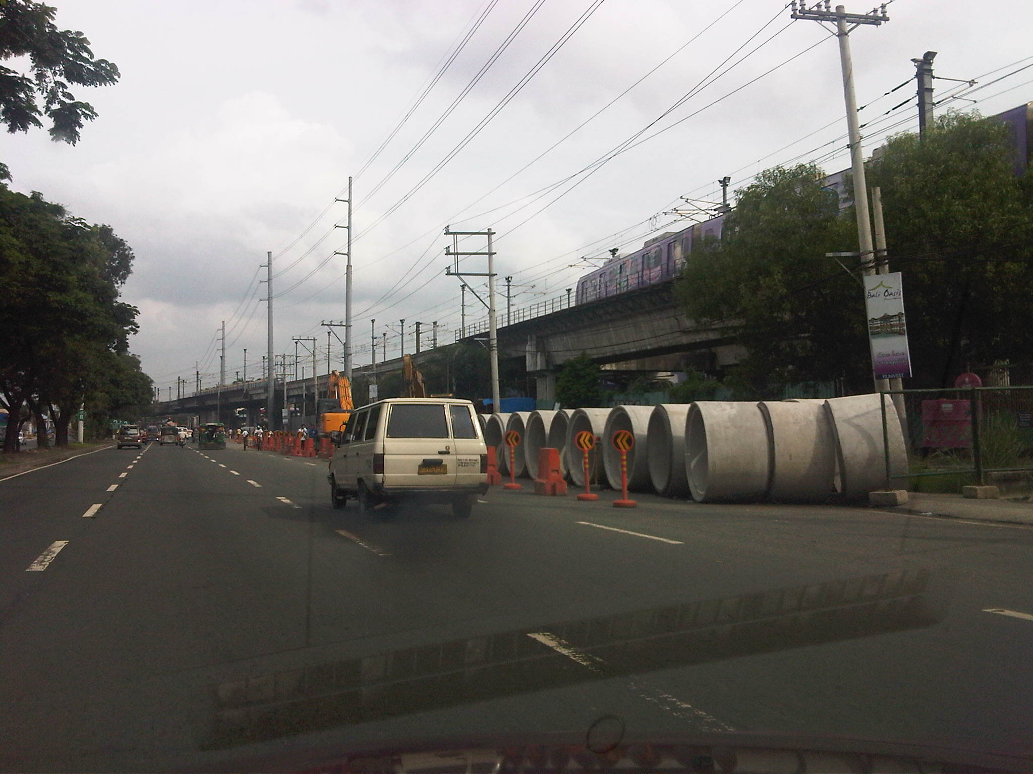
 Unfinished drainage and roadworks along eastbound direction of Marcos Highway approaching Golden Meadows gate – note that materials occupy practically 2 lanes of the highway.
 Construction along Marcos Highway eastbound in front of AMA Computer College just after Filinvest East Gate – only 3 lanes available to traffic, sometimes 2 due to heavy equipment maneuvers.
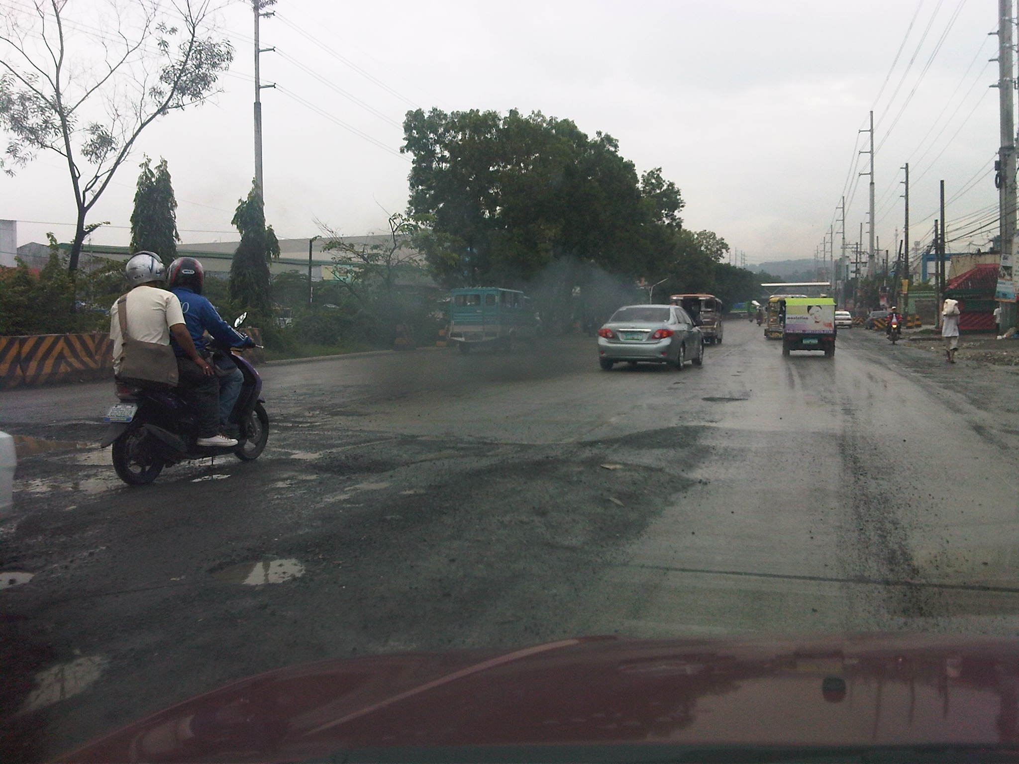 Unfinished road works near Kingsville Gate along Marcos Highway eastbound – bad road conditions lead to congestion as vehicles are forced to slow down due to the potholes and uneven pavement surface.
 Completed PCC pavement sections along Marcos Highway eastbound approaching SM City Masinag area – note that standard signs and pavement markings are still lacking along completed sections. Perhaps there is also a plan to have asphalt overlay as a protective or weathering layer for the concrete slabs?
 Completed section and newly constructed pedestrian overpass across SM Masinag – despite the overpass, many people still brave crossing the wide highway and risk getting run over by speeding vehicles.
 Jaywalking and risky crossing at Masinag Junction – I think traffic enforcers usually fail in managing pedestrians and cyclists crossing at the intersection resulting in the decrease in the throughput of the intersection. In any case, poor control may just lead to a road crash involving pedestrians and/or cyclists.
 More pedestrians crossing at Masinag junction – in this case, the only conflict is with vehicles turning right from Sumulong Highway.
 Another look at the new pedestrian overpass across SM Masinag along Marcos Highway westbound – this was a necessary facility for the safety of people (likely shoppers) crossing the 8-lane highway. The overpass would probably have to be modified later should LRT Line 2 be extended towards Antipolo City.
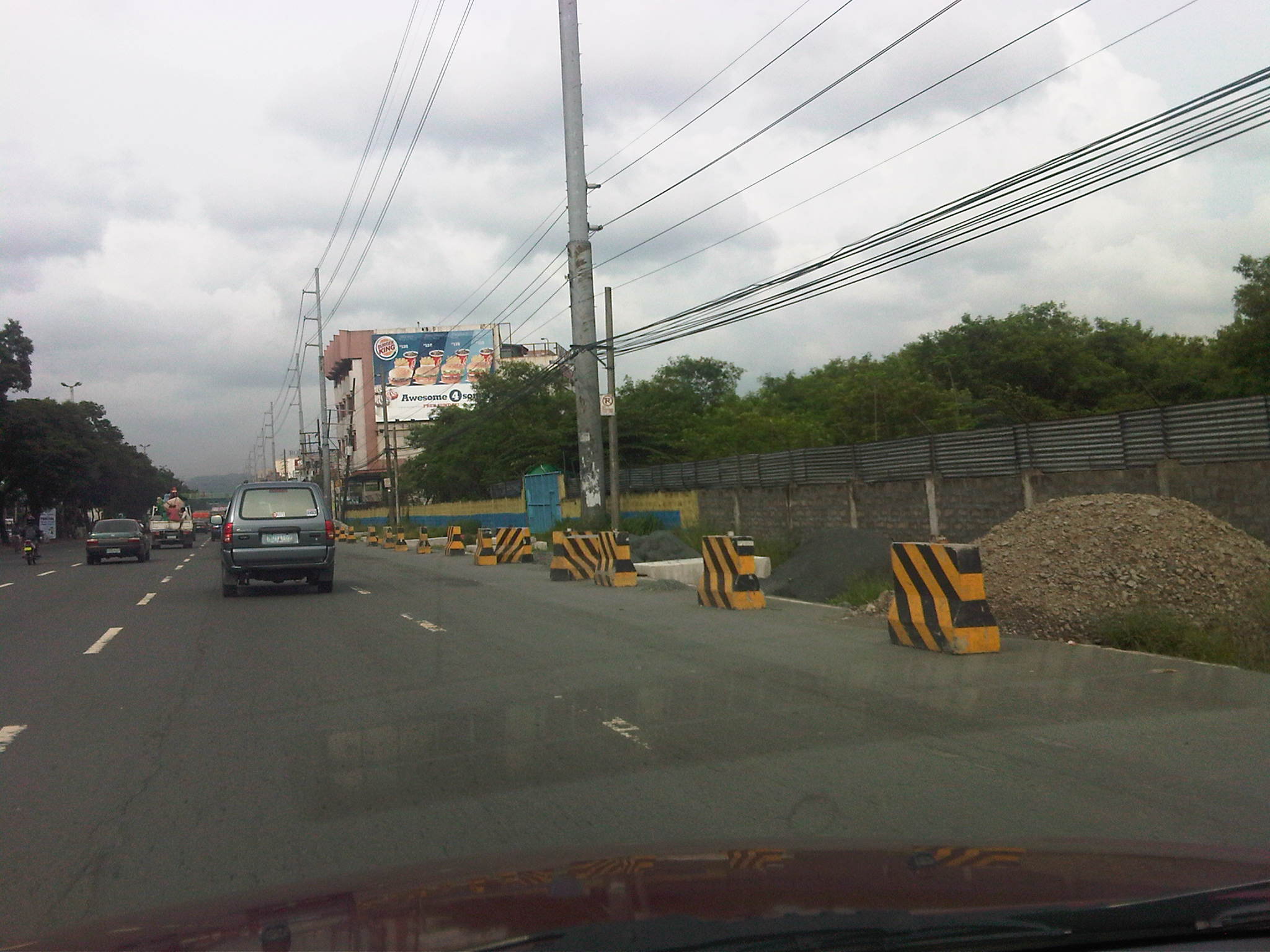
 Concrete barriers delineating lanes intended for vehicles making a U-turn along Marcos Highway just after SM Masinag – the barriers are also meant to reduce weaving caused by vehicles generated by the mall and intending to make the U-turn. These barriers, however, are also hazards as vehicles accelerating after Masinag will suddenly encounter these without adequate warnings. At present the lane is blocked right after the median opening due to uncompleted roadworks. Thus, erroneously entering the leftmost lanes will require a U-turn. Such barriers would have to be removed so traffic can still opt to pass through the section.
 Unfinished section along Marcos Highway westbound – the number of lanes are reduced from 5 to 2, drastically reducing capacity and causing serious queuing due to the shockwave resulting from the bottleneck.
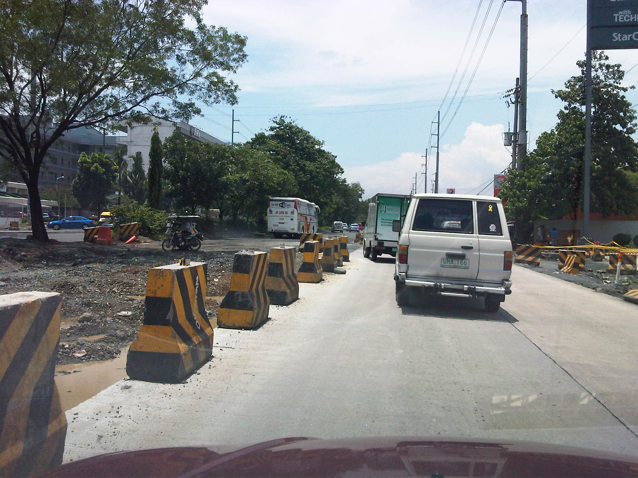 Unfinished drainage and roadworks along Marcos Highway westbound across the Caltex service station approaching the Filinvest East and Vermont Park gates – the section widens just before the subdivision gates and median opening but the inner lanes have not been paved at the time the photo was taken.
 Median opening (U-turn slot) for westbound traffic coming from Imelda Avenue – the old median opening across Burger King was closed and traffic was diverted to this slot located between the Shell and Phoenix service stations right after the Town & Country gate and CVC grocery. The result was less congestion due to weaving traffic between Imelda and this slot. This, however, came with a price – a longer trip for vehicles coming from Imelda Avenue.
With the completion of road and drainage works along Marcos Highway, it is expected that congestion will eventually be eased and the inherent costs will be reduced. Perhaps there will also be an opportunity to revisit traffic management and traffic control at critical junctions including Masinag, Imelda Ave./A. Tuazon, and A. Rodriguez/J.P. Rizal. So far, the perception of continuous movement due to the U-turn schemes along Marcos Highway have resulted in many adjustments to the locations of the slots while only producing congestion and perhaps encouraging aggressive driving behavior. Traffic signals should again be considered though traffic and travel behavior will surely be affected by a proposed extension of LRT Line 2.
Yurikamome – AGT in Tokyo
I lost a lot of photos and negatives to Ketsana. These included many about transportation systems in Japan during my 3 years while taking my doctorate. We loved to take pictures at railway platforms and I had a collection of photos of various trains approaching the platform including those taken by friends where I was in the picture as the train was approaching in the background. Fortunately, I have photos taken from more recent trips to Japan when I already had the benefit of having a digital camera for my shots. As I was browsing old photos, I came upon a set taken from a trip to Tokyo back in 2005. Following are a few photos I took when we went around the Odaiba district and used its popular Automated Guideway Transit (AGT) system called the Yurikamome or Seagull.
 Station platform – notice the doors that automatically open and close along with the AGT doors
 Another view of the station platform – notice the markings on the floor to designate queuing areas as well as standard guides for blind commuters (these are the yellow, dimpled tiles)
 Passengers’ waiting area with simple benches. The information boards for train arrivals are visible from this photo.
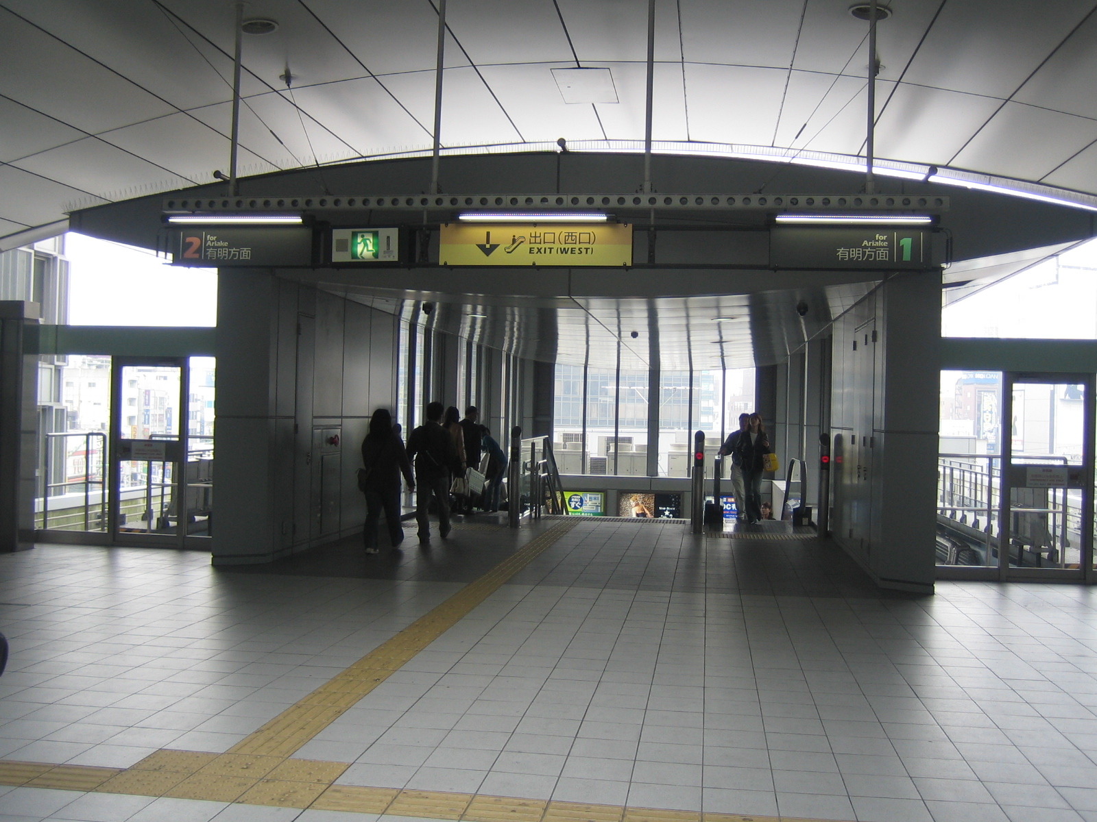 Entrance and exit to the station platform – both stairs and escalators are available to passengers.
 The Yurikamome’s guideway, which looks like a road. The AGT uses rubber tires much like road vehicles and employs a suspension system that ensures a smooth, comfortable ride.
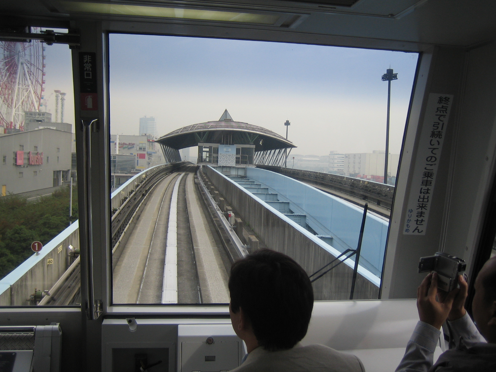 The Yurikamome is driverless (thus, automated). This is the view from the most coveted seats on the transit as the AGT approaches a station.
Dim your lights
I took the photo below in Cebu during one visit in 2010. The signs were posted along the coastal highway in the South Road Properties (SRP). Our friend explained that the signs were supposed to have been posted there as a spiteful message by a former mayor of the city to a political rival whose entourage commonly used the highway going to the city. Apparently, the vehicles on the politician’s convoy have the habit of using their lights even during the day to announce their presence in traffic. It seems their headlights are always on high beam (i.e., bright), which can be distracting for opposing traffic even if there is a median island along the highway. I can also imagine that in the past, vehicles on the convoy would probably use sirens or wangwang.

Many Philippine roads, especially in the rural areas, do not have lighting or are poorly lit, and it would be a lucky night when the moonlight is sufficient to provide illumination. Thus, it is understandable if we use the high beam or bright mode of our headlights when we are driving along dark roads and if there are no traffic on the opposing lanes. However, I think it is a matter of road courtesy that we dim lights when we encounter other vehicles on the road at night. Maybe it’s okay if the opposing lanes are divided by a median (like the island with plants in the photo) or barrier such that the lights are dissipated somehow. But most Philippine highways are undivided and thus, bright lights may become a hazard for motorists and lead to road crashes. If only for this, then there is actually a sound basis for reminding drivers to dim their headlights, especially in the city where there is significant vehicular traffic.
A glimpse of transport in the Philippines – General Santos
I’ve been fortunate to travel around the Philippines due to my line of work. In some cases, it is for our training programs, for others we do fieldwork for technical assistance or consultancies. You get to see not just the nice places around the country but also get to see transport in other cities and towns including a glimpse of its character and the behavior or preferences of its users. In the previous posts, I have included photos I’ve taken myself of some transport curiosities and there are many more that I have collected over the last few years. I guess I just need to find time to sort through the many folders containing these photos. Unlike before when the conventional cameras required photo development and I had to scan each one that I intend to save for my lectures or for posterity, nowadays there seems to be no limit with what you can take with a digital camera except perhaps the battery life and the size of you storage media.
Below are a couple of shots I took during one visit to General Santos City (GenSan) in south western Mindanao. The scenes do have similarities with others I have taken in other cities like the one I took while traversing Kennon Road en route to Baguio City. I believe the first 2 photos were taken along the Digos-Makar Road also known as Asian Highway 26 (AH 26). Note what seems to be the comfortable state of the passengers sitting on the roof of the jeepney and the disregard for safety for the bunch on top of a local truck.
 Passengers sitting on top and hanging behind a jeepney in GenSan
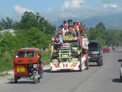 Typical tricycle and people riding on top of a local truck
 Typical tricycle and multicab in GenSan (photo taken along Catolico Sr. Avenue)
Local transport services for moving about in the city are generally provided by jeepneys, multicabs (which are actually a form of jitney service), tricycles and non-motorized pedicabs. There are also the informal motorcycle taxis (habal-habal) but these are to be found mainly in the outer parts of the city. Taxicabs generally ferry passengers to and from the airport. Buses and vans are used for inter-city or inter-town transport (i.e., long distance transport) and are banned from plying routes in the city center. These may only use the national roads to get to the terminals. Tricycles are actually banned from the national roads and this is indicated in the sidecar bodies. However, the enforcement is usually lax and you can take the tricycle almost anywhere using any road in the city. Perhaps it is really too difficult to implement the ban due to the number of tricycles?
Sustainability and the roads to Baguio
News about the garbage in Baguio City and the slide that caused the death of many in that city brought back memories of my last visit. That was back in June 2009 when we were conducting consultation workshops for the formulation of the national environmentally sustainable transport strategy. We stayed and held the workshop at a hotel that was a short walk away from the Good Shepherd Convent. The convent, of course, is famous for the strawberry jams and other delicacies bearing the convent’s name. Also nearby was the Mines View Park that used to give a breathtaking view of mountains covered with pine trees. Those among my older friends who were able to experience this many years ago attest to the pleasing scent of pine in the cool breeze that is also a characteristic of this city. Nowadays, the view is mainly of mountains covered with shanties and looking downwards you would have a good view of a lot of roofs and, surprise, even a couple of structures that look like graves! If you’re unlucky enough, you would be taking in the scent of smoke coming from something that is being burned nearby.
Another thing that caught my attention in 2009 was the uncollected garbage along the streets and in front of many houses and other buildings leading to the convent and the park. Residents explained to us that Baguio already had a garbage problem and that waste management and disposal has been an issue in the city for quite some time. Previous to this visit, I had the chance to go to the city a few other times, even staying there for almost week in 2004 when we were conducting another study. At that time, I was not aware of the garbage problem probably because the problem has not yet manifested itself as it did in 2009. It is sad that the city has done little to address such issues considering the many indications of impending (if not ongoing) disaster due to their waste. It is also disappointing to see their leaders pointing fingers at others but seemingly refusing to take responsibility for the tragedy of the garbage slide.
On the way up to Baguio, we usually take Kennon Road, which is usually my choice when riding our own vehicle, rather than the more common Marcos Highway. The latter is a relatively easier route that was constructed as a safer alternative to the two more traditional routes via Kennon or Naguilian Roads. I usually choose Kennon because the drive provides great vistas including those you can view from observations points along the road. During bad weather, however, Kennon and Naguilian can be treacherous with both being relatively narrow as compared to the newer and upgraded Marcos Highway. There are many incidences of rockslides or landslides that have often made these roads impassable. In fact, Kennon Road is usually only for light vehicles and can be challenging to those who are unfamiliar with its combination of curves and slopes. Naguilian is no longer a choice among travelers from Metro Manila as it starts further from both Kennon and Marcos. Buses and trucks commonly use Marcos Highway, which has slope protection along critical sections and even a roof along one that makes it look like a tunnel section. It is also easier to negotiate this highway for most motorists though there is one long climbing section just before you get off the highway that has caused many radiators to overheat or brakes and clutches to malfunction.
The photo below was taken as we negotiated a populated area along Kennon Road in 2009. Note the two jeepneys in the photo that are loaded with passengers. It was a surprise that no passengers were hanging by the door of the jeepney like what we usually see in Metro Manila during the peak hours. Nevertheless, such an image suggests that the public transport supply is no longer sufficient for the passenger demand along this route. Perhaps their numbers are no longer enough or maybe there is a need for a public utility vehicle with a larger capacity? One thing is sure and that the practice of overloading is unsafe and is a fatal crash waiting to happen given the geometry of Kennon Road. While this seems acceptable to many (I couldn’t even count how many people were sitting on the roofs of the jeepneys we passed.), this is not something that should be encouraged, and careful examination of services is necessary for both the local government (in this case Baguio) and the national agency in-charge (LTFRB).
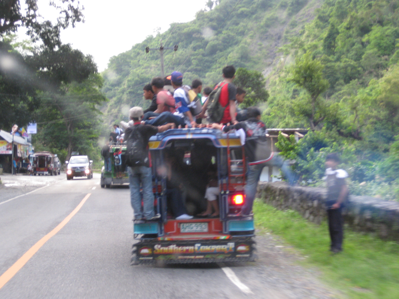
More on Baguio and jeepneys on future posts.
Pedestrian overpasses along Espana Blvd., Manila
I took some photos of pedestrian overpasses along Espana Avenue in Manila while en route to a meeting in Malacanang. I was hoping to capture the conditions along such facilities and maybe compare them with my observations along Commonwealth Avenue. Following are photos taken from my trusty Blackberry. I ask my readers to excuse the reflections due to the sun bearing down on the windshield of our vehicle.
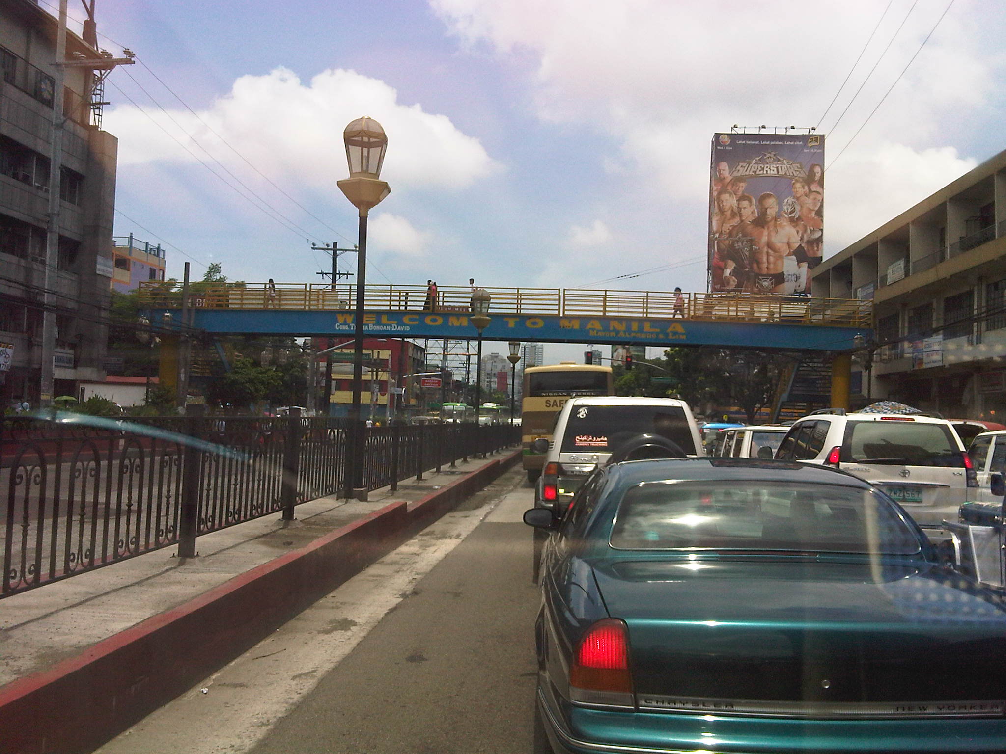 Steel overpass built during the last MMDA administration. Many pedestrian overpasses were constructed out of steel by the MMDA and this was attributed (allegedly) to the previous Chair having a construction and steel manufacturing outfit. True enough, many of these structures bear his initials that is also the name of his corporation. Many of these structures were criticized by the DPWH for not following standards (e.g., one can feel the deflection of the overpass while traversing its length) but the same agency seemed helpless in their case against such facilities.
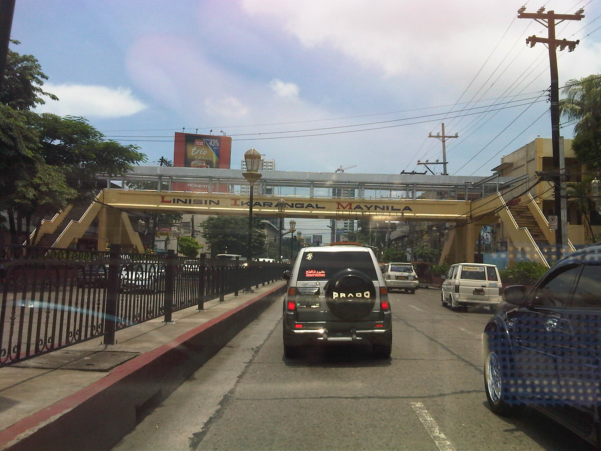 Older concrete overpass across Ramon Magsaysay School. This appeared to be clear of vendors while the roof structure is unfinished giving users no protection from the elements.
 Overpass across UST. This is one of the older and larger (widest?) pedestrian facilities along Espana considering it serves the students of one of the largest (in terms of population) universities in the country. There are vendors on this overpass but mostly those selling candies and cigarettes(!). I am not sure if UST has posted a guard along this overpass considering the safety and security interests of its constituents. Similarly situated overpasses along Katipunan Avenue are secured by personnel provided by Ateneo De Manila University and Miriam College. I would like to see this overpass retrofitted and re-designed to match UST’s heritage. The institution, after all, just celebrated its 400th anniversary.
 Overpass at P. Noval Street. It is not so clear from the photo but one can easily see vendors with their wares set-up along the overpass and clogging the flow of people. This is another relatively old structure as this is a major crossing point for people in studying or working in the University Belt.
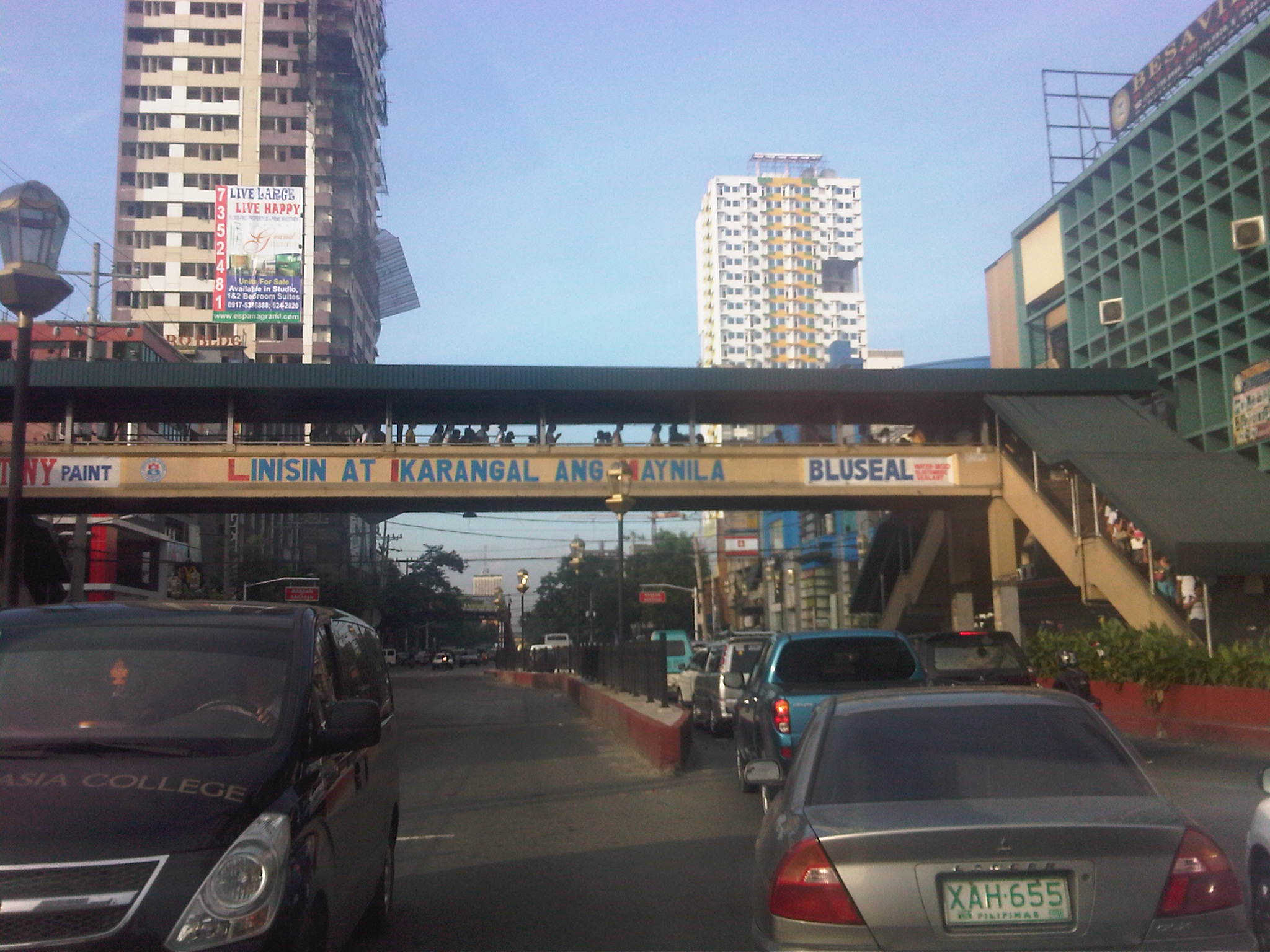 Another look at the P. Noval overpass from the Quezon City-bound side of Espana. Notice the high volume of pedestrians using the overpass? Most of these are students studying at one of the universities at U-belt or graduates reviewing for their respective licensure exams in one of the many review centers located in the area. There are many nursing and engineering review schools in the area.
If we are to encourage walking as a mode of transport and especially applicable to short distance trips, we would need to invest and build the necessary pedestrian facilities. Such facilities need to be structurally sound and therefore compliant with the standards set by the DPWH and properly located to encourage their use. Design, of course, includes capacity considerations since they should be able to accommodate volumes of pedestrians during peak periods. As such, overpasses would have to be clear of vendors or others that constrict flow. Ideally, pedestrian facilities should also be designed according to a criteria that includes aesthetics that adheres with the character of the area where it is located. It is understandable that construction of such facilities may have been rushed due to the urgency of the situation (i.e., like in the case of Commonwealth). Nevertheless, while the intent is good, the execution of the solution should still adhere with standards considering that these are often long-term investments for public infrastructure.
Car crazy: remembering an acquaintance
I met Prof. Lee Schipper for the first time when I attended the WCTR Conference held in UC Berkeley in 2007. I was presenting a paper on traffic schemes in Metro Manila at the time while a student was presenting our paper on bus operations. We had a sizable delegation from the Philippines at the conference considering Filipino students who were studying in Japan, Australia and Canada were also participating in the conference. Prior to the conference, my student was already communicating with Prof. Schipper who was reviewing our paper and he was very helpful with his comments to improve the material during the refereeing process.
I had the pleasure of meeting him a few more times in Manila at one ADB Transport Forum and at meetings organized by Cornie Huizenga’s Partnership for Sustainable Low Carbon Transport (SLoCaT). He always had a unique opinion on transport and I found his ideas quite useful for as an alternative take on a lot of things about transport that we often take for granted and orthodox.
As a tribute, here is an article by Lee Schipper published online by World Streets:
Car Crazy: Lee Schipper on the Perils of Asia’s Hyper-Motorization
Prof. Schipper was quite passionate about transport in Asia as he probably realized that motorization in Asia would have tremendous impacts on the environment (mainly on air quality and energy) and not just on the local or national levels. Perhaps the battle has been on the losing side in many industrialized countries and the huge Asian market is where efforts should be exerted in order to prevent or mitigate experiences similar to those in the US and other countries.
Prof. Schipper will be missed.
Bottlenecks along Marcos Highway
Motorists and commuters using Marcos Highway which connects towns in the Province of Rizal to Metro Manila (particularly Marikina, Pasig and Quezon City) typically experience severe congestion due to two bottlenecks. These are at Santolan in the general area of the LRT 2 Station and near the junction with Evangelista Street, and at Ligaya near the junction with Amang Rodriguez/J.P. Rizal Avenues (note that the road intersecting with Marcos Highway is known as Amang Rodriguez on the Pasig side and J.P. Rizal in Marikina). Even without the current road and drainage projects being implemented on both sides of the highway, severe congestion is experienced in these areas.
There are mainly two reasons for congestion. The first is the operation of public utility vehicles, particularly jeepneys, in these areas. The second is the traffic flow characteristics, particularly merging and weaving activities, along Marcos Highway. Undisciplined operations of jeepneys in both areas have always led to congestion as they have tended to occupy significant road space (say 2 or 3 lanes) as they compete among themselves for space and for passengers. This generally results in the reduction of road capacity as there are less lanes available for all other vehicles traversing the highway. Chaotic loading and unloading have also influenced commuters to also compete for their rides with people often found advancing to meet up with the approaching jeepneys, and occupying road space in the process.
In the case of Santolan, people occupy 2 lanes just after the junction with Evangelista street right after the bridge. Such results in usually 2 to 3 lanes available to motor vehicles. Combined with jeepneys stopped across the LRT2 station, only 2 to 3 lanes are effectively available to traffic along a stretch of the highway. I always wonder why the MMDA and Pasig City enforcers are always appear to be helpless against these people when the former should be preventing the latter from occupying road space and causing congestion that can reach as far as Aurora Boulevard along and also fill up the bridge from C5. The situation is very similar for Ligaya where Pasig-Marikina jeepneys tend to establish informal, on-road terminals at the intersection itself and clogging both sides of Marcos Highway. Again, people are everywhere and occupy road space, ensuring that only a couple of lanes are usable for general through traffic. Here also, there seems to be enough enforcers from the MMDA and Pasig City but I always observe them not doing their jobs of managing the traffic and preventing mayhem in the area.
From the perspective of traffic flow, these two areas also have weaknesses. Santolan is already located in the vicinity of an LRT2 station so it is a natural stop for both public and private vehicles. Complicating its situation is the fact that for the eastbound side of the highway, two major streams merge. One comes from the highway bridge fed by both Aurora Boulevard and Maj. Dizon (Industrial Valley), and another comes the Macapagal Bridge that connects to C5. Since the general direction of most vehicles are towards Rizal, there is tremendous weaving activity in the area causing much friction among motor vehicles. On the westbound side of Marcos Highway, there is the tendency for divergence of traffic flow again due to the two bridges plus the presence of an SM Mall whose access road is to the right of the ramp leading to Macapagal Bridge. Again there is weaving activity here that has caused not a few road crashes.
The Ligaya junction used to be a signalized intersection that was closed and replaced by a pair of U-turn slots sometime during the past dispensation at MMDA. Thus, vehicles that used to go through Rodriguez/J.P. Rizal are now required to take a right turn and weave towards the U-turn slots a few meters downstream and weave again to take a right to Rodriguez or J.P. Rizal. Many of these are public utility jeepneys, the same ones that have informal terminals at the intersection itself. Vehicles negotiating the U-turn slots tend to block through traffic as they maneuver towards the outer lanes of the highway and head for the intersection, resulting in daily congestion at the already widened section of the highway in the vicinity of the U-turn slots. The morning case is usually the more severe one and there are usually no traffic enforcers in the area between 5:30 and 6:30 AM. If there happens to be a few early birds from the MMDA and Pasig, these seem to be more concerned with setting up the barriers for the counterflow scheme they implement in relation to the road and drainage project along the highway. Pasig enforcers do not manage the traffic but seem to be engrossed in apprehending those violating the number coding scheme. During the evenings, they are unmindful of the congestion and the people spilled out and occupying the traffic lanes seemingly content on watching vehicles crawling by.
These bottlenecks along Marcos Highway are examples of situations where simple traffic management in the form of active enforcement would be enough to alleviate congestion and perhaps help reduce the potential for road crashes (that may also result in more congestion). The enforcers’ presence and absence in these cases seem to add insult to the injury that is already caused by congestion that can be solved if the enforcers were doing their jobs in the first place. I would not even consider the relocation of the U-turn slots or the criticize the flaws of the design of the bridges’ ramps because the weaving behavior of vehicles may be effectively addressed by proper traffic management. And there are many similar cases throughout Metro Manila and other Philippine cities where this is happening. Hopefully, the agencies or local governments can address such concerns and with urgency considering the time and fuel wasted due to such bottlenecks.
Congestion along Imelda (Felix) Avenue
Imelda Avenue was its original name and is taken from the first name of a former First Lady of the Republic. It was appropriate at the time considering it intersected with Marcos Highway, which was being developed as a main thoroughfare to the east and alternate to the older and established corridor of Ortigas Avenue. Imelda Avenue extends from the Cainta Junction where the road continues towards the town center of Cainta as A. Bonifacio Ave., up to Marcos Highway, across which, the road continues towards the Marikina City center as A. Tuazon Ave.
Imelda Avenue is basically a 4-lane, divided road with the division pertaining to the narrow island in the middle of the avenue than separates opposing flows of traffic. At some point in the middle of the avenue, from the Vista Verde subdvision main gate, two 2-lane undivided service roads appear on either side of the highway and continue until Karangalan Village, which has phases on each side of Imelda Avenue. Sometime in the 1990s, the avenue’s name was changed to Francisco Felix Avenue, in honor apparently of a former mayor of Cainta who was the first of a dynasty of three Felixes who became Mayor of the town. The current mayor is a former media personality on his third term and, who seems to be on the way to establishing his own dynasty by already advertising projects and accomplishments of his better half. But that’s politics and definitely another story that we will steer away from. Anyhow, the original name of the avenue was restored sometime ago as most people still referred to it as Imelda rather than Felix.
Adding insult to the injury that is congestion along Marcos Highway are the severe jams experienced by motorists and commuters passing through Imelda Avenue. The congestion is primarily attributed to the civil works related to projects of the Manila Water concessionaire whose pipes happen to be located in the middle of the road and not conveniently under one lane of the highway. Manila Water is not to blame as this was something they inherited from the MWSS who laid down the pipes, apparently without the benefit of foresight. The result of the project is severe congestion as only one lane has been practically available for Cainta-bound traffic.
But even without the project, congestion has been an issue due to the continuously increasing volume of through traffic plus the contributions in vehicle generation of the residential areas on either side of Imelda. These generators include the sprawling Vista Verde, Village East and Green Park subdivisions that have relatively high car ownership due to their mainly middle class residents. Jeepney operations along the highway where loading and unloading operations are indiscriminate and undisciplined. The two service roads offer minor comfort considering these are usually clogged by on-street parking due to commercial establishments. Tricycles operating along these service roads also contribute to slow traffic if one opts to bypass the sections affected by the water project.
The following photos were taken during a weekend trip where I had to pass through Imelda Avenue. Many areas along the highway are flood-prone (much of Imelda was submerged during Ketsana/Ondoy) so this eventuality is partly to blame for what seems to be a slowly progressing project that has already wasted a lot of valuable time and fuel. Hopefully, the project will be completed before the “ber” months arrive when traffic naturally starts to increase due to the anticipation for the Christmas season.
 Cordoned section showing only one lane of Imelda Ave southbound available to traffic. Other vehicles brave the west service road on the right.
 Pavement subgrade prepared for subsequent pouring for concrete at section approaching Vista Verde main gate. The pedestrian overpass downstream serves a national high school along the northbound side of Imelda Avenue and beside the Vista Verde gate. Notice the island on the right occupying space equivalent to 1 lane.
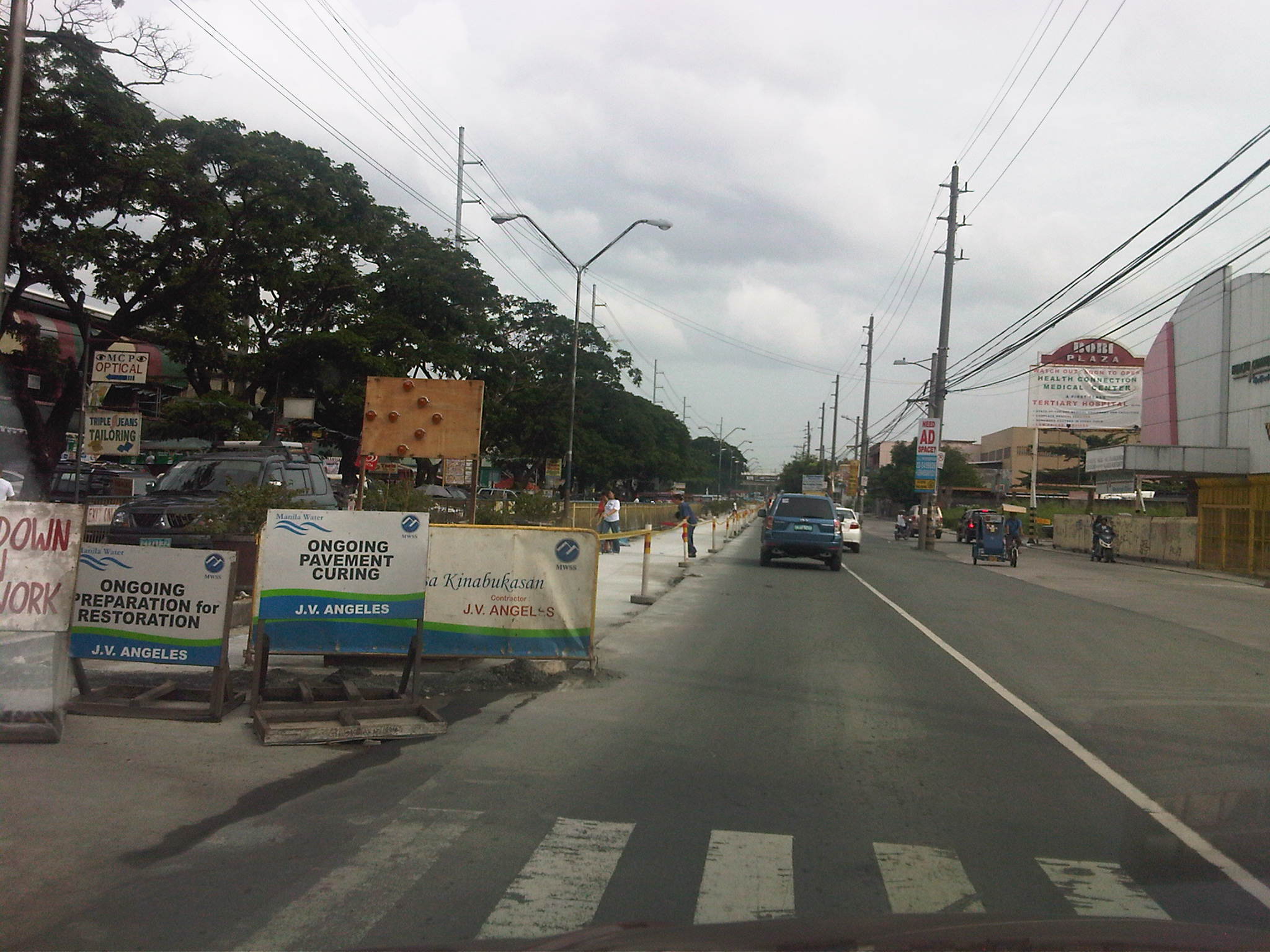 Newly paved lane along Imelda Avenue fronting the Karangalan market. The island separating Imelda from the west service road has been removed along this section to alleviate congestion and permit vehicle maneuvers in the vicinity of the market.
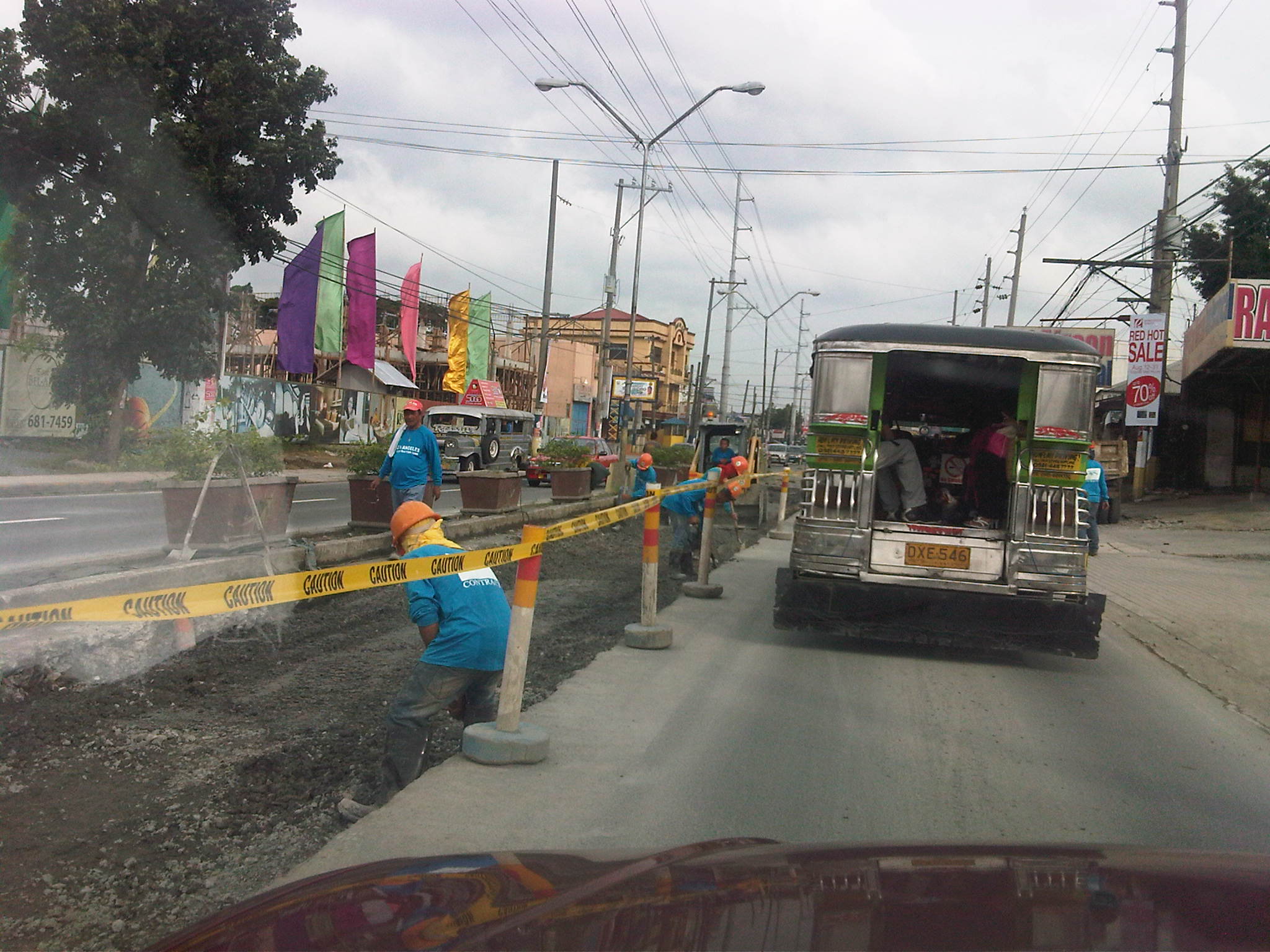 Manila Water contractor working on lane past Vista Verde main gate . Notice that there are no service roads along either side of Imelda from this point.
Road and drainage improvements along Marcos Highway
People driving or commuting from the eastern part of Metro Manila and the towns of Rizal Province have been experiencing traffic congestion for quite some time now due to the civil works associated with the improvement of Marcos Highway. The project is part of the Metro Manila Urban Transportation Integration Project (MMURTRIP) that finally pushed through after failed bids that caused significant delay to its implementation. The major components of the project include road widening and pavement rehabilitation, and the improvement of drainage along the highway. The latter component is quite important as the drainage system is supposed to contribute to the alleviation of flooding in areas along the highway. Who knows if the system could have prevented or at least mitigated the floods brought about by Ketsana (Ondoy) in 2009 if the project had been implemented according to its original schedule?
The photos below were taken during a regular commute along the highway and shows civil works in various stages of completion.
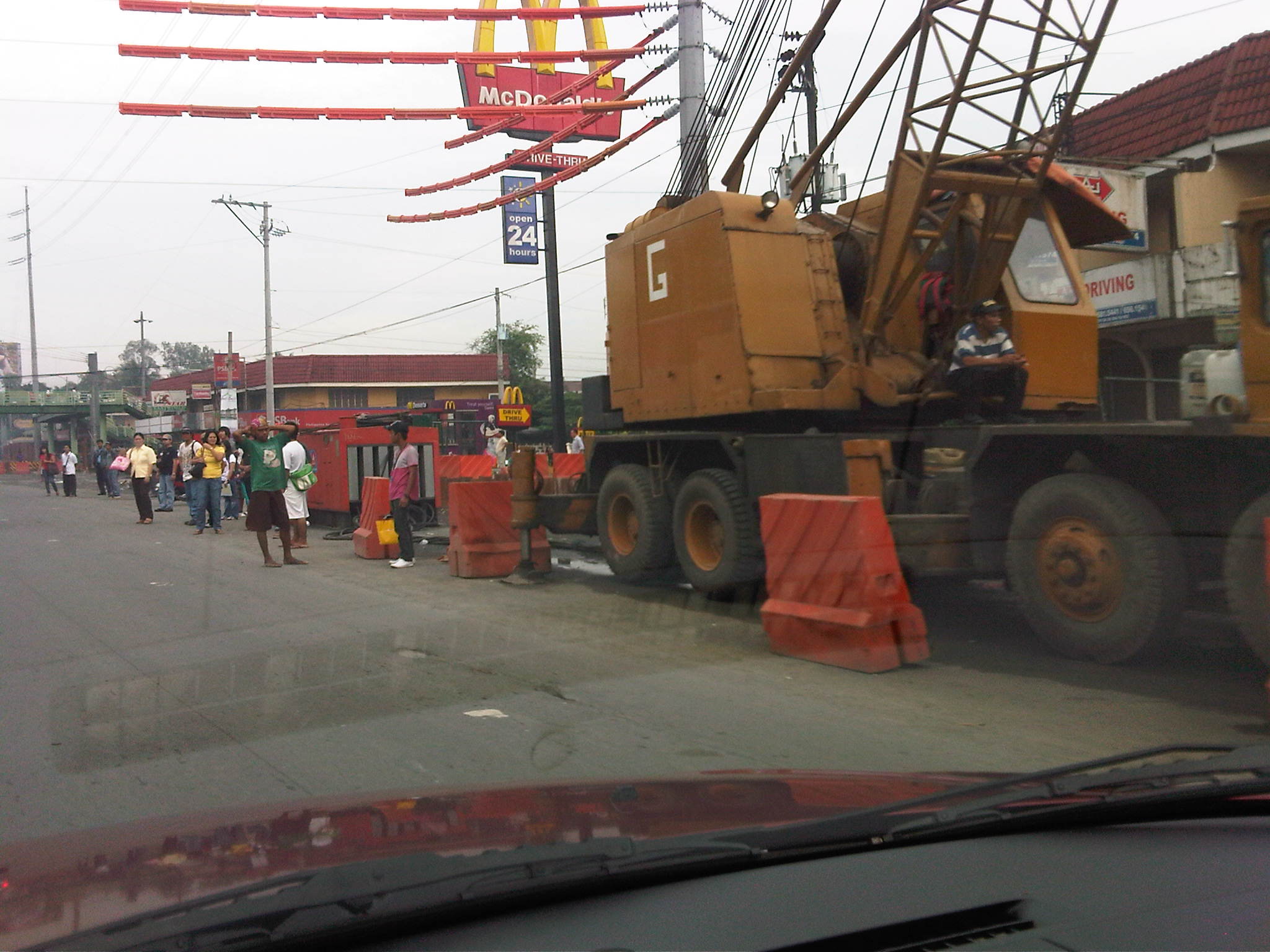 Crane deployed along westbound lane of Marcos Highway – Note the barriers and other equipment that effectively occupy about 2 lanes of the highway and the passengers waiting along the highway.
 Partly completed works along Marcos Highway westbound just after the junction with Felix Ave./A. Tuazon Ave. and across from Sta. Lucia Grand Mall
 Civil works along Marcos Highway eastbound in front of the LRT2 Depot in Santolan
 Partially completed works along Marcos Highway eastbound just after junction with A. Rodriguez Ave. (Ligaya)
 Project equipment and materials and informal barracks along Marcos Highway eastbound near the Barrio Fiesta/Slimmer’s World
 Excavations along Marcos Highway eastbound
Due perhaps to the magnitude of the project, traffic congestion along many if not most sections of the highway have been inevitable though prolonged. But partly responsible for the congestion is the Manila Water concessionaire that also did their own civil works at the same time as the DPWH project. As such, the capacity of the highway was significantly reduced with the outer lanes affected by the DPWH project and the inner lanes impacted by Manila Water works.
We should be hopeful though that once the project is completed, traffic flow will greatly improve and flooding may be alleviated along the highway and its catchment area. Works seems to be continuing although there seems to be less people working on the project these days compared to when the project started. Maybe they are just spread out along the highway? The following photos show examples of progress in the civil works.
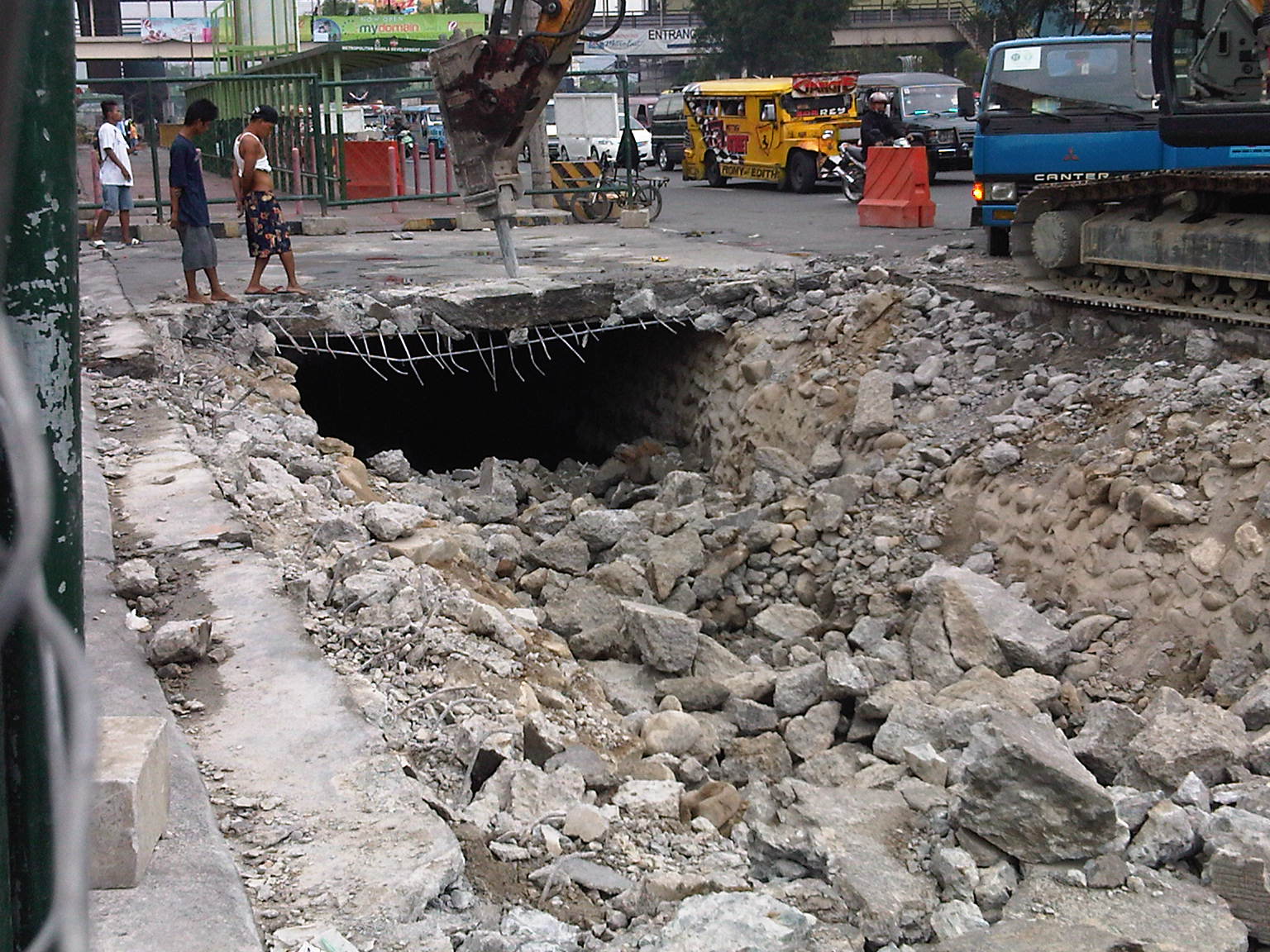 Demolition work of slab covering drainage along Marcos Highway westbound (before)
 Drainage canal covered and pavement engineering works (progress/after)
While it is expected that vehicle flow will be facilitated by the project, it can be said also that this may only encourage more vehicular traffic. As such, perhaps the next project that could be considered for this corridor is the also much-delayed extension of LRT2 towards Masinag.


