
NAIA Expressway – T2 to T3
This is a continuation of yesterday’s post on the NAIA Expressway. This time, I am posting on the trip back from Terminal 2 to Terminal 3. It cost us 45 pesos, which is the same toll fee we paid for the reverse direction. Here are photos I took of NAIA X with some comments on the sections and signs.
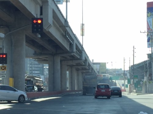 Vehicles coming from Terminals 1 and 2 would have to take the on-ramp after the intersection of NAIA Road and the Paranaque-Sucat Road (Ninoy Aquino Avenue) and just before the intersection with the Domestic Airport Road.
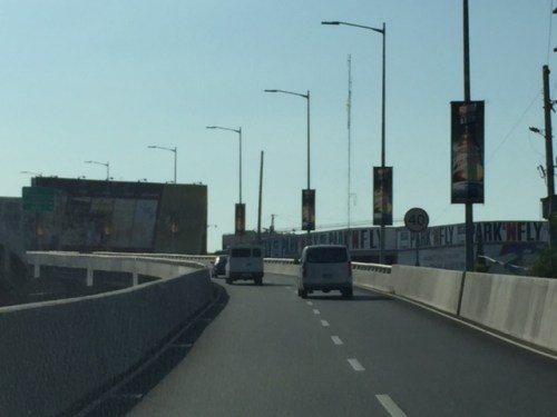 That’s the Park’N Fly building that is located at the corner of the NAIA Road-Domestic Road intersection.
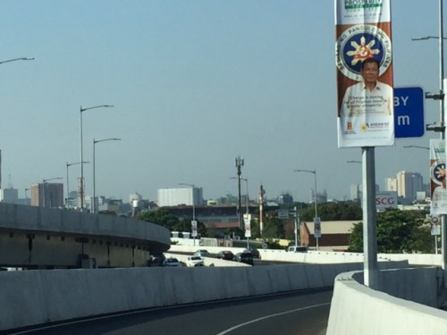 Vehicles bound for Terminal 3 and the Skyway should keep right.
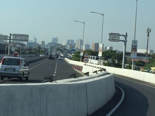 Traffic will merge with those coming from Macapagal Boulevard.
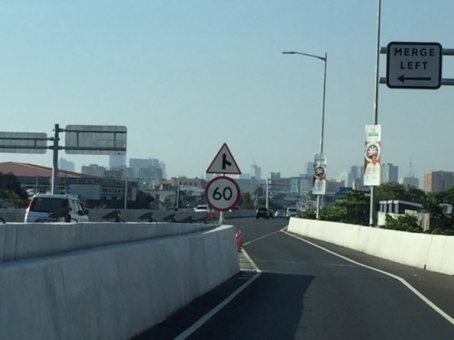 Speed limit and signs for merging traffic
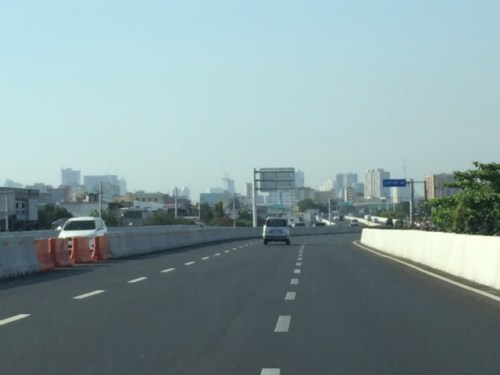 The three lanes include the merging lane at right.
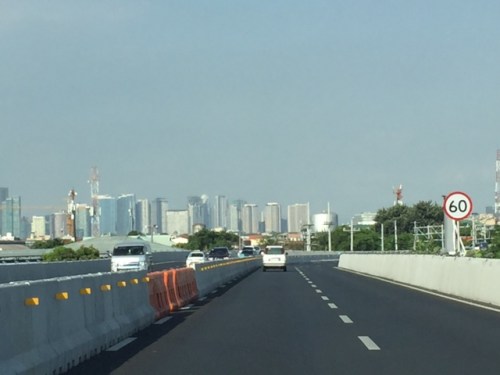 Noticeable along the NAIA X is the lack of shoulders. Although the lanes appear to be wide, drivers may become uncomfortable when two vehicles are side by side due to the perception of constricted space.
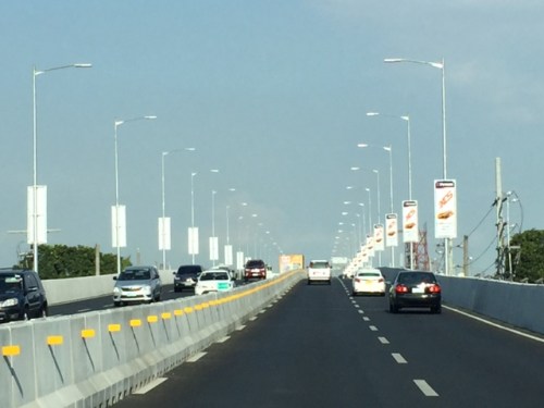 There are lots of reflectors installed on the media barriers. There are also a lot of ad space with tarps installed on each lamp post along the expressway.
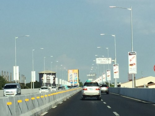 Sign informing travelers of the toll plaza coming up ahead.
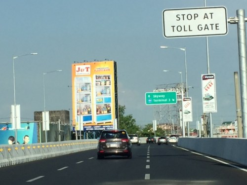 Directional sign guiding vehicles bound for the Skyway or Terminal 3. My colleagues and I agree that instead of just stating “Skyway”, the sign should state “Skyway/C5/Nichols”. Travelers who are not heading south and unfamiliar with the NAIA X off-ramps would likely take the Terminal 3 exit and end up passing through T3. There is actually another off-ramp leading to Andrews Avenue and eventually Sales Road (formerly Nichols) so you don’t have to pass through T3. We made that mistake and ended up going through T3.
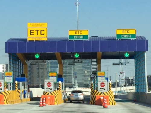 Toll plaza prior to the T3 exit ramp
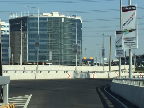 Section just after the toll plaza
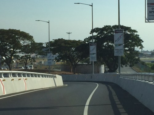 Off ramp
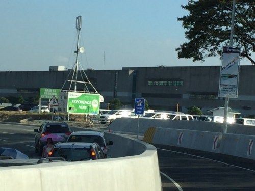 Standing vehicles right next to the off-ramp with their drivers likely waiting to fetch arriving passengers. It is practically impossible to make a hard left to avoid going into T3 so you have no choice but to go through the terminal via the departure level (elevated) or the arrival level (ground).
–
NAIA Expressway – T3 to T2/T1
Last Friday was our first time to use the NAIA Expressway. This was one of the major projects under the last administration and under the Public-Private Partnership (PPP) program and became operational last year after being delayed (It was not operational during the APEC summit in 2015.) for some time. I also commented on the need for NAIA X in one post before as I preferred to have a transit system instead. NAIA X is basically and mostly beneficial to cars and not necessarily for public transport. It also practically limits if not eliminates the possibility of having elevated transit (e.g., monorail or AGT) to connect the 4 terminals among them as well as to areas outside the airport zone (BGC, Makati, etc.).
I thought this post would be a useful one for travelers especially those coming in and out of the airports at this time of the year. A lot of people are departing or arriving at the Ninoy Aquino International Airport (NAIA), which is a main gateway to Metro Manila and adjacent regions. It can get congested along the roads between the four terminals of the airport and since there is not internal transport system linking them, travelers would need to travel along public roads. It cost 45 pesos (less than 1 USD) for the stretch from Terminal 3 to Terminal 2 (same if you’re headed for Terminal 1), and I thought it was well worth it considering it can really be quite congested between the 4 terminals. That congestion has already victimized a lot of people before with many missing their flights. But then perhaps one major cause of that congestion was the construction of the NAIA Expressway?
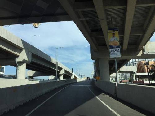 Entry ramp across from Terminal 3 and before the Sta. Clara church at Newport City
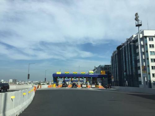 Toll plaza where travelers pay upon entry to the tollway
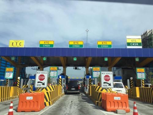 Just before the toll plaza where most booths are for mixed ETC/cash transactions
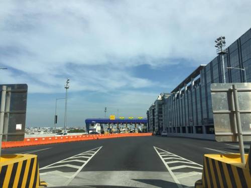 Upon exiting the toll plaza, travelers have to deal with multiple lanes merging into two
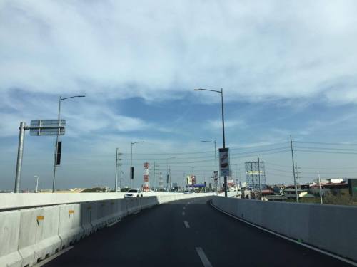 Two-lane section with neither shoulders nor “elbow room”
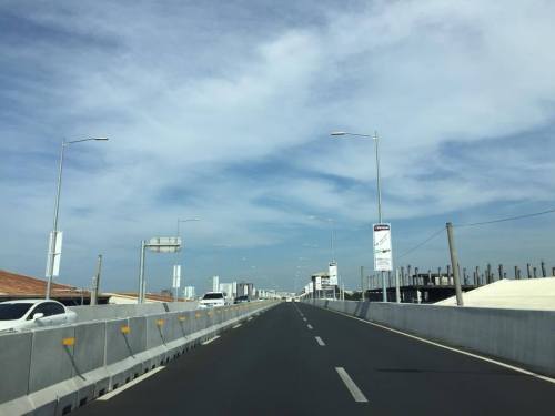
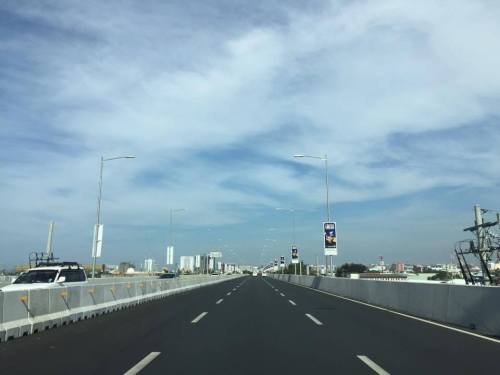
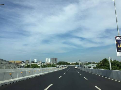
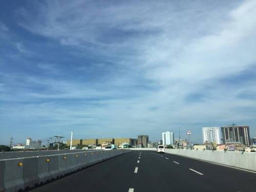
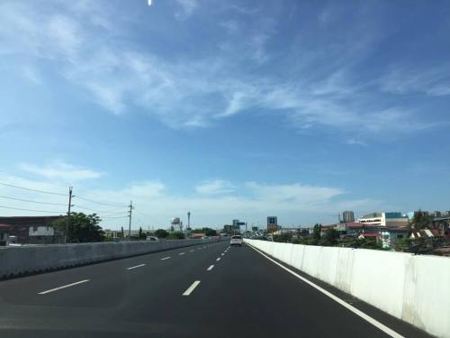
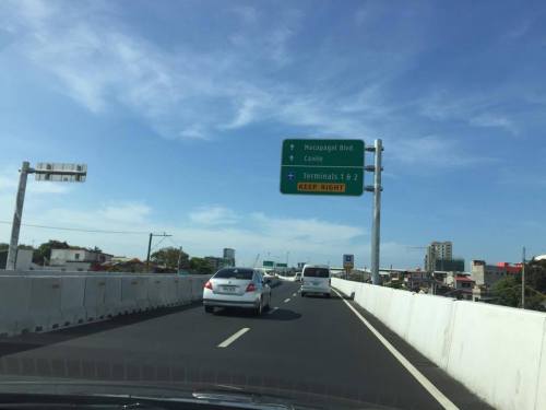 Directional sign providing guidance especially for vehicles headed to Terminals 1 &2
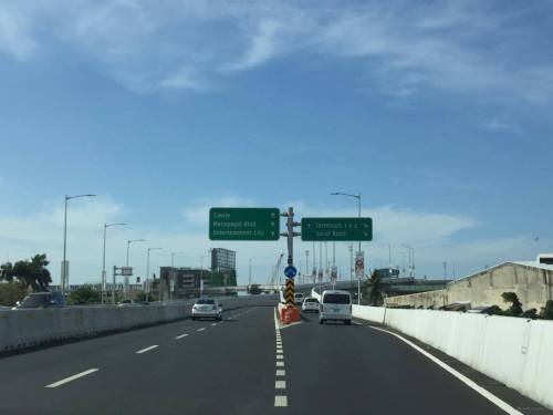 Directional signs for vehicles bound for Cavite and Macapagal Blvd (left) and Terminals 1 or 2 (right)
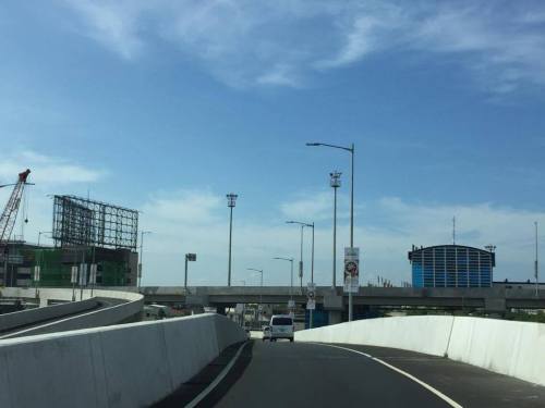 The tollway section goes underneath the section headed towards Macapagal Boulevard and the Coastal Road
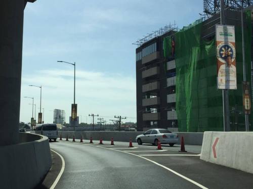 The lane from Terminal 3 merges with another from the Coastal Road
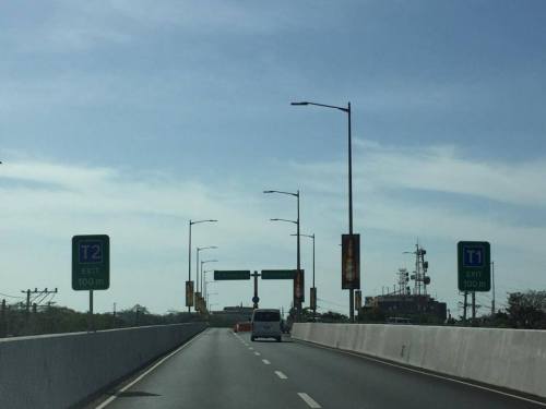 Signs showing which side to stay along towards either Terminal 2 or 1
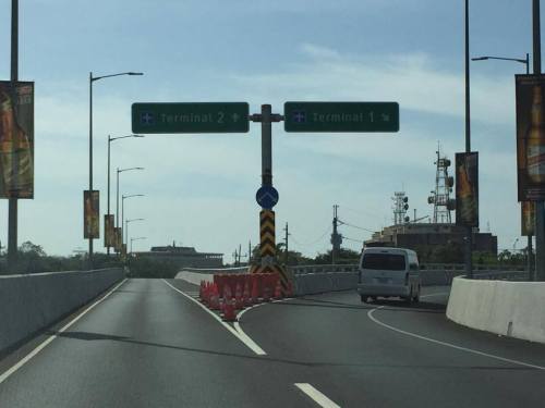 Fork in the road – the tollway branches our to either Terminal 2 or Terminal 1
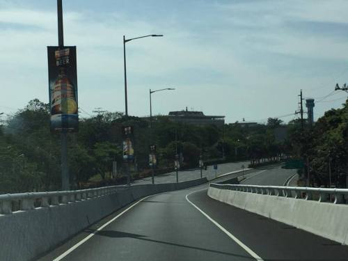
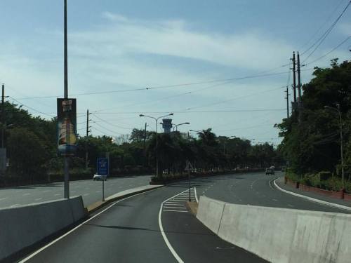 Off ramp towards Terminal 2
Next: Terminal 2 to Terminal 3
–
On motorcycle taxis becoming the “new king of the road” (cont.)
This is a continuation of the yesterday’s post on motorcycle taxis. The feature appearing in Sunstar Philippines also focuses on the case of Cebu City where there is a rising demand for motorcycles and issues on public transport have given rise to a motorcycle taxi use despite their being basically illegal under current laws/guidelines. Habal-habal as these motorized 2-wheeler taxis are known have been in service in many cities and municipalities but are mostly tolerated in rural areas where conventional public transport services are scarce.
Part II of the feature by Sunstar:
New King of the Road – Part II
There are three articles in Part II:
Ramirez, J.A.C. (2017) Motorcycles on the rise, Sunstar Philippines, Retrieved from: http://www.sunstar.com.ph, April 4.
Ramirez, J.A.C. (2017) Habal-habal drivers form group to ‘professionalize’ services, Sunstar Philippines, Retrieved from http://www.sunstar.com.ph, April 4.
Ilano, M.V. (2017) Hailing a motorcycle taxi with your smartphone, Sunstar Philippines, Retrieved from http://www.sunstar.com.ph, April 4.
Part III of the feature by Sunstar:
New King of the Road – Part III
Ilano, M.V. (2017) Even with BRT, motorbikes still needed in Cebu City, Sunstar Philippines, Retrieved from www. sunstar.com.ph, April 4.
Ilano, M.V. (2017) Will Cebu City lead the way?, Sunstar Philippines, Retrieved from http://www.sunstar.com.ph, April 4.
I hope these articles on motorcycles and motorcycle taxis will generate meaningful discussions pertaining to their applications and perhaps their regulation. One issue, of course, that should definitely be on the table is safety. That is non-negotiable and assurances by motorcycle taxi transport providers should not be enough to persuade their becoming formalized as a public transport mode. The basis for mainstreaming these should be evidence-based including assessments based on crash (accident) data. Here is something that can be studied by the various schools around the country especially universities that have the capacities and capabilities to conduct such studies in aid of policy formulation at the national and local levels.
–
On motorcycle taxis becoming the new “king of the road”
There is a really nice feature on Sunstar about motorcycle taxis that came out today. This was shared by a good friend on his social media account, which got my attention as we just completed a study on motorcycles last January 2017. Here is the feature:
Part I includes two articles:
Ilano, M.V. (2017) Habal-habal invades cities, Sunstar Philippines, Retrieved from http://www.sunstar.com.ph, April 4.
Anunciado, D.D. (2017) Deadly motorcycle rides, Sunstar Philippines, Retrieved from http://www.sunstar.com.ph, April 4.
Here’s a graphic from the second article that says a lot about motorcycle safety in Metro Manila:
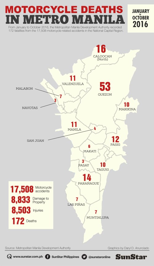
I would just like to comment that the graphic shows MMDA-recorded crashes in Metro Manila. There can be a lot of incidents that went unrecorded or unreported with the MMDA. It would be interesting to check with the local government units about their own statistics and compare these with the MMDA’s. Also, “crashes” is the preferred term over “accidents” as road safety practitioners and advocates argue that these are preventable incidents.
Sadly, such statistics can only be shown by cities doing the diligent work of recording such incidents. The Department of Public Works and Highways (DPWH) has already ceased collecting, processing, analyzing and reporting road crash reports many years ago (which is quite surprising for an agency mandated to plan, design, construct and maintain national roads). There is currently no agency (no, the Department of Transportation (DOTr) has not yet taken over the enormous task) that is collecting, processing, analyzing and reporting on road crashes at a nationwide scale and few LGUs do so at their levels.
I will also post about Part II once its out. There is a preview of what articles will be in the next feature and so that is something to look forward to.
–
“Great wall” of trucks along C5
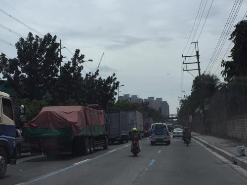
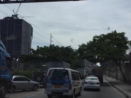
The Metro Manila Development Authority (MMDA) has implemented a truck lane policy along Circumferential Road 5 during the last administration. It has continued at present and a long line of trucks are regularly observed along C-5 whenever the truck ban is lifted during what is designated as off-peak hours for all other traffic. Many travelers have termed the line as a “Great Wall of trucks” although in many instances, the line is “breached” by vehicles needing to shift lanes along this major thoroughfare. Strict implementation by the MMDA and the affected LGUs as well as the compliance of most trucks have led to the maximization of the occupancy of the designated truck lanes. These are easily observable along most of C-5 and particularly along sections close to the CBDs (e.g., BGC, Ortigas, Eastwood, etc.). Following are a few photos showing the long line of trucks along C-5:
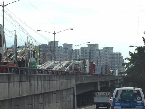
Here’s another photo I took earlier last month:
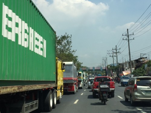
We have a couple of students now at UP Diliman who are studying the policy and taking a look at the traffic and pavement conditions along C-5. Interesting would be their comparisons of traffic along the truck and non-truck lanes during both peak and off-peak periods as well as for weekdays and weekends. Interesting, too, will be their assessment of pavement conditions. So this will be something to look forward to once the research is completed this coming May 2017.
–
Incentives for not driving?
There’s a nice article on Wired that argues for giving an incentive to commuters to give up driving (i.e., using their cars to go to/from workplaces). My only comment here is that it might have better chances elsewhere but not in the Philippines where such incentives often are seen as dole-outs and, despite guidelines or rules for implementation, are likely to be abused or taken advantage of in many offices. This is especially true when cities do not have good quality public transportation and you have low priced motorcycles and cars on sale with the many dealerships. Sad to say but the Philippines is not ready (not mature enough?) for such schemes.
Want commuters to ditch driving? Try giving them cash money
The article is by Aarian Marshall and appeared on the online version Wired last March 26, 2017.
–
Traffic management in Tagaytay?
My recent trip to Tagaytay made me recall why I no longer like the city as much as before when we were frequent visitors for rest and recreation. Two things come to mind whenever we plan a trip to Tagaytay, one is where to stay and the other is when to go. The latter question is usually a no-brainer as we opted to go to Tagaytay on weekdays rather than the weekends. There are much less people during the weekdays and you can still enjoy the city even with one having to deal with the worsening traffic conditions brought about by the intense development along the national highways. The former question is easily answered, too, since there are many good hotels (including bed & breakfast places) in the city.
Traffic though has worsened in this city that probably has tourism as its top industry. It has attracted a lot of developers who seem to have gobbled up a lot of land for what has become intense development. Surely they were targeting a market comprised of people wanting to own property in Tagaytay. The high rise condominiums address the demand for a view of Taal Lake and Volcano. The commercial developments are supposed to cater to the needs (shopping?) of tourists. The city seems to have neglected the fact that its transportation system’s carrying capacity (never mind for this article the capacities for other critical resources like water) cannot handle the trip generation attributed to these developments. And so its transport problems, again basically rooted on trip generation, are exacerbated by limited capabilities for traffic management. [The capacity seems to be there given all the staff manning the Tagaytay rotunda.]
A colleague opined that perhaps traffic management here is limited, too, by the options Tagaytay has in terms of management measures. You basically have a major intersection, a rotunda, where practically much of traffic converges. These include traffic along the Tagaytay-Nasugbu Road, which includes a lot of vehicles coming from or going to the Sta. Rosa-Tagaytay Road. And there are vehicles taking the Aguinaldo Highway. Traffic personnel seem helpless as they attempt to manage traffic movements. Their approach though is haphazard and only results in very long queues extending outward along all the intersection legs.
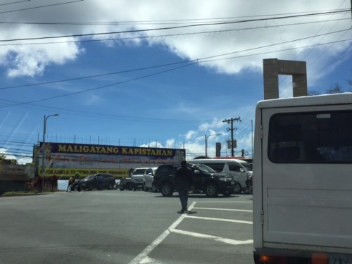 Traffic jam against the backdrop of a gigantic tarp with greetings from the ruling political dynasty in the city
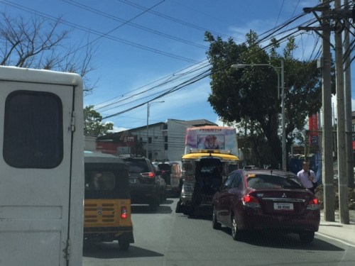 The Tagaytay – Nasugbu Highway is terribly congested due primarily to the Ayala mall. Not seen in the photo is the barrier that stretches from the rotonda to beyond Lourdes Church that forces all traffic from the west head to the rotonda to make a turn.
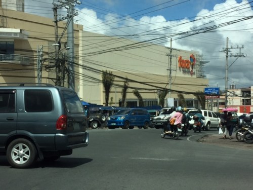 Vehicles coming in from Aguinaldo Highway are backed up. There is also a new mall under construction and opening soon that is too close to this major junction in Tagaytay.
I wonder if the major trip generators (i.e., malls and high density residential developments) were required to do impact studies before the projects were approved for implementation. There’s really not so much in terms of traffic circulation or transportation improvements that can be undertaken given the linear form of the city and the limited road network available for planners. I am curious too see for myself what recommendations were made by these studies in order to alleviate the detrimental impacts they now have on transportation in Tagaytay.
–
Contradictions in transport mode choices?
A friend posted a photo on social media and it immediately got my attention as it featured an ad by popular ridesourcing company Uber on a public bus in Singapore. There is a slogan there that reads: “Because weekends come once a week, make your move.” This statement is a promotion for Uber, which is already making inroads in the city state where taxi services are probably among the better ones in the world in terms of service quality and efficiency.
The ad itself is a contradiction in terms of who is promoting itself and where it is being promoted. Such promotion gimmicks are not beyond companies like Uber, which project themselves as mavericks in what are considered as traditional areas such as transport. Here is the photo of Uber advertising on a public bus in Singapore:
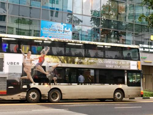
Taxi ownership and operations (i.e., driving) in Singapore is restricted to Singaporeans. Uber faced some issues with their operations as there were a significant number of foreigners, it seems, who took to Uber as a means for employment. In a city-state like Singapore, which discourages private car ownership and use through schemes like congestion pricing and the provision of high quality public transport services, Uber could face a much stiffer challenge to its march towards dominating conventional taxis.
–
Vermont Royale pedestrian overpass
There was a comment on a previous article asking if the pedestrian overpass across Vermont Royale along Marcos Highway is already usable. The photo in that article showed a still-to-be modified overpass. Following are photos taken last Sunday of the overpass. It shows the lowered mid-section passing under the Line 2 extension structure.
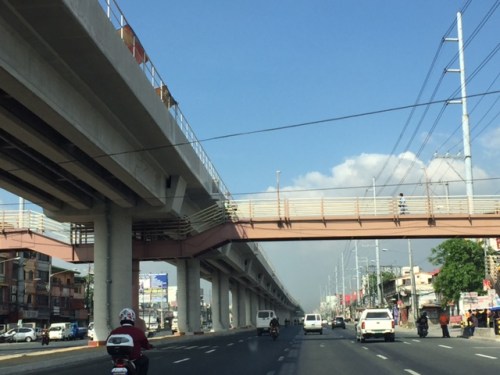 The modified pedestrian overpass across Vermont Royale along Marcos Highway
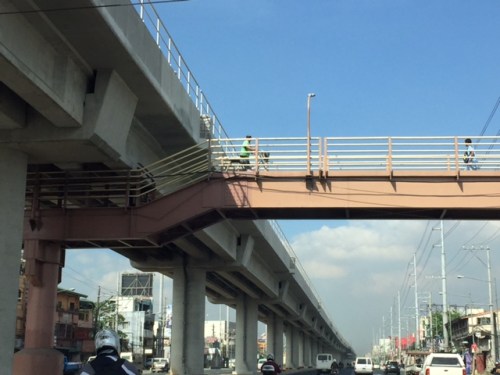 That’s a pedestrian and a cyclist using the overpass
–
Responding to the transport impacts of road crashes
Last March 9, traffic was terrible along Marcos Highway and roads connecting to it including Imelda Avenue and Sumulong Highway due to a truck that slammed into the scaffolding of the Line 2 Extension across the Sta. Lucia Mall, and barely missing the newly constructed column supporting the girders and elevated tracks of Line 2.
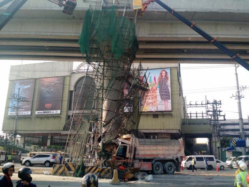 [Photo not mine but sent by an officemate who was glad to have taken his motorcycle that day instead of commuting by car.]
Following are comments I captured from Waze as I tried to get information about the traffic situation:
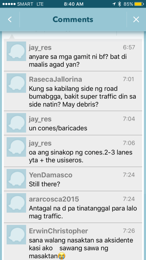
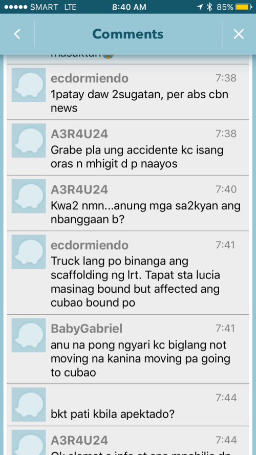
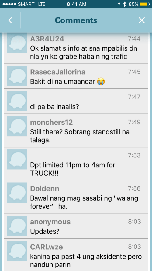
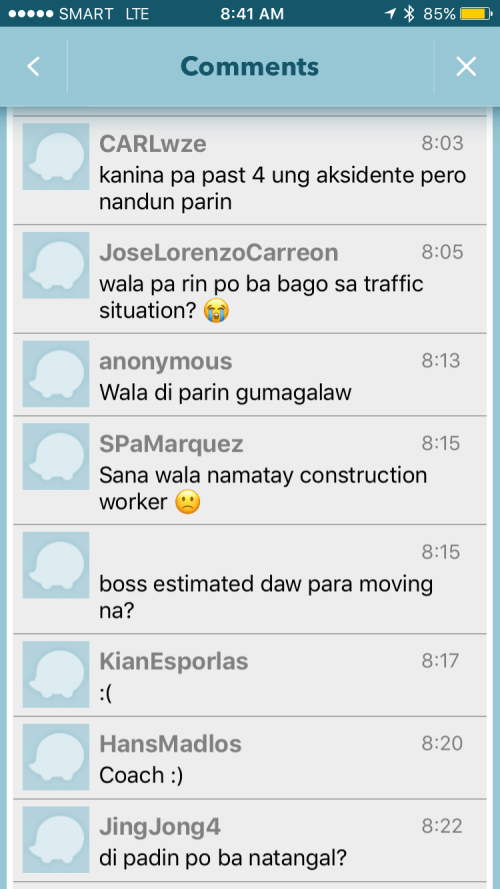

It is very clear from travelers’ comments that most were frustrated and many were angry about what seemed to be a very slow response from authorities in clearing the crash site and getting traffic to move faster. I myself wondered how a crash like this with its impacts manifesting in severe congestion along major roads was not dealt with as urgently as possible by so many entities that were not without capacity to act decisively. The front liner should have been the Metropolitan Manila Development Authority (MMDA) and there were at least four local government units directly affected by the congestion: Pasig, Marikina, Cainta and Antipolo. Surely, these LGUs could have done more if the MMDA couldn’t, in order to resolve the problem? If the availability of heavy equipment was an issue, weren’t there available equipment from Line 2 contractor, DMCI, or perhaps from the construction sites nearby (Ayala is constructing a huge mall near the area.)? Surely, they could lend a payloader or mobile crane that can remove the truck or at least help unblock the area?
I finally decided to turn back and work from home instead that day. Later, I learned that authorities had to stop traffic along Marcos Highway around 11:00 AM in order to tow the truck and clear the area for traffic to normalize. I hope this serves as a lesson in coordination among government entities and that future incidents like this will not results in a “carmaggedon” like Friday’s congestion. One thing that also became obvious is that travelers passing the area are all dependent on road-based transport and the primary reason why a lot of people were affected by the crash. The expanded operations of the Line 2, whenever that will be, will surely change transport in these areas and for the better.
–

