
Some advantages of rail over road transport
In my previous article, I mentioned how rail transport is important as part of a country’s transport system, particularly on land. I also mentioned a study conducted by our undergraduate students that was completed back in April 2012.
Our students conducted a simple survey, as part of their research, to determine the travel times and costs for public transportation between several origin-destination pairs. These O-D pairs were selected to simulate costs and travel times of commutes using either primarily rail or all road transport. Note the choices of either ‘school’ or ‘office’ paired with ‘home’ somewhere in the south of Metro Manila.
 Travel time comparisons for commutes using road and rail public transportation – ‘Road’ refers to the entire commute using road-based transport (i.e., buses and jeepneys) while ‘Rail’ refers to commutes utilizing mainly the PNR but with road transport used in the end parts of the journeys (e.g., jeepney ride from near the PNR Espana Station to UST).
 Travel cost comparisons for commutes using road and rail public transportation
Relevant to understanding the above are the following
- Fare rates have changed since 2012. However, this presents a constant change over the fares that are being compared so the basic differences will remain the same across origin-destination pairs.
- PNR services had to be discontinued for some time due to derailments because of poor conditions of tracks.
- Road traffic has worsened since 2012 with several “carmaggedon” episodes showing how vulnerable commuters are when using solely road transport.
- Road public transport services are frequent and practically 24/7. PNR services are of very limited frequency. Waiting times for the trains typically add to travel times in the form of delays, which make commuting by rail an unattractive option due to their unreliability of service.
–
Antipolo public market pedestrian overpass
I took some photos atop the pedestrian overpass connecting the New Antipolo Public Market and the Robinson’s Place mall. The overpass is across Sumulong Highway, which terminates nearby at the intersection with Antipolo Circumferential Road (Daang Bakal), which is currently being widened.
 The overpass is a steel structure, including the flooring, which reminded me of factories. This industrial look is not new as there are other overpasses that have been constructed in Metro Manila similar to this.
 A look at Sumulong Highway towards Masinag. The highway has 4 lanes and at this section has sidewalks on either side of the road. There is no median island to separate opposing flows of traffic. The Antipolo Public Market is on the left side.
 A view of Sumulong Highway towards the Antipolo Shrine of Our Lady of Peace and Good Voyage. The Public Market is at the right and the mall is at the left.
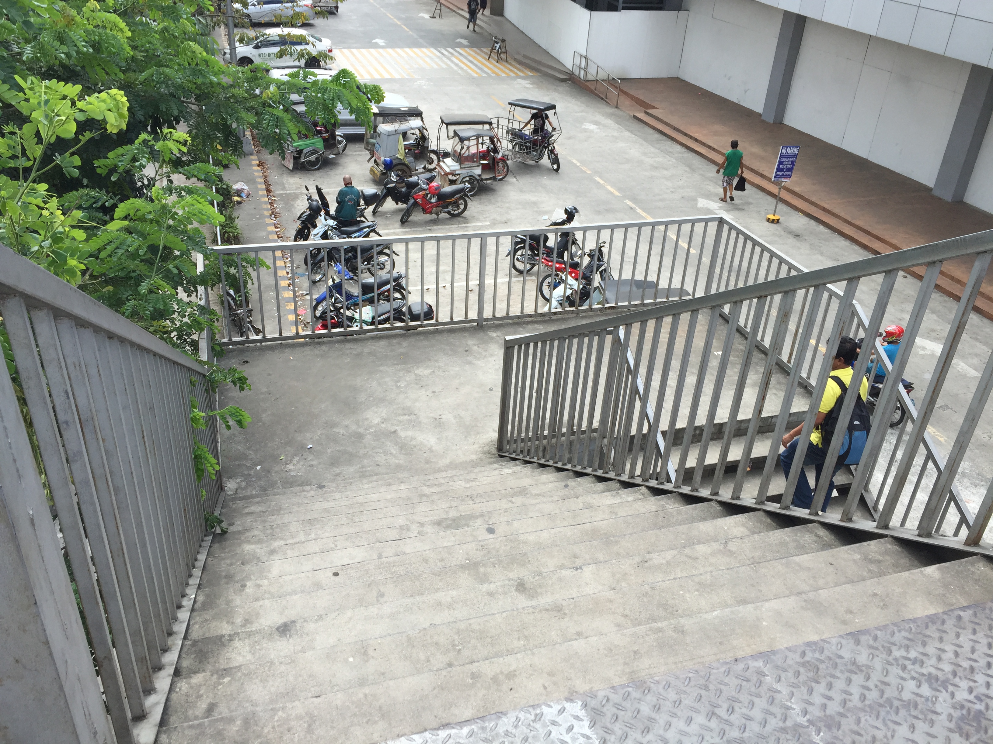 The overpass’ stairs are a bit steep and perhaps not so friendly to senior citizens. There should probably be a ramp for persons with disabilities or for cyclists to use as they carry their bicycles to cross using the overpass.
Despite calls from some advocacy groups for pedestrians to be prioritised and for them to cross at-grade, the reality is that we are still far from achieving safe roads for pedestrians given the way motorists run their vehicles. In the case of Antipolo, many jeepneys, UV Express and tricycles (freely roaming the city) are operated by reckless drivers. Private vehicle drivers are not so different and I have seen scenes of road crashes along Marcos Highway and Sumulong Highway where those involved are private vehicles including motorcycles. Clearly, many of these people should not have driver’s licenses in the first place given their mindset when driving. So until this improves, pedestrians are safer when they do use these overpasses. Of course, that goes without saying that the location and design of overpasses need to be thought over carefully so that these facilities will be used and not just become white elephants.
–
On the severity of traffic congestion along Ortigas Avenue and the necessity of a mass transit line
With the worsening congestion along Marcos Highway due to the construction of the LRT Line 2 Extension to Masinag, I have been using Ortigas Avenue as an alternate route to go home. Granted, the stretch from the Park Place gate near Cainta Junction and Brookside is currently undergoing roadworks elevating that entire section (which is prone to flooding), and this is the main cause of much congestion as fewer lanes are usable to traffic. However, what is perceived to be relief from traffic once the project is completed will eventually and surely revert to a very congested Ortigas Avenue.
Traffic congestion along Ortigas Extension is primarily due to a dependence on road transport, particularly private vehicles, by people living along Ortigas Ave. and the roads feeding into it. The Manila East Road, for example, passes through the most populous towns of Rizal outside of Antipolo City. The dependence on road transport (especially private vehicles) is due to limited options for public transport. There are buses, jeepneys and UV Express but these, too, contribute to congestion due to their increased numbers and limited capacities given the high demand for public transport. Among the infrastructure proposed along this corridor is an overpass along Ortigas Ave. at Cainta Junction. A mass transit system has also been required along this corridor for a very long time but for some reason, such infrastructure has not been provided.
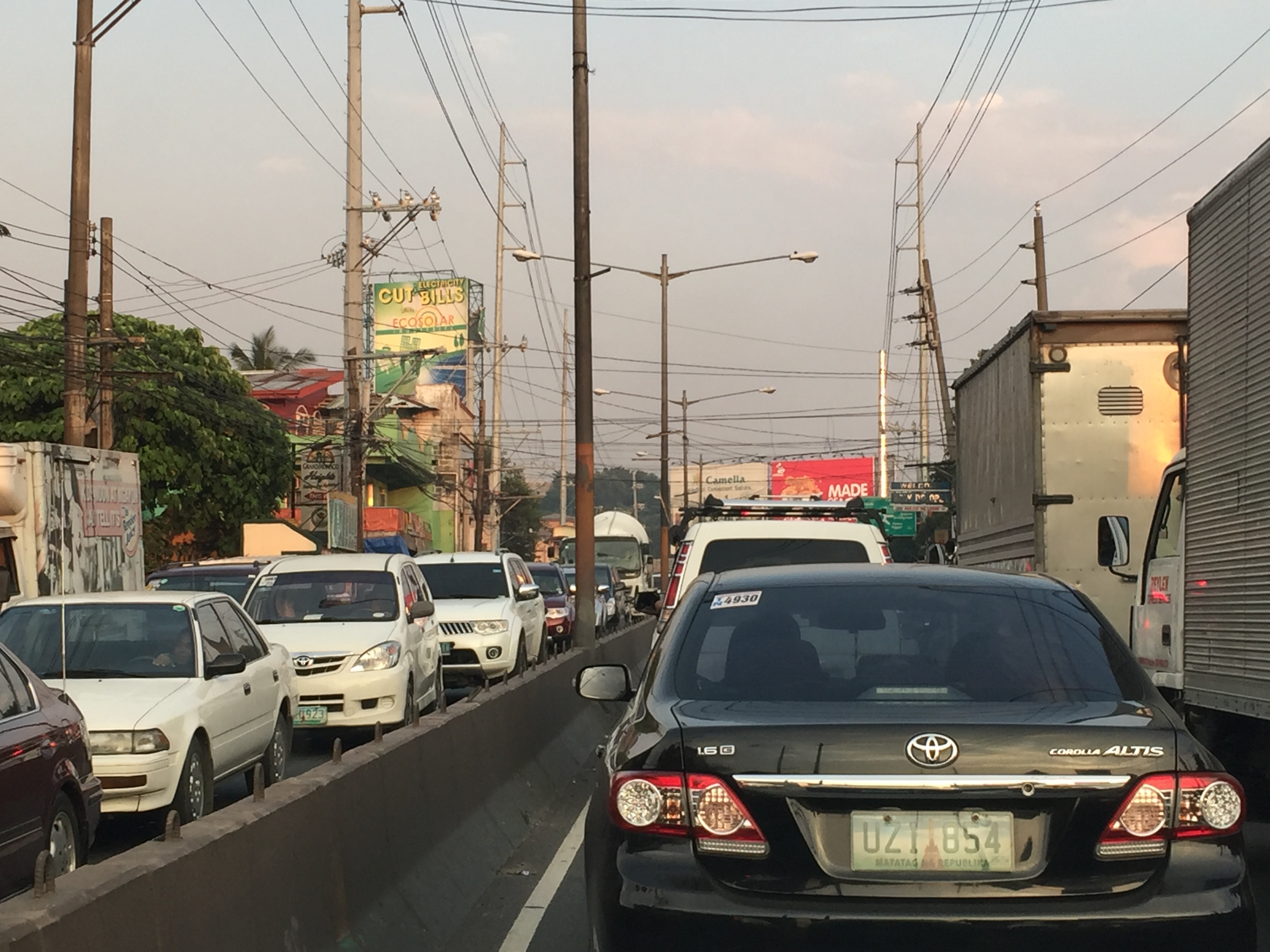 Severe traffic congestion along both directions of Ortigas Avenue Extension
 Congestion stretches all the way along the Manila East Road
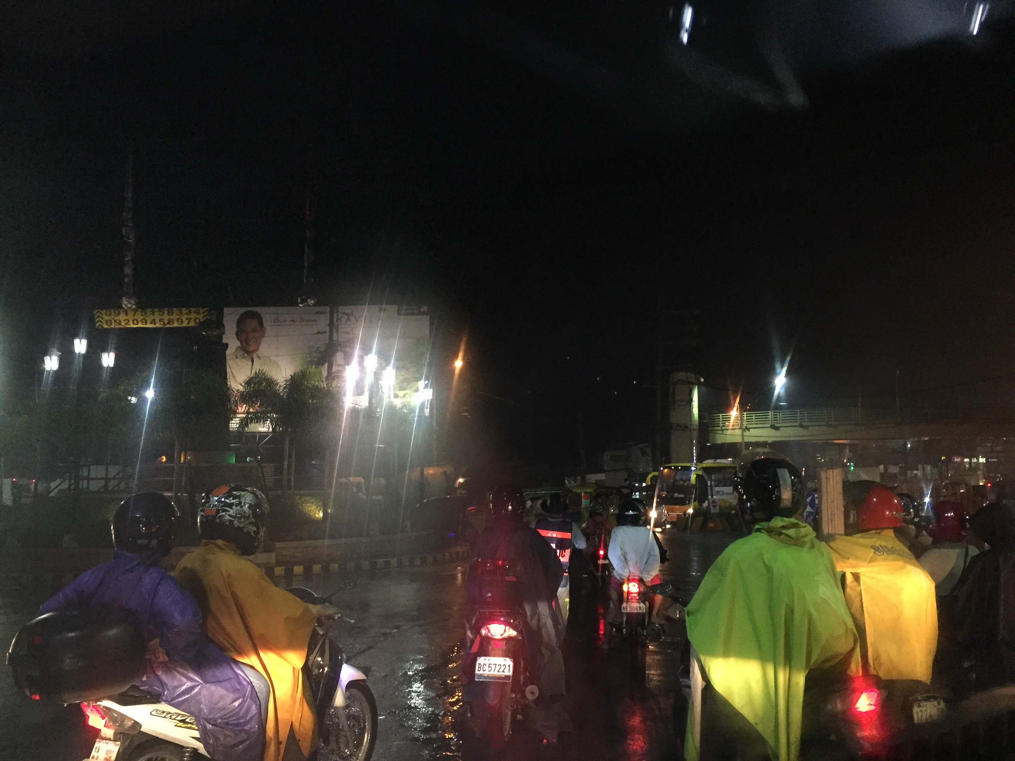 Night-time traffic congestion at the Tikling Junction
There is a proposal for a mass transit system along this corridor. Following are references to the project:
From the PPP Centre: https://ppp.gov.ph/?ppp_projects=ortigas-taytay-lrt-line-4-project
From CNN Philippines: http://cnnphilippines.com/metro/2015/07/22/neda-approves-naia-lrt-ppp-projects.html
I found it quite odd that the stations are not referenced according to the more common place names for the locations. For example, ‘Bonifacio Avenue’ should be ‘Cainta Junction’ and ‘Leonard Wood’ should be ‘Kaytikling Junction’. Nevertheless, this is the least of our concerns pertaining to transport and traffic along this corridor.
Perhaps the conditions are ripe now to finally implement transport infrastructure projects along this corridor. The proposal and approval of a rail transit line by NEDA means the corridor has the national government’s attention. The local government leaders along this corridor are also more progressive and aggressive than their predecessors. These include a very dynamic mayor in Cainta and the former governor-turned mayor in Antipolo. A collaboration towards better transport among these two LGUs alone would be influential and instrumental to improving travel along Ortigas Avenue.
–
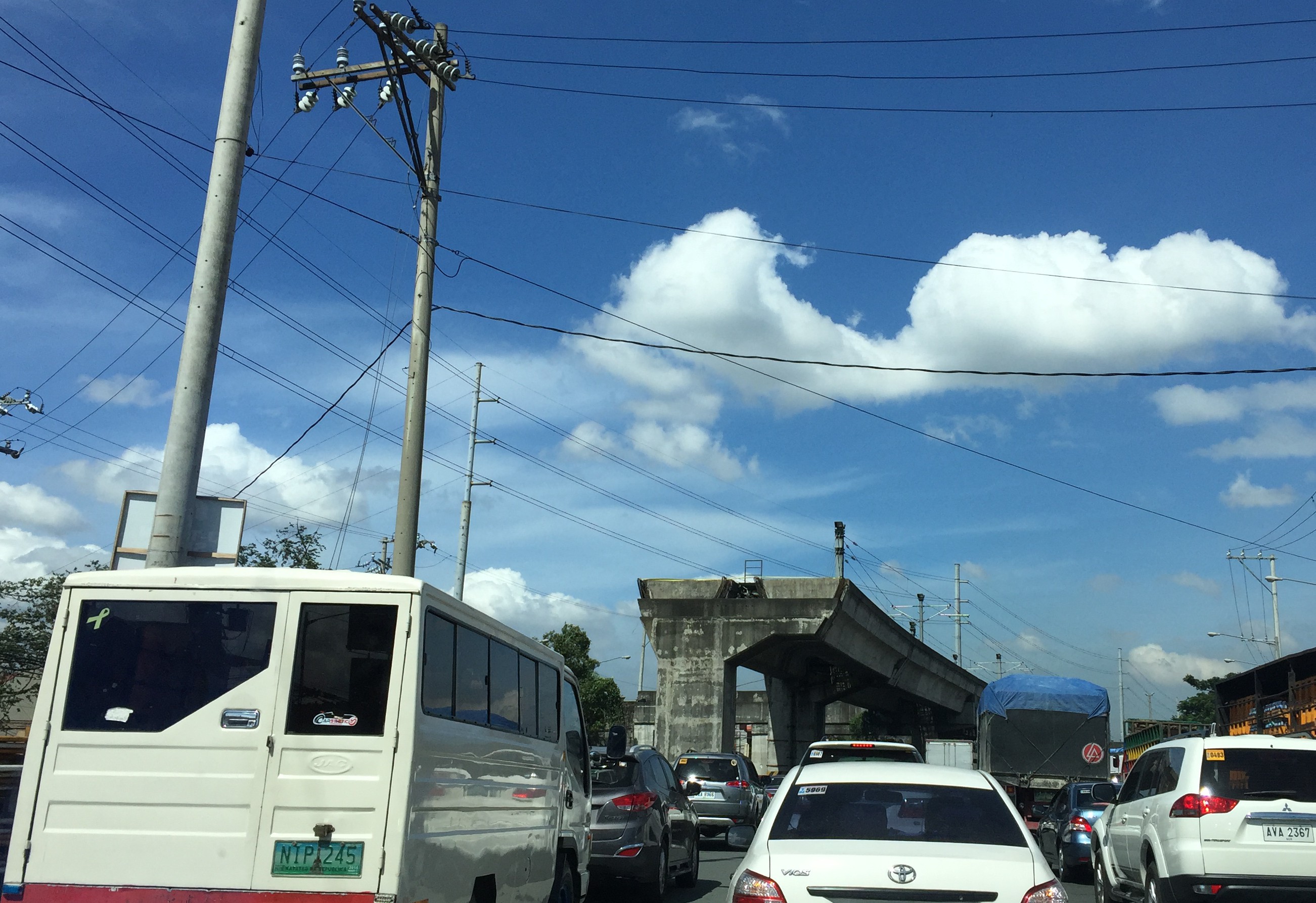
Updates on the LRT 2 Extension – no more trees!
It’s been a while since I last passed by along Marcos Highway. This morning, I was a bit surprised by what I saw (or perhaps, more appropriately, what I didn’t see). The median along the section between Imelda Avenue all the way to Santolan has been cleared of trees. This was already expected as the contractor was already clearing the median for the past weeks. The work entailed fencing off the inner lanes of Marcos Highway and has caused congestion with the highway’s capacity significantly reduced and many motorists slowing down to observe what was going on (usyoso). Following are a few photos of Marcos Highway taken this morning.
 DMCI removed the barriers securing the inner 2 lanes to reveal a median clear of trees. The median will be where the columns for the elevated LRT Line 2 extension to Masinag will be constructed.
 I wonder what will become of the pedestrian overpasses along Marcos Highway. These structures would have to be redesigned with respect to the elevated structure of the LRT Line 2.
 Here’s the conspicuously clear median along Marcos Highway approaching Ligaya. The Ayala development can be seen on the right side along the Quezon City bound side of the highway.
 Waiting – Line 2 currently terminates just after Santolan Station where trains make the switch for the return journey.
–
Railway network for the Philippines?
We start November with an article about railways. There seems to be a lot of buzz about rail these days including talks about the prospects of a subway line in Metro Manila and long distance north-south lines for Luzon Island. These projects, though, will take a lot of time to be constructed and operational, even if these projects started immediately (i.e., next year). That is perhaps one reason why these projects need to be implemented sooner rather than later. And the more these projects are delayed, they become more expensive and also difficult to build (e.g., there are other developments such as roads that may hamper rail and other mass transit projects).
I had a couple of students who did research a little over three years ago on the state and operations of the Philippine National Railways (PNR). Aside from the research manuscript, their work has not been published. The results, however, seems quite appropriate these days as the country and Metro Manila in particular grapples with problems pertaining to commuting that is dominated by road-based transport. I will write about their results here but only show some excerpts as we intend to have part of their work published.
As a first salvo, here’s a map that they were able to get from the Philippine National Railways (PNR). The map shows current and proposed railway lines throughout the country. These include the PNR Main Line South (MLS), which extended to Laguna, Batangas, Quezon, Camarines Norte, Camarines Sur and Albay. There is also what used to be the PNR Main Line North (MLN) that extended to Bulacan, Pampanga, Tarlac, Pangasinan and La Union. Panay Railways, the only other long distance railway system aside from the PNR as late as the late 1970s, is also in the map along with the proposed Mindanao Railways.
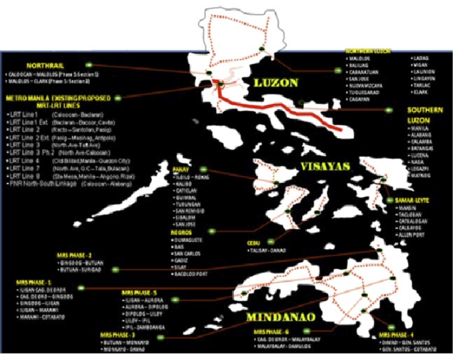
This map was provided by the PNR and likely includes data coming from the Rail Transport Planning Division of the Department of Transportation and Communications (DOTC). Contrary to the perception of many in the current administration, a lot of railway planning was conducted by past administration and many were sound ideas that justified feasibility studies. As usual, the main obstacle for railways would be the competition with road transport. It was road transport and the construction of expressways and other highways, after all, that dealt the PNR its decline (and death in the case of the MLN) to what remains today.
[Reference: Paragas, L.K.B. and Rañeses, M.K.Q. (2012) Assessment of the Philippine National Railways Commuter Line System, Undergraduate Research Final Report, April 2012.]
–
Undas traffic
Metro Manila traffic is usually lighter during Undas – the days when we remember those who passed away. Many people go back to their hometowns and this is significant because many residing or working or studying in Metro Manila hail from other provinces. Of course, some people would rather go on a vacation during this time with many now opting to travel abroad rather than braving crowded cemeteries of their hometowns. Some do the so-called ‘staycations’ – basically staying put at home during the undas break (Sorry, staying in a hotel is technically not a ‘staycation’ as many people claim it to be.)
What are the facilities that are expected to be congested? These would be the gateways from Metro Manila to other provinces. These would be airports, sea ports, bus terminals and major roads connecting Metro Manila to the provinces. There would be similar situations in other gateways as well such as in Cebu in the Visayas and Davao in Mindanao. Of course, all roads leading to cemeteries, memorial parks and columbariums. These roads would be filled with people (mostly walking) and vehicles (mostly private cars and tricycles and pedicabs if local roads) who congregate in these areas to remember and pay tribute to their dead.
The congestion experienced in most roads during this time of year is usually manageable and local governments can and are usually prepared to address transport and traffic issues within their jurisdictions. Tollways also employ their own strategies and tactics to deal with toll plaza congestion. The Land Transport Franchising and Regulatory Board (LTFRB) issues additional temporary permits to bus companies to field more vehicles along high demand routes. Meanwhile, airports and seaports would have to deal with their own versions of congestion though it is expected that such peaking or spiking up of travel activity can be handled by many airports and ports considering that these facilities are supposed to be designed for higher than usual demands.
Here’s wishing everyone safe travels during this Undas weekend. Mag-iingat lalo na sa pagmamaneho. Huwag magpatakbo na tila hinahabol ninyo ang araw ng mga patay!”
Trip cutting with respect to the LRT Line 2
Trip cutting is one of the undesirable behaviors of public utility vehicle drivers. It is most common with jeepneys and UV Express than with buses.
The findings of the study completed by our students last June 2015 are the following:
- It was proven that trip-cutting behavior is a common practice by both jeepney and UV Express drivers with routes along Marcos Highway and Aurora Boulevard, covering parts of Pasig City, Marikina City and Quezon City.
- The underlying factors involving trip-cutting behavior by PUV drivers were found to be the following:
- Jeepneys and UV Express unload most of their passengrs during peak hours at the LRT Santolan and Katipunan Stations – there was a higher likelihood for passengers to ride the Line 2 from these stations to their destinations including Cubao and the University belt. A lot of passengers are students and trying to keep their schedules. Road transport can be very unpredictable and the trains offer more reliable travel times.
- Drivers can maximize profit by having shorter trips and at the same time having passengers at full capacity – jeepney and UV express drivers unloading most of their passengers at the stations and turning around there (i.e., cutting their trips) means they avoid the congestion along Aurora Boulevard and faster turnarounds translate to their being able to carry more passengers thereby earning more revenues.
- It was observed that the top trip-cutting routes for PUVs along Marcos Highway and Aurora Boulevard are as follows:
- For jeepney vehicles:
- Cogeo – Cubao and Antipolo – Cubao routes in relation to the LRT Santolan Station;
- Calumpang – Cubao and SSS Village – Cubao routes in relation to the LRT Katipunan Station.
- For UV Express vehicles:
- SSS Village – Cubao and Cogeo – Cubao routes in relation to the LRT Santolan Station;
- Marikina – Cubao and Rodriguez/Montalban – Cubao routes in relation to the LRT Katipunan Station.
- For jeepney vehicles:
The following recommendations were made in relation to the findings of the study:
- Route modification of top trip-cutting routes to take into account the realities with respect to the current demand.
- Study on supply of PUVs with respect to the Cubao terminal station in relation to trip-cutting violations.
- In the future, when the construction of the LRT Line 2’s Masinag and Emerald stations is completed, it is recommend to that further route modifications be made relative to these new stations.
Such studies are important especially in light of the construction of railway lines including this case of the extension of Line 2 from Santolan, Pasig to Masinag, Antipolo. There is an opportunity here for the rationalization of jeepney routes to complement the obviously higher capacity and more efficient trains of Line 2. Rationalization here translates to the shortening of jeepney routes with many units terminating at Line 2 stations. ‘Cogeo-Cubao’ jeepneys would become Cogeo-Masinag jeepneys while ‘Antipolo-Cubao’ jeepneys will become either ‘Antipolo-Masinag’ or ‘Antipolo-Emerald’ jeepneys. A Masinag route end would apply to ‘Antipolo-Cubao via Sumulong Highway’ jeepneys while the Emerald route end would apply to ‘Antipoli-Cubao via Junction’ PUJs. Such will reduce the travel distances covered by the jeepneys as well as reduce their travel and turnaround times. Also, such a rationalization will lead to a better structured public transport system following a hierarchy among modes.
–
Improving road drainage to prevent flooding
Road drainage seems to be a most suitable topic given the heavy rains the past few days due to a powerful typhoon that hit the northern Philippines. With or without typhoons, however, the frequency of flash flooding has increased the past few years in part due to the heavier than usual monsoon rains but mainly due to the poor state of road drainage in our cities. The photos below show an example of flash flooding due to a sudden downpour in Cebu City.

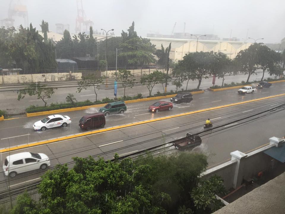
What is noticeable along the road is a lack of storm drains that could have prevented the accumulation of water on the carriageway. If there were storm drains at strategic points along the road, it is difficult to judge from the photo. I also suspect that road construction may have adversely affected the slopes required for the water to travel to the drains. These are surely stated in the road design but are somehow lost or deficient upon construction of the road. There are similar situations in other cities as well and especially in Metro Manila where flash floods often cripple road traffic around the metropolis as critical sections of major arterials like EDSA, C-5, Espana Blvd. and E. Rodriguez become flooded.
We were traveling back to Quezon City along Sumulong Highway after a meeting in Antipolo City. We noticed the road widening projects along the highway; effectively increasing the number of lanes and the capacity of the road. Included in the project are the construction of sidewalks and drainage along both sides of the road. Below is a photo of the section near the Sumulong gate of Valley Golf clearly showing the newly constructed lane and sidewalk along the Masinag-bound side of the highway.
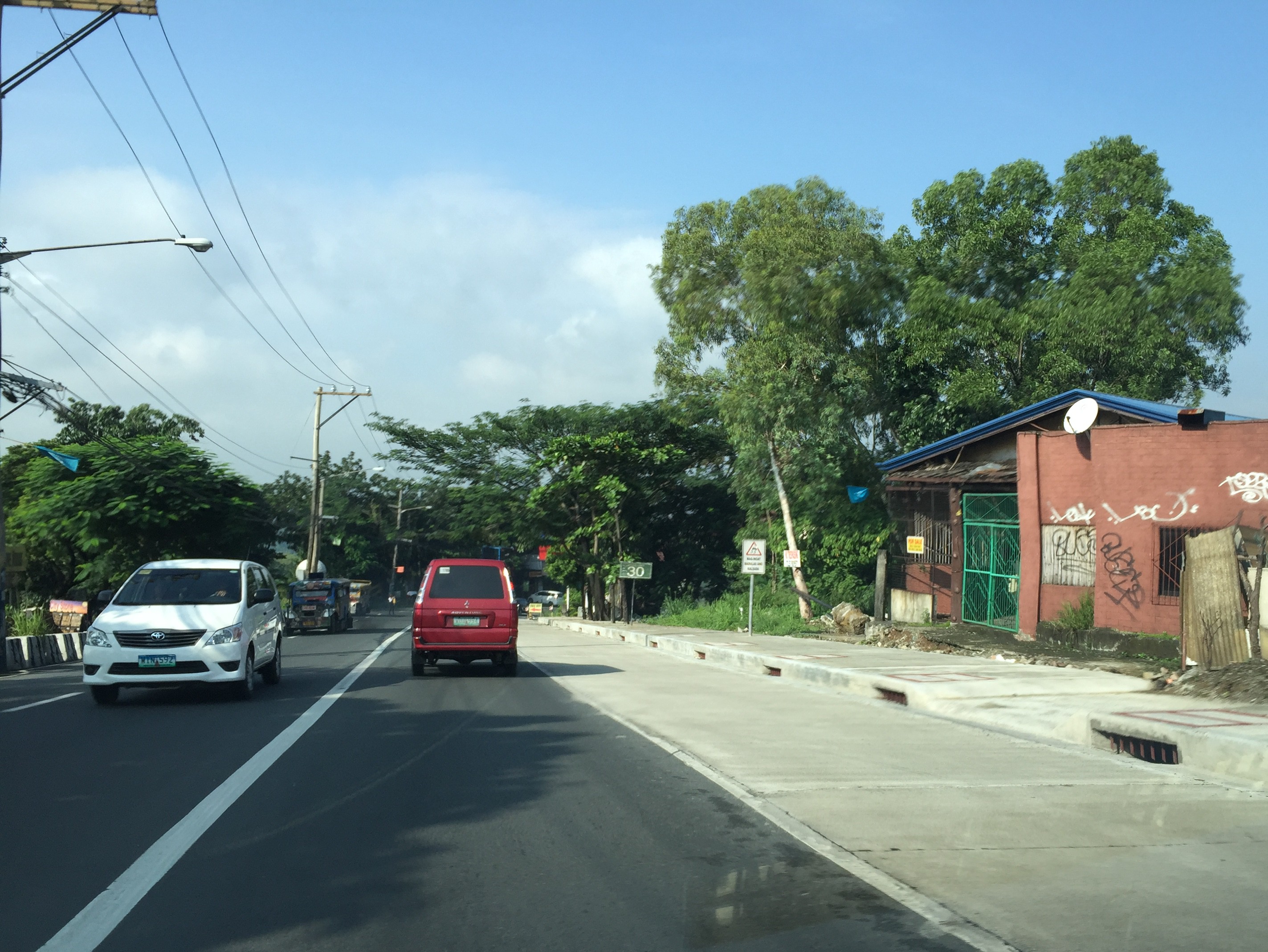
Note in the photo the size and intervals of storm drains along the the highway. Compare this with what we have along most Metro Manila roads including overpasses and it shouldn’t be a surprise why there are frequent flash flooding in Metro Manila. Of course, the capacity of the culverts is a factor (and many are already clogged or barado with garbage and mud) but then it starts with the drains for water to go to the culverts. Many newly rehabilitated roads in Metro Manila have small drains spaced at long intervals. With heavy rainfall, these cannot take in the amount of water given the rate at which they drop from the skies. Perhaps a quick fix to address flash floods is to make these storm drains larger and spaced more closely like those shown in the photo of Sumulong Highway. And then, of course, there should be increased efforts to make sure these drains are not blocked/clogged and that garbage, dirt and other debris will not go straight into the culverts.
–
Roadside views of the Pillila, Rizal Wind Farm
A highlight of our recent road trip to and from Lucena, Quezon via the Rizal – Laguna – Quezon route is the impressive roadside views of the new Pillila Wind Farm. The array consists of 27 turbines, more than the number in Bangui, Ilocos Norte. Following are a few photos of the turbines of the farm which has a total capacity of 5.2 Megawatts. I noticed though that many of the turbines were not running so the capacity is likely not reached and the output highly varies depending on the season and time of day.


There are two access points from the national highway to the wind farm. Via these access roads, one can get near the wind turbines to get photos including ‘selfies’ with the turbines as background, just like those trending photos posted on social media taken at the Bangui Wind Farm.
The Philippines needs more of these clean energy sources. The promotion and spread of such types of energy generation should be able to reduce our dependence on fossil fuels. This would be good in the long run and also for transportation since there are already many initiatives for electric vehicles. E-vehicles are not necessarily zero contributors to air quality and ultimately to climate change if we consider the sources of electricity when these vehicles re-charge their batteries.
–
Local papers presented at the EASTS 2015 conference – Xavier University
I almost forgot to post this article showing the technical papers coming out of Xavier University. Following is the list of papers from Xavier University. Xavier University is basically Ateneo de Cagayan De Oro and is a leading institution in Northern Mindanao in the southern part of the Philippines.
- Sustainable Paratransit: Best Practice Cases in Europe and the Philippines [Martin Smoliner & Anabel Abuzo]
- On-street Parking Evaluation Divisoria, Cagayan De Oro City [David Jorey Alfaro, Francis Camomot, Allison Cyril Escalante, Hipolito Bair & Anabel Abuzo]
- Pavement Distress Evaluation Using Pavement Condition Index around Agora Market, Barangay Lapasan, Cagayan de Oro City [Risa Gwen Martinez & Anabel Abuzo]
- An Analysis of Pedestrian Traffic Safety in Public School Zones in Cagayan de Oro City [Jefferson Vallente Jr., Ferven Cabugao & Anabel Abuzo]
- Agent-Based Mobility Simulation Model for Disaster Response Vehicles [Elvira Yaneza, Gerardo Doroja & Anabel Abuzo]
- A Traffic Congestion Study of Non-signalized Intersections along Yacapin-Capt. Vicente Roa, Yacapin-Osmena, J.R. Borja-Capt. Vicente Roa and J.R. Borja-Osmeña Streets in Cagayan de Oro City [Jude Añana, Kevin Calma, Carlo Flores, Dennis Tantoy & Anabele Abuzo]
Many of the papers are on local problems and very specific to certain streets or areas in Cagayan de Oro City with the exception of the first one in the list, which is on a comparative study of transport in the Philippines and in Europe. Transportation research in Xavier University basically is conducted through its Civil Engineering Department via Dr Anabele Abuzo who obtained her MSCE degree from the University of the Philippines Diliman and her doctorate from the Tokyo Institute of Technology.
–
