
The journey to PHL’s railway renaissance
Here is a quick share of an article on railway development in the Philippines. It certainly took a while for railway development to get underway with considering rail transit would probably had a major impact on commuting particularly in Metro Manila and highly urbanized cities like Cebu and Davao that require mass transit systems to alleviate congestion.
Source: The journey to PHL’s railway renaissance
The article though doesn’t contain a narrative on the journey but rather only a summary of the rail projects that are currently being implemented as well as those in the pipeline. It would be a nice to have a more historical approach to this so-called journey so we can have an objective look at what happened to our railways from the 1970s when its decline began until the last few years when a so-called renaissance came to be.
–
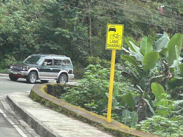
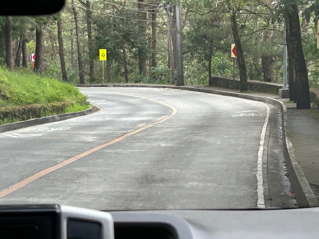
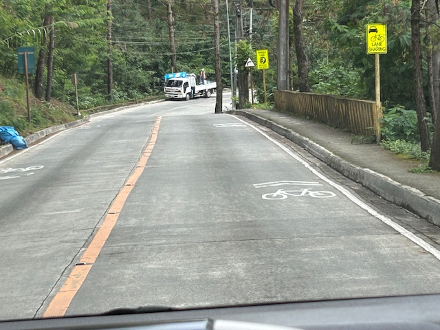
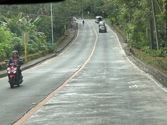
Shared lanes in Baguio City – Loakan Road
I have several drafts of articles about our recent travel to Baguio City. Those include write-ups about roads to/from and in Baguio City. Before I post about Kennon Road and Marcos Highway, I want to share some examples of shared lanes I was able to take photos of while going around the city. The following photos were taken along Loakan Road near Camp John Hay. It is the same road that takes you Baguio’s airport.
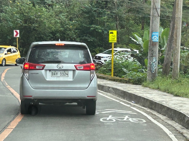 Note the use of the international standard for bicycle pavement marking. This is different from the rather odd bicycle marking in the DPWH guidelines that looks like a person on a treadmill (among other interpretations).
 The signs are also not standard and somewhat small as you can probably see in the photos.
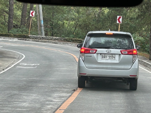 Chevron signs for the curve
 Another example of a curve section
 There are actually two types of signs installed along the road – both state lane sharing but with the other directing bicycles to keep right.
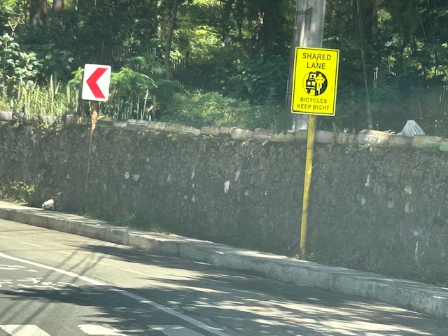 Two signs alternated along Loakan road. This one directs bicycles to keep right.
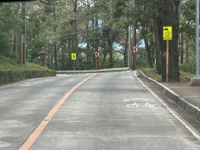 Signs and pavement markings are closely spaced. Perhaps the intervals are less than 5 meters for the pavement markings?
 Section showing pavement markings for shared lanes
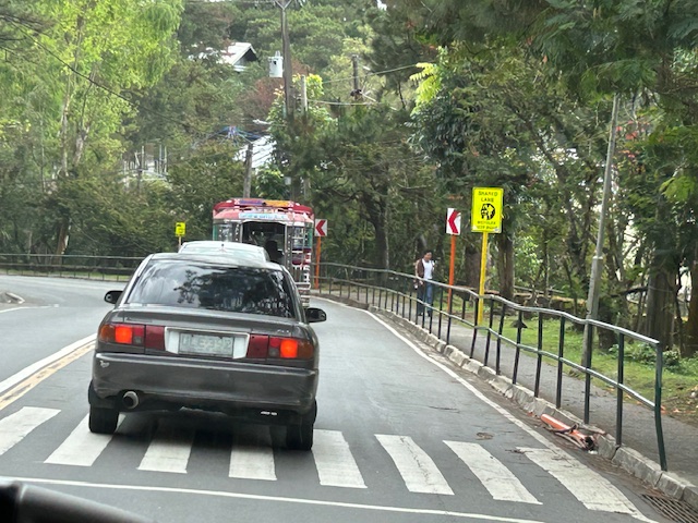 Pedestrian crossing and fenced sidewalks
While shared rights of way (sharrows) or shared lanes is not preferred where there is space for bikes, these can be implemented for 2-lane roads with adequate lane widths such as Loakan Road. It is clear from the photos that there is ample if not generous space for cyclists and motorists to share a single lane. The premise for safety here is that motorists will not be hogging the road space, being mindful of cyclists, and will move at safe speeds.
–
Davao 8th, Manila 14th worst in Tomtom Traffic Index
I just want to share this news report here:
Source: Davao 8th, Manila 14th worst in Tomtom Traffic Index
I have to admit that I still have to figure out in detail how exactly their data were collected and evaluated. However, knowing and experiencing traffic in these cities, I would like to opine that traffic is still worse in Metro Manila cities compared to Davao and perhaps others across the country.
Another look at the Candaba viaduct’s new lanes
I recently wrote about the new lanes along the Candaba viaduct and my thoughts about them being used as variable lanes (i.e., more lanes assigned along the peak or heavier traffic direction). Only this January 2, I observed that the lanes were being used instead for the southbound traffic as the older southbound viaduct appeared to be closed to traffic. Perhaps that side is up for rehabilitation or maintenance work?
 The new lanes between the two viaduct structures are now in use.
 These are assigned to southbound traffic while the original lanes appear to be closed off.
–
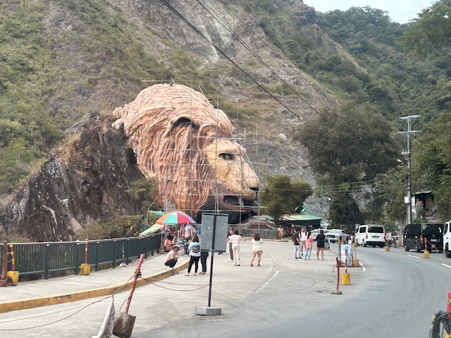
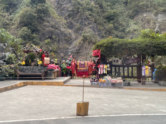
Landmarks – the Lion’s Head, Kennon Road
The main landmark along Kennon Road is the Lion’s Head. I think most people heading to or coming from Baguio have taken a photo of if not with the Lion. Here are photos I took as we descended from Baguio via Kennon Road last December 2024 after participating in a workshop.
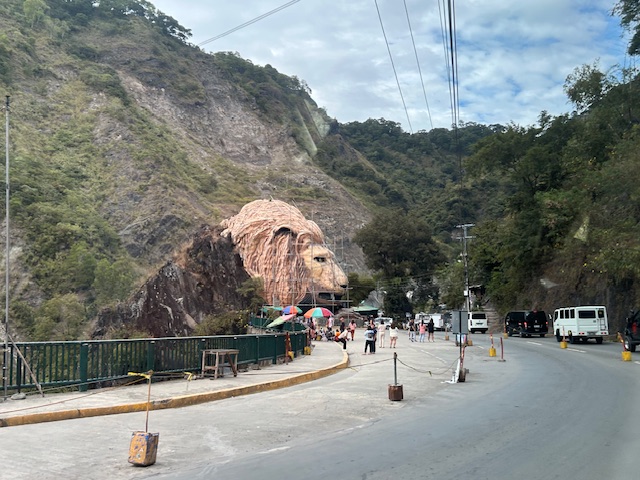 Approaching the Lion’s Head along Kennon Road, the monument appears to be under maintenance with scaffolding around the head.
 An entire section is cordoned off, likely for tourists or visitors. The lane though looks newly paved, perhaps part of a road widening project.
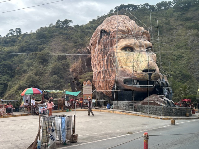 A closer look of the Lion’s Head and the touristy things in the area. Notice there weren’t too many tourists at the time and there weren’t so many shops and vendors set-up.
 Among the activities are dressing up in local costume and taking photos wearing these with the mountains or the monument in the background.
–
–
Happy New Year 2025!
Before I start writing again about transportation, traffic and related topics, I just want to greet everyone a Happy New Year!
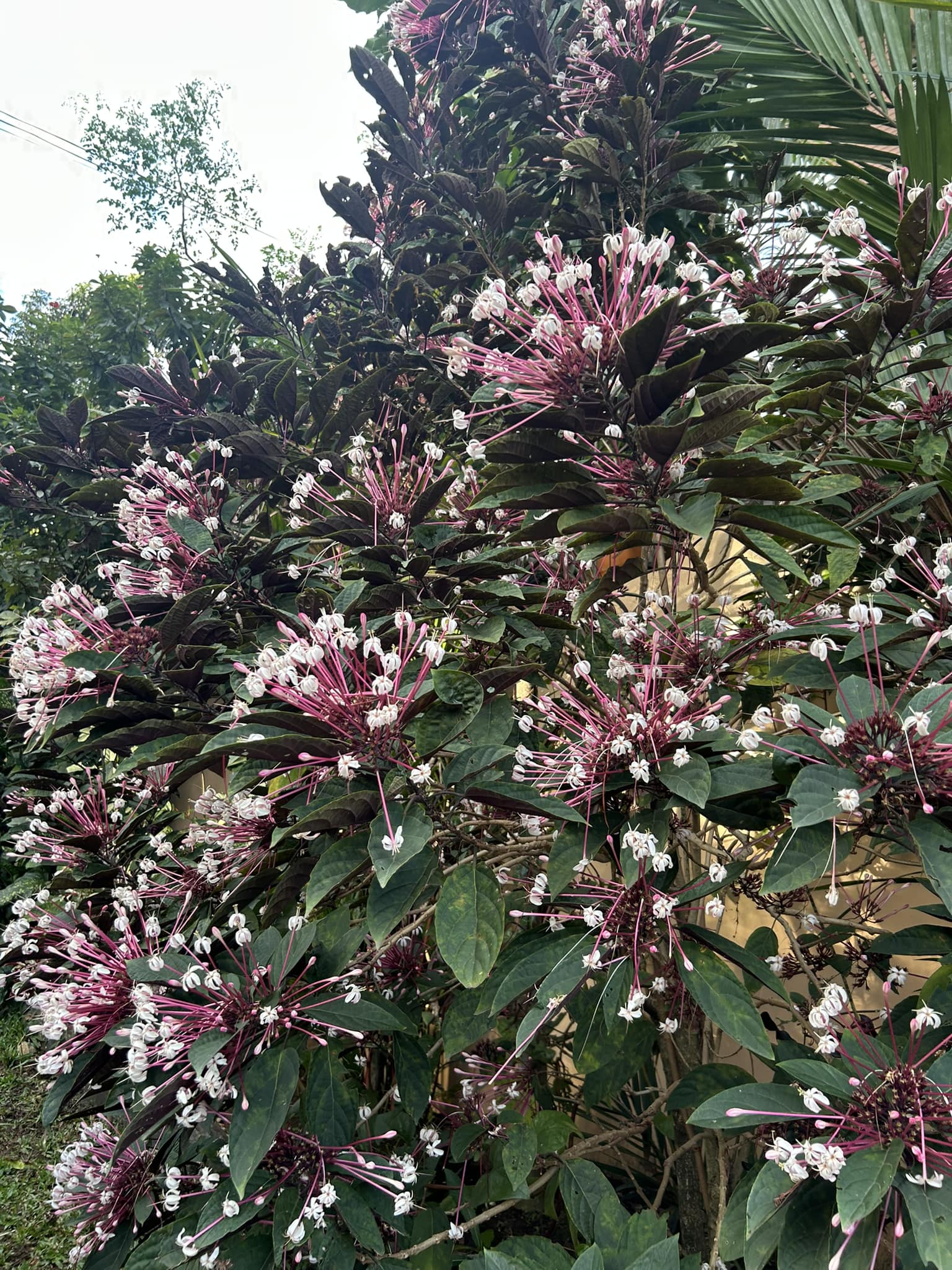
My walking route includes a street where one of the houses has this starburst plant. I always think of this as nature’s version of showing fireworks that don’t actually involve fire.
–
On “levelling-up” on fare collection
I found this article on how Japan Railways East (JR East) plans to upgrade its Suica card so passengers don’t need to swipe them at the stations. That will mean practically seamless entries and exits at the stations and perhaps the elimination of most queues related to this part of rail operations. Here is the article published on Medium:
To quote from the article:
“You can currently use Suica to pay for goods and services at around 2.26 million locations in Japan. However, JR East has only issued around 31.47 million mobile Suica cards. That lags behind the two most popular cashless payment options — PayPay (66 million) and d-Barai (63 million).
The move comes as transportation cards, long a staple of travel inside of Japan, seem to be going out of style. More train companies are introducing QR code and credit card touch payment options, making the one cutting-edge technology obsolete.”
I have a Suica card as well as others like it from Bangkok, Kuala Lumpur and Singapore. Suica has really been a convenient way to pay transport fares as well as to purchase items such as drinks or snacks particularly at train stations in Japan. We are not yet at the level of the Suica card of more than ten years ago but there are lessons to be learned here in case we finally have something like it and others that make travel or commuting easier.
–
New lanes along the NLEX Candaba Viaduct
Heading to Baguio, I noticed the new lanes in the middle of the NLEX viaduct. The viaduct was actually two bridges constructed over the Candaba Swamp. The soil being too soft for a normal road, the viaduct allowed for two way traffic with each bridge carrying northbound or southbound vehicles. The recall that the original bridges each had 2 lanes plus a shoulder lane. Each now have 3 lanes plus shoulder after expansion years ago. The additional lanes in the middle probably required additional columns to be built with more modern foundations than the original viaduct. The new structures had to be integrated with the older viaducts. Here are photos of the completed sections:


You can go to Google Maps if you want to see what the lanes looked like under construction. Here is a screenshot:

Screenshot
The middle lanes look like they can be used as variable lanes. That is, all or some of the lanes may be used to serve the direction with the heavier traffic. The directions can change depending on the time of day, day of the week or the season. I don’t know at this time though how exactly this can or will be implemented as there are no signs to guide motorists for variable lanes. What signs am I referring to? Here are examples from Bangkok showing overhead signs assigning lanes for the direction with heavier traffic:
 A close up of the signs designating lanes for traffic
 In the example above, 4 lanes including one counterflow lane are assigned to traffic along the southbound direction.
–
On a ride-hailing apps algorithm and surge pricing
I am sharing this very informative article on ride-hailing based on an investigation conducted by investigative journalists:
Ilagan, K. and Rainis, F.A. (December 10, 2024) “How we investigated the algorithm behind the Philippines’ largest ride-hailing app,” ijnet.org, https://ijnet.org/en/story/how-we-investigated-algorithm-behind-philippines-largest-ride-hailing-app?fbclid=IwZXh0bgNhZW0CMTEAAR2azviuNxdh5gSbrJKl8lsViL5YRO5k33QHFc24EAFkIi4HTo-Ew4H7LO4_aem_NnVHOD8B1PERNOQYSjVHdg [Last accessed: 12/27/2024]
To quote from the article:
“Once all the fares were broken down, we found that a surge fee was always present. With the help of statisticians from two local universities, we conducted a statistical analysis to scientifically determine whether the waiting time for a ride decreases when the surge fee is higher.
The results didn’t show a significant correlation between the surge rate and waiting times. This contradicts the assumption that a higher rate attracts more cars to the street and lowers waiting times.”
I leave it up to my readers to make their own assessment of what the conclusions to this report state or imply. The bottomline is that the ride-hailing company is making a lot of profit from their surge pricing scheme that really doesn’t make it easier for people to get a ride from their app.
–
Article share: On improving the Philippines’ transport system
I share this article on the desire for a sustainable transportation system for the country. This was written by a former Assistant Secretary of the Department of Transportation (on secondment) who has returned to teach at the School of Urban and Regional Planning of the University of the Philippines Diliman. Here is the article published by the Philippine Daily Inquirer:
To quote from the article:
“The present condition of the Philippine public transport system is indispensable to the desired transition from more sustainable, in this case, electric forms of transportation—to a better public transportation system. A good public transportation system is defined by reliability, accessibility, safety, and security…
The imperative to consolidate is clear and crucial. It is not just a technical necessity, but a pathway to inclusive growth where all stakeholders benefit from the transition, and where we can truly create an inclusive and sustainable system for public transportation.
Improving public transportation, by making it cleaner, safer, and more accessible, will directly enhance the quality of lives of Filipinos.”
–
