
Batangas port passenger terminal
The center I am affiliated with recently held its planning workshop off-campus in a venue on the island of Mindoro. To get there, they had to travel from Quezon City to the province of Batangas where ferries and other vessels provide the transport link between Luzon (where Batangas was located) and Mindoro. A colleague snapped a few photos of the passenger terminal in Batangas, which are shown below.
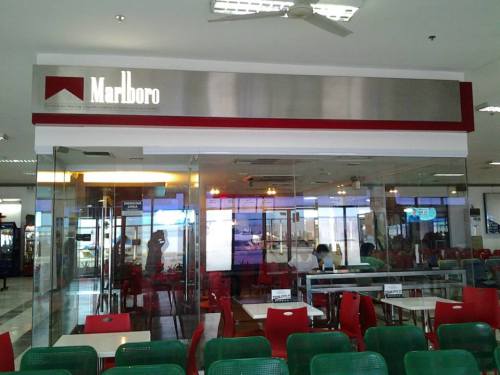 Smoking room in the passenger terminal (Photo credit: Sheilah Napalang)
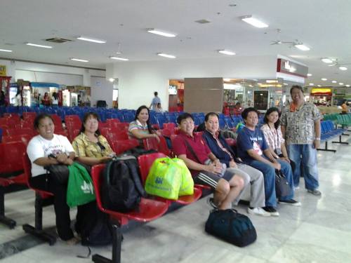 Colleagues pose for a souvenir photo at the passenger terminal (Photo credit: Sheilah Napalang)
The Batangas port passenger terminal is a good example of a modern seaport facility in the Philippines. I think it is a better facility compared to the terminals in Cebu and Tagbilaran, as well as the Eva Macapagal Terminal in Manila. Of course, my opinion is limited by the terminals I’ve seen so far and I would like to see the ferry terminals in Sorsogon, Samar, Leyte and Surigao , which are part of the Eastern Nautical Highway and has been the main land-sea route between Luzon, Visayas and Mindanao. Here’s looking forward to more posts on maritime transport and terminals in the future!
–
NAIA Terminal 3 check-in
I was again at NAIA Terminal 3 for a very early flight. I always enter Terminal 3 from the ground (arrival) level, whether I am coming from the open parking lot or am driven to the airport by a driver. There are less people lining up to enter the terminal at the arrival level so its usually faster compared to the departure level, which seem to be always crowded. It’s only logical because it is the departure level and most people would automatically proceed there. The layout of Terminal 3, though, allows for the passengers and well-wishers to circulate within the arrival and departure areas that are open to the public, including the restaurants and shops located at the third level of the terminal.
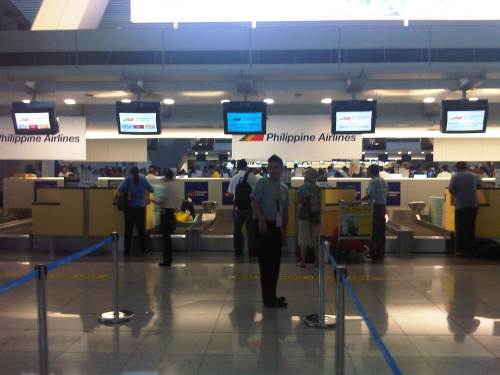 Check-in counters for PAL and PAL Express flights
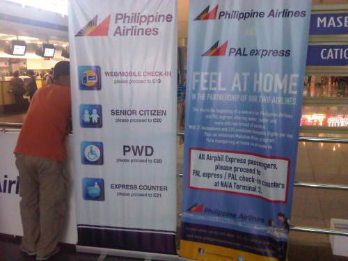 Important information for passengers of PAL and PAL Express includes info for counters for senior citizens, persons with disabilities (PWD), and persons who have checked-in using the internet.
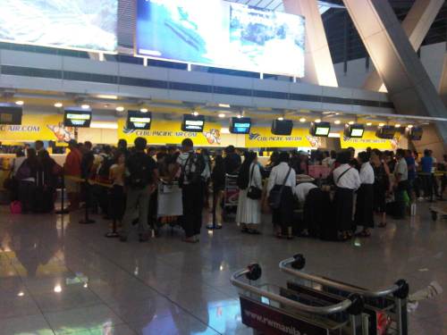 Crowded Cebu Pacific check-in counters for domestic flights – Terminal 3 is the home terminal or hub for Ceb Pac in Manila. As the country’s largest airline in terms of both aircraft and passengers, their international and domestic flight counters are are almost always crowded.
–
Poverty should not be entrusted to economists | Social Watch
Saw this article shared on Facebook. I thought it was a relevant piece with respect to a work I am currently doing, relating transport infrastructure and services with economic growth in the Philippines. With the release of the latest poverty statistics in the country late last month, there has been a lot of discussions regarding inclusive growth as poverty incidence across the country is still quite high though there have been gains in many provinces based on the statistics.
Poverty should not be entrusted to economists | Social Watch.
I suddenly remember the experience we had while doing field work in the island of Samar where we performed a road safety audit for a national road. While coordinating with the barangays along the highway for our traffic surveys, we observed that people were generally poor but in the financial sense – they didn’t have money and many didn’t have regular jobs. I say this because I would like to qualify the way we define poverty that is biased on the monetary aspect. From what we saw, people were not hungry as they had food like fruits and vegetables. Perhaps to get other items, they trade or barter what they have with what they needed (e.g., vegetables for rice, fish for rice, etc.). Still, the point is for these same people to generally benefit from the economic gains that is supposed to be experienced by the country. Is the growth trickling down to these people and therefore inclusive? Or is it enjoyed only by a few and especially our elite classes, and therefore exclusive? So far, what I have seen out there is the latter case and not the former.
–
Here’s to walking!
I was lucky to be able to take a couple of photos as our vehicle passed along Marcos Highway to be able to capture images of people walking along the sidewalks between Ligaya and De la Paz. The driver maintained his position along the right side of the road so I had a good view of the pedestrians and cyclists making their way from Ligaya in the general direction of De la Paz and the two shopping malls downstream (the signs of one mall are visible in the photo).
Ligaya is a transfer point for people traveling to and from Pasig, Pateros and Marikina who use the jeepneys connecting these towns. They typically get off at the junction of Marcos Highway and Amang Rodriguez. From here, one can take a jeepney to the towns of Rizal or perhaps to Quezon City (Cubao). These days, however, it is not so easy to get a ride at Ligaya and one cause of congestion emanating from the junction are people taking two lanes of the road as they position themselves to board stopping jeepneys. Instead of waiting for the jeepneys and whatever limited seats are available, many people have decided to walk towards the junction with Imelda Avenue. There located are commercial establishments including two shopping malls and the terminals of public transport whose routes terminate at the area. There, it is relatively easier to get a ride home though during the early evenings it can also be difficult to get a ride to the Masinag and Cogeo districts of Antipolo (And that’s part of the reasons why the LRT Line 2 extension is necessary!).
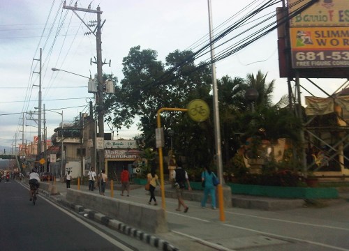 Pedestrians walking towards De la Paz or the shopping malls a little further on. There is actually a bicycle lane beside the pedestrian walk similar to how the Marikina Bikeways were designed but most cyclists opt to use the curbside lane of Marcos Highway.
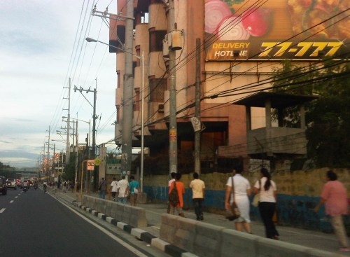 Pedestrians walking from Ligaya include workers and students.
The walkways are generally clean and well-lit during the night time, though I think portions are still quite dark. I also think the more people opting to walk means it can be safer to walk (strength in numbers?). The observation that many people walk encourages other people to do so, and is a deterrent for unlawful elements of society. Perhaps to further reinforce the safety and security aspect of walking, Pasig Police or the MMDA could have some of their personnel walk along this path. Police visibility here, especially at night, would help deter muggers and hold-uppers who might see the pedestrians as potential victims.
–
Tacloban Airport arrival
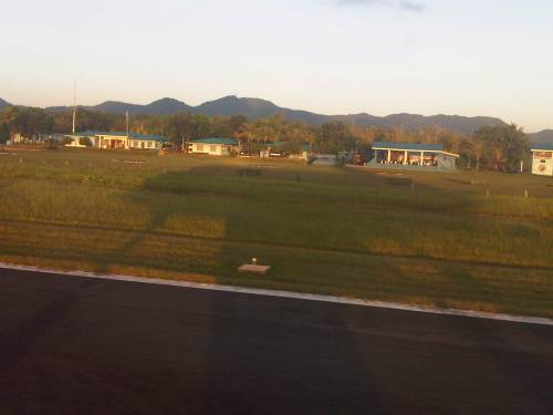
After landing at Tacloban Airport during one trip last April, I took a few photos as our plane was taxiing towards the airport terminal. Following are those photos with annotations/comments.
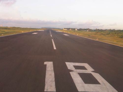 A view of the runway as our plane turned to taxi towards the airport passenger terminal. The terminal is somewhat visible in the photo. The control tower can be seen just to the right of the Cebu Pacific plane that arrived ahead of us.
 Philippine Air Force buildings at the Tacloban Airport – you tend to wonder how we can defend our country when there are no aircraft at an air force base facing the Pacific Ocean. I remembered seeing impressive planes and helicopters of the Japanese Self Defense Forces and US Marines lined up along the tarmac at Okinawa.
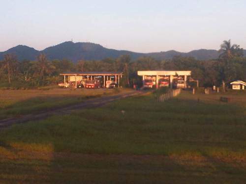 Fire trucks and other emergency vehicles are always ready (SOP) for whatever incident may happen during aircraft take-offs and landings. You just wonder if they have sufficient skill and equipment to handle the more serious cases.
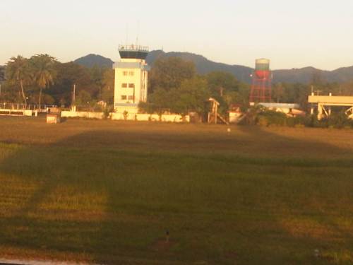 Air traffic control tower at Tacloban Airport
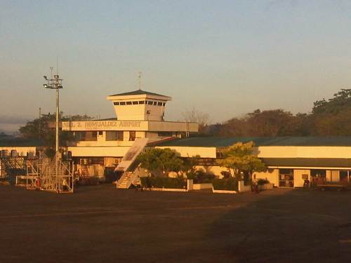 The Daniel Z. Romualdez Airport terminal building
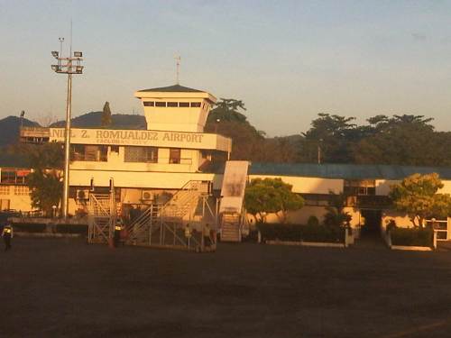 From the looks of it, the terminal has seen better days and badly needs repairs/renovations.
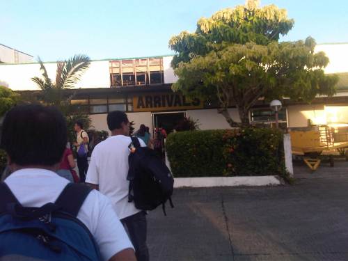 Passengers file towards the arrival area to await their baggage before exiting the terminal to proceed to their respective destinations. Many passengers may not necessarily be heading to Tacloban or other towns in Leyte but will cross over to Samar, which is physically connected to Leyte via the San Juanico Bridge. Tacloban has more regular flights in the region and is the best bet for people opting for flexibility in their travel schedules.
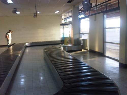 Baggage claim is similar to other old airports around the country. With passenger arrivals well above 1 million per year, Tacloban, which is the principal airport in Region VIII (Eastern Visayas), needs an upgrade.
–
Traffic congestion along Buendia (Gil Puyat Ave.)
The Makati CBD generates a very high number of trips owing to it being arguably the largest CBD in Metro Manila in terms of offices and workers. There are several other CBDs like Manila, Ortigas, Cubao, Eastwood, Filinvest City, and Bonifacio but they generate less traffic compared to Makati. There are several major roads in the area including four intersecting roads that practically define the CBD. These are Ayala Avenue, Gil Puyat Avenue (formerly but still popularly known as Buendia Avenue), Makati Avenue and Paseo de Roxas. Both Gil Puyat and Ayala Avenue are lined with offices along either side and are often congested due to the vehicle traffic generated by the CBD. Following are a few photos of Buendia Ave.
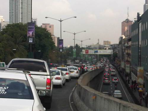 Traffic congestion along Gil Puyat Ave. as seen from the overpass from Kalayaan Ave. Even the sidewalk on the right side of the road is filled with pedestrians.
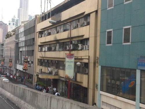 One can see many people walking along the narrow sidewalk along Buendia. Some buildings have been renovated and refitted but many remain as they were in the last decade or more. The building in the center of the photo has so many air-conditioning units jutting outside the windows that it is quite obvious the units were an afterthought. Other buildings would likely have centralized or more strategically positioned air-conditioning units.
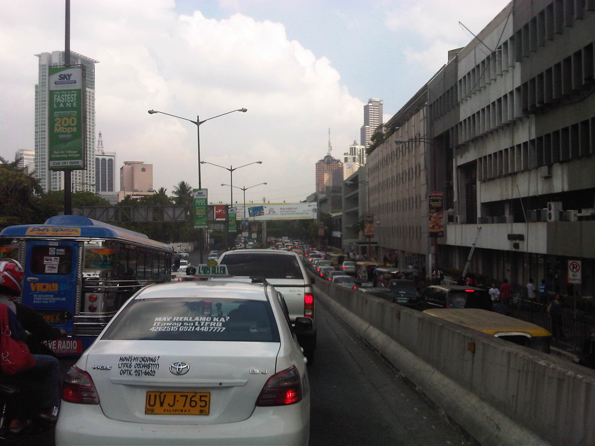 Another look at the traffic jam along one of Makati’s main roads indicate a lengthy queue from the Buendia Ave.-Paseo De Roxas intersection. The junction is signalized but saturated during peak periods. I am not sure about the optimization of the signal settings but it should be synchronized with at least two other intersections: Buendia Ave.-Makati Ave. and Paseo de Roxas-Makati Ave.
The DPWH is proposing a grade separation project along Buendia that is supposed to alleviate congestion at the intersections with Paseo de Roxas and Makati Avenue. The plan is to have an underpass along the avenue that would allow vehicles to flow through and bypassing the two major intersections. At-grade would still be signalized intersections but minus substantial through traffic along Buendia. The downside of such a project, of course, would be the expected traffic congestion during the construction phase. With very limited alternate routes and restricted space (i.e., unlike the case of the Quezon Ave. underpass at Araneta Ave.), traffic management in the area will surely be a challenge for the combined forces of Makati and MMDA traffic enforcers.
–
Other issues on second hand imported vehicles
Much of the discussions regarding imported second hand vehicles focus on issues of taxation (customs) or registration and allegations of smuggling. The entry of used vehicles and their significantly lower-priced sales have been issues particularly to the established automobile manufacturers and dealers in the country. Importers and dealers of vehicles coming from these special economic zones/free ports claim that they are serving people who want to own a vehicle but couldn’t afford brand new or even second hand vehicles. While this may be true for some cases where regular cars, vans or even SUVs are concerned, the perception is that these importers and dealers are mainly serving a demand for luxury vehicles like sports cars, limousines and high end SUVs from prominent brands such as Audi, BMW, Lexus, Mercedes Benz, Porsche, and Hummer, and even Ferrari and Lamborghini.
On the surface, the claimed benefits to people seem an acceptable and even noble intention. However, this is further from the truth and there is the strong opinion that all this is really just for money, plain and simple. It is also not enough justification for the negative impacts of these used vehicles, which do not go through a process of being tested for compliance with emission standards as well as for safety. The latter concern is for vehicles that undergo “conversion” from their original right hand drive set-up to become left hand drive vehicles, which are the norm in the Philippines. There is also the issue of fuel efficiency for these used vehicles and the maintenance required for these to stay in A-1 condition. All these concerns stack up and clearly show the folly of the importation of used vehicles through the economic zones.
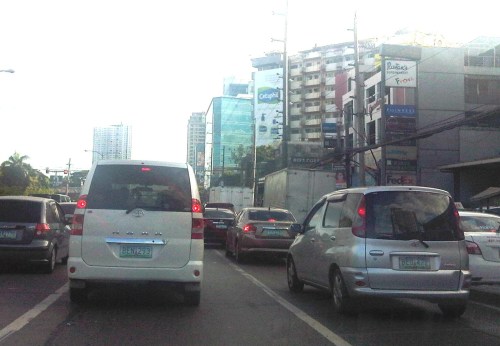 I saw these two vehicles along Katipunan as we were coming from a meeting one afternoon. Both models were not sold by Toyota Motor Philippines and conspicuously have license plates bearing the letter “B” as a first letter, indicative that they were registered in Region 2. Region 2 is where Port Irene, Cagayan is located and which is being alleged as the source of a lot of used vehicles linked to anomalies in taxes and registration. More serious are concerns pertaining to emissions, safety and fuel efficiency.
–
What Public Transit Data Teaches Us About How People Use a City
I’m sharing an interesting article featured on The Atlantic Cities, one of our favorite sites on the internet. Enjoy!
What Public Transit Data Teaches Us About How People Use a City.
National Budget Memo No. 118
The Department of Budget and Management recently released the National Budget Memo No. 118 with the subject: Adoption of the Budget Priorities Framework in the Preparation of the FY 2014 Agency Budget Proposals. The Memo emphasizes “the need to prioritize the programs critical to the attainment of the desired outcomes for the 2014-2016 period.” In addition to the bottom-up budgeting (BUB) approach, the memo identified priority geographical areas for program convergence for the 2014 budget. It is important to note the focus of the government on inclusive growth and the convergence programs for infrastructure to support industry, agriculture and tourism, as well as significant mention of climate and disaster resilience for programs to be implemented by the government. Following is a link to the DBM site where a PDF copy of the memo can be downloaded:
DBM National Budget Memorandum No. 118
I’ve downloaded a copy and this may be downloaded here:
–
NAIA Terminal 3 domestic departure
NAIA Terminal 3 hosts the domestic flights of Cebu Pacific and PAL Express (formerly Air Philippines and Air Phil Express). PAL now also flies out of T3 for major cities like Cagayan De Oro, Legazpi, Puerto Princesa and Tacloban, where PAL and PAL Express flights seem to have merged and are quite difficult to tell by the aircraft. The difference becomes clear when one boards the plane and sees no Mabuhay Class seats for PAL Express and seats have the leatherette covers (similar to Ceb Pac’s) instead of the more classy fabric in PAL planes.
 Hallway to the boarding gates – there are many shops and restaurants to choose from where one can have a meal or drink before a flight.
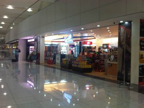 This shop is packaged like the higher end duty free shops on international terminals. There’s a Krispy Kreme donut stall that’s quite popular as pasalubong.
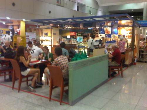 A typical cafe at NAIA T3
 More cafes give passengers a lot of choices for where they might want to get their beverage, meal or snack.
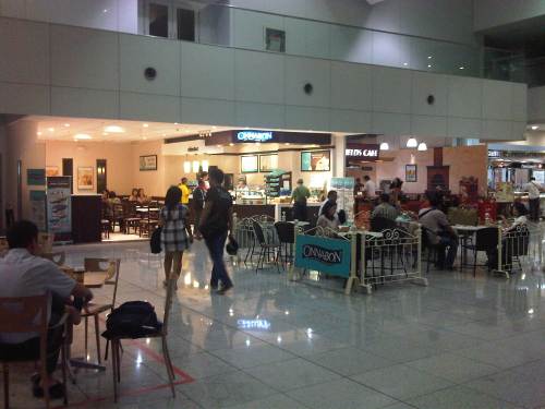
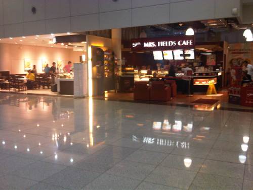 And still more cafes…
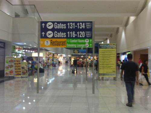
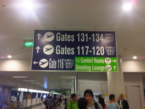 Large signs provide adequate guidance for passengers.
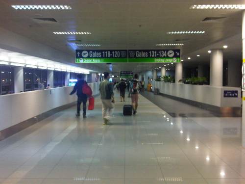 The long walk – T3 is a linear terminal with gates spread along either wing of the building, which means passengers would have to walk some distance to and from their gates for departures and arrivals.
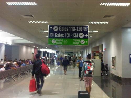 It’s summer in the Philippines, so there are more flights and passengers than usual. I was at the terminal for a 0440 flight to Tacloban and there were already a lot of people waiting for their respective flights to destinations such as Cebu, Iloilo, Bacolod, Dumaguete and Davao.
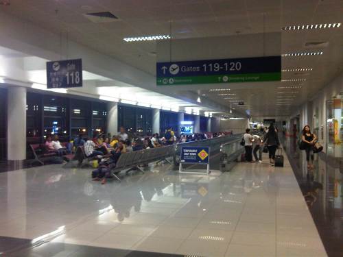 Passengers at Gate 118 seated along a corridor that also features a non-functioning “walkalator” or moving walkway. Such walkways should help passengers move more conveniently and swiftly to and from their gates but all are currently not operating (for one reason or another).
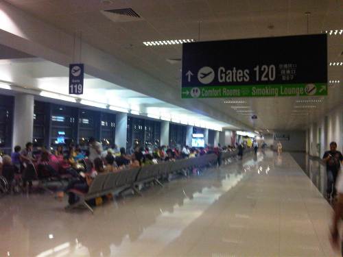 Fellow passengers at Gate 119 waiting for our boarding call
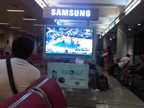 There are many television sets at T3 where passengers can catch the latest news on cable or, in this case, a replay of an NBA Playoff game.
–
