
The streets and sidewalks of Melaka
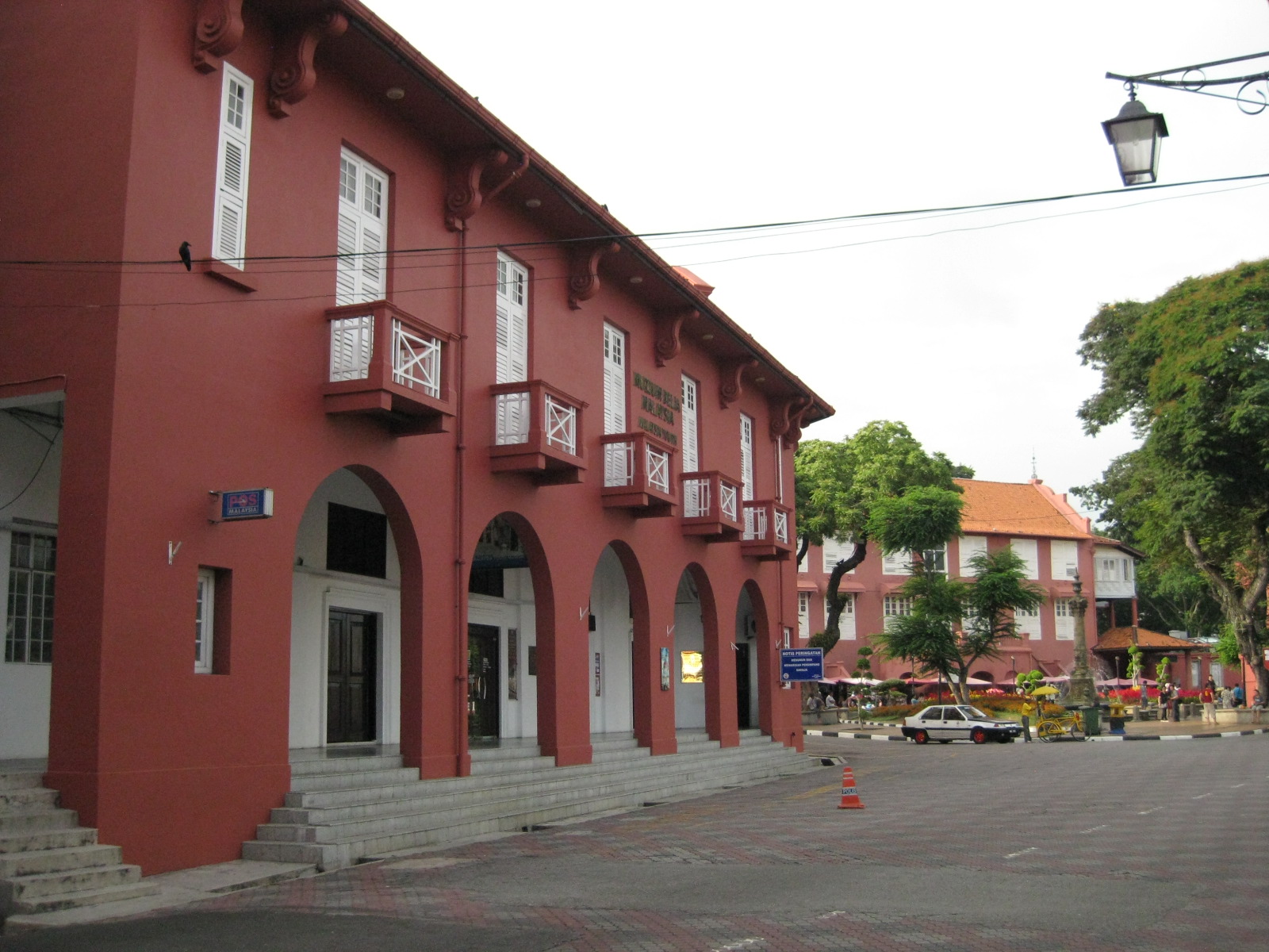 |
| View towards the plaza – the red building is part of the Christ Church complex but is now home of the Melaka Post Office |
 |
| The walkways reminded me of similar forms in Manila, Cebu and Iloilo, all old cities established during the Spanish Period when Melaka was under the rival Portuguese. |
 |
| The pavement was tiled but well-maintained |
 |
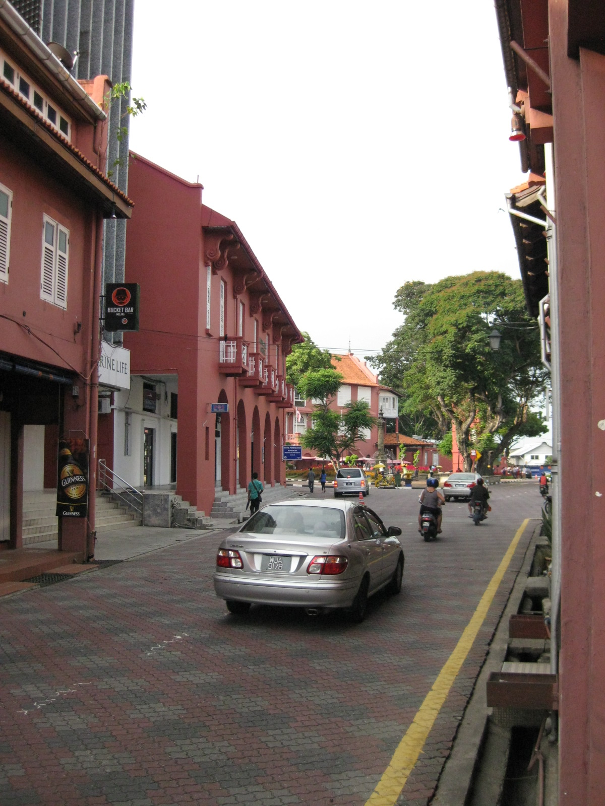
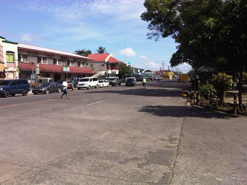
| Traffic was light so one could get a good shot of the street leading up to the plaza. |
 |
| The street leading to St. Francis Xavier made me imagine how old cities in the Philippines would have looked like if those cities made an effort to preserve heritage and controlled motor vehicle access to their street. |
 |
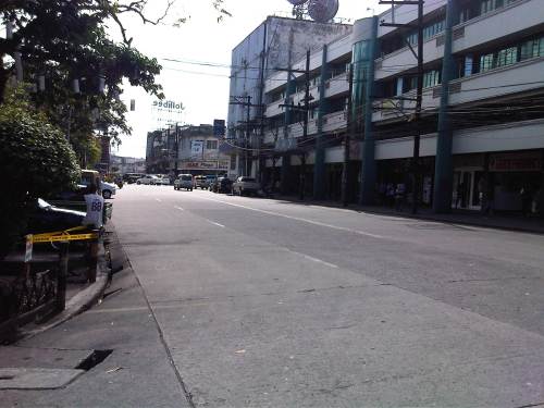
| Some buildings have been converted to restaurants and bars but they retained their nostalgic features and feel. |
 |
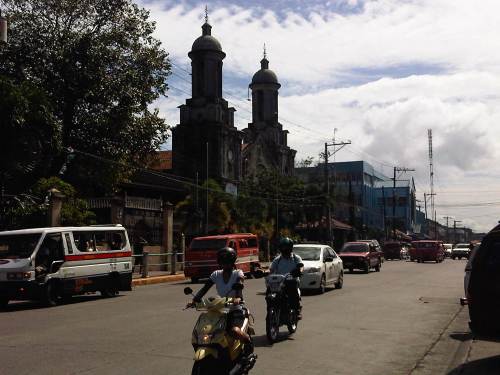
| Melaka made sure their signposts and lamps were designed consistent with the ambiance of the heritage city |
 |
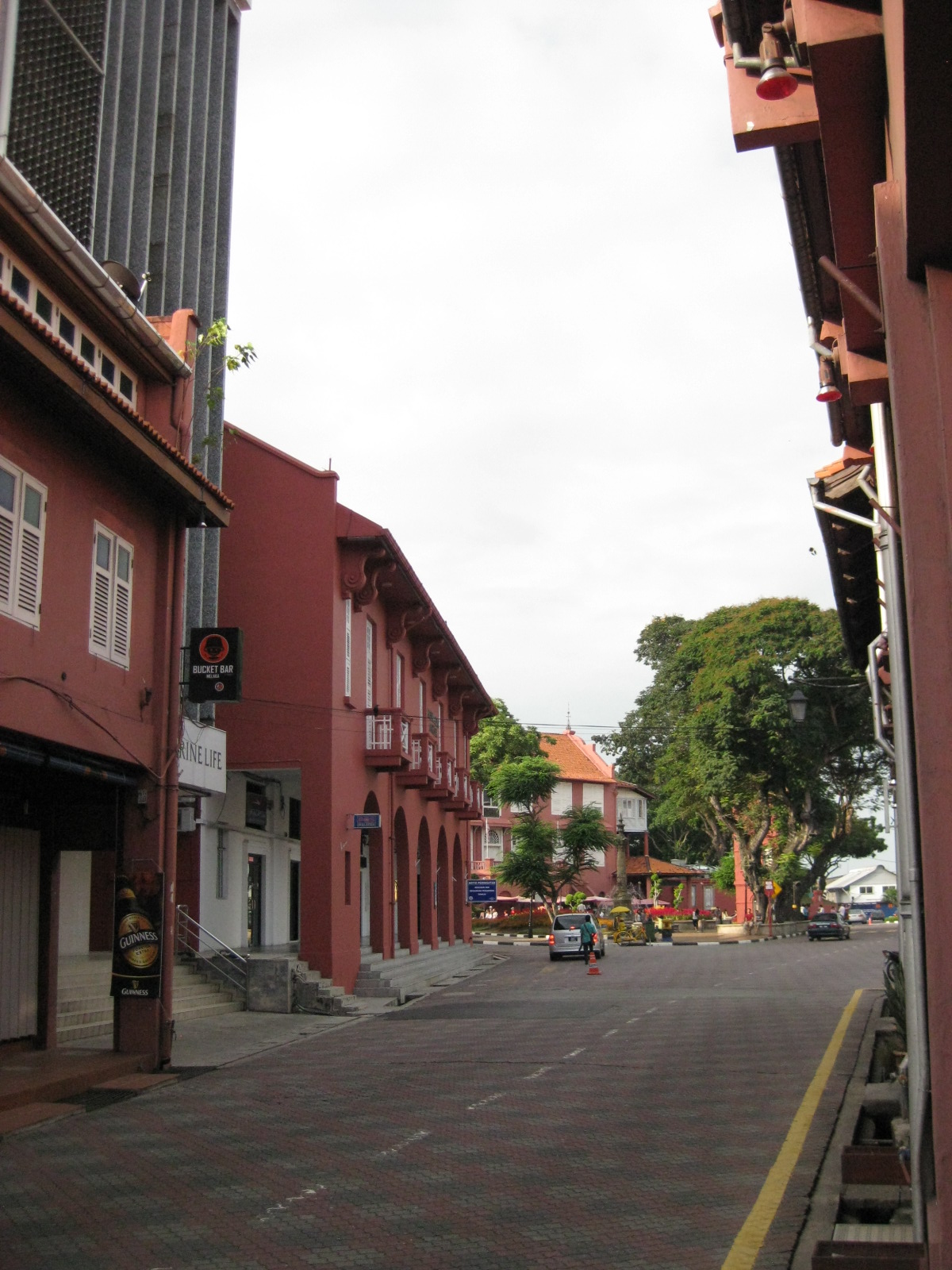
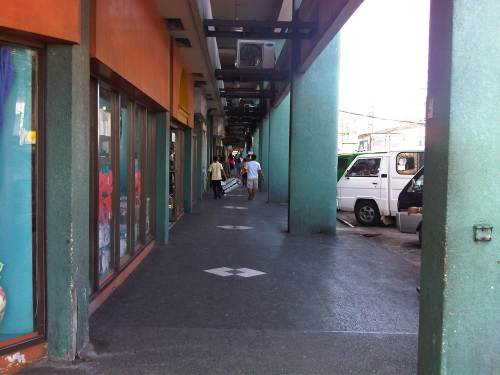
| Another shot of the seemingly endless walkway beneath the buildings. |
The Streets of Bacolod: Around the Public Plaza
The streets surrounding the Bacolod Public Plaza are one-way streets following a counter-clockwise circulation around the plaza. Typical of plazas of old, the latter has around it the church (in this case San Sebastian Cathedral), the old city hall, commercial establishments, the police headquarters, and a major school (La Consolacion College). The following photos were actually taken a year ago in February 2012. I doubt if much has changed since then but the circulation and traffic situation should practically be the same give and take the normal traffic growth due to progress for the capital city of Negros Occidental.
 Intersection of San Juan St. and Gonzaga St. (view along San Juan St. towards southwest)
 Intersection of San Juan St. and Luzuriaga St. (view from east corner of intersection towards Westown Hotel)
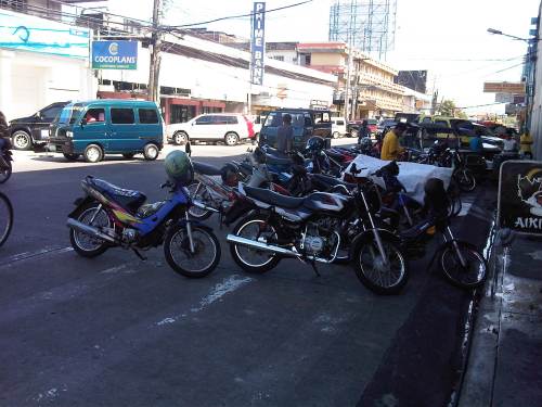 Roadside parking along San Juan St. Noticeable above are the motorcycle parked along the road, with some occupying pedestrian crossing space.
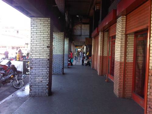 Old cities like Bacolod have buildings featuring arcades like this where pedestrians have the ROW and are sheltered from the elements. I was glad to see that the city basically cleared these facilities from obstacles. It is not entirely without impediments though as shown in the photo.
 Luzuriaga Street (view towards southeast)
 Arcade of Plaza Mart building along Gonzaga Street and across from the Bacolod Public Plaza (view towards Araneta Ave. and Gatuslao Street)
 Another view of the arcade of Plaza Mart, this time along San Juan Street (towards Luzuriaga St.)
 San Juan Street (view from the corner at Gonzaga Street) – at right is the Plaza
 Gonzaga Street (view at corner of the Plaza along San Juan Street) – vehicles downstream are at the intersection of Gonzaga St. and Araneta Ave. Further downstream is Gatuslao Street
 Rizal Street taken from the plaza side and featuring San Sebastian Cathedral
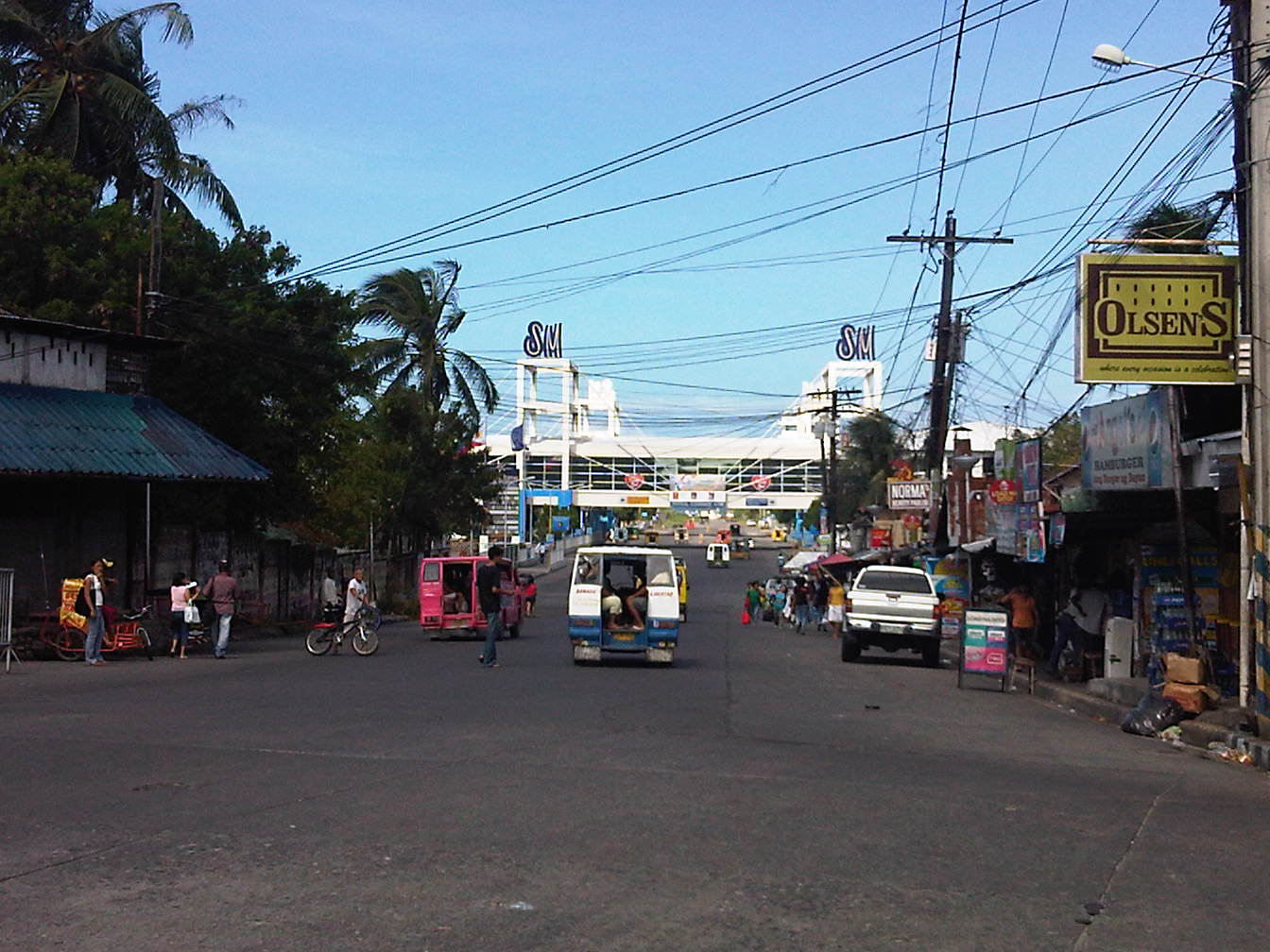 Rizal Street leads to SM City Bacolod, which is found in the reclamation area. (View from the intersection of Rizal St. with San Juan Street)
 Steel barriers along Rizal Street prevent vehicles crossing the street from the northeast side of San Juan St. All traffic must turn right towards SM. (view from the corner of San Juan and Rizal along San Juan towards the southwest direction) The PNP headquarters is the building on the opposite corner with the blue roof.
 Intersection of San Juan Street and Luzuriaga Street (view along San Juan St. towards southwest)
 San Juan-Luzuriaga intersection (view from Westown Hotel corner)
 San Juan-Luzuriaga intersection (view along Luzuriaga St. towards southeast)
 Luzuriaga Street is also a one-way street and with significant roadside parking as shown in the left side of the photo. View of traffic coming from the intersection with San Juan St. Westown Hotel is the building at left.
The circulation scheme at the plaza seems to be working out well at the time. This is despite the proliferation of roadside parking along the streets and around the plaza. The streets are relatively wide and so a one-way scheme works well in terms of taking advantage of the capacities of the streets while allowing for curbside parking that typically occupies one lane of road space as shown in the photos above. We didn’t see anyone charging parking fees for the vehicles and so we assume that these are practically free though we did see some informal “watch-your-car” boys who rely on tips from those parking along the road. Ultimately, though, the city should look into the provision off-street parking facilities as I can imagine traffic congestion, for example, in the vicinity of San Sebastian Cathedral on Sundays. Traffic in the area should be expected to increase as the city continues to experience economic growth and more developments ultimately locate at the reclamation area.
–
Arches in La Union and Ilocos Sur
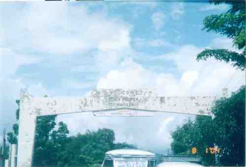
Road travelers are welcomed by arches found at the boundaries of cities and municipalities. These are commonly seen along national roads and often reflect the character, history or product for which the city is known for. The town of Paniqui, Tarlac has a bat featured in its arch while Castillejos, Zambales includes a castle. I stumbled into a lot of old photos recently. Well, probably not so old considering they were taken in 2004 during the time we were implementing nationwide surveys for passenger and freight flow. As our group was assigned to do surveys along McArthur Highway from Tarlac to Ilocos Sur, I frequently took photos using the old Pentax camera I bought during my first visit to Japan in 1996. In 2004, digital cameras were still quite expensive and so were cell phones with cameras. It was cheaper to buy film and have it developed and photos printed. In my case, I usually bought a lot of film when I traveled to Tokyo (it’s cheaper there) and I carried a few rolls whenever I went on trips. The prints I discovered were taken along the national road while we were traveling from La Union to Ilocos Sur. Many of the photos showed arches of towns that I took note of as we proceeded to Vigan. I think I may have missed some but checking the maps I believe I was able to catch most of the arches between Agoo, La Union and Santa, Ilocos Sur.
 Agoo, La Union
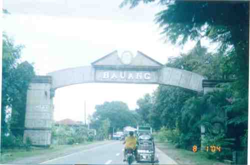 Bauang, La Union
 Balaoan, La Union
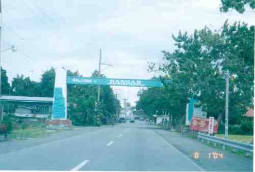 Bangar, La Union
 Sudipen, La Union
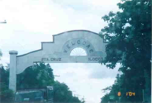 Sta. Cruz, Ilocos Sur
 Santa Lucia, Ilocos Sur
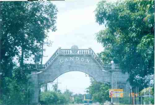 Candon City, Ilocos Sur
 Sta. Maria, Ilocos Sur
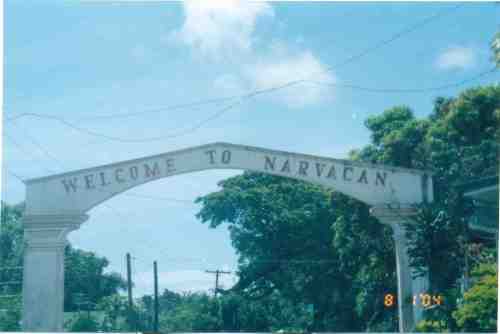 Narvacan, Ilocos Sur
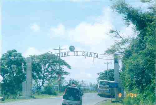 Santa, Ilocos Sur
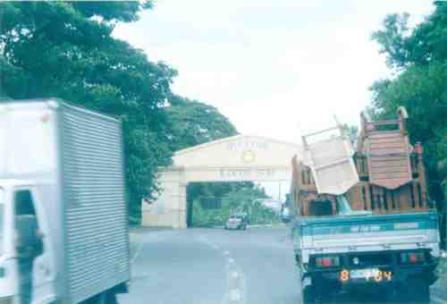 Welcome arch for the Province of Ilocos Sur from La Union
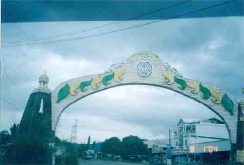 Welcome arch for the Province of La Union from Ilocos Sur
–
Antipolo Simbahan
“All roads lead to Antipolo” is a saying that is especially true for devotees to Our Lady of Peace and Good Voyage for whom the shrine in Antipolo is dedicated. Indeed, major transport routes lead to Antipolo City and signboards on jeepneys (and buses of old) state “Antipolo Simbahan” as their destination. In much older days, the Manila Railroad Company used to have trains directly serving this route. The remnants of its right-of-way is still there but in the form of roads. These are the Daang Bakal, which stretches from Valley Golf in Cainta, Rizal until its junction with Taktak Road and Ninoy Aquino Blvd., where it becomes the Lorenzo Sumulong Memorial Circle, Antipolo’s circumferential road. A trace of this old railway line may be found in this previous post.
 From J.P. Rizal Street, which extends from Sumulong Highway, one turns left to head straight towards the Antipolo church along P. Oliveros Street. The street is a two-lane, one-way road that has been widened at some sections. The shoulders, however, are mostly used for parking as shown in the photo.
 The dome of the church becomes visible to the traveler as one comes closer. P. Oliveros St. is closed to traffic during the feast day in May. It is usually open during Lent even during the Holy Week when there are lots of people coming to Antipolo for the Visita Iglesia. Traffic during those times can be quite slow because there are also lots of people walking along the streets, many of whom are devotees who are namamanata, or have promises of sacrifice and prayers to the patron of the shrine.
 Similar to other poblacions around the country, commerce surrounds the church. Antipolo receives thousands of visitors daily and its being a natural traffic generator provides opportunities for businesses to thrive around it. Establishments around the church are proof of this and one will find most major fast food chains within a stone’s throw away from the shrine. In the photo are major chains Jollibee, Mang Inasal, Greenwich along the right and Mercury Drug(not fast food but the largest drug store chain in the Philippines) and McDonald’s on the left. There are more including banks and food stalls along M.L. Quezon Street, which is the main street of the poblacion.
 M.L. Quezon Street in front of the shrine and the main street of the poblacion, is also a two-lane, one-way street (southbound flow). There are many one-way streets here as it is no longer possible to widen streets. One side of M.L. Quezon is used for parking and a short walk from the church is Antipolo City Hall, which is the red building barely visible (obscured by the tree on the left) downstream in the photo.
 The Antipolo City Hall building is seen here at the left in this photo.
There is a proliferation of tricycles operating in the poblacion. I don’t know how many there are but they seem to be from different tricycle operators and drivers associations (TODA) that all converge at the shrine. This overlap of service areas (tricycles do not have fixed routes) suggest everyone is taking advantage of the shrine and city hall being major traffic generators. The problem is that the city has not been able to control their numbers and regulation is probably limited to registration, which brings some revenues to the city. This is certainly not sustainable from the perspective of transport
It would be nice to see the poblacion re-planned, designed and managed so that walking may be given primacy over other modes, particularly motorized ones. Antipolo should be walkable and it was in the past considering there were no tricycles and automobiles during the Spanish and early American periods. One took an animal-drawn vehicle, road a horse, or walked even when there was a train service in the early part of the last century. If parking is an issue, then perhaps the city, with the cooperation of the private sector, could find ways of building multi-storey parking facilities in the periphery and within comfortable walking distance from the shrine and city hall. There’s much potential here that is steadily being wasted due to traffic and with no design theme even for buildings surrounding the shrine. The shrine represents heritage and to preserve and enhance it, Antipolo City should find ways to introduce sustainable transport as well as applying architectural principles for the poblacion.
–
On license plates
More than 2 years ago, the current administration made an inspired move after the President mentioned in his inaugural speech that he was among those who didn’t like “wangwang” (sirens) and associated these with abusiveness, of feelings of entitlement among road users. The use of sirens and other similar devices tells people that the user is an “important” person whose time is more valuable than others.
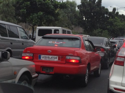
Whatever happened to the drive against “wangwang” in all its forms? The proliferation of commemorative plates, for one, can be a form of “wangwang.” While the Land Transportation Office (LTO) came up with a memo a few years ago providing clear instructions on how the commemorative plate should be displayed (i.e., on top or above the legal plate), many have returned to the practice of replacing the license plate (hiding it) with the commemorative one. This is especially true for those plates bearing police, military, government, and other agencies or organizations that can be used to make traffic enforcers think twice about apprehending a motorist for legitimate traffic violations. One sees such plates everywhere screaming “PNP,” “CIDG,” “NBI,” “PMA,” “Prosecutor,” “Councilor,” etc. and you know these are statements that are meant to intimidate traffic enforcers, which is often denied by the guilty party.
Then there is also the abuse of special plates, particularly those supposedly assigned to lawmakers. How many people have “8” as their license plates? Do children or staff of senators and congressmen enjoy the same privileges as the elected official? In the past, plates bearing “8” also indicated the district represented by the person supposedly using the vehicle. And so you would know, for example, if the person happens to be from the 1st District of Iloilo or the 3rd District of Quezon City. The same goes for vehicles bearing “16” and other special plates indicating someone holding a high position in government. Nowadays, even family members and staff members of these officials use the special plates, thereby extending to them the courtesies usually given to elected or appointed officials like not being covered by the number coding scheme in Metro Manila. This should not be the case for such “extensions” if we are to enforce the law firmly and fairly.
In certain cases, worse are those who use neither license plates or authorized commemorative ones. There seems to be a proliferation of people using personalized, souvenir or replica plates from other countries. These are often used in lieu of the rear license plates. These are claimed to be harmless since traffic enforcers usually check only the front plates for registration and compliance to number coding. However, there are implications for when the driver and the vehicle are involved in incidents such as traffic violations or crashes (e.g., hit and run incidents). While witnesses would probably be able to describe the car, the license plate cannot be recorded. Therefore, it would be quite difficult to trace the vehicle’s ownership information that could be retrieved from the LTO’s computer records to identify the violator or suspect in an incident.
 The legal plate is deliberately obscured on this one as it is hidden in the rear bumper.
 The plate suggests one is driving in Europe rather than along C-5 somewhere in Pasig City
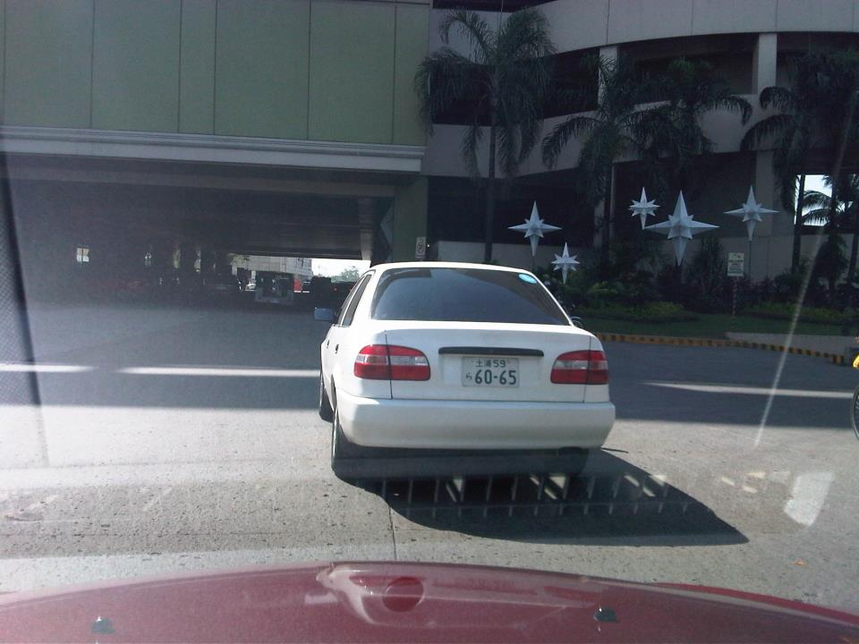 This one thinks he’s driving in Japan.
Perhaps the LTO and traffic enforcers who are deputized by the agency should also clamp down on these cases of violating RA 4136. The idea is to have a campaign similar to what was implemented to rid our roads of the annoying “wangwang” back in 2010. Such an initiative should help promote discipline on our roads in the sense that motorists would be more aware of traffic rules and regulations and that they cannot continue trying to circumvent basic laws.
–
Roadside barriers
A few weeks ago, the evening news reported a truck losing control along Marcos Highway and slamming into houses along the roadside. The site of the crash was along the Quezon City-bound stretch of the road between the Marcos Highway Bridge and Bonifacio Avenue in Barangay Barangka, Marikina City. I took a couple of photos of the area when we passed by last weekend from a trip to Antipolo. The first photo shows where the truck went off the road, smashing through the barrier and hitting some houses just beside and below the road. Marcos Highway at this section is elevated because the adjacent land on the north side of the highway is a flood plain. The second photo shows a typical road side section just after the crash site, illustrating the type of barrier used that is supposed to protect residents from wayward vehicles. Clearly, the barriers were not sufficient for the purpose, which brings us to the question of what is appropriate in such cases. Fortunately, no one was killed in the crash.
 Site where the truck rammed into a barrier and fell off the road into houses in Bgy. Barangka, Marikina City
 Semi-rigid barrier along the Marcos Highway – on the right are houses in Bgy. Barangka, Marikina City
Traffic barriers are used to minimize the severity of potential road crashes that may occur when vehicles leave the traveled way. There are three types of longitudinal barriers: flexible, semi-rigid, and rigid. Flexible barriers are usually of the cable type and depend on their tensile strength to hold off vehicles or pedestrians. Semi-rigid barriers are usually rail and post systems such as the one shown in the previous photos. These combine tensile and flexural strength of the rail and posts to stop vehicles from getting off the road. Rigid barriers are made out of reinforced concrete and are not supposed to deflect on impact. Energy is dissipated by raising the vehicle plus the deformation of the vehicle itself. These are what are usually provided for bridges and overpasses to keep vehicles from going over in cases where there are road crashes or control of the vehicle is lost.

Based on the adjacent land use and the traffic characteristics along Marco Highway along with the incidence of crashes along this section, rigid barriers satisfying Test Level 4 at the very least should be constructed along the roadside. These should be designed to provide adequate protection for people residing along the road given also that vehicle speeds would naturally be reduced by the upward slope of this section. On the side of safety, perhaps Test Level 5 barriers could be provided considering observations of vehicles speeding along this section.
–
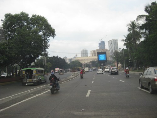
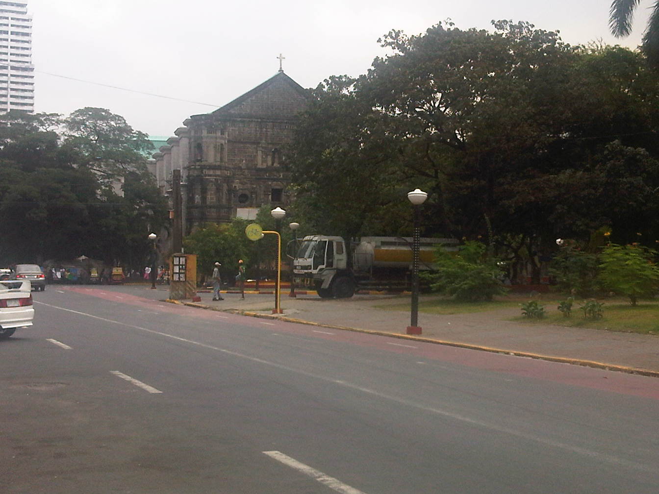
Padre Burgos, Manila
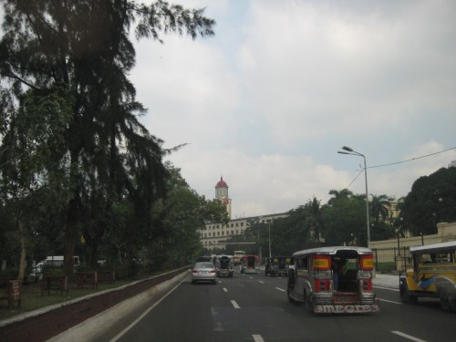
Padre Burgos Street stretches from Roxas Boulevard to Plaza Lawton and the Manila Central Post Office. Along its western side is the golf course surrounding the walled city of Intramuros. It is one of the more picturesque streets in Manila considering travelers would have a view of the walls of Intramuros on one side and historic buildings and a park on the other. Following are a few photos I took on my way back from a meeting at the DPWH Head Office along Bonifacio Drive.
 The northbound side of P. Burgos St. has 4 lanes and intersections are signalized. The street has a median island (on the left) dividing opposing traffic flows. The traffic lights shown are for the intersection with the Finance Road, which leads to the Ayala Boulevard.
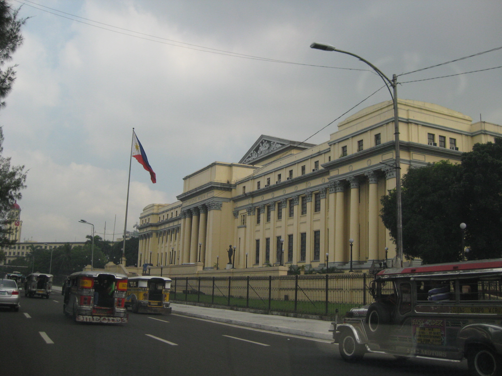 On the right, travelers will see the National Museum building, which used to host the Senate of the Republic of the Philippines.
 Past the museum, one is treated first to a glimpse of the historic Manila City Hall
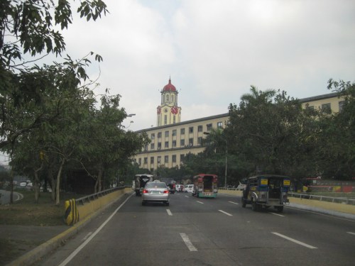 The Manila City Hall’s clock tower is one of the most familiar landmarks in Manila, seemingly unchanged through so many years.
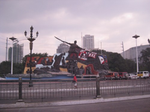 Right after city hall is the Kartilya ng Katipunan shrine
 P. Burgos Street splits up into three sections, all named the same: the left leads to the Jones Bridge and Quintin Paredes Street, the center leads to McArthur Bridge and Rizal Avenue, and the right leads to Quezon Bridge and Quezon Boulevard. At center in the photo is the Manila Central Post Office building in front of which is Plaza Lawton, named after the highest ranking American officer killed in action during the Philippine American War.
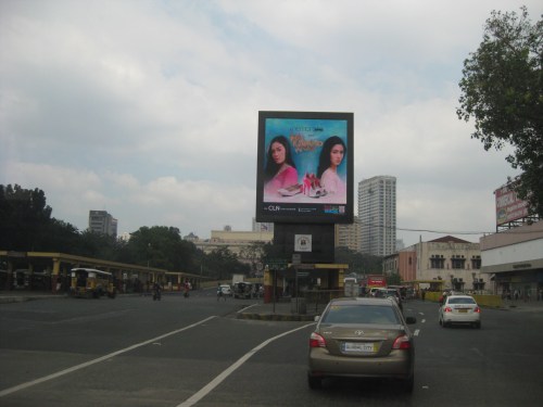 Visual intrusion? Obstruction? The video screen installed where P. Burgos splits up to McArthur Bridge and Quezon Bridge obscures what many would consider as a nice view of the Manila Central Post Office. At the right of the photo is another historic building that has been neglected – the Metropolitan Theater.
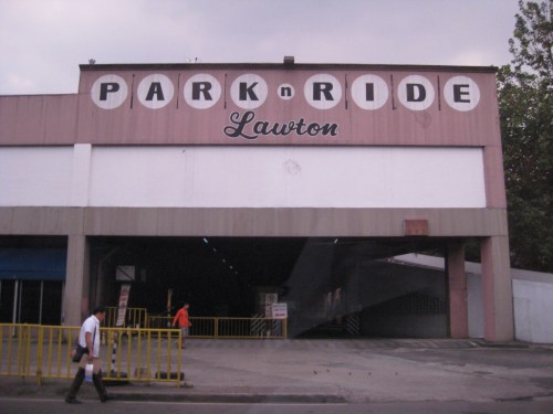 Park and ride facility along P. Burgos St. Behind the structure is the Central Station of LRT Line 1.
–
Another what if: Rapid Transit Railway for Metro Manila
I posted a map on my FaceBook page showing the lines of a railway network for Metro Manila proposed about 40 years ago. The map, which I reproduce below, was produced from the original featured in the Final Report of the Urban Transport Study in Manila Metropolitan Area (UTSMMA) that was completed in September 1973. To enhance the image, I traced the lines and provided some color. I also indicated the intersections among the lines that are potentially common stations for the network. The study was funded by what was then the Overseas Technical Cooperation Agency of Japan, the predecessor of the Japan International Cooperation Agency (JICA). The study recommended for a Rapid Transit Railway (RTR) system for Manila.

The main routes of a mass transit system was recommended by UTSMMA to be restricted to railways in the form of subways in the inner area bound by what was then called Highway 54 (C-4 or EDSA) and elevated trains outside in the suburban areas. The study recognized the important roles of buses and jeepneys while recommending that these serve feeder routes once the railways were completed. Following are descriptions of the Lines including their lengths:
- Line 1 (27.1 km) – from Construction Hill to Talon via central Quezon Boulevard, Manila downtown and the International Airport
- Line 2 (36.0 km) – from Novaliches to Cainta via Manila downtown and Pasig
- Line 3 (24.3 km) – Along Highway 54 (C-4): half a circle route about 12 km from Manila downtown
- Line 4 (30.1 km) – From Marikina to Zapote via Cubao, Manila downtown and the Manila Bay area
- Line 5 (17.6 km) – From Meycauayan to Manila downtown running between Line No. 2 and PNR
- PNR improvement (56.4 km) – From Bocaue to Muntinglupa via Tutuban Station
Curiously, a Feasibility Study for Line 1 was completed in June 1976 but unfortunately (or tragically) plans for the implementation of the network were apparently scuttled after a subsequent study that included a land use component. This was the Metro Manila Transport, Land Use and Development Study (MMETROPLAN) that was completed in February 1977, which came up with the following assessment:
“Heavy Rapid Transit (HRT) would provide public transport passengers with much faster journey, but by 1990 would attract only 2.5% of motorists and would have negligible impact on traffic congestion. Partly because of this and partly because of its very high capital cost, it would be hopelessly uneconomic: the annualized capital costs would be higher than the estimated benefits in 1990…passenger flows are not high enough to exploit its full capacity…and the large savings in time for public transport passengers are not given a high value in Manila, and are not high enough to persuade motorists to change mode.
These results are conclusive , and are unlikely to be changed by any circumstances or reasonable assumptions…it is clear that any other fully segregated public transport system, whether light rail or busway, would also be uneconomic. As such systems would require the appropriation of most, if not all, of the available funds for all transport (including highways) in Metro Manila for the foreseeable future, and as there is not other rationale for their implementation, they have been rejected from further consideration.” (MMETROPLAN, Final Report, 1977)
Looking back and then making a rapid assessment of what is now Mega Manila, we now know that this conclusion in 1977 was so off the mark. Further, the assumptions then that included restricted development in areas such as the Marikina Valley were not realized; resulting in a sprawl and population distribution that pretty much requires the RTR system recommended in 1973. We also now know that such a system could have been a game changer in terms of how we commute and how lands were developed along those transit corridors. I would even be brave enough to state that a subway system could have forced us to invest in a comprehensive drainage system to prevent flooding that could also have had tremendous benefits now in these times of Ondoy and Habagat with heavy rains often wreaking havoc on Metro Manila.
–
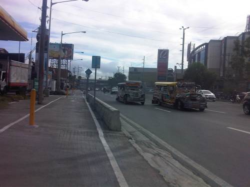
More quick wins for cycling
Metro Manila is basically not a cycling-friendly metropolis. Road space is practically devoted to motor vehicles and sidewalks are not wide enough to accommodate a lane for cycling or space that can be shared by pedestrians and cyclists. The latter observation on space is actually arguable considering that in Japan, narrow sidewalks and carriageways are usable for cyclists and people are generally respectful of others’ right-of-way and perhaps right to travel. As such, conflicts are minimized among pedestrian, cyclists and motorists.Such situations can also be achieved in Metro Manila and other Philippine cities as well. Key is to have a consciousness among people of everyone’s right to space. Also, there is a need to actively, persistently promote a safe interaction among road users such as what has been done by cycling advocates like the Firefly Brigade and what the MMDA is now doing with their initiatives promoting NMT.
Searching for some quick wins aside from the example of Marikina (where there are formal bikeways already in place), I’m featuring a few photos taken around Metro Manila that can be regarded as examples where there have been initiatives toward quick wins in promoting cycling. These include a couple of photos in the Malate, Manila area and couple along Marcos Highway in Pasig City.
 Bikeways in Malate
 The Malate Church
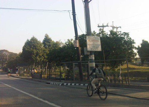
 Segregated bicycle lane along Marcos Highway
 Cyclists along Katipunan Avenue (C-5)
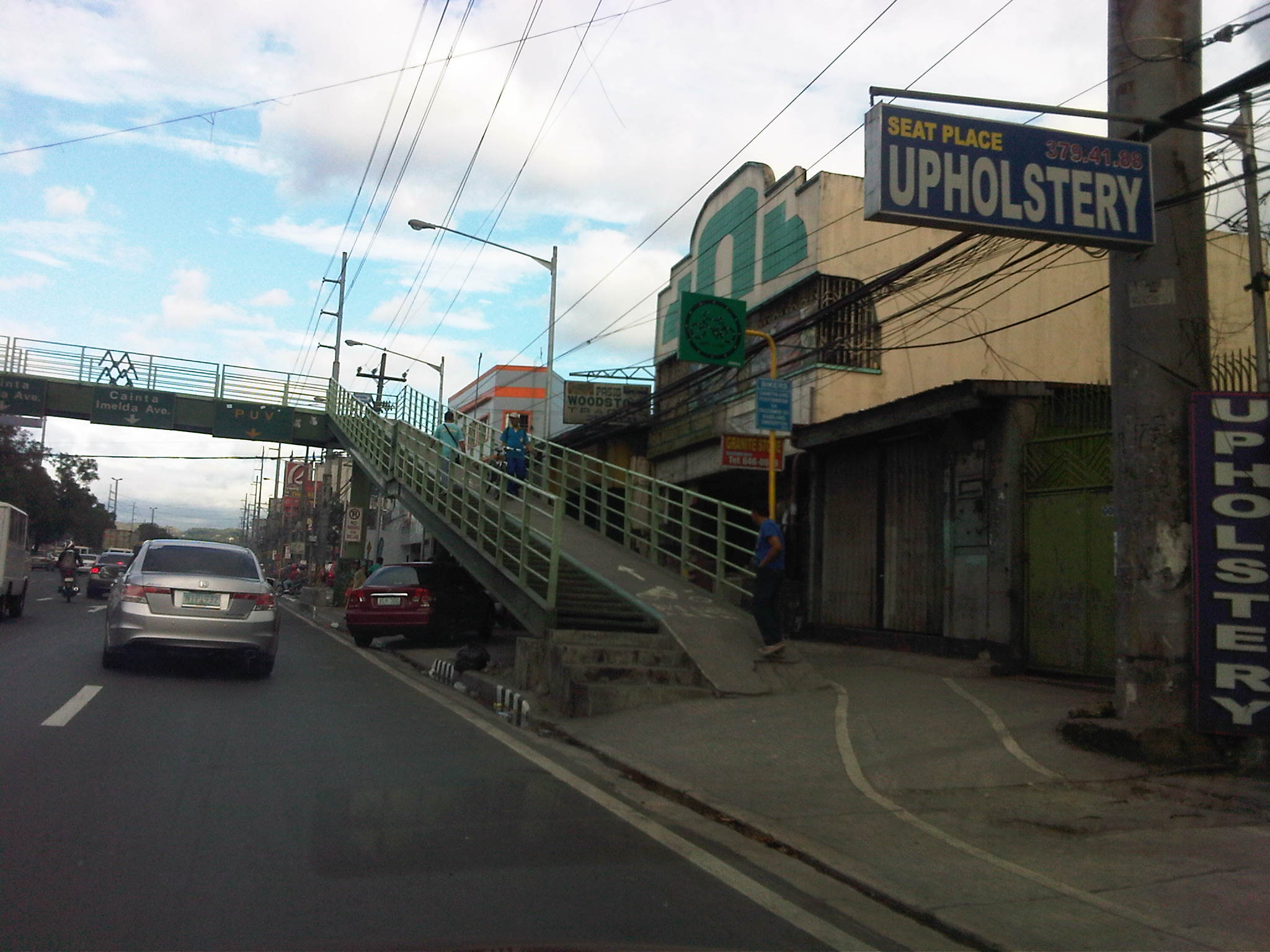 Segregated bikeway and overpass ramp along Marcos Highway
Except for the case of Katipunan, all the photos show space designated for cyclists. But Katipunan should be seen as a corridor that has a high potential for walking and cycling given the nature of the land use between Ateneo and UP Diliman. There are opportunities here to promote suitable non-motorized modes of transport while also working for a reduction in car use associated with the schools in the area. While there are still issues of encroachments (e.g., vehicles parked on the sidewalk, and depriving pedestrians and cyclists of their space) in the case of Marcos Highway, these are enforcement issues that LGUs like Antipolo City should address. I cite Antipolo because Marikina and Pasig are generally for cycling and have often reminded establishments to clear the space for pedestrians and cyclists.
–
Housing and transport in Singapore
I had wanted to write about the relationship between housing and transport. This relationship falls under land use and transport interaction or LUTI, as it is often called. But while I continue to procrastinate on writing an article on this topic, I refer my readers to another article that appeared in a regional daily. The article from The Freeman written by a good friend who is now the Manager of the Mactan Cebu International Airport and was the City Planning and Development Officer of Cebu City relates about public housing in Singapore and gives a commentary on their strategic locations in relation to Singapore’s efficient transport system. The article is part of a series that the author is writing about his observations in Singapore, and provides a peek into housing and transport in a developed city state. I believe such is an example of a best practice in public housing that the Philippines should learn from in order to solve its own housing problems.
–
Addendum: Here are the first and third parts of the series of articles by Nigel Paul Villarete for The Freeman. There are also archives of his articles under his column Streetlife. Good reads that our officials at the national and local levels should indulge in to have a grasp of solutions and best practices concerning transport and traffic.
–
