
On C-6 and the proposal for another expressway, Part 2
The recent announcement and launch of the Southeast Metro Manila Expressway (SEMME) included this map showing the (very) rough alignment for the proposed tollway. The map also shows the proposed locations of interchanges including one in Tikling and another in Masinag. There is also another in Tumana. From the looks of this, the SEMME will be a skyway or elevated expressway/tollway.
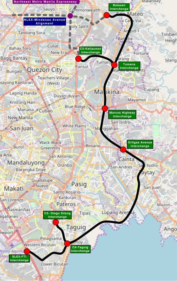
My first impression is that this elevated tollway will pass through predominantly residential areas with columns rising from private subdivisions. It doesn’t help that the topography also means the columns will be built along hilly or mountainous terrain, thereby making construction more challenging than the elevated tollways in Metro Manila.
Do we really need another circumferential road and particularly another tollway? I think that is a very important question that not only needs to be asked but also answered the right way. I, for my part, don’t believe we need another tollway, elevated or not, as this will not solve the so-called traffic problem. In fact, it creates more problems than what is supposed to be solved with the induced traffic this will generate and its promotion of car-centricity. For the price and effort of such an infrastructure, you will get more bang for your buck with a mass transit line or lines. Road congestion can only be solved by constructing the public transport system we needed decades ago.
–
Back in Bicol
I have not been to Bicol since before the pandemic in 2020. But that was in Naga City in Camarines Sur to which I have been a few times. I have not been beyond Naga City since my early high school days. That was my last travel to my mother’s hometown in Gubat, Sorsogon. I think that was when we traveled on the occasion of my maternal grandfather’s passing.
We arrived at Legazpi City yesterday via the Bicol International Airport in nearby Daraga. I was looking forward to this trip as I also wanted to see the new airport and, of course, Mayon Volcano. Unfortunately, the weather is bad and so I currently have not seen the volcano even during the plane’s approach to the airport.
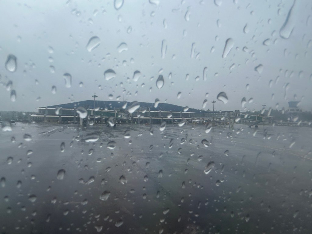
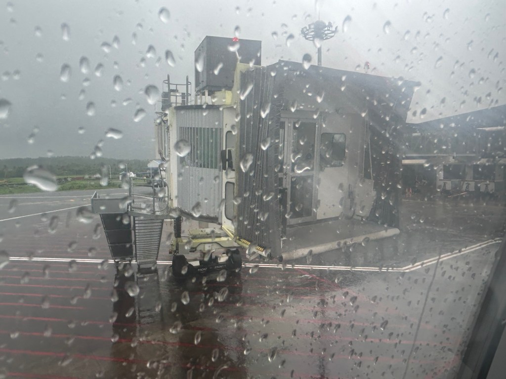
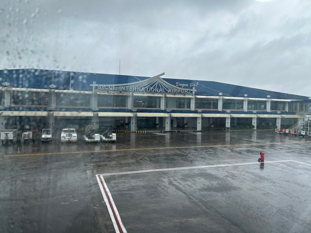
More on Bicol and Legazpi in future posts.
On C-6 and the proposal for another expressway, Part 1
I’ve written about Circumferential Road 6 many times in the blog. Mostly, these were about the existing sections along the Laguna de Bai in Taguig and Pasig cities of Metro Manila and Taytay in Rizal Province. I share below two maps showing different alignments of C-6. The first one is a rather old one from the 1990s that I recall was from a presentation of a friend at DPWH.
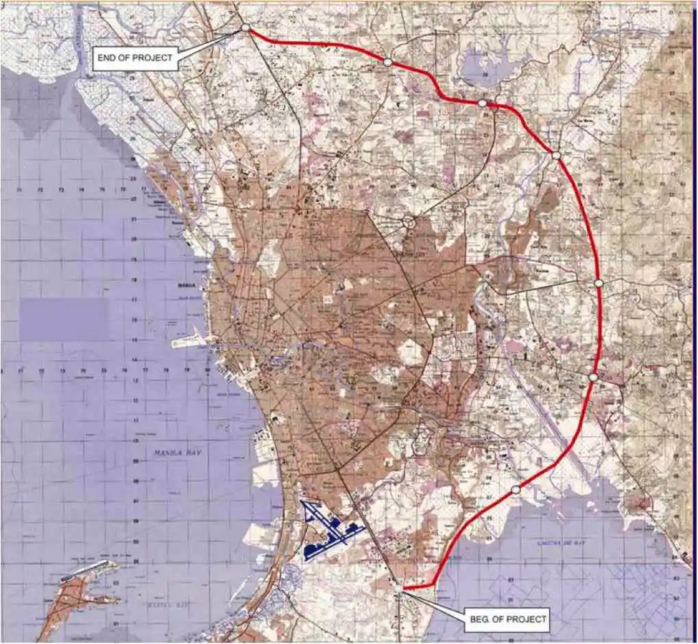 An old map I got from the DPWH a long time ago that I have used in my lectures.
The second map is supposed to be more recent, perhaps in the last 5 to 10 years if not more recent. This shows a more realistic alignment composed of what looks like existing road sections that were connected to form a semblance of a circumferential alignment.
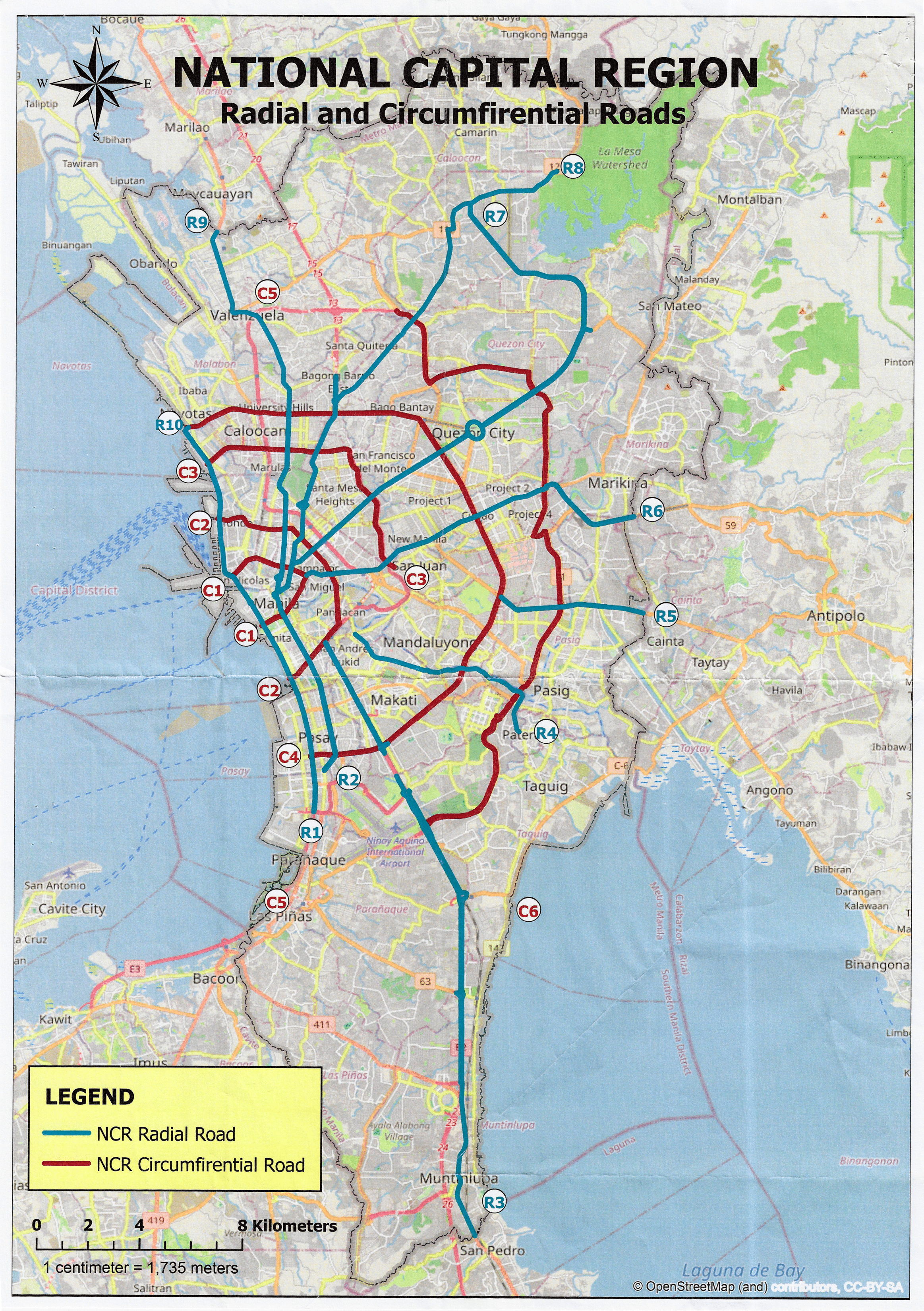 Here is a more recent map that’s also attributed to the DPWH.
In the first map, you will notice that the proposed alignment is more circular and smoother. This means that the road would have had a mostly new alignment instead of utilizing existing roads like Circumferential Road 5 before it. The newer sections for the latter were the ones connecting the existing roads. For the second map, noticeable is the somewhat forced connections of what looks like existing roads on the map. And while for Map 1 the alignment will be passing under the La Mesa reservoir, the alignment for Map 2 will circle the watershed like a coastal road. The alternative alignments presented an interesting exercise for students of highway engineering particularly for the topic of alignment design. Do you pick an entirely new alignment, sketch it out and determine the crossings and other constraints or do you try to make do of what roads are existing and perhaps improve (i.e., widen) these to produce an arterial?
The proposed alignment for what is now called the Southeast Metro Manila Expressway (SEMME) seems closer to the alignment in Map 1 than the one in Map 2. I will write about the proposed expressway that was recently launched in the next post.
–
To B(RT) or not to B(RT)?
I kind of expected questions or comments from my ‘students’ after my lecture last Wednesday about “Traffic Congestion.” Among my slides were those featuring solutions to transport and traffic problems. I presented both soft and hard approaches including travel demand management schemes and infrastructure that we should have built decades ago. The uniformed officers who were there had a very simple take on congestion – it’s basically because of a lack of discipline. While theirs may also be valid observations based on their experiences, ‘discipline’ is not the most critical problem that we have especially considering the ever increasing demand for travel. One government official present was very direct in his question about what I thought about the MMDA’s pronouncement that they plan to remove the EDSA Bus Carousel. I thought my reply and the following explanation was clear – it was a wrong move.
The EDSA Bus Carousel is simple. Bus lang sa bus lane (Only buses along the bus lane). Pag may private or pa-VIP, bawal at huli dapat (If there are private vehicles or those who regard themselves as VIPs using the lane, then they should be apprehended. An HOV (high occupancy vehicle) lane is more difficult to implement. Mas pahirapan ang pag monitor and enforce (It is very difficult to monitor and enforce). So this proposal to phase out the EDSA bus lanes don’t make sense from this perspective. In fact, I don’t agree with a couple of more senior transport experts who say that the MRT Line 3 is sufficient and that it hadn’t reached capacity yet. It has but in the time that the carousel has been operational, the carousel had absorbed much of the demand along the corridor. There is also the fact that it will take much time before Line 3 is upgraded. Are the new train sets here? Are the stations designed for these trains and more passengers? If the answers are no, then MRT3 will not have its capacity increased in such a short time. That also means the carousel is very much relevant not just to supplement MRT3 capacity but as a needed alternative mode for commuters.
–
On affordable housing
I’ve written about the relationship between transportation and housing in many of my previous posts. Here is an article defining affordable housing from the US context:
Axel-Lute, M. (January 23, 2025) “What is ‘affordable housing’?” Shelterforce, https://shelterforce.org/2025/01/23/what-is-affordable-housing/ [Last accessed: 2/4/2025]
To quote from the article:
“With no other qualifications, “affordable housing” in the United States typically refers to housing whose cost is affordable to households that make somewhere between 40 and 80 percent of the area median income.
Below 80 percent of AMI is how the U.S. Department of Housing and Urban Development officially defines “low income”—but be careful about making assumptions. Area median incomes are calculated at the metropolitan level, so for many areas they can be quite high. In those cases, “affordable housing” might be targeted to people who wouldn’t have considered themselves low income.
On the other hand, in some less affluent neighborhoods, official “affordable housing” might be too expensive for most of the people who already live there. And in metropolitan areas with lower housing costs overall, official “affordable housing” might not be much cheaper than market rate!”
How do we define affordable housing in the Philippines? Is our definition of “low income” similar to how they define it in the US or elsewhere? Or are our definitions flawed and therefore affect how we provide (or not) housing to those who need them the most?
–
Article on the evaluation of congestion pricing
I want to share this article on the congestion pricing zone in London. This is called the Ultra Low Emission Zone (ULEZ), which also met resistance when it was first implemented.
Selby, O. (January 16, 2025) “ULEZ expansion hasn’t hurt high street spending,” Centre for Cities, https://www.centreforcities.org/blog/ulez-expansion-hasnt-hurt-high-street-spending/ [Last accessed: 2/1/2025]
Quoting from the article:
“The benefits ULEZ has provided to public health have been studied extensively. The data is clear: London has the worst air quality of any UK city and the capital’s emission zone is helping to change this.
So far, card transaction data does not suggest that ULEZ is harming high street spend. This should reassure policy makers in London, who committed to the emission zone a while ago, and strengthen the convictions of policy makers in New York who are now following suit.”
The article is a nice reference not just for evaluation of similar congestion pricing schemes but can also be used for carless streets or zones. I wonder if there are similar work being done for Baguio’s congestion pricing scheme as well as the carless programs in Ortigas Center. Quezon City should also do this for the newly implemented program along Tomas Morato.
–
On unwanted traffic
I just want to end this first month of 2025 with a commentary on unwanted or undesirable traffic. Last year, one of our neighbors leased their property to a trucking company. This was without information to the homeowners’ association and certainly without the knowledge or notice to neighbors, particularly those near their property and along the routes the trucks use. The result was unwanted truck traffic along roads that we usually used for our daily walks. Truck drivers’s usually drove the vehicles as if they were not in a residential area. That is, they were usually fast and belching smoke. Add to this the drivers hanging around and even loitering around the village. Many neighbors complained about this but the resident did not respond favorably or in a neighborly manner. And so each one of us had to confront the drivers ourselves and reminded them to drive carefully and slowly as they were in a residential subdivision. The village security was also told about them and the roving guards also reminded the drivers about safe driving.
And so I was pleasantly surprised when during my first walk of the year, I found that there were no more trucks along the road and parked in their property. I thought this was a nice New Year’s gift and ended what is generally regarded as an external cost to society.
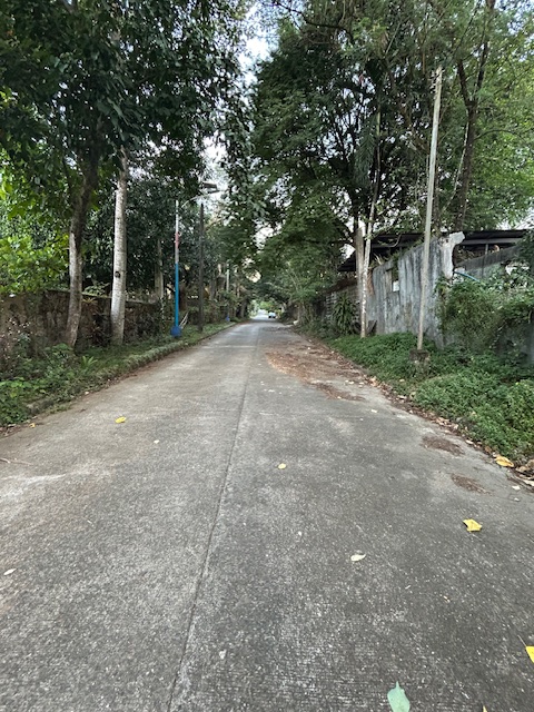
The now clear street in our neighborhood used to be lined with trucks. This street was quite busy, noisy and smelled of emissions from idling trucks. It’s good to recover the road space for walking again. Do you have something similar happen in your neighborhood?
–
On civil works for transferring cables and wires underground
I got messages this week about the civil works to be implemented in relation to transferring overhead cables and wires underground at the Ortigas Center in Pasig City. This is a screenshot of what’s been circulating the past days:
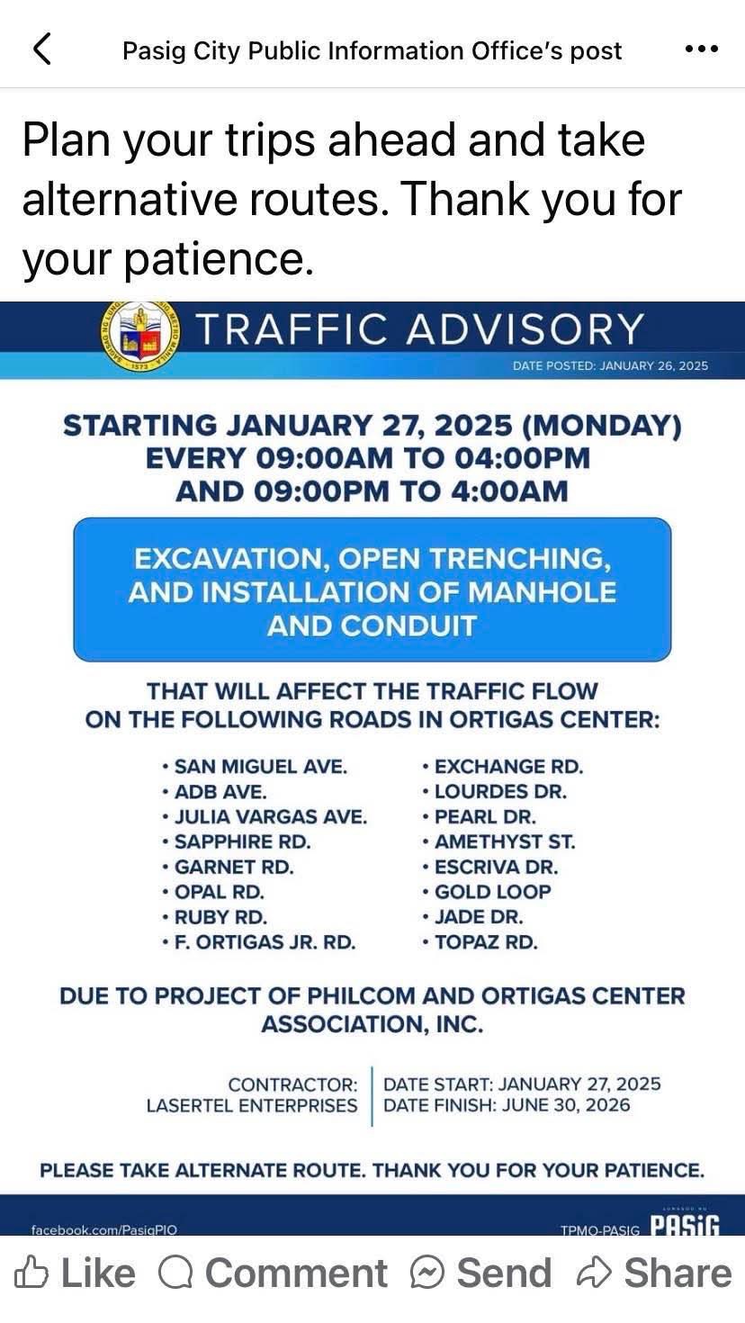
I think this follows the examples of cities like Iloilo and Davao already transferring or placing power and communications cables and wires underground. Prior to these, Bonifacio Global City (BGC) in Taguig City already did so but that was from the start considering BGC is a masterplanned development. Other masterplanned developments are already consciously doing this so there will be no overhead cables and wires that are often criticized as unsightly or ugly. Such works will require traffic management as excavations will surely reduce road capacities and lead to more congestion. The timeline or schedule can also be affected once they do the excavations as conflicts among utilities are expected. Note that water lines and drainage are already underground and there will be the need to resolve the intersections of these with the power and communications lines to be transferred.
Perhaps we can learn from this experience that Ortigas Center will undergo until 2026 as other Metro Manila LGUs also consider transferring their overhead cables and wires underground. Quezon City, for one, is already at the early stage of identifying an area or corridor to serve as a pilot for the city. That can be a road like Commonwealth Avenue or Visayas Avenue or perhaps the Araneta Center in Cubao.
–
Roads, railways support needed for airport upgrades — analysts
Here’s a quick share on an article on the infrastructure needed to support airport development:
Source: Roads, railways support needed for airport upgrades — analysts
Unlike many capital airports including Malaysia’s Kuala Lumpur International Airport and Bangkok’s Suvarnabhumi International Airport, Ninoy Aquino International Airport does not have rail or mass transit access. It will eventually have rail access via the currently under construction Metro Manila Subway. The airport construction in Bulacan should also have transit access in order to make it more accessible to passengers and other airport users. Railways will provide an alternative to road-based transport that would probably require much road space and likely lead to congestion just like what we experience around NAIA at present.
–
Tips for walking
I was at a clinic last week and found this special edition of a certain magazine that had meditation and mindfulness as the main themes. Walking was a topic of one article in the magazine and I got the following “tips” for walking:
- Walk when you wake up
- Walk to get lost
- Walk in the cold
- Walk in silence
- Walk after you eat
I will leave these tips as is for now and won’t be expounding on these. I will try to write about each in future posts. The reader is free to interpret or identify with these tips. I’m sure that many people will have experiences with at least one of the tips.
–

