
Repair C6 now!
The existing roads that comprise what has been designated as Circumferential Road 6 is an important link that serves as an alternate route for people and goods traveling between the eastern towns of Rizal province and Metro Manila to urban centres in Makati (Ayala CBD) and Taguig (Bonifacio Global City) as well as the southern areas of Metro Manila all the way to Laguna and Cavite. During the last dry season or summer, the roads conditions have been quite good such that travellers from Rizal could easily reach BGC or Makati in less than an hour give and take typical congestion during the peak periods.
The situation has significantly worsened since the onset of the wet season as the pavement quickly deteriorated with the combination of heavy rains and heavy vehicles utilising the road. Highway 2000 from Taytay, Rizal was already in bad condition during the summer so it became only worse once the rains came. However, it is the C6 segment from Pasig to Taguig that has deteriorated and is now in a state of disrepair. Following are photos that show how bad the conditions are and which have led to travel times worsening to more than double than what it should be if the roads were in good condition.
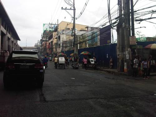
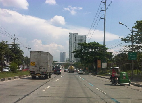
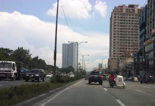
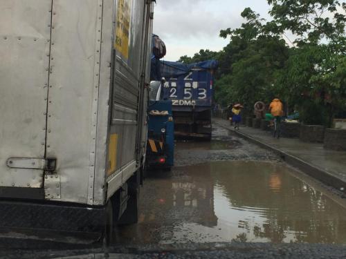 Section in Taguig along the shores of Laguna de Bay where even large trucks avoid the deep holes along the road. These situations along C6 constrict traffic everyday.
 C6 section in Pasig City where what used to be asphalt is now a muddy mess.
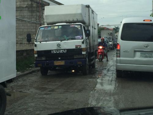
 Another section in Pasig City where C6 passes through a relocation area (Lupang Arenda) where local traffic affects through traffic and C6 is probably at its narrowest.
The section from Pateros to Taguig was built as a road dike protecting these areas from floods brought about by the increasing level of Laguna de Bay during the wet season. While it is basically a secondary road compared to the other circumferential roads, traffic has significantly increased along C6 due to many people discovering that you can travel faster between Rizal and Makati or BGC via this road. Sadly, there seems to be little or no attention given to its current state.
I understand that the DPWH has a process for determining whether a road needs to be repaired and given limited resources, the agency also applies a process for prioritisation of road repairs (i.e., there are many other roads that also need repairs). However, there should be a way to allocate resources for the repairs of the road and this includes involving the LGUs whose constituents benefit from the use of the road. Rizal province and towns and Pasig City should take the initiative to find ways to improve the conditions along C6. It is also in the interest of Taguig to improve this road as many of its residents use it, too. Hopefully, the road will be repaired sooner rather than later and travel times will improve again. Of course, this should be the case whether or not the proposed C6 expressway is realised.
–
The return of traffic signals at Katipunan
It’s been more than a decade since the MMDA implemented what was formally called the Grand Rotunda Scheme. To most, it will always be the U-turn scheme that was implemented all around Metro Manila. After seeing what seemed like success along roads like Commonwealth and Quezon Avenue, it was concluded that the U-turns were the answer to Metro Manila’s traffic woes or at least the part that’s blamed on signalized intersections. The perception by many at the time was that traffic signals were not working and caused so much congestion as evidenced by the long queues at intersections. This is not entirely false as intersections with in-optimal settings would definitely bring about congestion especially along corridors or networks where signals are not coordinated. It was, however, a generalization at a large scale and led to more experiments of opening and closing slots in order to determine which would be the most effective combinations. These experiments and their outcomes include drivers becoming more aggressive in order to maneuver ahead of others at the U-turn slots. Weaving has become the norm and in many cases have increased the risk of road crashes.
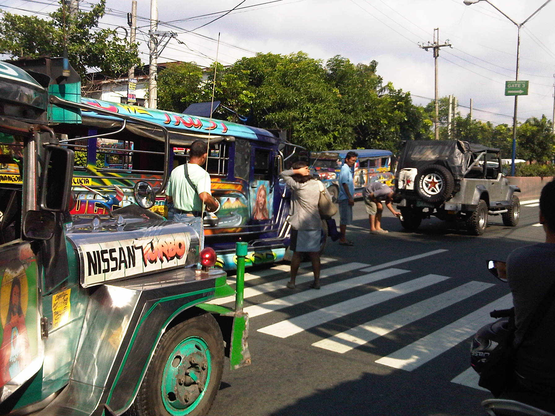
 Traffic signals have been installed and the section of the median island has been removed across Ateneo’s Gate 3. This will become a three-leg intersections once again but I hope the signals will not favor Ateneo over through traffic along C5.
 Traffic lights are already installed along the southbound side of Katipunan at the approach to the junction with Miriam College’s Main Gate. This will be a four-leg intersection as across Miriam is B. Gonzales Street that connects to Esteban Abada.
The signals are supposed to be operational starting September 13, which is a Saturday. Perhaps this is to try it out first during that weekend and for the MMDA to do some tweaks before the real deal that is traffic on Monday. But then how can you simulate traffic generated by the two schools in the area except maybe if there is significant enough traffic on Saturday? Did the MMDA or its consultants do some simulation using their computers and the VISSIM software they acquired many years ago? Or will we see more of the experiments as signals are fine-tuned according to the conditions along Katipunan?
We are hopeful that the signals along Katipunan will help improve the traffic along this very busy corridor. The results for sections of C5 from Libis (QC) to Ugong (Pasig) are promising and many people I know have told me that traffic has improved. Of course, this may also be partly due to the one-lane policy the MMDA has implemented for trucks. It’s never just one scheme or measure that will work wonders for Metro Manila traffic. It will always be a combination that will alleviate traffic woes in the metropolis. We’ll soon know what will become of traffic along Katipunan. We should, however, temper expectations at least for the 6:30 – 7:30 AM period during weekdays when traffic peaks in the vicinity of Ateneo and Miriam. The sheer volume of vehicles generated by the schools will overwhelm any system that is put up in the area. Nevertheless, for the rest of the day at least traffic flow should improve when signals are operational once again for Katipunan.
–
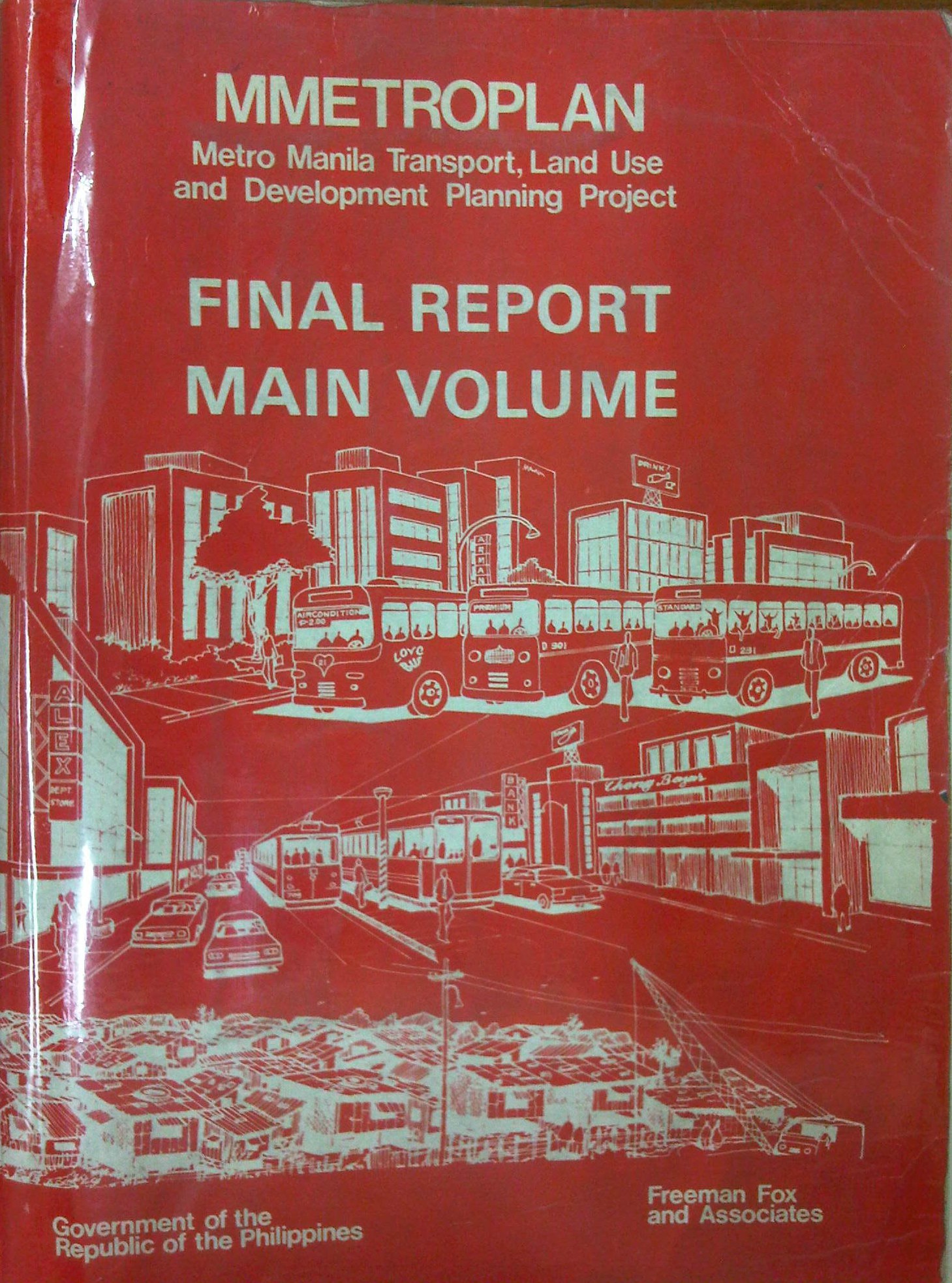
Metro Manila Transport, Land Use and Development Planning Project (MMETROPLAN, 1977)
[Important note: I have noticed that the material on this blog site has been used by certain people to further misinformation including revisionism to credit the Marcos dictatorship and put the blame on subsequent administrations (not that these also had failures of their own). This and other posts on past projects present the facts about the projects and contain minimal opinions, if any on the politics or political economy at the time and afterwards. Do your research and refrain from using the material on this page and others to promote misinformation. I suggest you go to the The Mass Transit System in Metro Manila site for more facts about railway development and history. I do not consent to the use of my articles for the purposes of misinformation and historical revisionism. 10/13/2019]
In a previous article, I had written about the Urban Transport Study for the Manila Metropolitan Area (UTSMMA), which was completed in 1973 and proposed, among others, a rapid rail transit network for Metro Manila. The government proceeded to undertake a feasibility study for the first line of that network almost immediately afterwards. However, something happened a few years later that effectively contradicted UTSMMA’s recommendations and, from what the documents available to us now suggest, effectively doomed the future of transport in Metro Manila.
The Metro Manila Transport, Land Use and Development Planning Project (MMETROPLAN) was implemented from January 1976 to February 1977. It was apparently commissioned by the Philippine Government, and funded by the World Bank, which commissioned the precursor of Halcrow Fox to do the study with a steering group comprised of senior government official dealing with transport at the time.
The MMETROPLAN project team is shown in the photo below. Note the inclusion of some familiar names particularly from the DPWH and DOTC who were then with what was the Department of Public Works, Transportation and Communications (DPWTC) and Department of Public Highways (DPH) before these were reorganised. Note, too, a familiar name under Planning, who is very much active today with his own advocacies.

The study is more expansive in terms of scope as it included components on land use and development planning for Metro Manila. It identified three main strategies to address issues on traffic congestion and public transport requirements, namely:
- Cordon pricing,
- Bus lanes, and
- LRT
Short-term recommendations focused on bus and jeepney operations, recommending that:
- Standard buses (non-airconditioned) be designed for more standing passengers and charge a fare affordable by the poor;
- Premium buses (including Love Bus) be designed for seated passengers and charge a higher fare; this may be used to cross-subsidize Standard bus operations;
- Metro Manila Transit Corporation (MMTC) bus operations should not be further expanded:
- MMTC buses should operate missionary routes, which are generally unprofitable routes.
- There should be no arbitrary exemption on franchises like in the case of MMTC.
- In reference to private bus companies, the project states that “properly regulated competition” provides best course of action for the foreseeable future;
- Jeepneys are suited for low demand but high frequency service
MMETROPLAN also touched on the route structure for road public transport. However, its most far-reaching recommendations on road public transport concern the issuance of franchises for buses and jeepneys. The study recommended that franchises should be issued for a period of a few years instead of 25 years and to define a minimum LOS. The study cautioned against arbitrary restrictions on franchises for buses at the time while mentioning that there were already restrictions for jeepneys. MMETROPLAN further recommended the encouraging of small operators for both jeepneys and buses.
However, MMETROPLAN deviated from the recommendations of UTSMMA in that it struck down the proposal and plans for the Rapid Transit Rail (RTR) network for Metro Manila. The long-term recommendations and conclusions of the study show these and one particular recommendation that probably doomed heavy rail transport and the RTR network is quoted below:
“Heavy Rapid Transit (HRT) would provide public transport passengers with much faster journey, but by 1990 would attract only 2.5% of motorists and would have negligible impact on traffic congestion. Partly because of this and partly because of its very high capital cost, it would be hopelessly uneconomic: the annualized capital costs would be higher than the estimated benefits in 1990…passenger flows are not high enough to exploit its full capacity…and the large savings in time for public transport passengers are not given a high value in Manila, and are not high enough to persuade motorists to change mode.
These results are conclusive, and are unlikely to be changed by any circumstances or reasonable assumptions…it is clear that any other fully segregated public transport system, whether light rail or busway, would also be uneconomic. As such systems would require the appropriation of most, if not all, of the available funds for all transport (including highways) in Metro Manila for the foreseeable future, and as there is not other rationale for their implementation, they have been rejected from further consideration.” (MMETROPLAN, 1977)
The study also did not have good words for the PNR as it concluded that its “routes related poorly to the major demands for movement” and that it would be expensive to improve the PNR at the time. PNR costs were compared to buses and jeepneys with the further concluded that these road transport modes are preferred over an upgraded PNR.
MMETROPLAN assessed the LRT vs. the Monorail in the context of cordon pricing and bus lane strategies. While the monorail was dismissed for reasons that included few monorail systems operating at the time, the study recommended for an LRT along Rizal Avenue, which was considered feasible. These conclusions and recommendations by MMETROPLAN would eventually have far-reaching impacts on Metro Manila’s transport system and the study would be among the most cited in discussions and future planning where land use and transport are discussed in the same light.
For land use planning, the report also provides us with a history of land use planning for Metro Manila, which we can now compare with what actually happened. That is, if the plans made back in the 1970’s were actually implemented and to what extent were they realised. Many of these plans remain controversial to this day and are often invoked whenever there is talk about the perennial flooding and the spectre of earthquakes threatening much of Metro Manila and its surrounding areas in addition to other issues like the transport and traffic problems experienced around what has become a megalopolis.
[Reference: MMETROPLAN, 1977 – NCTS Library]
But what could have influenced the MMETROPLAN study team and government officials to debunk UTSMMA? Why the “about-face” for something that seems to be the JICA Dream Plan circa 1970’s? UTSMMA and the rail rapid transit network, after all, was the product of a vision for future Metropolitan Manila transport by a visionary professor from the University of Tokyo – one Dr. Takashi Inouye of that university’s Department of Urban Engineering. I think the next article will provide us with the answers to these questions regarding the turnaround. Abangan!
–
Urban Transport Study in Manila Metropolitan Area (UTSMMA, 1973)
[Important note: I have noticed that the material on this blog site has been used by certain people to further misinformation including revisionism to credit the Marcos dictatorship and put the blame on subsequent administrations (not that these also had failures of their own). This and other posts on past projects present the facts about the projects and contain minimal opinions, if any on the politics or political economy at the time and afterwards. Do your research and refrain from using the material on this page and others to promote misinformation. I suggest you go to the The Mass Transit System in Metro Manila site for more facts about railway development and history. I do not consent to the use of my articles for the purposes of misinformation and historical revisionism. 10/13/2019]
With the recent approval of JICA’s Dream Plan for Mega Manila, I thought it was timely to look back at similar plans developed for Metro Manila and its surrounding areas. At the time these plans were made, I guess they were all regarded as “dream plans” in their own ways. Let us start with what is probably the original dream plan, the Urban Transport Study in Manila Metropolitan Area (UTSMMA, 1973). The project was implemented from March 1971 to September 1973 with the assistance of the Government of Japan’s Overseas Technical Cooperation Agency (OTCA), the precursor of today’s Japan International Cooperation Agency (JICA). Being the first comprehensive study for a metropolitan area that was yet to be formally consolidated and called Metro Manila, UTSMMA set the stage for future transport studies for the metropolis. Among the study’s main recommendations is one proposing for a mass transit system restricted to railways. A Rapid Transit Railway (RTR) network was recommended in the form of subways in the inner area bound by EDSA, and elevated in the suburban areas. Brief descriptions of the proposed lines are as follows:
- Line 1 (27.1 km) – from Construction Hill to Talon via central Quezon Boulevard, Manila downtown and the International Airport
- Line 2 (36.0 km) – from Novaliches to Cainta via Manila downtown and Pasig
- Line 3 (24.3 km) – Along Highway 54 (C-4): half a circle route about 12 km from Manila downtown
- Line 4 (30.1 km) – From Marikina to Zapote via Cubao, Manila downtown and the Manila Bay area
- Line 5 (17.6 km) – From Meycauayan to Manila downtown running between Line No. 2 and PNR
- PNR improvement (56.4 km) – From Bocaue to Muntinglupa via Tutuban Station
The following that was posted here before in another article shows a map illustrating the recommended RTR network for the Manila Metropolitan area. (Note that the map was enhanced from the original black and white to clearly show the proposed lines back then.)  UTSMMA also recognized the important roles of buses and jeepneys in the future, and recommended that these be used for feeder services once the rail systems have been constructed and operational. As a result of the study, a Feasibility Study for the Manila Rapid Transit Railway Line No. 1 was conducted and completed in June 1976. The study, which was supported by JICA, noted that “the implementation should be initiated immediately” in light of the estimated heavy traffic demand along the corridor. This project could have been the first major transport project for Metro Manila if it had been implemented. Unfortunately, despite a favorable assessment in this study, the proposed RTR Line 1 was not implemented after a contrary assessment by a subsequent study, MMETROPLAN, which is discussed in the succeeding section of this report. The estimated costs of construction of recommended transport infrastructure were provided in the Final Report of the study including indicative costs and benefits of proposed urban expressways and urban rapid transit railways. [Reference: UTSMMA, 1973 – NCTS Library] Whenever I go back to UTSMMA and the network of proposed railway lines, I can’t help but wonder what could have been one of the more efficient transport systems in Asia or even in the world. What happened? Why was this plan not realised? The answer may be found in the next big study conducted for Metro Manila that also included in much detail its land use and development plans. Next: MMETROPLAN, 1977 –
Tutok – tailgating
A common practice of motorists along Philippine roads is tailgating. This is not only common in congested traffic, when vehicles are practically “bumper-to-bumper,” but also in free flowing traffic where drivers or riders tailgate for a number of reasons (e.g., to put pressure on the one ahead of them, to display skills in following closely behind another vehicle, etc.), all of which are dumb. There is always the risk that the driver or rider of the vehicle in front will brake to slow down or stop and the driver/rider of the vehicle behind will not be able to brake in time to hit (rear-end) the one ahead. Both time (reaction, headway) and space (distance between vehicles) are factors here as driver or rider reaction times vary and will affect the outcome of the chain of events should the leading vehicles suddenly slow down for any reason.
 A passenger can only scratch her head as she tries to get back her fare from the conductor after alighting from a jeepney involved in a collision with another vehicle. Meanwhile, the driver of an owner-type jeepney inspects the damage to his vehicle as the driver of the jeepney that hit him looks on.
I was just explaining about Stopping Sight Distance (SSD) to a class of senior students and SSD very much applies to tailgating. Given varying traffic conditions along the roads, tailgating compromises the safe distance between vehicles and therefore too often leads to situations that lead to road crashes. Rear-end collisions in turn often lead to traffic congestion and raise the costs brought about by such incidents. In most cases, this happens because authorities are unable or incapable of managing the aftermath of the incidents where parties involved often argue in the middle of the road without regard for other road users plights. These cases need to be resolved quickly and efficiently in order to remove these obstacles from the road.
–
EDSA: Taft to Tramo
The EDSA-Taft Ave. intersection was in the news a few weeks ago due to the MRT3 train that derailed and overshot the end of the line along EDSA. Being a major intersection for roads as well as for rail (MRT3 and LRT1), it is a very crowded area. Nearby, too, is the Redemptorist church in Baclaran that attracts a lot of people especially during Wednesdays. Following are a few photos of the area showing the conditions on the pedestrian overpasses and at street level.
 The pedestrian overpass at EDSA-Taft is also a mall of sorts given the merchandise being sold at informal shops at the overpass.
 The overpass connects to the EDSA-MRT 3 Taft Ave. Station. This is the MRT 3’s end station and the overpass system connects the MRT 3 Taft Ave. Station with the LRT Line 1 EDSA Station. The connection was not and is still not a smooth one, which has been the subject of criticism from a lot of people.
 The overpass allows people to walk around this large intersection
 Pedicabs freely travel along this stretch of EDSA between Taft and Tramo on lanes designated for public utility buses and clearly violating regulations regarding what vehicles are allowed on EDSA. You can also see in the photo a cart full of merchandise being pushed along the curbside lane.
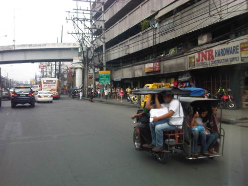 A motor tricycle ferrying passengers along EDSA just before Tramo (that’s the street above which is an overpass from EDSA southbound).
–
2014 Professorial Chair lectures on transport topics
The 2014 Professorial Chair Colloquium of UP Diliman’s College of Engineering was held from yesterday until today. Most of the lectures concerning transport were presented today. Here are some of the highlights of the lectures delivered this morning:
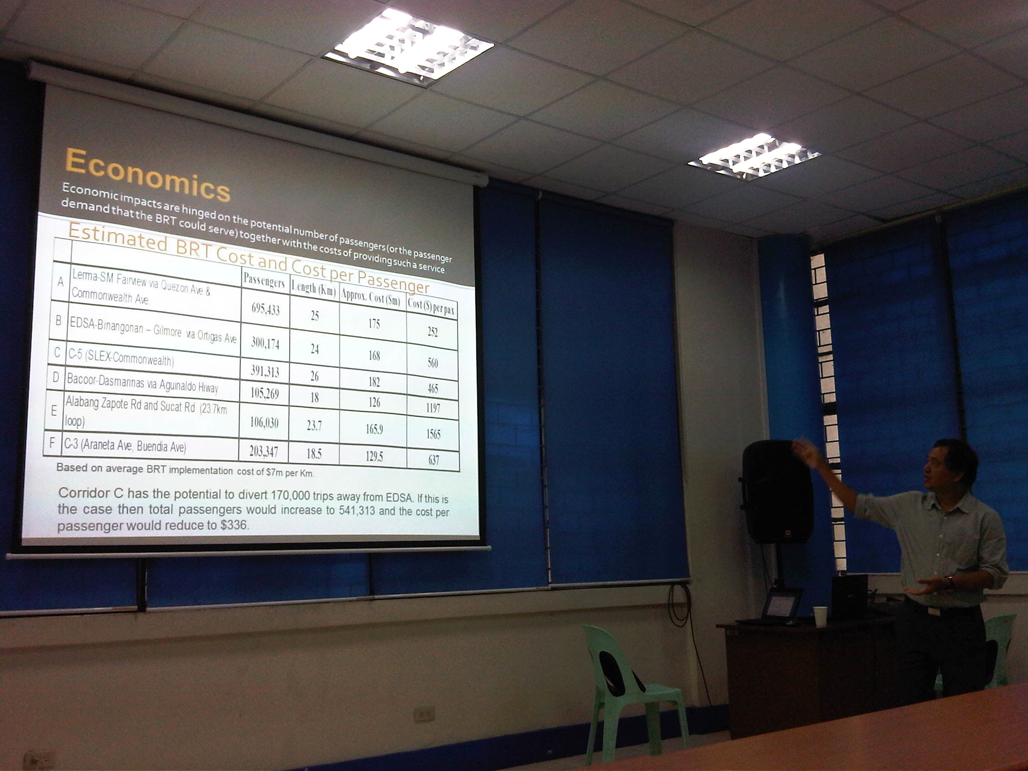 Dr. Ric Sigua, Director of the Institute of Civil Engineering, making a point about the economics of Bus Rapid Transit (BRT).
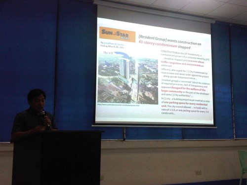 Dr. Sean Palmiano, Director of the National Center for Transportation Studies, explaining the finer points of traffic impact assessment for high density residential developments.
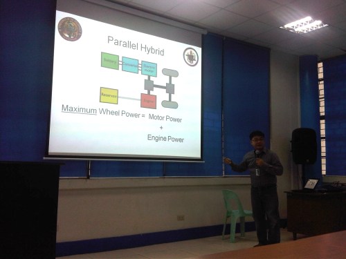 Prof. Happy Denoga of the Department of Mechanical Engineering explaining on the advantages of hybrid systems for vehicles.
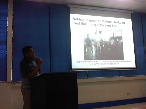 Dr. Karl Vergel of the Institute of Civil Engineering talking about the on-road tests for jeepneys using B5 or 5% CME-blended fuels in a project commissioned by the Philippine Coconut Authority.
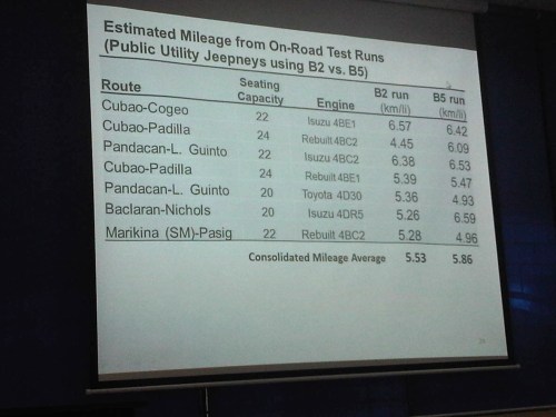 Comparison of jeepney mileage using 2% and 5% blended fuels.
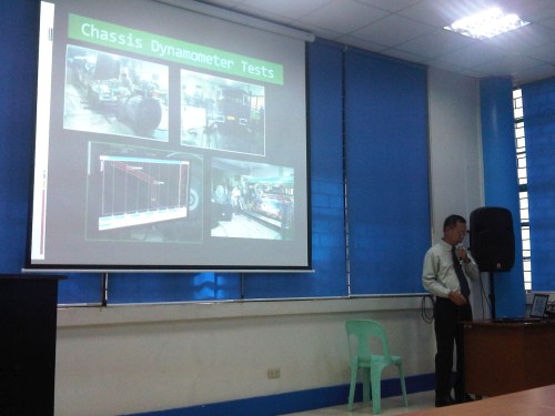 Dr. Edwin Quiros of the Department of Mechanical Engineering’s Vehicle Research and Testing Laboratory (VRTL) discussing the dynamometer tests conducted for jeepneys using B5 fuel.
There were other presentations but unfortunately, I wasn’t able to attend these as lectures were spread among various venues at the college. That’s often the hang-up of having parallel sessions during these colloquiums. Nevertheless, it is nice to know that transport remains a popular subject for these lectures.
–
On logistics in the Philippines
I am not a logistics expert and will not pretend to be one. I have, however, been involved in several projects that included logistics as a major study component. These include a nationwide study on inter-regional passenger and freight flow and another for freight forwarders affected by vehicle restraint policies in Metro Manila. A more recent engagement has allowed me to take a look at logistics in the country from other perspectives including that of national agencies seeking to improve goods movement in the country and development agencies that have committed to help the country to do just that. There are local issues and there are regional ones. The regional ones often involve the need for infrastructure such as maritime ports and airports, highways and bridges, and other facilities such as those for storage and refrigeration.
For an archipelago like the Philippines, logistics is a bit more challenging than in countries whose territories are not separated by bodies of water. There is no lack for good practices though as there are other archipelagos that could provide good examples for connecting the islands such as Japan and the United Kingdom. Nearby, we share similar challenges with Indonesia and to a certain extent Malaysia. Of course, availability of resources is always an issue and particularly for the prioritization of infrastructure to be constructed aside from those that need to be maintained. The DOTC along with its attached agencies like the Philippine Ports Authority (PPA) and the Civil Aviation Authority of the Philippines (CAAP) are in the frontline when it comes to airports and ports planning, development, and maintenance are concerned. However, the DPWH plays a vital role for highways and bridges and the connections for these ports and airports including what is termed as “last-mile” connectivity that is often passed on as a responsibility of local governments. This is likely due to local roads often providing the connection between national roads (under the DPWH) and ports and airports. It is a good thing that the current DPWH has committed to a convergence program regarding national and local roads that has benefited a lot of sectors and industries like tourism and agriculture.
Rail transport is not mentioned here because there is practically none even for what remains of the once relatively extensive PNR main lines. The local issues are not simpler and can be a bit more complicated than the regional ones. The complications are usually due to more petty circumstances that may involve politics and local power plays. The basic ingredients though are related to traffic congestion and the damage to roads and bridges attributed to trucks.
Many cities and municipalities have implemented truck bans along their major roads. These are usually one or two routes in the smaller cities and towns, usually passing through the “bayan,” “poblacion” or central business district (CBD). These roads are usually national roads (e.g., McArthur Highway and the Pan Philippine Highway pass through many towns). As such, there are cases where bypass roads are constructed to alleviate congestion along these roads as well as to try to preserve the pavements in the town proper. Such traffic schemes targeting heavy vehicles are not new and are also a way to address the issue on overloading that is common in trucking in the Philippines. The bypass roads, however, generally invite development and unplanned development have often made these alternate routes more congested than the original ones.
Manila did a “power play” recently by implementing a more aggressive truck ban. This led to more severe congestion around the Port of Manila and a lot of delays that have cost a lot of money in part due to the limited alternative routes in the city and most roads are already constricted. The costs have repercussions on the economy in general as the movement of goods are affected by the impasse in Manila. Whether this was for more political or practical reasons is difficult to say because the mayor and vice mayor have invoked the very common issues of traffic congestion, road safety and pavement maintenance that got the attention, sentiment and agreement of a lot of people. Many of these people though do not understand the impacts of inefficient goods movement and likely are concerned only about passenger transportation.
More recently, a lot of containers were shipped from the Port of Manila to Subic. These are supposedly “overstaying” shipments or those that have not been claimed for a long time or have some issues regarding their release. This should ease congestion somehow but there remain the problems of shipping or logistics companies regarding freight transport in general that needs to be addressed. Both Subic and Batangas ports have been mentioned in many formal studies over the past few years including a more recent one supported by JICA. Still, there is a lot of hesitation if not confusion or uncertainty on how to go about with shifting goods movement to these ports, which are regarded to be underutilized. There are good roads connecting these ports with cities and towns but these might not be enough in the long run.
Perhaps there is a need to reconsider regional rail transport again especially for the islands of Luzon and Mindanao where long distance rail may have a tremendous impact for transporting goods over long distances. Of course, there are also issues pertaining to other ports and airports in the country including those in Mindanao (e.g., Davao, Cagayan de Oro, Phividec, Gen. Santos, etc.) and Visayas (e.g., Cebu, Iloilo, Tacloban, etc.). The RORO ports are among those that need attention as they are directly involve road transport aside from the ferries that carry them over the waters. These nautical highways are vital for goods movement around the country and require both national agencies and local governments cooperating for these facilities and services to function efficiently.
–
Transport related topics at the 2014 Professorial Chair Colloquium
The 2014 Professorial Chair Colloquium of the College of Engineering of the University of the Philippines Diliman will be held from August 28 – 29, 2014 at five venues at the college. Following are the transport-related topics to be presented at the colloquium:
Dr. Nathaniel B. Diola, “Performance Standards for Concrete Roads,” Prof. Jose Ma. Diago de Castro Professorial Chair in Civil Engineering [0830-0850, GE Theater, 4F, Melchor Hall, August 29]
Asst. Prof. Adeline A. Pacia, “A Study on the Application and Impact of Eco-Driving Seminars Conducted by UP-NEC,” Cesar E.A. Virata-Daikin Industries Ltd. UP Centennial Professorial Chair Award [1030-1050, GE Theater, 4F, Melchor Hall, August 29]
Dr. Ricardo G. Sigua, “Identification of BRT Corridors in Metro Manila,” Dean Reynaldo B. Vea Professorial Chair [0830-0850, Maynilad Room, 3F, Melchor Hall, August 29]
Dr. Jose Regin F. Regidor, “Philippine Transport on a Diet: Low Carb Systems for the Future,” Cesar A. Buenaventura Professorial Chair [0850-0910, Maynilad Room, 3F, Melchor Hall, August 29]
Dr. Hilario Sean O. Palmiano, “Traffic Impact Analysis (TIA) for Site Development in the Philippines,” Cesar Buenaventura UP Centennial Professorial Chair in Engineering [0910-0930, Maynilad Room, 3F, Melchor Hall, August 29]
Asst. Prof. Gerald Jo C. Denoga, “Development of a Parallel Hybrid Sprint Car,” Dean Ruben Garcia Professorial Chair Award [0930-0950, Maynilad Room, 3F, Melchor Hall, August 29]
Dr. Karl B.N. Vergel, “On-Road Test of 5% CME Biodiesel in Public Utility Jeepneys,” DATEM & ACES Professorial Chair [0950-1010, Maynilad Room, 3F, Melchor Hall, August 29]
Dr. Edwin N. Quiros, “Comparative Drive Cycle Fuel Economy of In-Use Public Utility Jeepneys Using 2% and 5% CME-Diesel Blends,” Ariston Delos Reyes Professorial Chair in Energy Engineering [1010-1030, Maynilad Room, 3F, Melchor Hall, August 29]
Asst. Prof. Joseph Gerard T. Reyes, “Comparison of the Characteristics of Coco-Methyl Ester Biodiesel with other Biodiesels,” Quezon Power Philippines Professorial Chair in Engineering [1030-1050, Maynilad Room, 3F, Melchor Hall, August 29]
The colloquium is open to the public.
–
Re: traffic congestion along Katipunan
Yesterday was a holiday in Quezon City so most offices and schools were closed. It was not a holiday elsewhere so through traffic along Katipunan Avenue would have been “normal.” This is assumed especially for trucks that have been blamed as the cause of the severe congestion. I was curious about how traffic would be with the holiday in QC and through traffic could practically be “isolated.” There still was significant traffic generated by establishments like restaurants and cafes along Katipunan. It was a regular weekday and not like it was a Sunday. Following are photos that were taken around 2:00 PM when the truck ban is not enforced in the area.
 Free-flowing traffic along the section across from the UP Town Center – There were no long queues at the approach to the Katipunan-C.P. Garcia intersection.
 Free-flowing traffic along Katipunan across from Ateneo – the two universities generated few private car traffic yesterday during a period when there’s usually a lot coming in and out of the campuses due to the dismissals in the early afternoon.
 Free-flowing traffic along the Katipunan-Aurora overpass – in the early afternoons, the northbound side of Katipunan is usually full of vehicles mainly private cars and trucks. While there were many trucks yesterday, their numbers were not enough to cause traffic jams.
I think the traffic situation yesterday provided a clear picture that the major traffic generators along Katipunan are mainly the reason for traffic congestion along the stretch from Blue Ridge to Balara. These are mostly the schools (Ateneo, Miriam and UP) that generate so much private vehicle traffic on weekdays and Saturdays. Sundays are different because there’s no school nor work at offices on this day. With the QC holiday, the through traffic was still there owing to work and school in other cities (e.g., Residents of QC would still have to travel to Makati or Ortigas if their workplaces are located there. Similarly, students residing in QC whose schools are in the University Belt in Manila would have to travel.). This means there is really a need to understand why there is congestion and what causes it. A lot more effort is needed for this understanding and to ultimately reduce traffic congestion along this stretch of C5. Pointing fingers among agencies and simply putting the blame on one sector of traffic (e.g., trucks) will not get us anywhere. The solution will require strong cooperation among stakeholders and will definitely be not a painless undertaking for many.
–
