
Kalayaan Bridge (BGC – Ortigas Center Link)
The Kalayaan Bridge, also known as the Bonifacio Global City (BGC) – Ortigas Center Link opened about a year ago and was supposed to ease traffic along the usual routes along EDSA and C5 that crossed the Pasig River. The new bridge is located between the EDSA and C5 bridges and is a more direct route to and from BGC if you reside in Pasig and choose the route to/from BGC via Pasig/Shaw Boulevard.
 The approach ramp to the bridge from the BGC side is in the vicinity of the Uptown part of BGC. The bridge goes over Kalayaan Avenue, which is one of the major access roads to BGC from C5 or EDSA, and J.P. Rizal Avenue Extension but there is access and egress to Kalayaan Avenue.
 The ramp is practically a single lane with painted bike lanes on either side of the bridge. There is noticeably no space for pedestrians on this bridge. That is only a curb on the right side. This lack of pedestrian provisions is a major flaw of this bridge.
 A lone cyclist traversing the bridge – the merge for traffic from BGC and vehicles from Kalayaan Avenue is seen downstream.
 Approaching the merging section (from this perspective; its diverging on the other side) of the bridge.
 A motorcycle merges with the traffic from BGC. Notice the chevron markings separating merging flows as well as the yield marking for vehicles coming from Kalayaan (i.e., priority is for vehicles coming from BGC). The bridge from this section becomes two lanes per direction. There is, however, a risky part for cyclists who will cross paths with vehicles coming from Kalayaan. Cyclists from BGC will have to cross a lane to get to the bike lane on the outer side of the bridge. There is no space for pedestrians along this bridge.
 There is only this part of the bridge where there appears to be a sidewalk. Was this really the design for this bridge? It is very obvious that many people failed in both design and implementation of this project.
 The view towards the Pasig side of the bridge. There are two lanes per direction and narrow bike lanes along the curbsides.
 There is an intersection at the end of the bridge but the road immediately at the right is closed to incoming traffic so right turns are currently prohibited despite the pavement markings that indicate they were allowed at one time.
 The road leads to this intersection which is in area generally referred to before as ‘Pioneer’. The area hosts many warehouses or storage buildings and I remember going here many years ago to check out the imported wood furniture and office surplus items. Turning right leads one to the area generally known as ‘Unilab’ because that was where United Laboratories had their plant and offices. It retained the property where now stands an events venue. Further on leads you to Kapitolyo and the Estancia Mall.
–
Micromobility anyone?
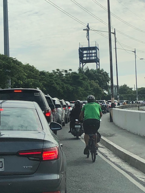
I just wanted to share a couple of photos I took en route to BGC last week. Yes, the traffic is already terrible and yes, I drove to BGC (or more accurately, I was driven as we were hauling stuff to our home away from home at BGC). I couldn’t help but take photos of the motorcycles and bicycles passing our vehicles. These were definitely more efficient forms of travel considering they require less space and likely incur less travel times. In addition to these modes (and walking, of course), there seems to be an increasing popularity for other micro mobilities. I wouldn’t define and enumerate these emerging modes but you’ve probably seen some of them along your commutes – electric kick scooters (EKS), gas-powered versions of these scooters, other forms of electric vehicles including trikes, etc. Here are a couple of examples I captured in photos last week.
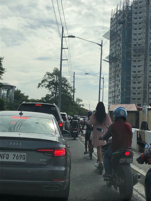 Cyclists and micro mobility users slugging it out with motor vehicles
 E-scooter in BGC: comfy clothes-check! backpack-check! helmet-check! Commuting to work should be something like this rather than most people using their cars.
Suffering and salvation for transport and traffic
I shared the following photo on social media with the label “Kalbaryo at Kaligtasan”:
 Cyclist pedaling ahead of cars queueing along the C5 ramp towards BGC
The label or title has double meaning. Conspicuous in the photo is the image of the Crucifixion atop what is a small shrine along Circumferential Road 5 across and facing SM Aura. The image appears to be a reminder or symbol of suffering but with the superimposed image of traffic congestion, alludes to the suffering endured by motorists on a daily basis. The “kaligtasan” or salvation part of the photo is in the form of the cyclist or the bicycle (I really have to explain that, right?) that offers an alternative or even hope for those who seek it. One thing the pandemic has taught us is that active transport in the form of walking or cycling is part of the solution to the transport problems we are experiencing. Public transport, of course, is touted as an ultimate solution but the reforms and infrastructure required are and will take time to implement, and these are already encountering problems leading to further delays or ineffectiveness.
–
Articles on railway safety
I shared a link to a Medium writer who specialized on articles about air crashes. These were investigative articles that provide details about air crashes especially since these are all tragedies and include those that have remained mysteries like Malaysian Airline Flight 370.
I am sharing today another collection of articles pertaining to transport safety. This time they are about railway or rail safety. Here is the link to the collection of articles from Max Shroeder:
https://mx-schroeder.medium.com
And here is an example of what he writes:
https://mx-schroeder.medium.com/stressful-schedule-the-2005-amagasaki-japan-derailment-12156ddd488
Again, there is much to be learned about these incidents. The circumstances, factors and experiences need to be examined in order to draw lessons from these incidents and reduce the likelihood of them happening again. In the case of the Philippines, this is especially applicable as the country rebuilds its long distance railways infrastructure with a line connecting Manila and Clark, Pampanga along what used to be called the Main Line North (MLN) of the Philippine National Railways (PNR), and another currently being rehabbed and for upgrading to the south in what was called the Main Line South (MLS). Other rail projects are also underway like the Metro Manila Subway and the MRT Line 7. All pass through populous areas, and railway crashes may not just lead to passenger and crew fatalities and injuries but also the same for those residing or working along these rail lines.
–
On the right to a walkable life
Here is an article from a perspective that’s very relevant today everywhere. We need to examine our daily routines particularly when it comes to commuting or moving about. Do we live in walkable communities? Is walking to certain places like school, the market, or the office an option to many of us? Or do we automatically choose to ride a car, a tricycle or motorcycle to get to these places?
Malchik, A. (May 13, 2022) “Driving is killing us,” Medium.com, https://antoniamalchik.medium.com/driving-is-killing-us-6a1b35158458 [Last accessed: 5/28/2022]
To quote from the article:
“Ask yourself this question: if you stepped foot outside your door, would you be able to walk anywhere you needed or wanted to go? Can you walk to a store, a library, school, or work? If your answer is “no,” what’s stopping you? Distance, highways, private property, broken or absent or inaccessible sidewalks? …
The loss of walking as an individual and a community act has the potential to destroy our deepest spiritual connections, our democratic societies, our neighborhoods, our freedom, our health, and our lives. But we can reclaim it. We can start to make a world that welcomes the walker, the pedestrian, rather than paving over that incredible human inheritance.”
I myself have enjoyed the benefits of walking when I was a college student in UP, when I was studying abroad in Japan, when we lived in Singapore and now in our community in the midst of the pandemic. I always think about opportunities and even schedule times for walking. Nowadays I am even conscious of my daily step count, which I equate with being active.
–
Tagbilaran – Panglao Airport Arrival
The last time we were in Bohol, the airport was still in Tagbilaran City. One had to travel about 45+ minutes if you were staying at a resort in nearby Panglao Island that is part of the province. The old airport was closed (the runway though served as a venue for ) and replaced by a new airport. This one is located in Panglao Island and close to the resorts that are the main attraction of the province.
 We deplaned via tube/bridge at the new airport terminal
 A photo of the control tower from the bridge
 Did the airport terminal architecture take inspiration from Bohol’s famous Chocolate Hills?
 The corridors were well lighted, again thanks to the building design.
 Our plane at the tarmac or apron unloading luggage and cargo
 We arrived at the baggage claim area ahead of most people. The carts were already placed across the conveyor belt by airport staff.
 Belt 2 on the other side is for international arrivals. The airport already served international flights before the pandemic. These have yet to resume.
 Passengers file unto the baggage claim area to pick up their luggage.
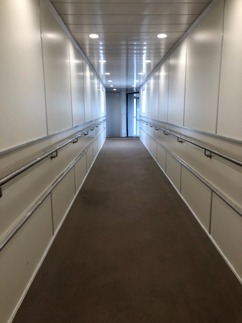
 The hallway towards the terminal exit. The toilets are on the left side of the hallway.
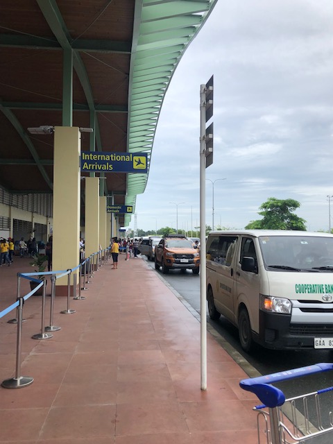
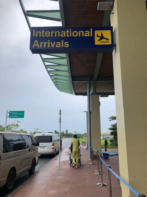 The sign indicates international arrivals. The airport currently does not serve international flights but these will likely resume once the pandemic threat is clearly contained. Other airports like Iloilo and Bacolod have also suspended international flights.
 The international arrival area at Tagbilaran-Panglao Airport
 Airport driveway
 Exit towards our destination
 A view of the control tower as we headed towards the airport exit gate
 The new road connecting to the national road circling Panglao Island, which connects to the local roads leading to the resorts and towns in the island.
It now only takes something like 10 to 15 minutes to many of the resorts in Panglao Island. This is a convenience to tourists. However, the distance from the main island of Bohol (the rest and most of the province) means a longer travel time for Boholanons or Bol-anons to/from their hometowns from/to the airport. This looks to be a non-issue considering the pros of the new airport outweighs its cons.
More on this airport soon!
–
On phasing out cars in cities
I’m sharing another article on reducing car dependence. The article was referred to by the previous series that I shared recently.
Nicholas, K. (April 14, 2022) “12 best ways to get cars out of cities – ranked by new research,” The Conversation, https://theconversation.com/12-best-ways-to-get-cars-out-of-cities-ranked-by-new-research-180642 [Last accessed: 5/20/2022]
Here are a few excerpts from the article:
“Question: what do the following statistics have in common?
The second-largest (and growing) source of climate pollution in Europe.
The leading killer of children in both the US and Europe.
A principal cause of stress-inducing noise pollution and life-shortening air pollution in European cities.
A leading driver of the widening gap between rich and poor urban residents.Answer: the vehicles on our streets, primarily the not-so-humble passenger car.”
also this:
“The research is clear: to improve health outcomes, meet climate targets and create more liveable cities, reducing car use should be an urgent priority.”
and this:
“To meet the planet’s health and climate goals, city governments need to make the necessary transitions for sustainable mobility by, first, avoiding the need for mobility (see Paris’s 15-minute city); second, shifting remaining mobility needs from cars to active and public transport wherever possible; and finally, improving the cars that remain to be zero-emission.”
You can also listen instead of reading it as it is a narrated article.
–
Articles on examining the role of the planning profession in both perpetuating and solving traffic congestion
Planetizen recently published a three-part series of articles examining the role of the planning profession in both perpetuating and solving traffic congestion:
Part 1: Brasuell, J. (April 13, 2022) “Planning and the Complicated Causes and Effects of Congestion,” Planetizen, https://www.planetizen.com/features/116834-planning-and-complicated-causes-and-effects-congestion [Last accessed: 5/17/2022]
Part 2: Brasuell, J. (April 20, 2022) “How Planning Fails to Solve Congestion,” Planetizen, https://www.planetizen.com/features/116914-how-planning-fails-solve-congestion%5BLast accessed: 5/17/2022]
Part 3: Brasuell, J. (May 12, 2022) “Planning for Congestion Relief,” Planetizen, https://www.planetizen.com/features/117153-planning-congestion-relief?utm_source=newswire&utm_medium=email&utm_campaign=news-05162022&mc_cid=34b0612d40&mc_eid=9ccfe464b1 [Last accessed: 5/17/2022]
I think these articles are a must read especially for students (and not just practitioners or professionals) and is sort of a crash course on transportation engineering and planning. It covers many concepts and learnings from so many decades and touches on certain programs that are most effective in reducing car trips. To quote from the article, the top 12 programs based on case studies in Europe are:
- Congestion Pricing (12-33% reduction in city-center cars)
- Parking and Traffic Controls (11-19% reduction in city-center cars)
- Limited Traffic Zones (10-20% reduction in city-center cars)
- Workplace Mobility Services (37% drop in car commuters)
- Workplace Parking Charges (8-25% reduction in car commuters)
- Workplace Travel Planning (3-18% drop in car use by commuters)
- University Travel Planning (7-27% reduction in car use by university commuters)
- University Mobility Services (24% drop in students commuting by car)
- Car Sharing (12-15 private cars replaced by each shared car)
- School Travel Planning (5-11% reduction in car use for school trips)
- Personalized Travel Planning (6-12% drop in car use share among residents)
- App-Based Incentives (73% – proportion of app users declaring reduced car use)
Are we ready to confront congestion and at the least start discussing these car trip reduction programs? Or are we content with the current discourse, which remains car-centric?
–
Join the campaign: UN Global Road Safety Week 2022
Next week will be the UN Global Road Safety Week. Many organizations will be holding activities or events to promote road safety. In our case, we are part of a National Coalition promoting child road traffic injury prevention (CRTIP) in the Philippines with the support of UNICEF.
Here is the link to the UN’s page promoting road safety:
https://www.unroadsafetyweek.org/en/home
The theme touches on the campaign to reduce speeds to 30 kph. This is particularly important in the vicinity of schools or school zones where children are at a high risk of being involved in crashes. Their safety is of utmost concern and requires interventions to improve conditions. We have done assessments using iRAP’s Star Ratings for Schools (SR4S) tool and recommended interventions for many schools in Valenzuela City and Zamboanga City. This year, we hope to do the assessments in Angeles City and Cagayan de Oro City as well for Phase 2 of our project with UNICEF as we continue to help improve road safety for our children. After all, roads that are safe for children are safe for everyone else.
–
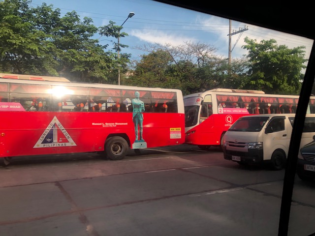
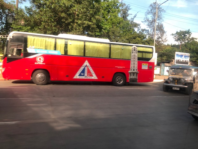
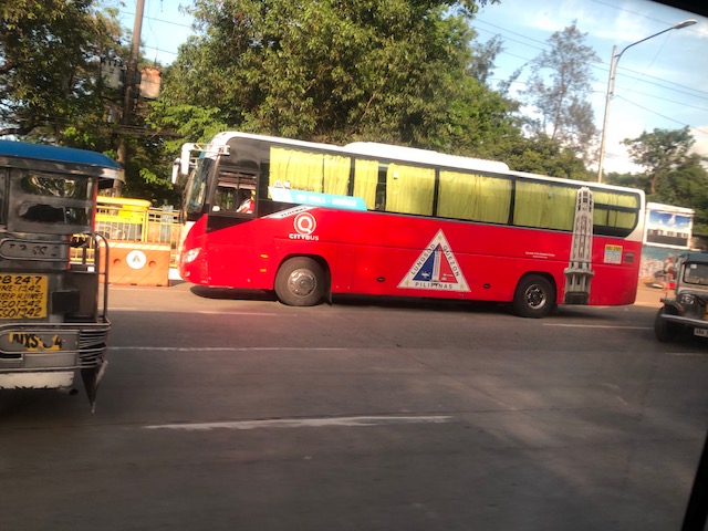
Quezon City’s bus services
One of the projects of the Quezon City (QC) government during the pandemic and which they continued to the present was transport-related. QC deployed buses to provide free transport for its residents.
Here are the routes (source: QC FB page):
Route 1 – Quezon City Hall to Cubao (and vice versa)
Route 2 – Litex / IBP Road to Quezon City Hall (and vice versa)
Route 3 – Welcome Rotonda to Aurora Blvd. / Katipunan Avenue (and vice versa)
Route 4 – General Luis to Quezon City Hall (and vice versa)
Route 5 – Mindanao Ave. cor. Quirino Highway to Quezon City Hall (and vice versa)
Route 6 – Quezon City Hall to Robinsons Magnolia (and vice versa)
Route 7 – Quezon City Hall to Ortigas Avenue Extension (and vice versa)
Route 8 – Quezon City Hall to Muñoz (and vice versa)
See their UPDATED Bus Route & Schedule:
https://m.facebook.com/story.php?story_fbid=273192358328744&id=100069139452704
https://www.facebook.com/photo/?fbid=273192031662110&set=pcb.273192358328744
Here are some photos of the buses along the Elliptical Road. These are air-conditioned and have WiFi for the comfort and benefit of the commuters.
With the fresh mandate (second term) of the QC Mayor Joy Belmonte, it is expected that they will continue with this public service. I am not sure if it should be strictly for QC residents. Perhaps those who work or study in QC should also benefit from the service. These people may show proof in the form of valid IDs like school or employee IDs.
–
