
Musings while waiting for a delayed flight at Suvarnabhumi Airport
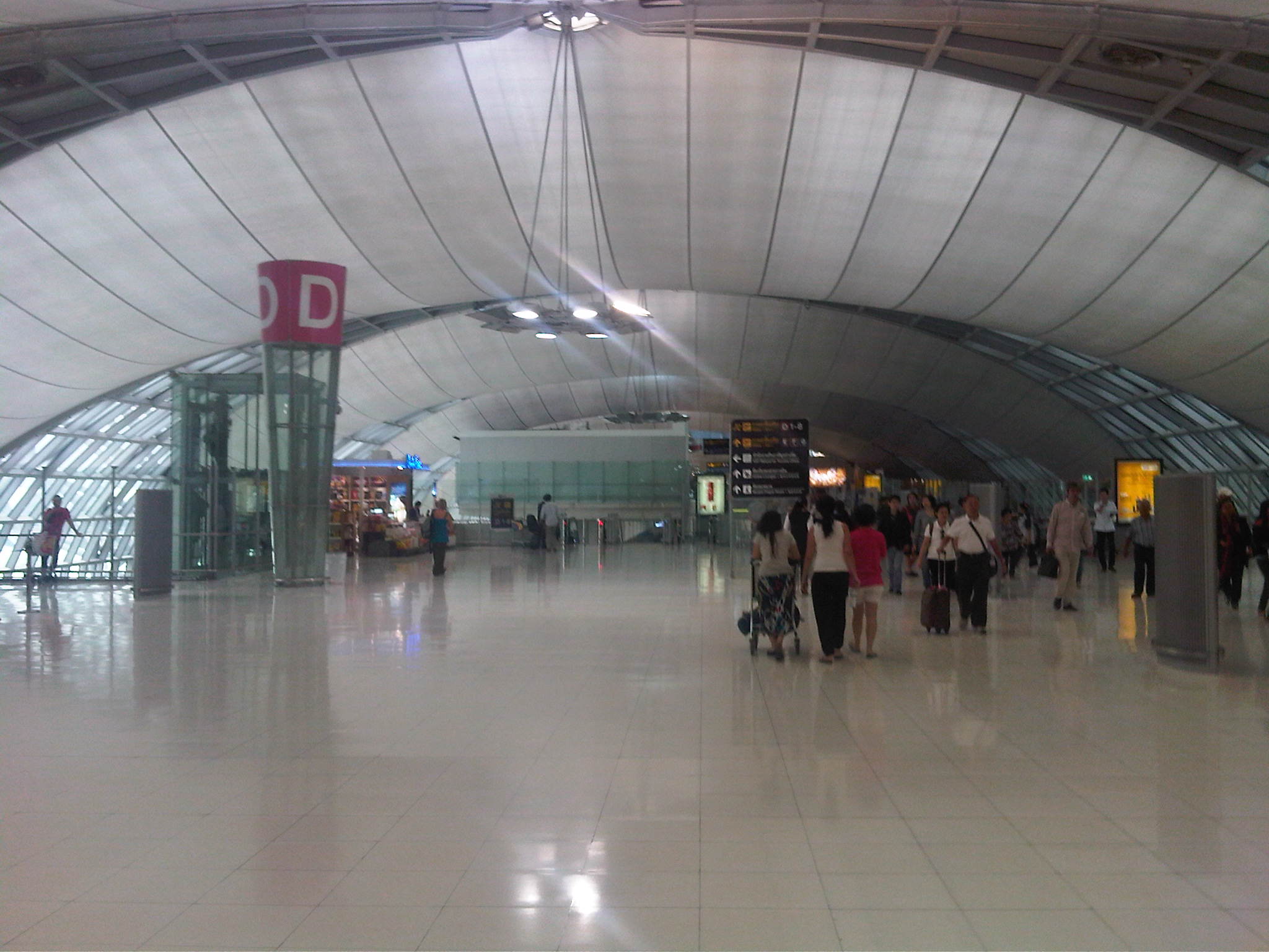
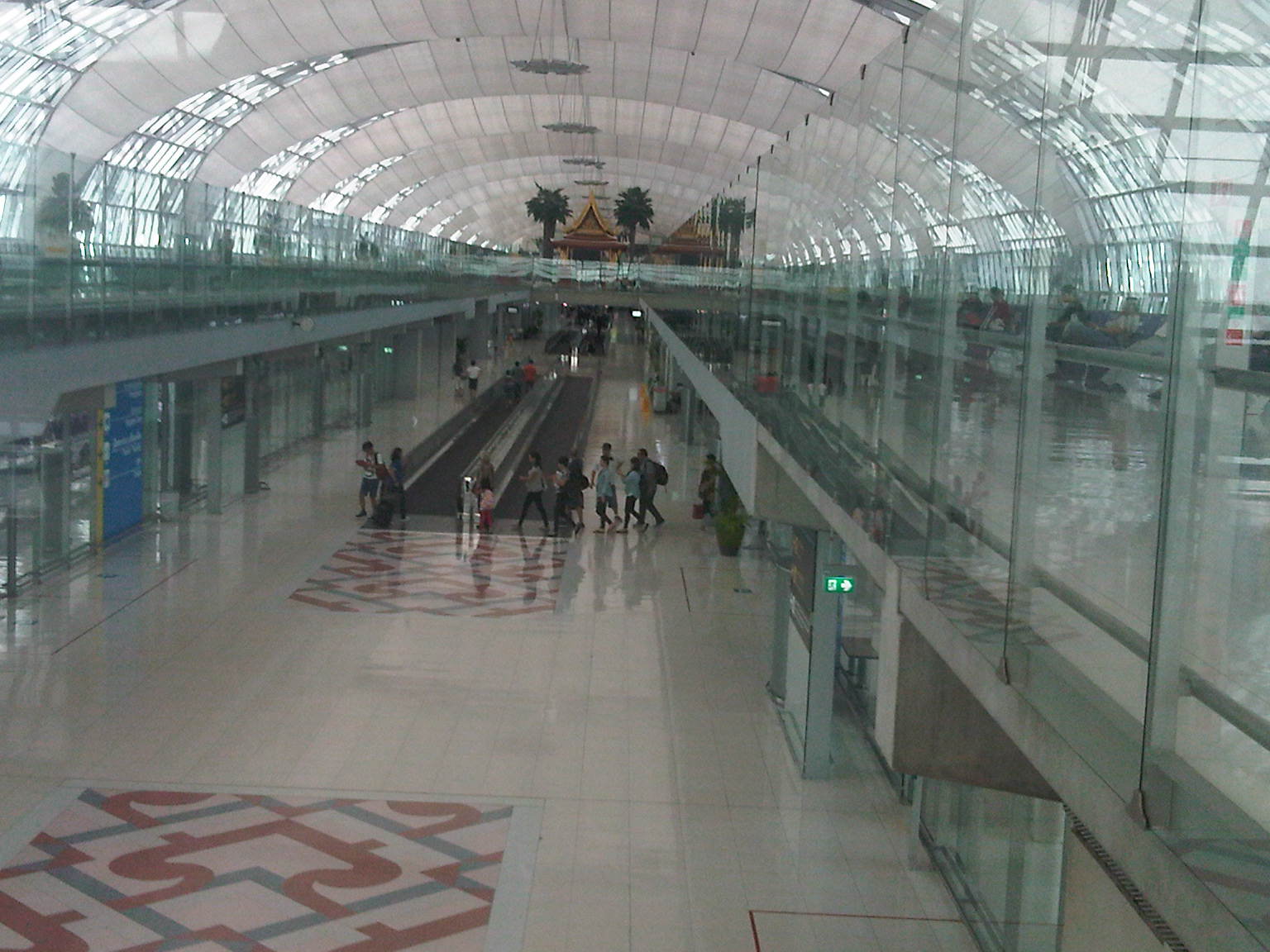
I’m writing this short post as I wait for our overly delayed flight back to Manila from Bangkok. Next to Changi, this is my next favorite airport and I always marvel at the expanse of the terminal everytime I am here. There were management or operations issues when the airport was newly opened (I think I have a post on this years ago) but I guess these have been resolved. Here’s a few photos of Suvarnabhumi International Airport I took while walking away the time until we board the plane.


–
Back in Bangkok
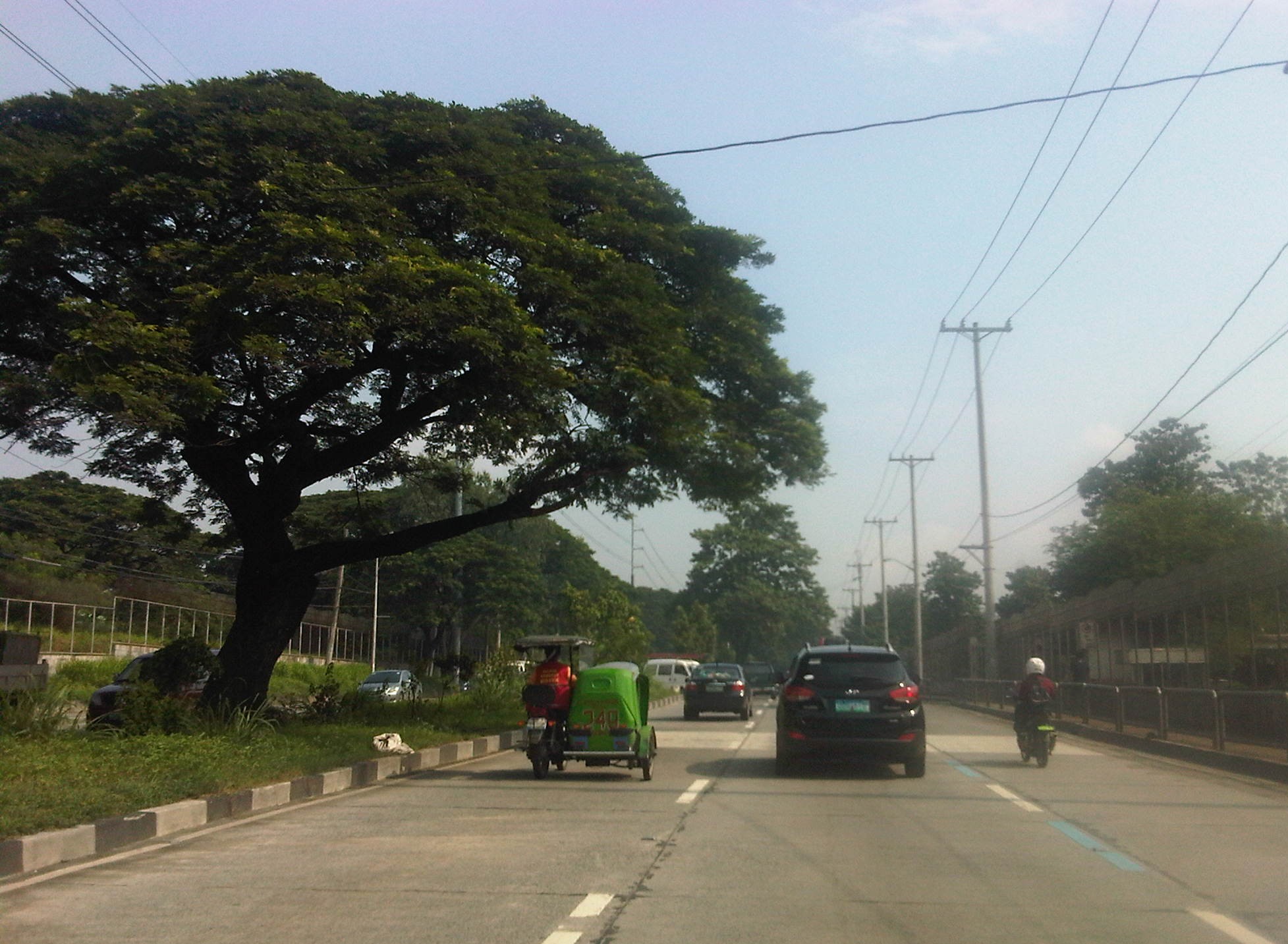
Back in Bangkok after a year, it was good that we are staying in the Siam Square area where I have become familiar with in the last decade when I seemed to be in Bangkok at least twice a year for official and personal trips. As we took the expressway en route to the city, I took a few shots from the perspective of a passenger of a van traveling along the elevated expressway.
 Our hosts arranged transport between the airport and our hotel. This was in the form of a van, with which we traveled to the city via the expressway.
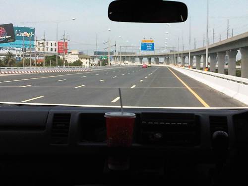 The elevated expressway connecting the airport to the city center is impressive for its capacity. The photo above shows a section with at least 4 lanes and shoulder space. Personally, I could have taken the express rail transit that connects with the BTS Skytrain. The elevated airport railway line is seen along the right side of the expressway in the photo.
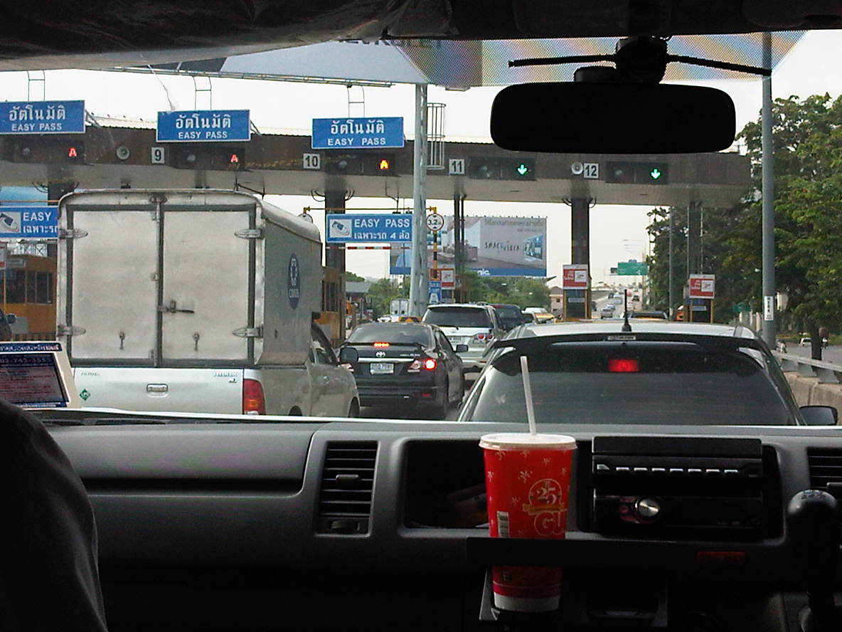 Queuing at the toll plaza.
This time around, I’d like to be able to some photos of street scenes in the city. Of course, that includes pictures of paratransit modes like the tuktuk and their motorcycle taxis. Here’s a couple of sample photos of tuktuks I took near our hotel.
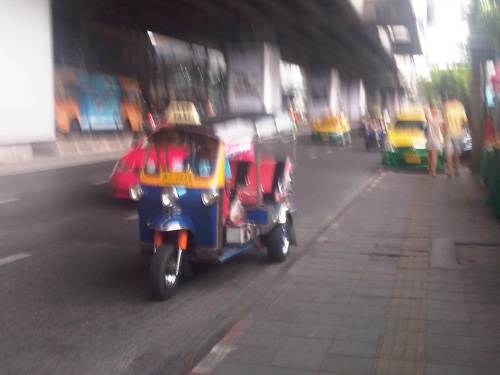 Tuktuk running along a city street.
 On-street tuktuk terminal.
More on Bangkok transport and traffic in the next posts!
#ReliefPH: Access and needs in many other places
The buzz on the streets and on social media is the focus on Tacloban, Leyte when vast areas and many other towns and provinces have been ravaged by super typhoon Yolanda (Haiyan). This seems unfair to other cities and municipalities considering Yolanda made 6 landfalls at or near peak strength (as a Category 5 typhoon) with winds topping 225 kph and generating destructive storm surges as it hammered through the central Philippines.
If you have Facebook, one provincial government staff has posted a lot of photos describing the situation in the northern towns of Iloilo where the destruction caused by the typhoon is very clear and to many, still unimaginable. These photos along with all others that can be Googled, Yahooed or found via other search engines or news agencies show the extent of the damage brought about by Yolanda.
Some people say that the islands of Cebu, Panay, Negros and Mindoro are fortunate as principal cities in those islands like Cebu City, Iloilo City, Bacolod City, Dumaguete City and Calapan City were relatively undamaged. This is also true, and so the airports and ports in these cities provide direct access to the islands for relief work. Moreover, government agencies and private entities have been able to organize relief activities through these cities and based on various news reports, it looks like a lot of people are already involved in these activities. That goes without saying that more people are still needed to be involved in various capacities for relief, rehabilitation and reconstruction work that are expected to be undertaken over a longer term considering the extent of the damages to towns. But given the circumstances for the said islands, there is no excuse for more rapid aid not being able to reach the affected towns in these provinces. In fact, much more is expected where accessibility is no longer an issue and so faster recovery is possible for Panay, Negros, Cebu and Mindoro. In the cases of Cebu and Bohol, it is important to remember that the provinces already are also still reeling from the impacts of the Magnitude 7.2 earthquake that occurred only a few weeks ago.
On another note…Tacloban Airport is still closed to commercial aircraft but the land routes via RORO or the nautical highways are open to traffic or operational. I think the quickest way to Leyte is via the route from Cebu. There are regular RORO and Supercat services between Cebu City and Ormoc City in Leyte. There are other maritime transport services from Bogo City in northern Cebu but I am not sure those services are back to normal. Then there are also access via the Eastern Nautical Route via the Bicol Region and crossing over to Samar Island (Allen) via Matnog, Sorsogon. Many roads still need to be cleared but the main highway (Pan Philippine Highway) including the San Juanico Bridge that connects the islands of Samar and Leyte.
–
#ReliefPH: Help the victims of Typhoon Haiyan in the Philippines
The online news organization Rappler has compiled a list of organizations by which you can course through your help.
Anything that can be spared will be of help to the people affected by super typhoon Yolanda (international name: Haiyan).
Tulung-tulong po tayong lahat!
Salamat sa mga tulong at dasal para sa mga nasalanta ng bagyo! Pagpapalain kayo ng Maykapal sa inyong pagtulong!
Aftermath of super typhoon Yolanda on transport infrastructure
The last time I was in Tacloban was in April of this year. I was able to take some photos of the airport as well as some roads, in the process capturing images of what used to stand along the roads. I say “used to stand” because the onslaught of Typhoon Yolanda (international: Haiyan) has left few structures standing with devastation in Tacloban comprehensive, and reducing many people to desperation.
Following are a few photos of what used to be the airport terminal at Tacloban City. These have been destroyed or badly damaged by the super typhoon and one can see the aftermath of the typhoon in photos on this link.
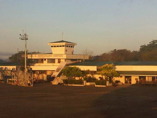 Tacloban Airport terminal – the terminal was practically destroyed by the typhoon
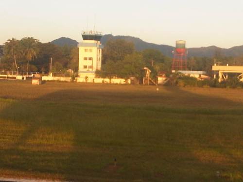 Tacloban Airport control tower – the tower lost its roof and all the equipment were lost as well
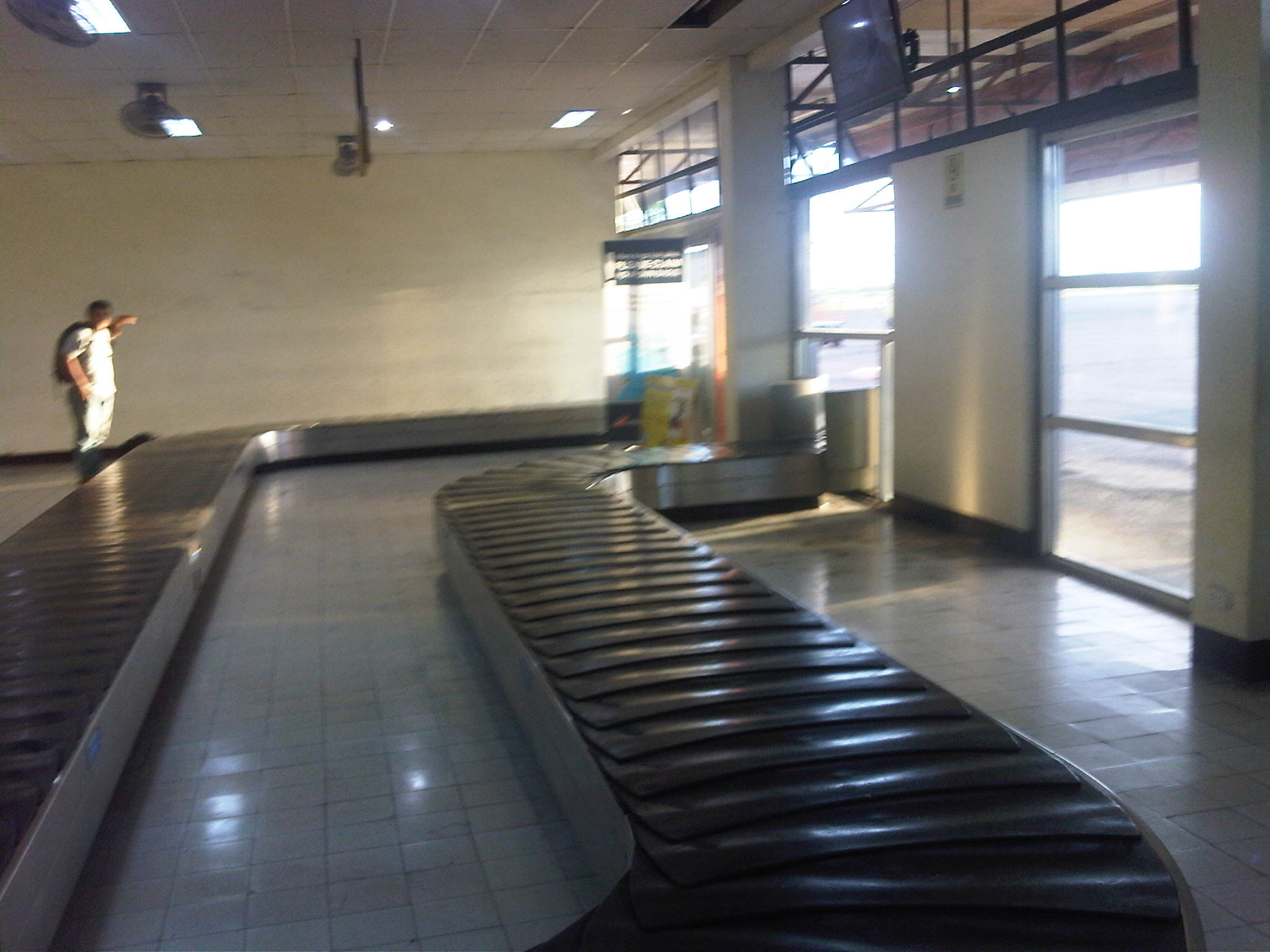 Conveyor belt inside the terminal – saw a photo of what’s left of this machine laying
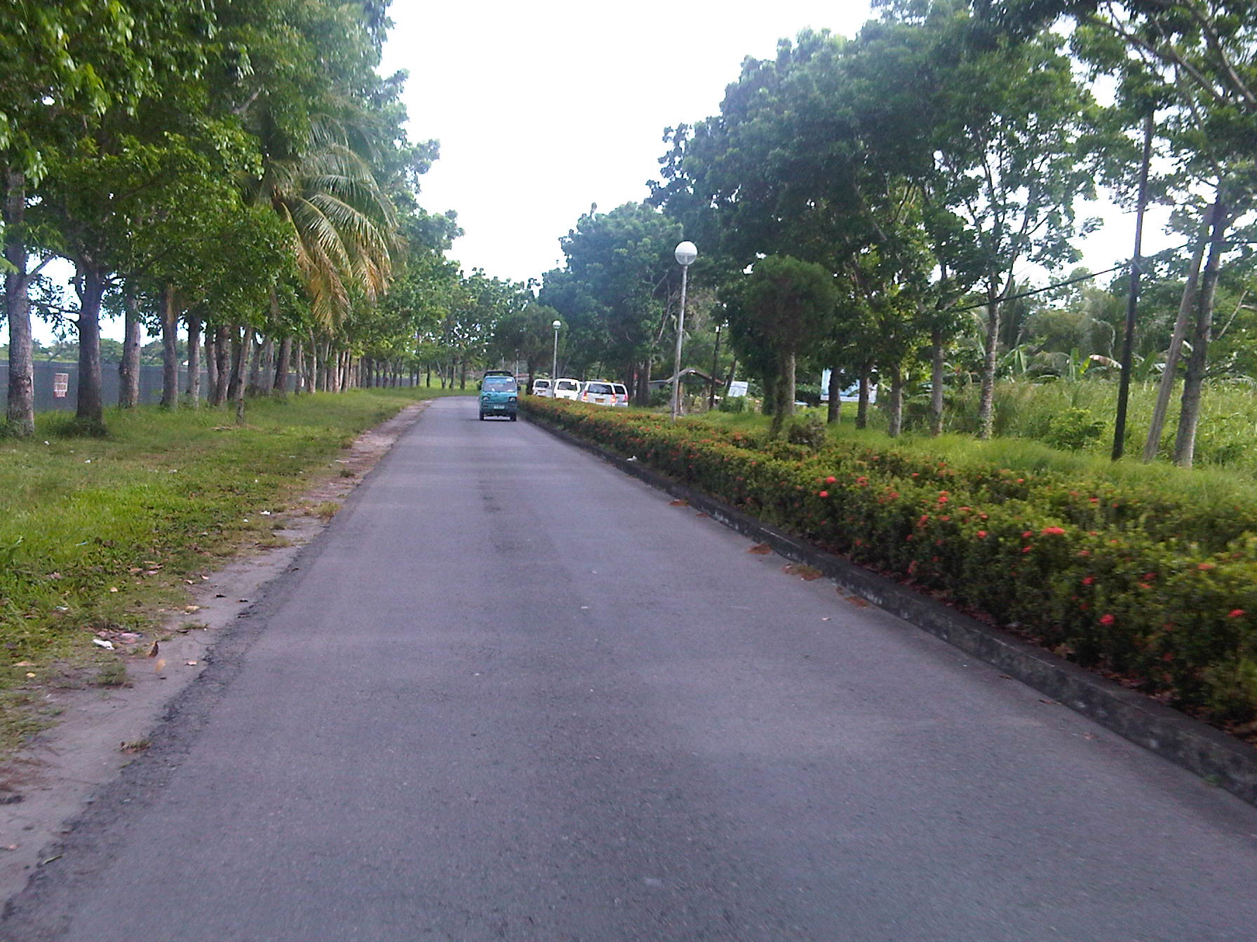 Tree-lined road to the airport – all of these trees did not survive Yolanda’s winds and the storm surge.
–
Super typhoon Yolanda (Haiyan)
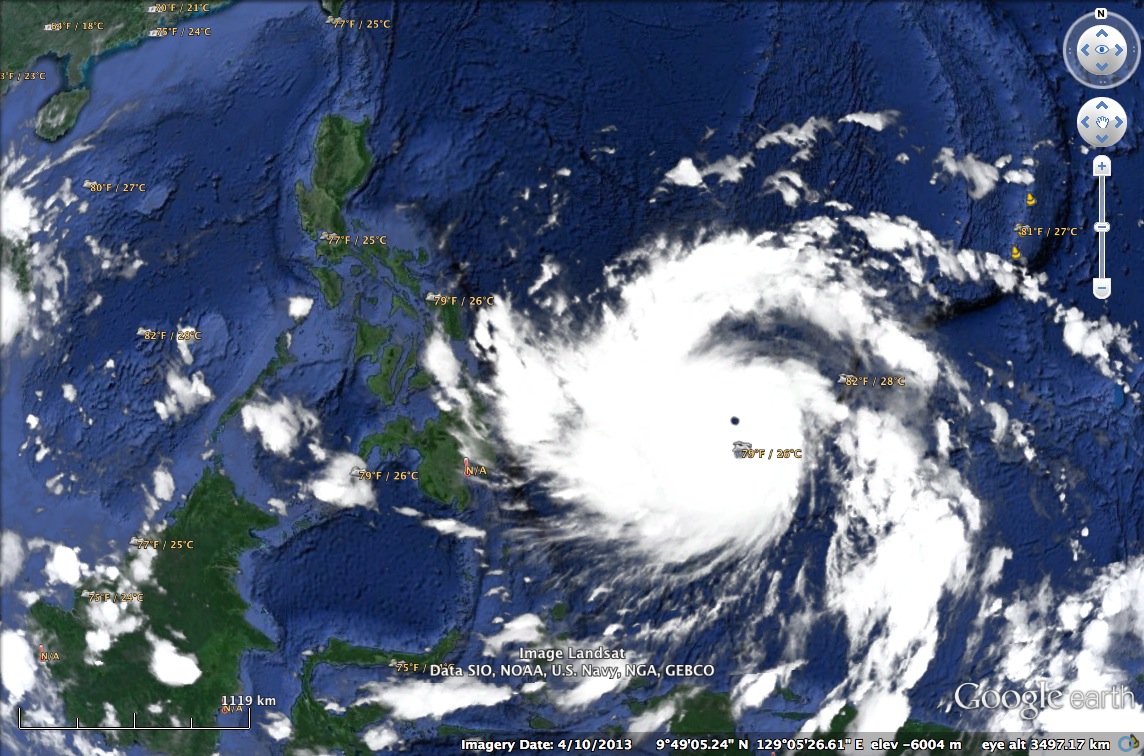
Lives will be at a standstill for many parts of the Philippines when super typhoon Yolanda (International name: Haiyan) finally makes its presence felt as it takes a path through the central Philippines from tonight until Saturday. The typhoon is already a Category 5 and packing winds above 250 kph. It will be a destructive system as it plows through areas already saturated by rains from a storm that preceded it just a few days ago. The image below is from Google Earth, showing the approaching typhoon as of early morning of November 7 (Philippine time).
Transport will surely be affected by this powerful typhoon with airlines already expected to cancel or postpone flights. Sea craft were also already advised against travel given the waves and storm surges expected from the typhoon. Landslides are also expected in mountainous areas where roads will probably be blocked by debris. Trees, poles and others are also expected to be strewn across many roads, limiting access to communities. As such, our disaster councils are on high alert to respond to the challenges that will be brought about by the typhoon’s onslaught.
People in the provinces of Bohol and Cebu that bore the brunt of the recent magnitude 7.2 earthquake are still reeling from the damages from the quake. Many are still living in tents after their homes were destroyed or damaged by the quake and its aftershocks. We can only assume and trust that our national agencies, disaster councils and local governments are prepared to provide immediate relief to those who will be affected by the typhoon including those who continue to defy advisories issued by authorities in order to minimize casualties from such events.
–
Scenes at Aurora-Katipunan
My commute between my workplace and home includes a stop at the junction of Aurora Boulevard and Katipunan Avenue (C-5) to transfer from one jeepney to another. This is very similar to my commute when I was a university student a couple of decades ago. At the time, there was no flyover in the area and the Katipunan jeepney terminal was located at what was called K-Mart, a wet market set-up on privately owned land that was tolerated for quite some time before the market and terminal were eventually evicted from the area. The transfers when coming to the university were smoother. It involved shorter walks then and now. Meanwhile, the Katipunan jeepneys had orderly queues for passengers. There were two types of jeepneys – those that terminate at Balara and those that are allowed to travel inside the UP Diliman campus.
The transfers going home were and are still more challenging as it required longer walks and crossing Aurora Boulevard to get to the informal terminal or the loading/unloading areas for jeepneys. Back in the day, there was no terminal and the loading/unloading zone was a stretch in front of the old Sta. Clara church in what is now the LRT 2 Katipunan Station. Now, there is an informal terminal also beneath the Aurora-Katipunan flyover.
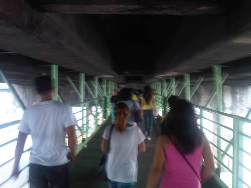
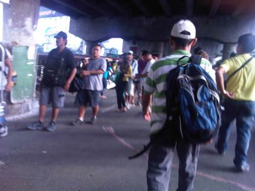 Walking and falling in line – commuters walking past the queue for Katipunan jeepneys at the terminal beneath the Katipunan-Aurora flyover.
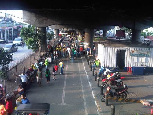 A view of the Katipunan jeepney terminal from the pedestrian overpass crossing Aurora Boulevard. Aside from the terminal, there are also parking spaces for bicycles and motorcycles as well as a police assistance center. There are also many vendors in the area selling items like fruit, peanuts, cigarettes and even sandals and used clothes.
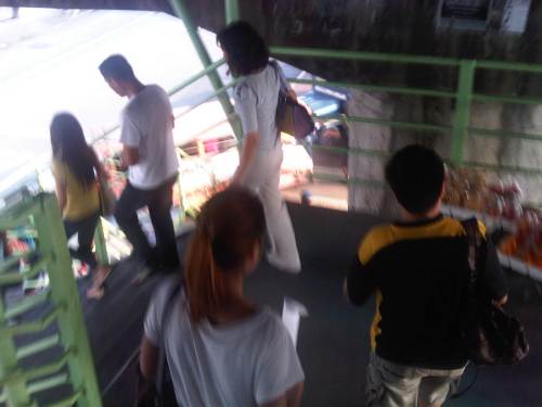
 Pedestrians along the walkway hanging from under the Aurora-Katipunan flyover. The walkway is quite stable and there are no noticeable movements in the structure even with significant pedestrian traffic.
 Pedestrians descending the stairs towards the informal terminal for Rizal and Marikina-bound jeepneys.
 Informal terminal for Rizal and Marikina-bound jeepneys.
This could have been a different commute if the LRT 2 terminated in Masinag instead of at Santolan. I could have been taking the trains instead of the jeepneys for one leg of my commute. I still look forward to the day I would be taking the trains and am constantly frustrated by the inaction of those responsible for public transport in Metro Manila and this particular corridor.
–
Tricycles in the Philippines – Part 2
In a previous post on tricycles, I featured some photos taken from various trips I’ve taken around the country. Closer to home are tricycles that provide some convenience to commuters along a stretch of C-5 that is more commonly known as Katipunan Avenue. The example below is of a typical tricycle traveling along a section that cuts through lands of the University of the Philippines Diliman.
 Tricycle along Katipunan Avenue
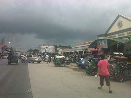
Tricycles do not necessarily just roam around to get passengers like what we usually see. They do have formal terminals though the informal ones outnumber these and typically cause problems due to the spaces they tend to occupy. These spaces include road space, the consequence of which is a reduction in road capacity, and sidewalks, which deny pedestrians space for walking. The first causes or exacerbates congestion while the second mainly puts people at higher risk as pedestrian safety is compromised. Following are photos of tricycle terminals taken from recent trips north of Manila in the provinces of Tarlac, Pangasinan and La Union.
 Tricycle terminal at the Moncada Public Market
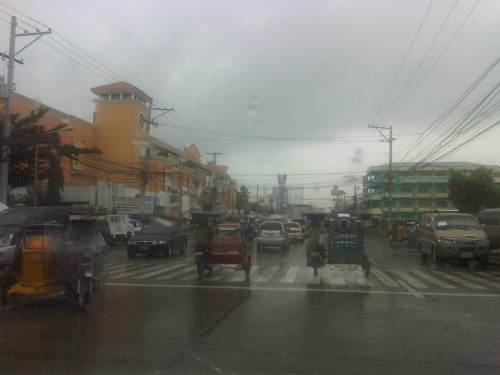 Tricycles still dominate traffic along the Manila North Road in Urdaneta, Pangasinan where they have terminals around the public market and at the intersections of side streets.
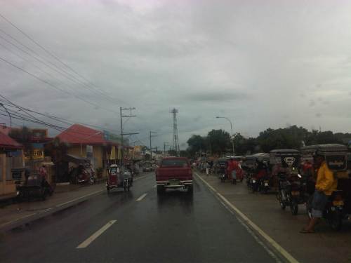 Roadside tricycle terminal in La Union where the newly paved shoulders are occupied by tricycles waiting for passengers from a nearby public school.
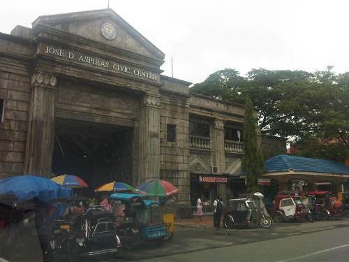 Tricycle terminal in front of the Civic Center in Agoo, La Union and just across the church.
More on tricycles and their terminals in succeeding posts!
–
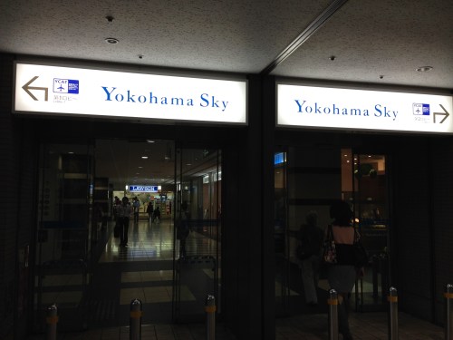
YCAT – Yokohama City Air Terminal
The Yokohama City Air Terminal (YCAT) is one of two city air terminals in the Kanto area, the other being the Tokyo City Air Terminal (TCAT). I have used both in the past including my first trip to Japan where I was instructed to proceed to TCAT where I met with a good friend of mine who took me to the university I was visiting. The second time I went to Japan, I proceeded to YCAT where eventual friends also fetched me to go to the university where I was to study for 3 years. On this sentimental journey of sorts, I made sure to take a few photos at the YCAT, which I chose over my usual Yokosuka-Sobu Airport Narita train between Yokohama and the airport.
 The YCAT is located at the Sky Building, which used to be the tallest building in Yokohama. The building is connected to Yokohama Station (East Exit). Proceeding left takes one to the departure lounge where people can purchase limousine bus tickets. To the right is the arrival lounge where people can wait for passengers arriving from either Haneda or Narita via limousine bus.
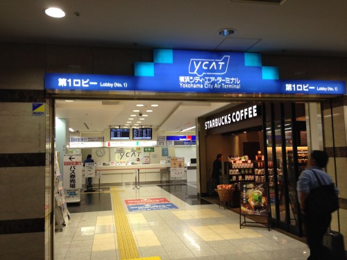 Main entrance to the YCAT right next to a popular coffee shop. Here, one can purchase tickets for Haneda Airport or Narita Airport, exchange currencies and even make some last minute souvenir shopping.
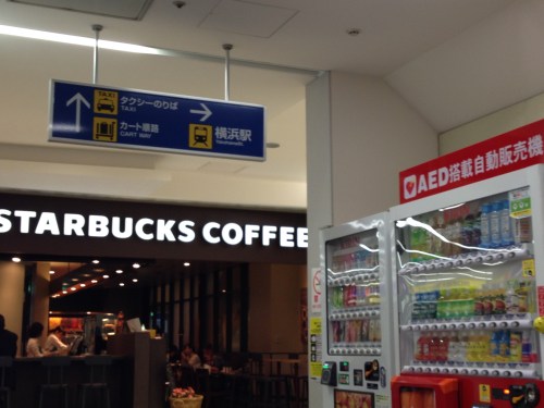 There are also many vending machines for those who just want a quick hot or cold drink.
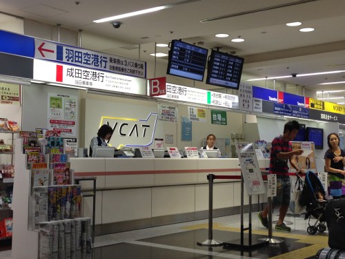 Airport limousine bus tickets can be purchased at these counters. The electronic boards provide information about bus schedules between YCAT and Haneda or Narita Airport. There is also a Travelex counter for currency exchange and a Western Union counter for sending or receiving money transfers.
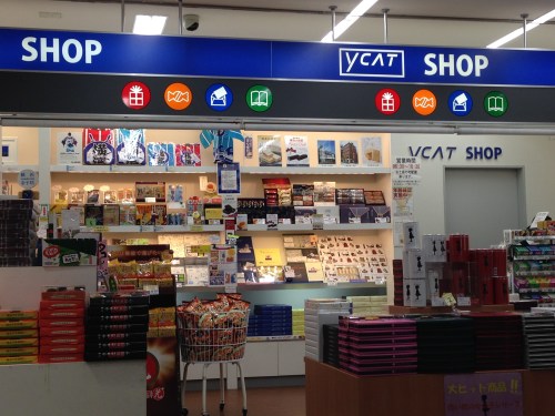 One can make some last minute shopping at the YCAT shop.
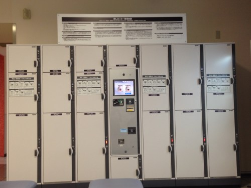 Coin lockers for travelers who might just want to keep their luggage secure while spending a little more time in the area for a meal or some shopping. Note that YCAT is located at the Sky Building, which is connected to shopping malls and Yokohama Station.
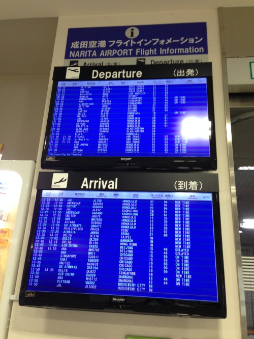 Airport flight information for departures and arrivals.
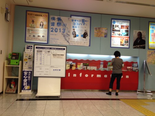 Other information on travel and events at the YCAT include brochures and posters.
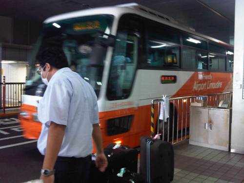 Airport Limousine Bus bound for Narita Airport arriving at the YCAT – luggage are tagged so limousine bus staff at the airport terminals can identify which bags are to be unloaded at which terminals.
 Stop 1 is for Narita-bound buses while Stop 2 is for Haneda-bound buses.
–
SuperCat trip from Calapan to Batangas
We were glad that we were able to get on either the SuperCat or FastCat for our return trip to Batangas after a meeting in Calapan. For one, this meant that our travel will only be an hour, 1.5 hours less than a trip on a regular RORO ferry. The RORO ferry schedule also didn’t favor an early arrival in Batangas considering we also had to travel back to Metro Manila. The SuperCat staff earlier didn’t sell us tickets because they were not sure there would be SuperCat trip in the afternoon given the conditions at sea.
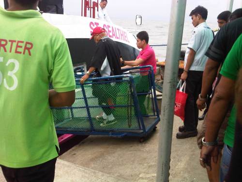 SuperCat staff had to assist passengers as they boarded the vessel due to the rough waters that frequently lifted the vessel and make one lose his/her balance.
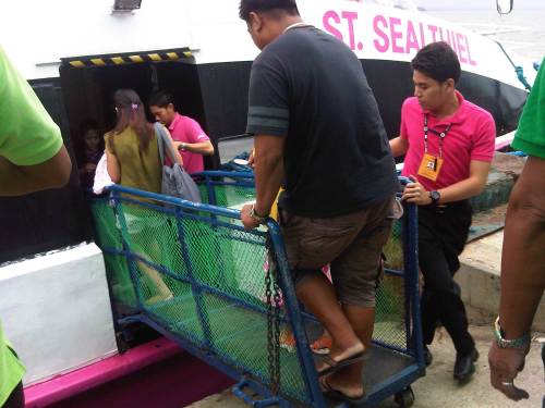 Another photo showing staff assisting boarding passengers. Each passenger had to go one at a time and at intervals due to the movements of the docked vessel.
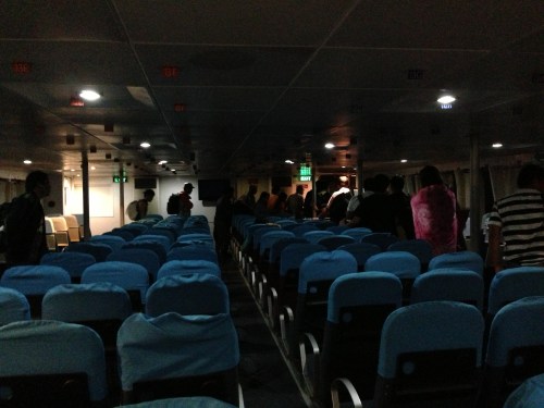
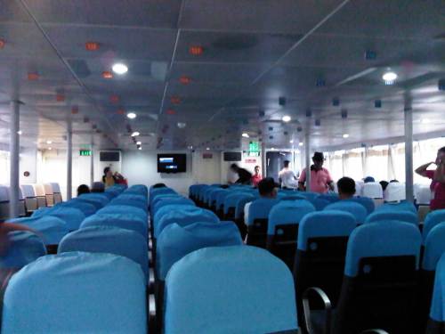 Inside the craft, it was obvious that this was a much better vessel than the regular RORO ferries plying the same Calapan-Batangas route. The seats were more comfy and the interior was clean and obviously well-maintained, and that includes the toilets on the vessel. There was airconditioning and staff were more professional and attentive to passengers (probably taking after airline flight attendants). There were few passengers so some people had entire rows to themselves.
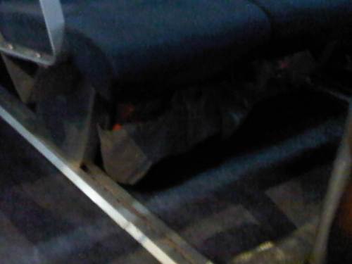 Passengers may place their bags or things under their seats or in front of them as there were no overhead compartments or space for stowing luggage and other items. Passengers with no one beside them put their bags on the empty seats instead.
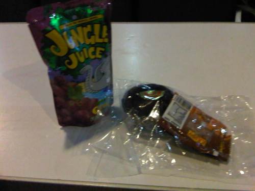 The crew served us some simple snack comprising of peanuts, a cupcake and a fruit drink. There were items like sandwiches, junk food and other drinks available at the bar inside the SuperCat but choices were limited and I learned their stocks were already depleted as this was the last trip for the day for the SuperCat. There were no night time fast craft trips.
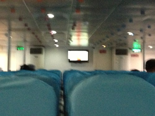 I tried to get photo of what was showing on the television screen but the choppy waters combined with the dim lighting didn’t favor my BlackBerry’s camera. There was only one screen and it’s size is obviously not suitable for passengers seated farther from the front. It didn’t really matter because it was only a 1-hour trip between Calapan and Batangas when using the SuperCat.
 Dim lights as passengers disembark from the fast craft. Outside, crewmen assisted passengers who might lose their balance due to the instability of the vessel due to the rough waters.
It was already drizzling when we got out of the terminal and rain was pouring as we drove out of Batangas and unto the STAR tollway.
–
