
Manila’s jeepney experiment
A few months ago, and almost right after the local elections, the City of Manila embarked on a campaign to reduce the number of colorum or illegal buses plying along the streets of the city. The result was confusion and mayhem as commuters and authorities were unprepared to deal with the sudden decrease in the number of buses (some companies even restrained all of their buses from entering Manila to protest the city’ move) and the jeepneys and UV express couldn’t handle the demand. Much of that seems to have been resolved and buses are now back in Manila; although whether all these buses are legal ones is still unclear. The city, it seems to some quarters, was only after buses with no formal terminals in the city and appeared to have made the drive to show bus companies who’s in-charge there.
Now comes a drive against jeepney drivers, particularly those undisciplined ones that are often found violating traffic rules and regulations, and endangering their passengers with their brand of driving. The result was a one-day strike (tigil pasada) of jeepneys belonging to the Federation of Jeepney Operators and Drivers Associations in the Philippines (FEJODAP), one of several organized jeepney groups in the country. Others like operators and drivers from Pasang Masda, PISTON and ACTO, opted not to join the transport strike. The result was a transport protest that had little impact on most people’s commutes though the group did manage to attract media attention and gave interviews to whoever cared to listen.
Not to judge Manila as I believe it has made huge strides by confronting the many urgent issues in transport in the city. Not many cities take these problems head on as Manila has done this year. However, the jury is still out there if their efforts have been effective and if these will be sustainable and not the ningas cogon kind that we have seen so much of in the past. For definitely, there are a lot of other transport issues that Manila needs to contend with including how to make the city more walkable and bicycle-friendly (not an easy task!) and how to address the excessive number of pedicabs (non-motorized 3-wheelers) and kuligligs (motorized 3-wheelers using generator sets or pumpboat motors for power) in the city. Hopefully, again, the city will be up to the task of addressing these problems along with the persistent congestion along its roads.
–
Road crashes: everyday disasters
The occurrence of road crashes involving road public transport has hit an alarming rate the past few weeks. Only this morning, a bus fell of the Skyway and as of this writing over 20 people have been confirmed dead from the tragic incident. These casualties add to those from other crashes this past month alone. Consider the following recent incidents involving buses:
- Yesterday, more than 50 people were hurt in a crash involving 2 buses in Olongapo City;
- Last November 16, 6 people died in a collision involving 2 buses in Camarines Sur;
- Last November 14, 6 people were killed in a crash along EDSA;
There are countless more people who have died in other crashes involving other vehicles including private cars and vans that have not been reported or were considered minor news in comparison with bigger events like those related to super typhoon Yolanda (Haiyan) and the powerful earthquake that hit the Cebu-Bohol areas. These are disasters happening everyday. However, unlike the earthquake and typhoon, these are very much predictable and the deaths and injuries preventable if the drivers of the vehicles only exercised caution given the conditions at the time the crashes occurred.
The Land Transportation Franchising and Regulatory Board (LTFRB) should examine their approach to punishing erring bus companies. So far, the policy of temporarily suspending the operations of the bus companies involved and investigating the cases of drivers involved in the crashes have not been effective in improving safety as such appear to have had no positive impacts to road crash occurrences in our roads. Given the bad safety records of such bus companies, it is high time to make a strong point by not only suspending these companies but by revoking their franchises. How many more people should die if bus companies do not comply with having their drivers practice safe driving? Their excuses of their drivers being the ones to blame do not hold any water as they have responsibility over them as stipulated in their franchises. The Land Transportation Office (LTO) should also move towards revoking the licenses of these drivers and to never allow these people to handle vehicles again whether as public utility vehicle or private drivers!
–
On the increase in overnight parking fees at NAIA
I’ve been reading some posts on social media complaining about the increase in the overnight parking rates at the Ninoy Aquino International Airport (NAIA). This seems to be a recent development considering the last time we used any of the parking facilities of NAIA was last November 23 when the wife parked to wait for my arrival at Terminal 2. It wasn’t overnight parking but then she said she doesn’t recall seeing any signs announcing changes in the parking rates. The posts I saw through Facebook are for overnight parking at Terminal 3 where the old charges were 50 PHP (about 1.14 USD) per day. This is actually very cheap even considering that parking is on an open lot with marginal security. Even parking lots in Makati, Taguig and Ortigas charge more for overnight parking on open lots.
The new rate is basically 300 PHP per day including taxes, which apparently surprised a lot of people after everybody got used to the 50 PHP/day rate of old. That meant that for a 3 night trip to Bangkok or Singapore, for example, where people left their cars at the airport, they had to fork over 900 PHP instead of the 150 PHP they used to pay for parking. Indeed, that’s a big jump in parking fees!
NAIA’s parking rates can be compared to the parking rates at the Los Angeles International Airport (LAX) is provided in their website. 30 USD (about 1,315 PHP) is charged for 24 hours for use of the multi-level/covered parking structures at the airport. Meanwhile, open lot parking charges 12 USD (about 526 PHP) per day. Suddenly, NAIA’s parking charges don’t seem to be expensive beside the 526 PHP/day charge at LAX. However, these rates are arguably in a country where there are higher wages and standards of living and so perhaps a fairer comparison would be for parking in a major airport in ASEAN. Doing a bit of research online, I found that Bangkok’s Suvarnabhumi International Airport charges the equivalent of about 341 PHP per day for parking. Singapore’s Changi charges the equivalent of around 701 PHP per day. And Kuala Lumpur International charges the equivalent of about 575 PHP per day for parking. [Note: Rates from the link may not be updated.] These are generally for multi-level parking buildings where vehicles are practically protected against the environment (e.g., rain, sun, etc.).
A comparison is also made for the nearby Park n’ Fly facility, which also publishes their parking rates in their website. The site of the private parking provider states a rate of 340 PHP + EVAT (taxes) per day. And this is for a multi-level, covered parking structure near NAIA Terminals 1 and 2. An argument can be made here for the location and proximity of NAIA parking spaces compared to Park n’ Fly but note that the fee for the private entity includes airport transfers with their own vehicle. Compared to this, the NAIA rates are quite expensive considering that it is for open lot parking and for what is perceived as marginal security. In fairness to airport parking security, I have not heard or read about incidents of burglary or stolen vehicles in relation to NAIA parking areas.
And so there are many questions that need to be answered in as far as the sudden and steep increase in parking rates at NAIA. The most important question here is what is the basis for the parking rate increase? It is assumed that the additional monies generated will cover certain expenses like security and maintenance. So there needs to be transparency in where the additional funds will go or how it will be allocated (e.g., repair works towards ultimately opening the multi level facility at T3). Also, perhaps the information dissemination for this rate increase was lacking and therefore ineffective in advising the public about the change. But then there was generally no major uproar over the increase so perhaps those complaining weren’t paying attention or were caught in the transition to the new parking rates. One can even say that certain posts in social media can be qualified as rants rather than objective takes on parking rates.
I would like to think that parking as an amenity should not generally be a revenue generating scheme for the airport. Collected fees should cover operating expenses and excesses can be used to build a trust fund, for example, for future expansion of the facility, but the latter should be clearly spelled out in a plan for the airport. After all, it is in the best interest of the public, the users of the airport, if improvements can justify what they are paying for and how much they are paying.
–
On data requirements and requests from the NCTS
The National Center for Transportation Studies of the University of the Philippines Diliman regularly gets a lot of requests for transport and traffic data. Most of these requests are quite specific for traffic counts along various roads. In many cases these are national roads but there are also requests for data on local roads. While the center has a library and laboratories where data and other information are available, most of those we can provide for public consumption may be quite dated and would need to be validated or updated. In certain cases, data were derived from our projects with private entities and we are not at liberty to share these without the permission of our clients. Many of these information are covered by non-disclosure agreements since these may be sensitive information or may lead to revealing projects that are still in the pipeline and which clients might prefer to keep to themselves at the time for one reason or another.
The best we could do for data requests would be to refer them to the sources or those who are supposed to collect data first-hand. For traffic counts along national roads, for example, the Department of Public Works and Highways (DPWH) publishes data on Annual Average Daily Traffic (AADT) for sections of national roads throughout the country. Most if not all these counts are made through manual surveys. That is, a team of surveyors literally count the number of vehicles according to categories set by the DPWH as they pass along specific road sections. Complacency, however, coupled with varying degree of quality control or supervision for manual counts can lead to erroneous data. Also, in several cases, one colleague allegedly was able to spot some trending that led him to conclude that some counts are actually projections from previous years rather than those derived from actual counts that should have been performed! It is highly recommended for researchers to make representations to the DPWH District Engineering Office where their study area or site is located or perhaps contact the many bureaus under the department (e.g., Bureau of Construction, Bureau of Design, Bureau of Maintenance, etc.) for other types of information.
Another source for transport data is the Land Transportation Office (LTO), which has information on vehicle registration and licensing. Unfortunately, not all of these data are published or readily available to researchers. Also, specific data requests (e.g., vehicle engine age, fuels, demographics of licenses drivers, etc.) are not easily accessible and may require time to process. In the past, we have also had first hand experience of the private IT company under contract with the LTO suggesting a fee for data processing. For public transport, the primary source would be the Land Transportation Franchising and Regulatory Board (LTFRB), which would have information on road transport routes, franchises, number of units of buses, jeepneys or taxis, etc. These agencies are under the Department of Transportation and Communications (DOTC), which also has several other agencies under it.
While most local transport and traffic data (e.g., number of tricycles and pedicabs, traffic along local roads, etc.) are with local governments, LGUs generally do not have up-to-date transport and traffic data. Only a few conduct regular data collection or will have recent data that would be useful for any meaningful analysis. Even big cities that have been recipients of transport studies have not been able to update basic data like traffic counts and travel speed along major roads. Perhaps the only updated information they would have are AADT for national roads (care of the DPWH District Engineering Office) and data on the number of public transport vehicles like buses, jeepneys and tricycles within their jurisdictions. AADT data from the DPWH are limited to few stations along national roads and there are none for intersections where counts per movement are important for analysis. Meanwhile, public transport operational characteristics are not generally measured so only the number of registered vehicles are known, basically from the LTO, LTFRB and the local tricycle franchising office. And so for very specific data on specific roads, for example, it is recommended that primary data collection (i.e., field surveys) be conducted.
Contrary to popular belief, the Center no longer has copies of reports of the more recent major studies or projects on transportation and traffic. The DPWH and the DOTC no longer furnish the NCTS library with copies of such reports and this limits the recent materials in our library that can be used by researchers for whatever purpose they may have. And so, the center will usually refer researchers to these and other agencies for data or reports that they need for the work they are doing. If the Center knows specific people from the agencies who are involved in the study or project or have worked on the data that’s subject of the inquiry/request then the researcher will be referred to those people.
–
Designing for walking and cycling
There are current discussions regarding the highway and street designs mostly from the perspective of safety. These discussions include those hosted by the academe and those posed as challenges by practitioners, mainly architects with experience designing similar facilities abroad and who are advocating for more people-friendly designs. Such discussions are slowly but steadily gaining traction in the Philippines but has met with some resistance in the form of key persons and agencies not giving due attention to the design challenges being posed that would have implications on planning and design guidelines. That is, the implications of promoting people-friendly designs in our roads will require changes in the National Building Code as well as the Highway Planning Manual of the Department of Public Works and Highways (DPWH). These changes will include standards and specifications for the geometric design of walkways and bikeways integrated into our roads and a departure from the current approach that basically treats pedestrian and cycle facilities as an afterthought to motorways.
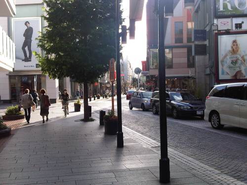
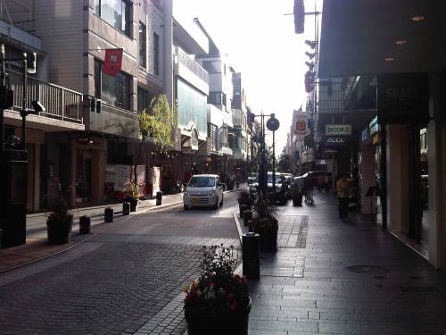
I’m posting a few photos I took from a recent visit to Yokohama, Japan, which was my home for 3 years back in the 1990s. Much has changed in Yokohama since I last visited in 2008 but notable are the people friendly transport infrastructure including pedestrian and cycling facilities. Following are photos taken in the Minato Mirai district of the city.
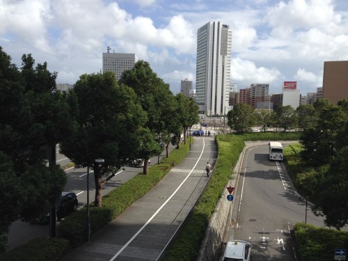 Pedestrian and cycling lanes along the main road of Yokohama’s Minato Mirai district. The tree-lined street provides a conducive environment for walking and cycling.
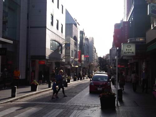
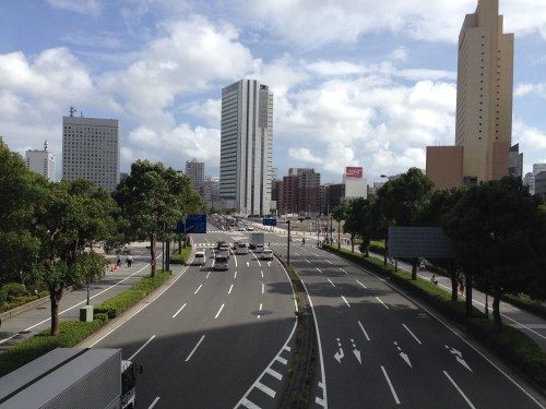 Depending on how one sees it, Minato Mirai Odori is a 10-lane road with 4 lanes allocated for walking and cycling (i.e., 1 lane each on either side of the lanes for motor vehicles).
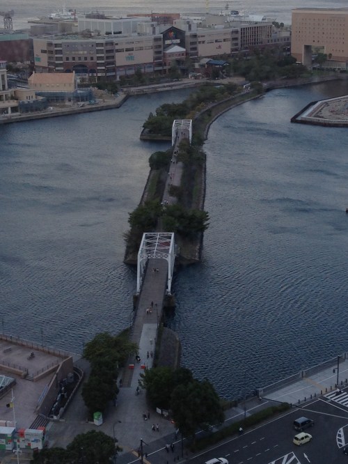 Pedestrian bridge connecting Minato Mirai Odori with the World Porters commercial development
 A 10-lane bridge with 2 of 5 lanes per direction devoted for walking and cycling. That’s a full lane of at least 3.2 meters allocated for pedestrians and another full lane for cyclists. While it is not shown in the photo, the pedestrian and cycling lanes are efficiently utilized during the peak periods.
–
Motomachi
It’s December again and during this month I like to reminisce about favorite places I went to or still go to here and abroad. One of my favorite haunts during the time I called Yokohama my home city was the Yamate area. I went to Mass every Sunday at Yamate Catholic Church. After church, friends and I descend towards the Motomachi shopping street to take strolls, window shop or have lunch in one of the many restaurants along the street. I think it is a good example of a shopping street that’s also found in many other places particularly in Europe and the US. It provides a better environment compared to the large malls we often find in many cities including Metro Manila.
 On-street parking spaces are provided along one side of several sections of along the street. There are parking meters at these spaces.
 It is a nice place to take a walk whether doing actual shopping, window shopping or just a simple stroll to while away the time.
 I like the brick road of Motomachi and the restaurants and shops lining the street.
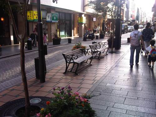 Benches where people can sit down, take a short rest or wait for their companions who are shopping at a nearby store.
 Motomachi Union where I used to do some groceries whenever I’m in the area (usually Sundays after Mass at Yamate Church).
 A look back to Motomachi as I approached the JR Ishikawacho Station.
There used to be a Indian restaurant at one of the side streets of Motomachi. The chef of the restaurant was a Sri Lankan Catholic who was a church mate at Yamate. We often went to eat there after Mass or on occasion. He would usually adjust the ingredients of our favorite curry and tandoori dishes so they weren’t too hot or spicy for our palates. I wonder where he is now with his family and hope they are doing very well.
There also used to be some clubs or pubs at the end of Motomachi. These included one that was operated by Filipinos that had the Philippine flag displayed. Those establishments are long gone, replaced by newer restaurants and shops as well as a building leading to the underground station of the Tokyu Minato Mirai Line. I know there are also a lot of new, still undiscovered shops and restaurants in the side streets to Motomachi. I look forward to going around the area again soon to check out these places.
–
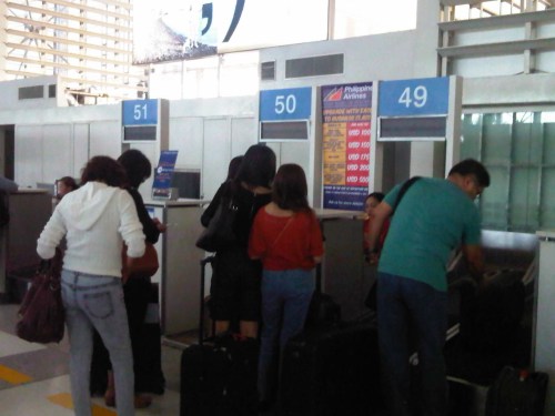
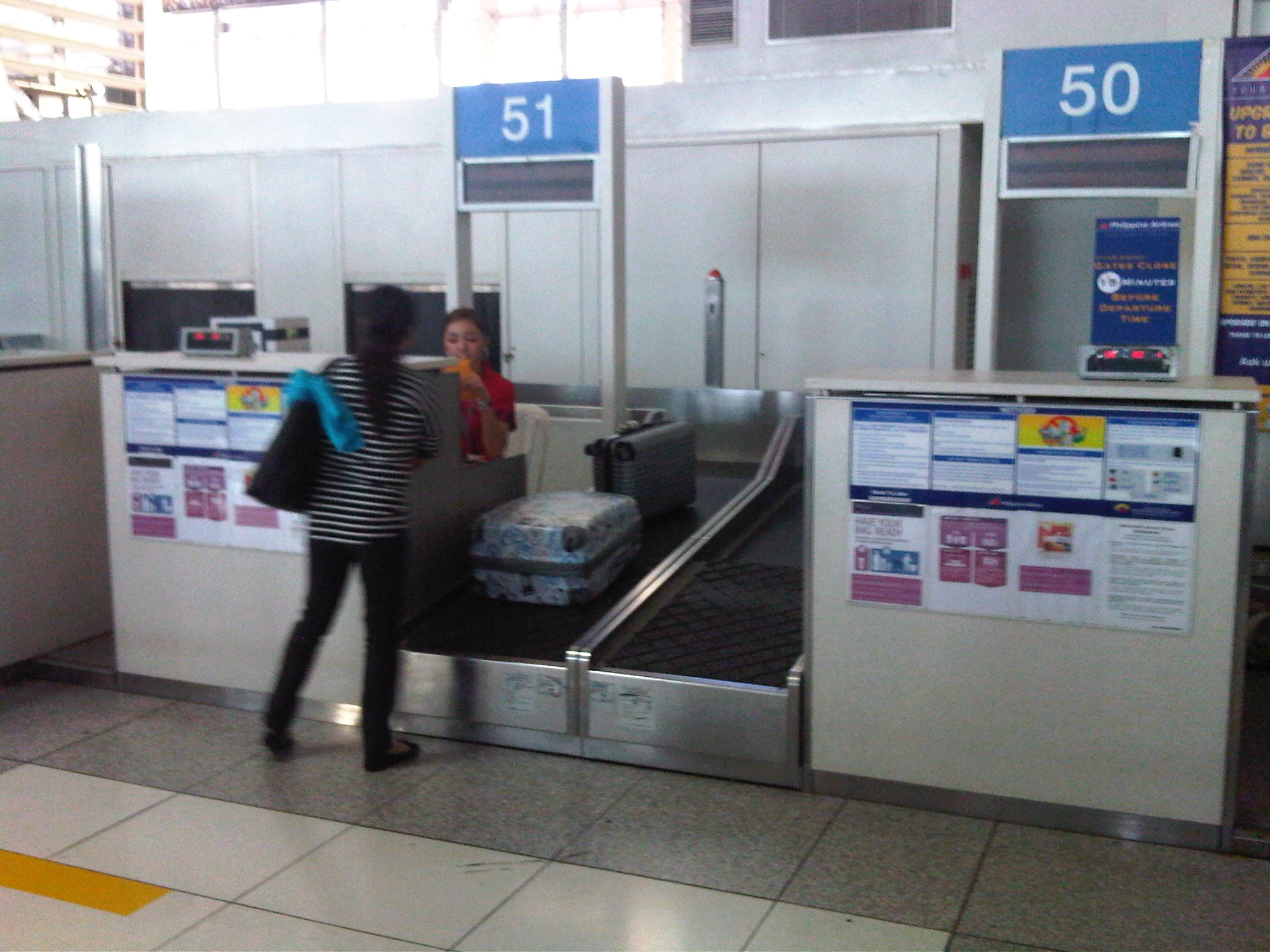
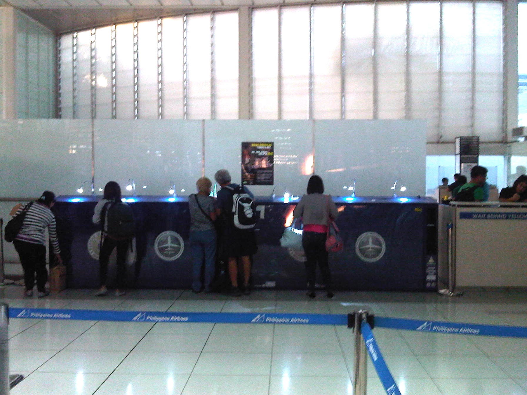
NAIA Terminal 2 international check-in
I took a few photos near the check-in counters at NAIA Terminal 2 as I myself checked-in for a flight to Bangkok. There was less confusion now compared to the last time I used PAL for an international flight and their ground staff were relatively unexperienced. This was the result of PAL rationalizing their workforce and opting for outsourcing ground services prior to San Miguel’s takeover of the financially-challenged full service airline. During the transition period, queues were longer as service times at the check-in counters were longer. Ground staff took some time to process each passenger as perhaps they had little training (if any) and thrust into the real work provided an initial shock that translated into slower services.
 Passengers checking-in at NAIA T2. There are no internet check-in booths (for those who already checked-in online and would just drop-off their luggage) or automated check-in machines at Terminal 2. PAL needs to work on these services for more efficient services at the terminal.
 A single queue with multiple servers means more orderly services for passengers. This is actually something that Philippines immigration should implement in all airports whether for departing or arriving passengers. I don’t get it why for departures, immigration can implement this simple system resulting in more efficient processing for travelers while the same cannot be implemented for arrivals.
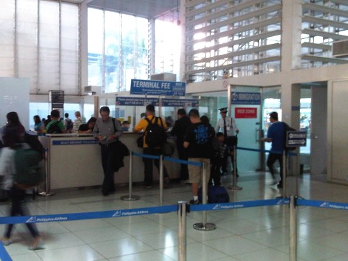 Passengers lining up to pay terminal fees. NAIA is one of very few terminals still charging terminal fees. Elsewhere, these fees (if any) are already integrated into the plane fares and so passengers don’t need to queue and spend time for another transaction.
 Travelers fill out immigration cards before lining up for the immigration counters. There are still many who seem oblivious to this requirement. While some are really the hard-headed type who end up stalling the queue, these people can easily be filtered by immigration or airport staff managing the queues.
–
Another look at the Iloilo airport – departure
I took the first flight out of Iloilo back to Manila during a recent trip to the city. I also took an opportunity to take some pictures of the terminal including the part when we lined up to enter the terminal. Security was strict (as is necessary for such facilities) so there was a single line to control the inflow of passengers. There’s nothing really new for departures except a few new cafes inside the pre-departure area. The shops prior to the final security check were still closed at the time so I could not do some final pasalubong shopping. I can only imagine that passengers directly bound for international destinations would need to pass through the immigration booths at the terminal.
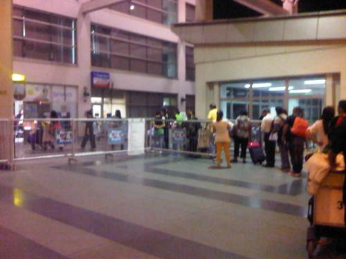 Queue of passengers entering the terminal – there was a single file for the initial inspection by airport security. Well-wishers are not allowed inside the airport unless there is prior clearance from the airport authorities.
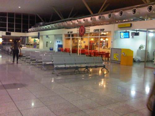 North wing pre-departure area – the shops were already open early in the morning
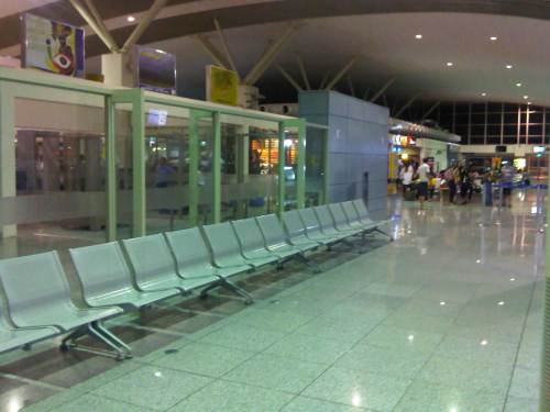 A glance back to the center of the terminal where passengers emerge from the final security check.
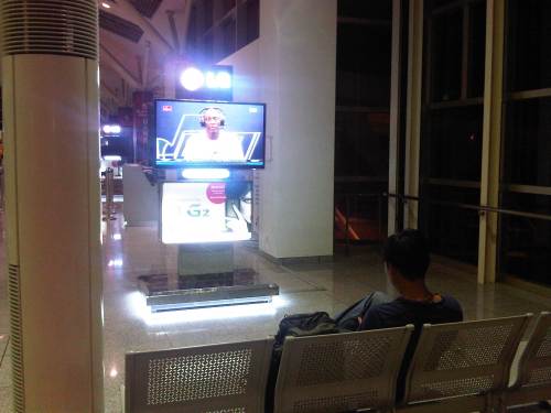 Passengers catching an NBA post-game interview while waiting for the boarding call.
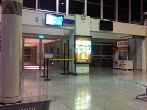 We were initially assigned to board at Gate 3 of the airport terminal.
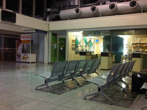 Cafe near Gate 3 that is also designated as a smoking area.
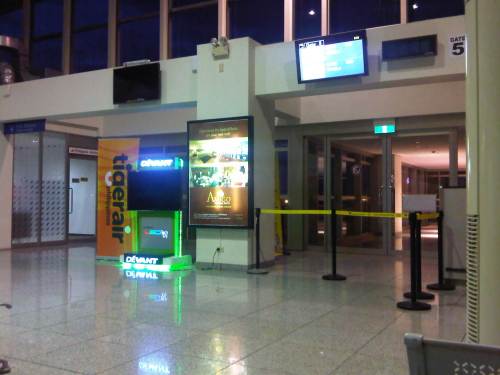 Later, we were transferred to Gate 5 at the other end of the terminal.
 Waiting passengers seated facing Gate 5. There are also cafes and fast food line along this terminal wing.
 Designated enclosed smoking area near Gate 5.
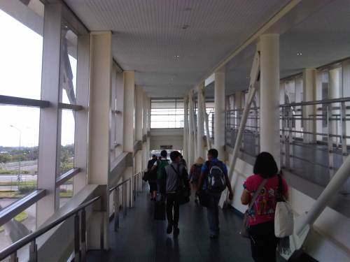
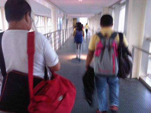 Fellow passengers walking on the bridge towards our aircraft.
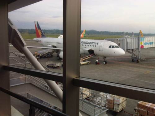 The first flight out of Iloilo to Manila is via Cebu Pacific. The second flight is via Philippine Airlines whose plane is shown unloading baggage as it arrived as we were boarding our aircraft.
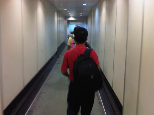 View inside the tube as we proceeded to board our aircraft.
–
Another look at the Iloilo airport – arrival
I have not been to Iloilo in a while despite having our ancestral home there on my father’s side of the family. It used to be that I was in Iloilo at least once a year and usually during the Holy Week when we had family reunions on Easter Sunday. Perhaps the last time was in 2010 when I gave a keynote lecture to the Metro Iloilo, Guimaras Economic Development Council (MIGEDC) during one of their last seminars under a JICA-assisted project to improve transportation in the area. And so I was quite happy to have an opportunity to travel to Iloilo even for a short stay to have a meeting and do some field work. I was also happy to have an opportunity to take some new photos of the airport, which is now serving as an international airport with regular flights to and from Hong Kong and Singapore.
 Arriving passengers pass through a corridor after disembarking through one of the three tubes at the terminal.
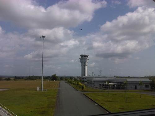 The Iloilo International Airport’s control tower as seen from the terminal building.
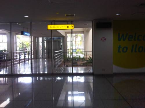
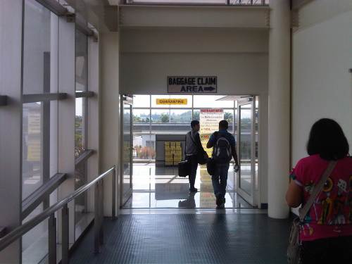 Direction to the baggage claim area.
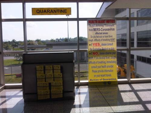 Quarantine section along the way to baggage claim.
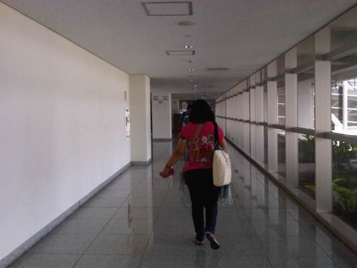 The corridor leads to a section allocated for immigration for international arrivals.
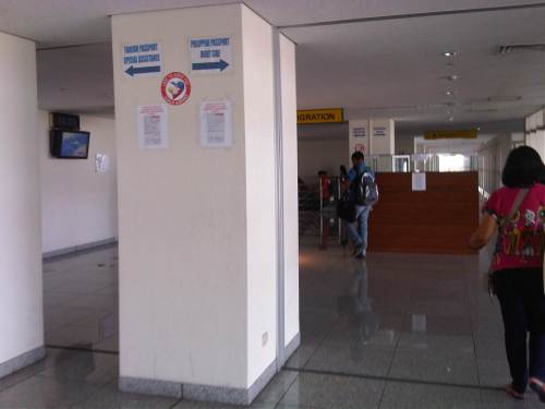 The immigration booths are manned only when there are international arrivals. Most of the time, these are unmanned as most flights throughout the day are domestic.
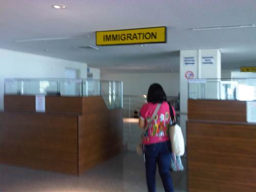 The booths look like they were set up only recently when the airport started catering to international flights. There were only two stations, each with a capacity for 2 immigration officials for a total of 4 officers to process international arrivals. I hope they are able to do their jobs efficiently (i.e., quickly but correctly) as the space for queuing is quite limited. There are few international flights, however, and one A319 or A320 planeload would probably not overwhelm 4 officers. Of course, I am assuming there would be that many officers to handle the arrivals.
 After going through the immigration area, one proceeds towards the baggage claim area via a staircase, which leads passengers to the ground level of the airport terminal.
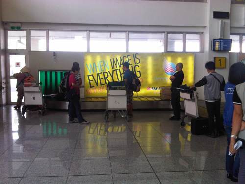 There are 2 baggage carousels where arriving passengers can get their checked-in luggage. Carts are provided free for use of passengers.
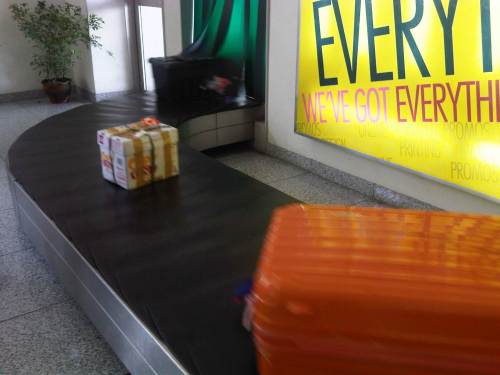 Luggage of all shapes and sizes are loaded unto the carousel and circulate for passengers to sort through and pick up.
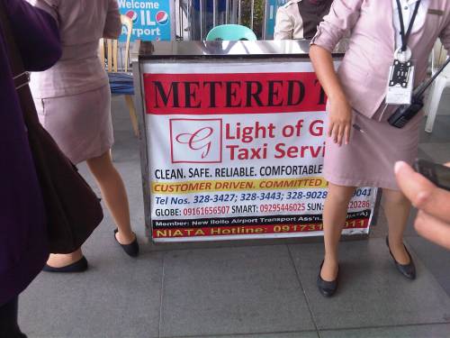 When in need of trustworthy and reliable transport in Iloilo, contact Light of Glory taxi service. Their metered taxi services are the best in the city and the province it is easy to arrange for a vehicle to fetch you at the hotel to any destination within the island. Their drivers practice safe driving so that’s always a plus for those who prefer to take the taxi over the jeepney when in Iloilo. I also noticed that they have a good dispatching system at the airport and at SM City Iloilo – definitely something that we should be replicating in Metro Manila and other cities.
–
NAIA T3 shops and eats
I had wanted to post about airports again but the aftermath of Typhoon Haiyan and the continuing efforts for relief in places affected by the typhoon made me hesitate a bit from doing “business as usual” writing. The past few days though I have seen a demand for information on NAIA Terminal 3 and so I decided to complete an unfinished draft on T3 to add on the information out there on shopping and eating/drinking at T3 once the passengers have passed through the final security check and proceeded towards their respective gates for pre-boarding.
We were at Ninoy Aquino International Airport’s Terminal 3 last month for a flight to Iloilo. I took some new photos to come up with an update to the pictures I’ve posted in the past on T3.
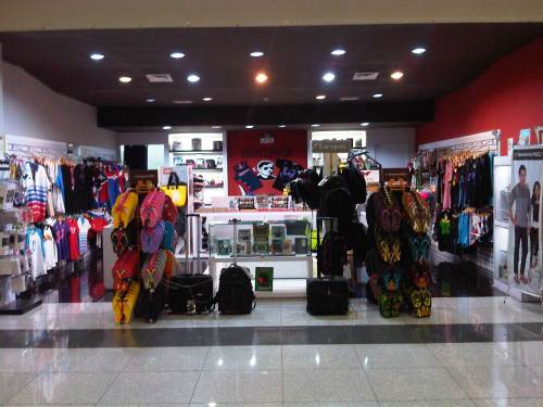 There are many souvenir shops at NAIA T3 including those selling flip flop sandals, shirts, swimwear, electronics, luggage and various accessories.
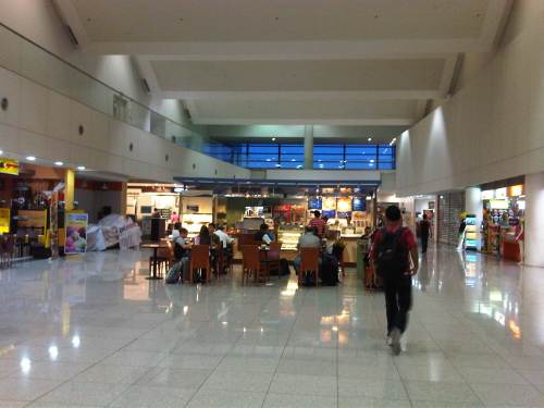 There seems to be a lot more options for eating or perhaps sipping a hot cup of coffee or tea while waiting for your boarding call.
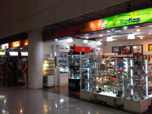 There’s a shop selling eye wear (sunglasses anyone?), electric razors and watches.
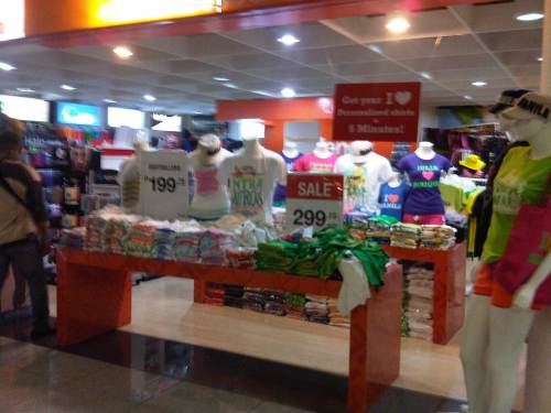 A popular souvenir shop for shirts is Islands Souvenirs. They have shops or stalls all around the country with each basically selling only designs attributed to the city or island where the shop is set-up. That means Cebu shops/stalls basically sell Cebu-themed shirts, Iloilo shops/stalls sell Iloilo-themed merchandise, and so on. The shirts they sell are of very good quality and don’t shrink after you wash them. I have quite a number of shirts (I used to collect them from my travels.) so I can attest to the quality of their products.
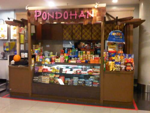 “Pondohan” translates into neighborhood “store” or “shop.” It is also more commonly called “sari-sari” store with the term “sari-sari” meaning “variety” and referring to the merchandise being sold at the store.
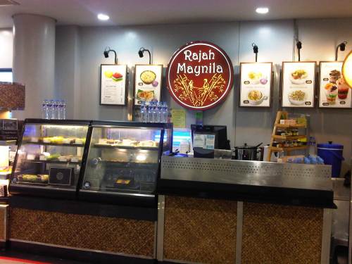 This stall offers quick meals as well as pasalubong in the form of their take on popular kakanin or rice cakes or puddings. Friends say they also have good coffee.
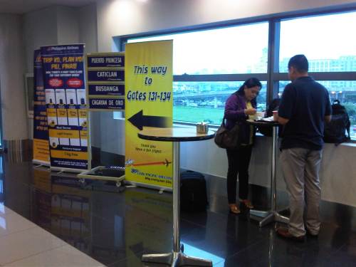 Colleagues of mine having a quick meal before our morning flight to Iloilo. Beside them are directional and information signs of PAL and Ceb Pac.
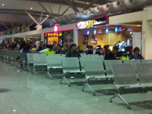
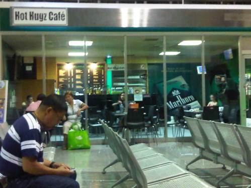
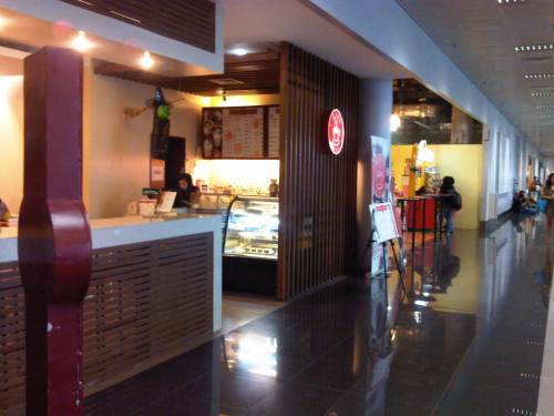 We found that there were already other shops and cafes/eateries along the way to the boarding gates at one end of the terminal. I guess with more passengers now using T3, there is also more demand for shops and options for eating at the airport’s pre-boarding areas (i.e., near the gates of this linear terminal building).
–
