
Take public transport…it’s good for you!
An article came out of the Philippine Daily Inquirer where a contributor wrote about her experience riding a jeepney ride from Ateneo to UP Diliman and then back after having lunch and some fishballs somewhere at the Shopping Center (more likely at the Coop rather than at the SC). The link to the article may be found below:
After being shared on social media like Facebook, the author and her article received a lot of flak from people whom I think didn’t quite get the lesson of the story – something deeper than how the writer related her story of her commute. Some found it amusing but others focused (more like ridiculed) on the Arneow aspect of the article. There is even a parody of the article where a blogger wrote about his “experience” riding an MRT train. I won’t post that here despite it being humorous as it is irrelevant to the points I will highlight in this post.
I think we should encourage more people who probably mainly travel by car and have little experience taking public transport to try taking a jeepney or bus ride. This experience (an honest one I believe for the writer) will be something that hopefully changes their perspective of transport (and life in general). Who knows? The person might one day be in a position to make a significant impact on our transport system. And we do need decision-makers who take public transport rather than private cars if only to have an appreciation of how it is for most other people who take public transport in this country.
I am reminded of experiences commuting in other countries where they have good public transport and people from most income levels take these everyday. Cars are used mostly during the weekends or when it is really necessary (e.g., emergencies, fetching someone at the airport, etc.). Snooty as some may seem, people have to be educated and have the experience of riding public transport in order to enlist them among the many clamoring for better transport services and facilities. Who knows that person might be able to influence well-placed people to make the decisions that will lead to the improvement we seek for public transportation. If you don’t use or haven’t used public transport, you likely to be detached from the reality that most other people encounter everyday as they travel between their homes and the workplaces or schools.
I reproduce the article from the Inquirer below for reference now and the future:
Lessons from a jeepney ride
Nicole Ki
Philippine Daily Inquirer, 12:43 am | Friday, September 7th, 2012It was lunchtime. My blocmate, who so badly wanted to go to the University of the Philippines (UP) for lunch, suggested that we go.
We were walking in the heat of the sun, and it had just started to get even warmer when we finally reached the underpass. Many jeepneys were parked, as barkers tried to lure passengers to ride.
I went through the motion with my blockmates and did whatever else they did throughout the commute; I was allowed to take public transportation only in college. I sat quietly, recalling how much I hated the thought of riding a jeepney, but how real it was that I was actually in one.
It didn’t turn out so bad; I didn’t experience the one-foot-in-and-the-jeepney-suddenly-jerks-pulling-you-in, like I did when I was a kid. That was my first jeepney ride, by the way.
I thought all jeepney drivers were impatient, like in the first ride I had. I guess I was wrong.
The jeepney came to a stop; finally we were at UP.
A short walk brought us to its Shopping Center. It had all sorts of stuff—photocopying shops, computer shops, a clothing store, mini restaurants, a barber shop, a hair salon, even a Bayad Center and Western Union; everything you could possibly ever need for school and more.
It was amazing. I had wanted to stop to look in every store, but we had a little less than an hour, and we still didn’t have a place to eat.
We continued walking until we reached a cafeteria which served cheap home-cooked meals. We all ooh-ed and ahh-ed with each bite, not only because the food was good but also because food here was cheaper than at Ateneo. Even if we were already full, we had set our minds to try out the famous UP isaw, kwek-kwek and fish balls.
We stumbled upon a stall which offered only fish balls. It took some 15 minutes for the food lady to fry them. As we looked at our watches, we knew we weren’t going to make it on time.
We walked some more to the nearest waiting shed to hail a jeepney. With our consolatory fish balls in hand, we saw kwek-kwek—but too late.
I had not expected the ride back to go as smoothly as the ride to UP. First off, I wasn’t seated in the farthest end anymore, nearest the door; I was nearest the jeepney driver. Just the thought of how I’d get off the jeepney at our stop made me cringe.
With all this negativity, I was genuinely surprised at how interesting my seat turned out to be! This was where the action happened, and I’m so glad I got to be in it.
“Para po.”
“Bayad ho.”
“Senior.”
“Estudyante.”
New language
When I first heard the passengers say these lines, I was amazed. It sounded like a new language to me altogether. The words sounded sincere and friendly. And since I was seated just behind the jeepney driver, most of the payments coming from these seemingly interesting human beings were passed to me. It felt like I had a sudden connection with all the passengers. I was suddenly part of something. I was wide-eyed in wonder. I got my P8 out of my pocket; “Bayad ho,” I said.
“Para po. Sa may National,” I said to the driver.
“Excuse me, bababa lang po,” I said to the person beside me, as I wiggled out.
And as I stepped down the jeepney and my feet hit the ground, a sudden realization hit me. Both of the jeepney rides I had that day, I realized, were a lot like life.
Our first experiences may not always turn out to be so great, like my first jeepney ride. We start just wanting to only try out things, and to test the ground, but as if with a sudden jerk, we’re pushed into a world we don’t know about yet. This would leave an unwelcome mark in our hearts, plus a bad memory, and this is usually the reason we stop and don’t give it another chance; we’re afraid to fail again.
But sometimes, life leaves us no choice; like this jeepney ride I was forced to take. I had unintentionally given public transportation another chance.
So if you tried something new for the first time and it didn’t turn out so well, try again. Don’t be like me, who had to wait for about 10 years just to be able to appreciate something. Who knows? It might be the most wonderful thing to ever happen to you.
It’s interesting how two simple jeepney rides can change your outlook in life. And guess what? I can honestly say I enjoyed them.
–
Some thoughts on transport and traffic while commuting between Cainta and Antipolo
Commuting from the Ortigas (Cainta) end of Imelda Ave. to its other end at Marcos Highway (near where Pasig, Marikina, Cainta and Antipolo meet), one should be able to observe and make a quick assessment of the positives and negatives of our local transport system. While there are more negatives at Cainta Junction and along Imelda Avenue, Marcos Highway definitely has improved particularly in terms of walkability. It is a commute that I have taken so many times since my childhood days and I can only now remember times when one could walk safely from one end to the other when there were far less vehicles than the volume that flows along Imelda Ave. these days.
Junction is still quite the mess despite some road widening at the intersection owing to various factors including the fact that the intersection simply cannot handle the volume of vehicles using it even after the elimination of some turning movements from Ortigas Ave. in favor of U-turns particularly for traffic coming from the eastbound side of Ortigas. It seems the traffic signal settings can no longer handle peak period traffic and manual traffic management probably aggravates the situation especially when enforcers employ the buhos technique of trying to dissipate as much of the queued vehicles per approach or movement. The latter technique does not take into consideration that the longer a movement or group of movements are allowed to move, there are corresponding build-ups in traffic along all other approaches. It is a vicious cycle (pun intended) that is supposed to be addressed by an optimally times signal system. Saturated conditions, though, are inevitable due to the sheer volume of vehicles using the intersection given that Junction is a catchment for vehicles from Rizal Province that ultimately uses Ortigas Ave. to head into Metro Manila in the mornings. The reverse is true in the afternoon to evening periods.
Imelda Avenue, which was also known for a time as Francisco Felix Ave., is plagued congestion due to notoriously bad pavement conditions, so many median openings, and high vehicle trip generation rates from the many residential subdivisions or village along the road. The pavement conditions are due mainly to damage brought about by trucks and, during the wet season, frequent flooding along many sections of the avenue. Bad pavement conditions and flooded streets significantly slow down traffic as Imelda Ave only has two lanes along each direction and is divided by a narrow median island that’s just enough for a few plant boxes and lamp posts.
There are mostly middle class subdivisions including the large Vista Verde, Village East, Karangalan, and Pasig and Cainta Green Parks along the road. There is also a DMCI medium rise development has its main access road also connecting to Imelda Ave. These villages generate much vehicle traffic and each have their own median openings that practically function as intersections along the entire stretch of the avenue. These openings create a lot of conflict between through traffic and vehicles entering and exiting the villages, especially those taking left turns to or from their gates.
While there are commercial establishments along the avenue, most were small and traffic generation characteristics were not so significant as to cause severe congestion. The first major generator in the middle of the avenue was a branch of the membership-concept Makro supermarket cum depot. Makro generated significant traffic but did not cause much congestion along the stretch in front of the Village East gate. It was eventually acquired by commercial giant SM and the branch is now an SM Supercenter that seems to be generating much more traffic than Makro did at its peak. While traffic studies are usually the norm before such developments are constructed given the trips attracted by SM, the congestion experienced along Imelda Ave has been reported to be generally un-managed despite the need for more disciplined loading and unloading by public transport, pedestrian movements and vehicle entries and exits.
Jeepneys are the main public transport mode along Imelda Ave. although there are tricycles serving the various subdivisions that often not only cross the road but also travel along Imelda Ave. for short distances. I remember in the 1970’s and early 80’s that the tricycles used to be the primary mode of transport from Junction and the Cainta Public Market as Imelda was not yet connected to the still to be completed and unpaved Marcos Highway. There was even a Metro Manila Transit Corp. bus service (probably missionary route and with low frequency of service) along Imelda Ave. that turned around near Kasibulan Village, one of the first subdivisions in the area. Many jeepneys are noticeably the patok or popular type known for their loud stereos and reckless driving. Still, there are the smaller, older jeepneys whose route connects either ends of Imelda Avenue. Most patok jeepneys are from the many longer routes between Rizal towns and Cubao overlapping along Imelda Ave (e.g., Angono-Cubao, Antipolo-Cubao, Binangonan-Cubao, Taytay-Cubao, etc.).
–
Luzon Avenue: Unfinished business
Luzon Avenue stretches from Commonwealth Ave. near Tandang Sora towards the Congressional Avenue Extension and currently ends at Sampaguita Avenue near the Fairview area. It is supposed to be part of Circumferential Road 5’s northern alignment that will connect with NLEX and McArthur Highway. It took quite some time to complete the bridge crossing Commonwealth Ave. and connecting Luzon Ave. to Tandang Sora near the end of the Katipunan Ave. stretch of C5. Issues were mainly on informal settlers occupying the land where the southern foot of the bridge and service road were to be constructed.
While much of the area has been cleared of informal settlers now, the ROW for the area has not been sufficiently cleared to complete the construction of the approach to the bridge. As such, only the northbound direction of the bridge has been opened to traffic as there is no space available for two-way traffic at the southern end where the bridge will ultimately connect to an intersection with Tandang Sora. Following are photos showing the approach at the north end of the bridge.
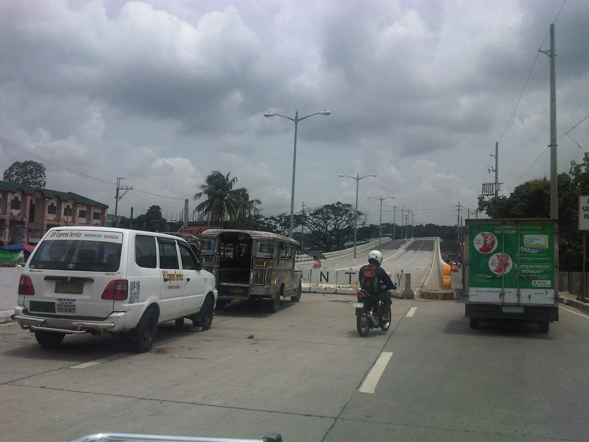 Approach at the north end of the bridge across Commonwealth Avenue – the south end connects to Tandang Sora Ave. near the University of the Philippines Diliman campus. The south end approach is partly finished and allows only right turns from Tandang Sora towards the bridge or to the one-lane service road that leads to Fairview-bound side of Commonwealth.
 Service road – southbound traffic would have to take the service road that leads to Commonwealth Ave. and a short drive to the intersection of the latter with Tandang Sora.
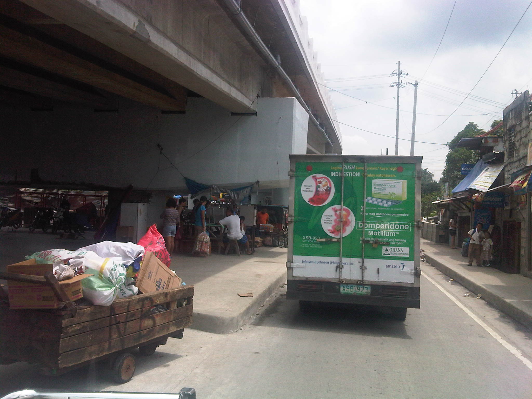 Talipapa? – this area under the bridge used to be occupied by informal settlers and there was a market here that usually spread to Commonwealth, with vendors and customers occupying the outer lanes of the highway during weekends and causing congestion for vehicles approaching Tandang Sora
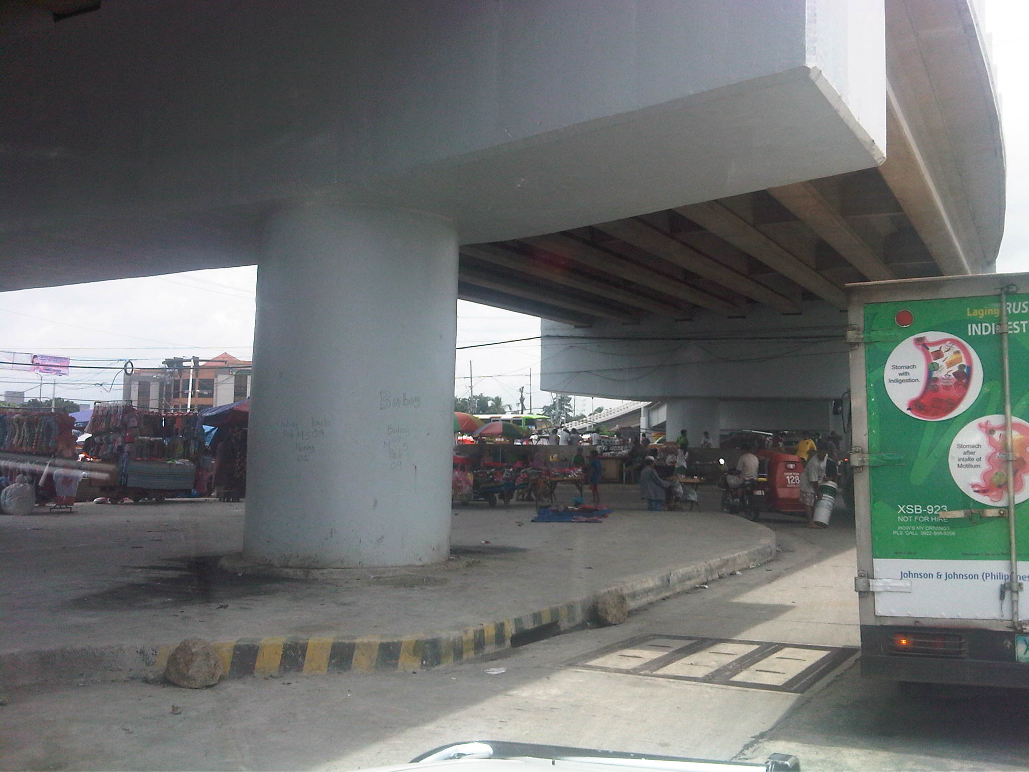 Remnants – there are still stalls, many of them mobile, selling a variety of goods including food, clothes, bags, plastic items and other commodities found in most wet and dry markets. There is a Puregold supermarket near the intersection on the left side and unseen in the photo.
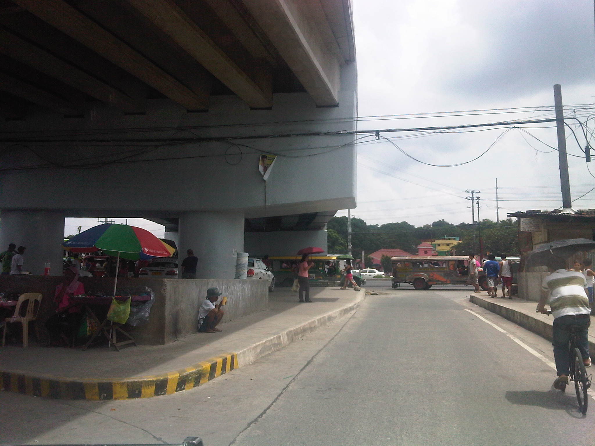 Exit to Commonwealth – the one lane approach to Commonwealth is sufficient now due to the light traffic but will not be enough once Luzon Ave and C5 is completed, bringing more vehicles to this area.
–
Views from a landing plane
I like taking photos when I am traveling and have always tried to get some clear shots when I’m on-board a plane, trying to identify certain landmarks like volcanoes and bodies of water or perhaps roads that I could identify from above. Aerial shots are quite tricky with a point-and-shoot even though one can have the benefit of zoom and other pertinent functions digital cameras have these days. On one particular trip I had the fortune of being able to take photos of Mayon Volcano while in another, I was able to take a photo of Taal Volcano. I missed one opportunity to take a photo of the Chocolate Hills of Bohol in one return flight from Mindanao.
The following photos were taken during one flight when the conditions were just right for some clear pictures of roads and then some familiar places as our aircraft approached NAIA.
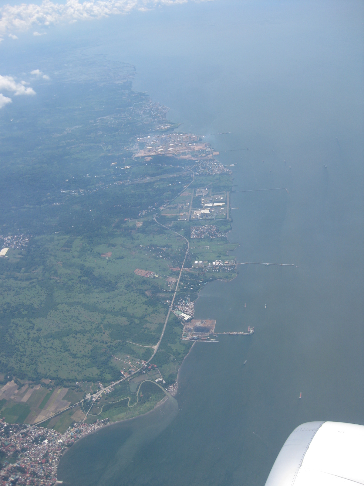 Roman Highway in the Bataan peninsula – there are many industrial estates and plants along the highway, most having their own seaports.
 Ortigas Avenue Extension with Cainta Junction on the upper left of the photo – one of the busiest roads connecting Metro Manila to the eastern province of Rizal, this avenue is often constricted due in part to varying road widths between Rosario and Junction and undisciplined public transport drivers stopping just about anywhere along the road.
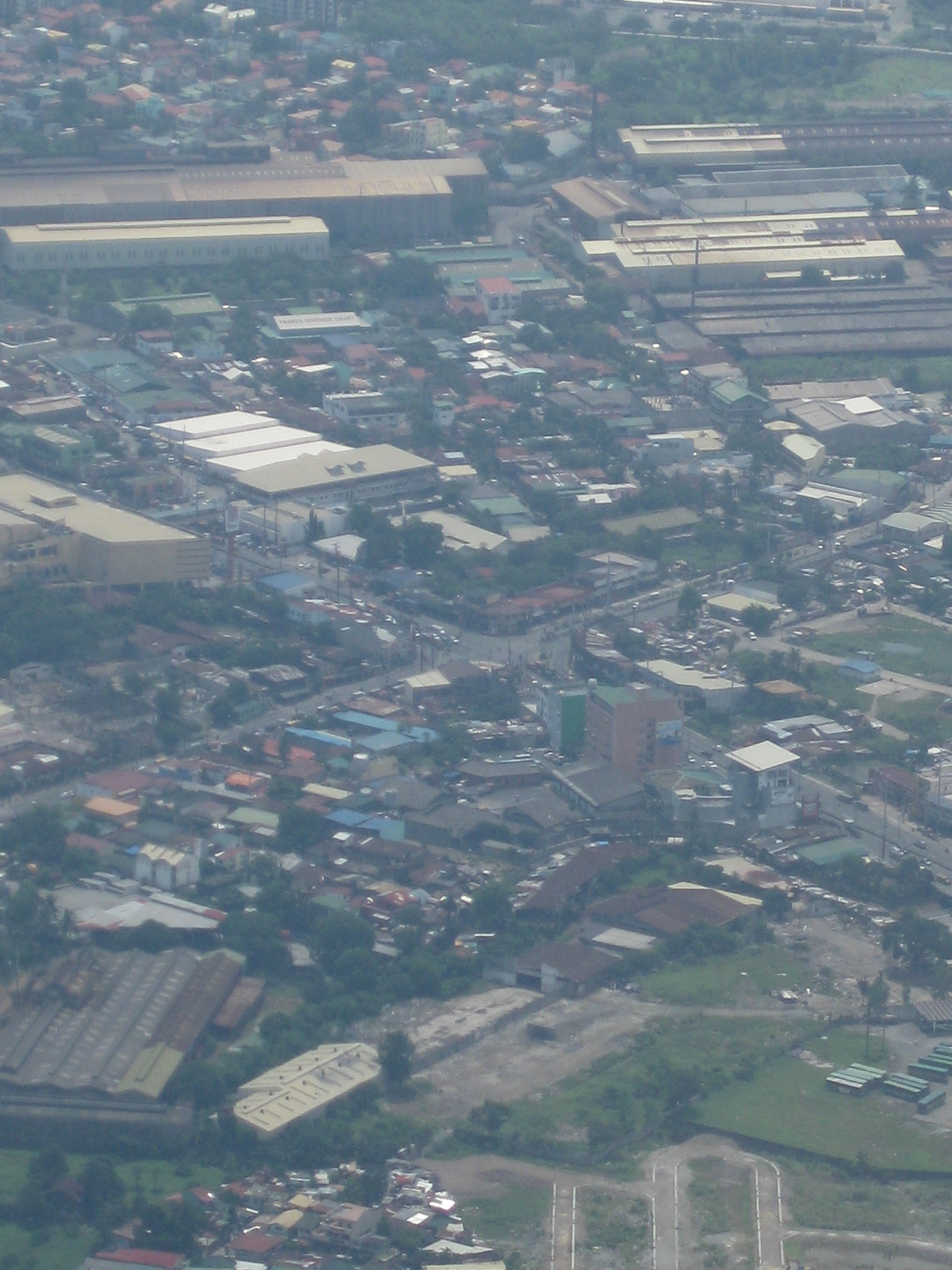 Close-up of Cainta Junction, the intersection of Ortigas Avenue and Imelda Avenue (formerly Felix Avenue) – this intersection is usually congested even during weekends as residents in Rizal with workplaces or schools in Metro Manila have steadily increased over the years.
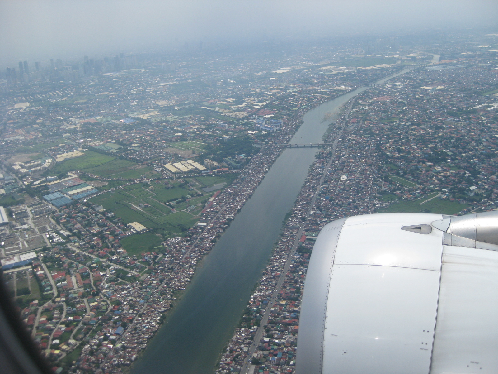 Manggahan Floodway – along the west and east service roads flanking the floodway are thousands of informal settlers. Notice the haze in the background?
 The high-rise buildings of Bonifacio Global City and the Makati CBD – Market! Market! is on the right side of the photo. While the photo seems clear, one can see the haze, probably from pollution, in the background and obscuring the buildings further away.
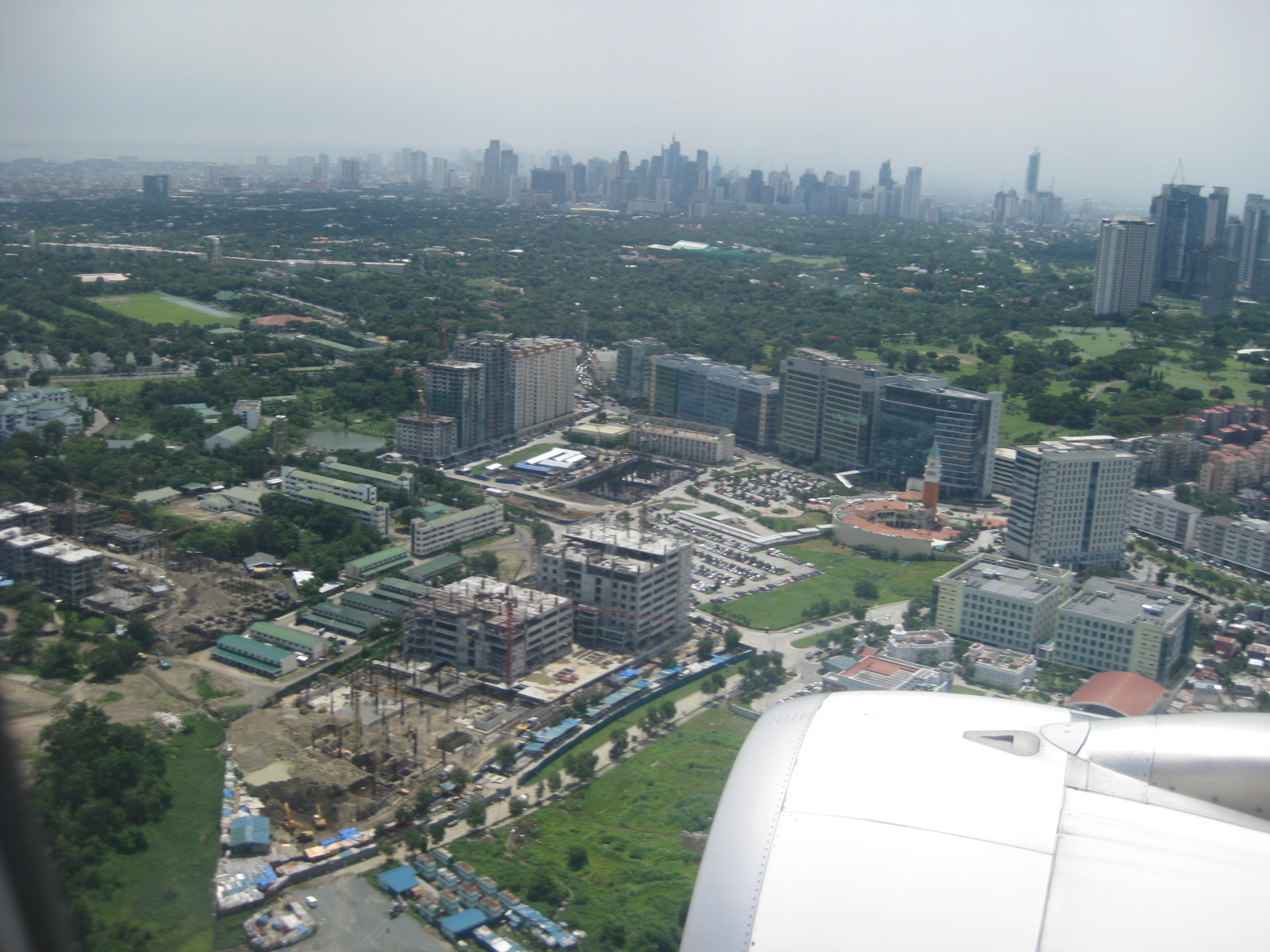 McKinley Hill – development west of Bonifacio Global City and beside the Philippine Army Headquarters. Buildings in the City of Manila are visible in the background/horizon despite the haze.
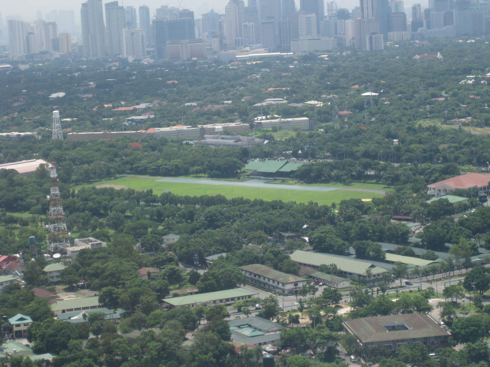 Philippine Army Grandstand and Parade Grounds at Fort Bonifacio. What looks like a wide green area between the Fort and the Makati CBD in the photo are actually parts of exclusive high-end residential subdivisions (i.e., Forbes Park and Dasmarinas Village).
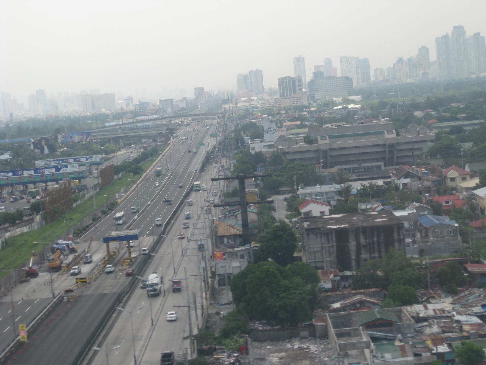 SLEX, Skyway, and the East Service Road – that’s the conspicuous TESDA building on the right with its inverted pyramid feature.
 View of the NAIA Terminal 2 upon touchdown – also known as the Centennial Terminal, this is used exclusively by Philippine Airlines for both international and domestic flight.
–
Predictability of school-generated traffic congestion
I have written about schools generating much traffic. The same characteristics of trip generation make congestion along streets affected by the schools quite predictable. For example, traffic congestion due primarily to the trip generation characteristics of schools along Katipunan Ave. may be observed during 6:30 – 7:30 AM as well as around 3:30 – 4:30 PM. The afternoon congestion though is exacerbated by the presence of significant truck traffic using C5 as part of their routes. Other cases would have similar predictability and I pointed this out to some guests while we were having a coffee break from our day-long meetings. The following photos were taken in the mid-afternoon and shows congestion along Ortigas Avenue in Mandaluyong City, including along an overpass affected by school traffic generation from a private school (the school is the one with the dome in the photo). Traffic is typically bad between 3:20 to 4:30 PM, after which it subsides until after 5:30 when the afternoon to evening rush from workplaces to homes take over much of the road space.
 View of the EDSA-Ortigas intersection showing the start of the build-up of traffic along the left turn overpass to Greenhills on the left side of the photo.
 View of the same flyover at around 3:36 PM. Note the long queue along both lanes of the overpass.
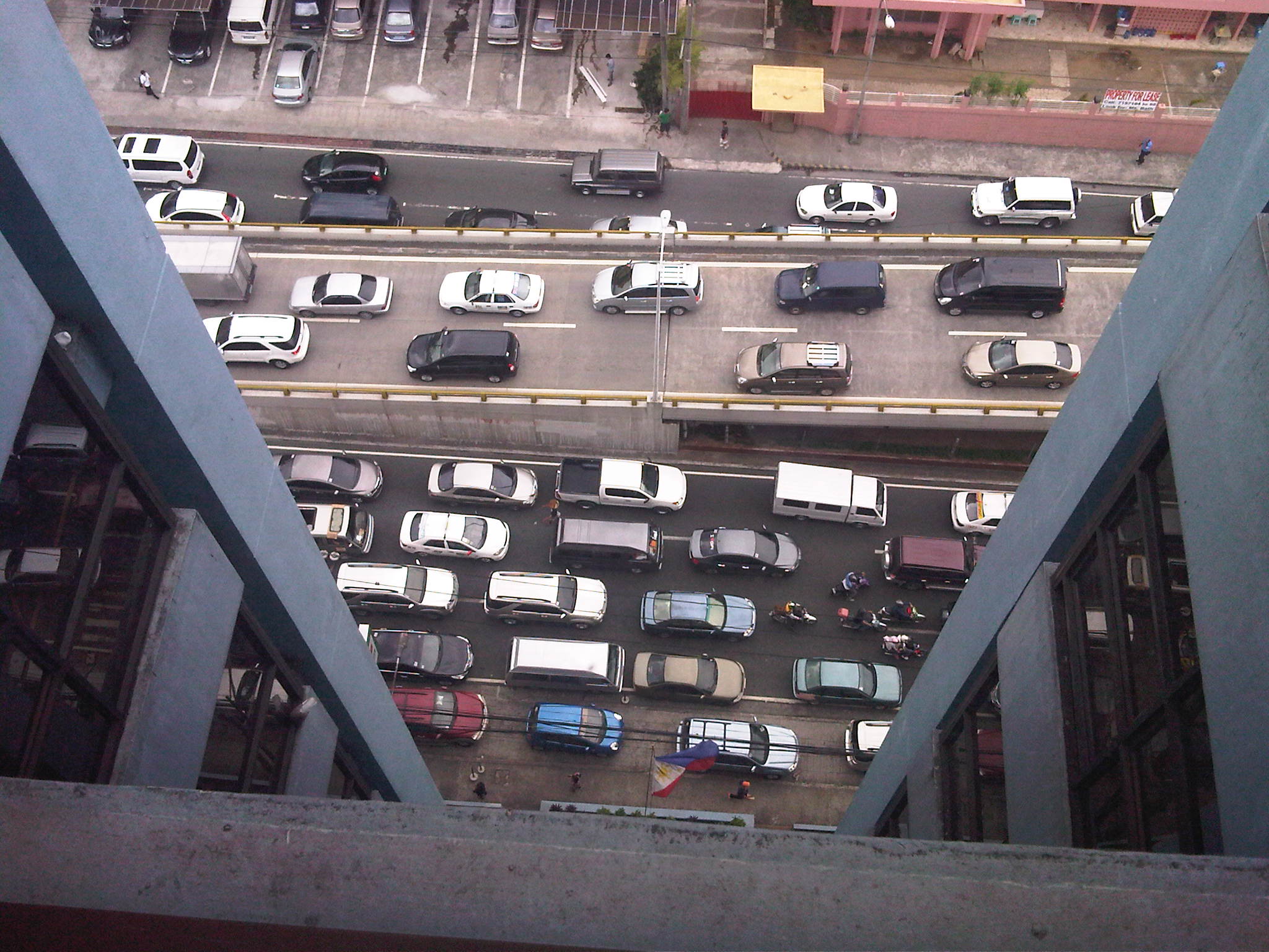 View of traffic congestion from the 16F of the building hosting the headquarters of the Department of Transportation and Communications. The overpass featured in the preceding photos is shown with vehicles descending to merge with Ortigas Avenue traffic. Both directions of Ortigas Ave. are congested.
 Congestion as seen from the street level. Vehicles descending the overpass are generally bound for San Juan while those on the foreground are bound for the EDSA-Ortigas intersection. Long queues are likely caused by a combination of high traffic volumes and non-optimal green time management at the intersection.
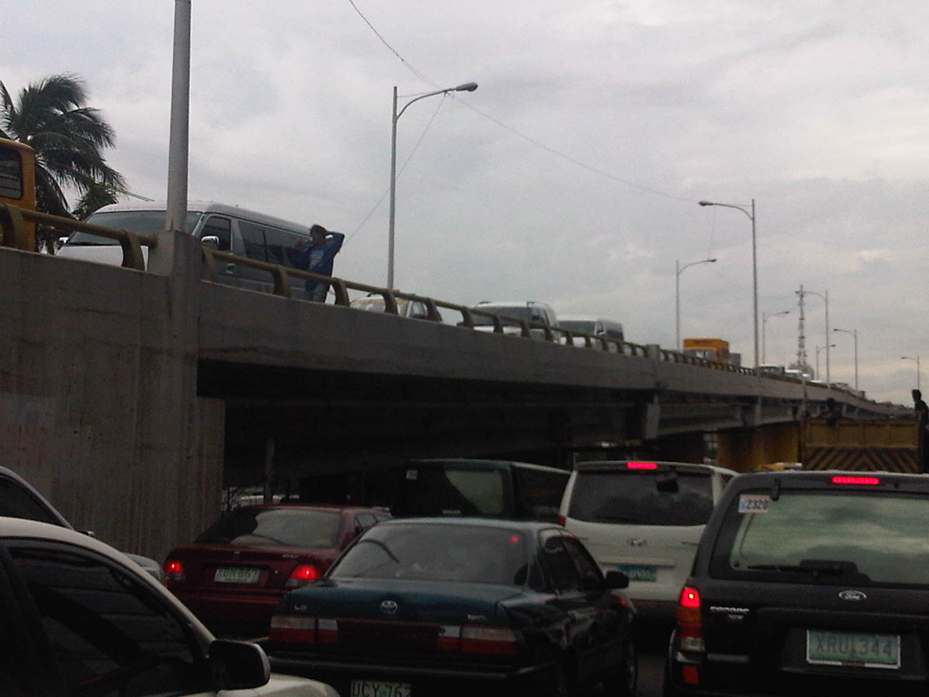 Another view of the congestion at both ground and overpass levels. Traffic is really bad when you have ambulant vendors walking along the overpass to sell their wares (e.g., cigarettes, candies, water, etc.) like what the man on the overpass near the van is doing.
Given the predictability of traffic congestion along this road, many motorists who have a choice or alternate route they can take avoid this road during such periods. Unfortunately, those taking public transport cannot avoid the congestion with passengers thereby incurring delays equivalent to wasted time. Most trips generated by such schools take private vehicles often having low occupancies (e.g., a driver plus a student = 2 passengers per vehicle). Perhaps schools should offer better school services/buses for their students? Or maybe there is a public transport option to be explored here? One thing is for sure and that is people at a young age learn that having cars is better than commuting. Such thinking is eventually carried over to when the same children become adults and an orientation favoring cars over public transport or even walking or cycling that they will eventually pass on to their own children, and so on. Perhaps our schools are in a very good position to influence the developing minds of their students and be responsible in promoting sustainable transport to their students.
–
EDSA traffic: view from the top
Traffic along Epifanio Delos Santos Avenue (EDSA) or Circumferential Road 4 is quite infamous considering it being a if not the main artery of Metro Manila and carrying much vehicular and passenger traffic between cities like Pasay City, Makati City, Mandaluyong City, Pasig City, Quezon City and Caloocan City where it has major junctions with other major thoroughfares like Roxas Boulevard, South Superhighway, Ayala Ave., Gil Puyat (Buendia) Ave., Shaw Blvd., Ortigas Ave., Aurora Blvd., East and Timog Avenues, Quezon Ave., North Ave., Roosevelt Ave., NLEX and A. Bonifacio Ave., Rizal Ave. and MacArthur Highway.
Shown in the following photos are traffic conditions along EDSA during a holiday, and typical afternoon peak and evening on a weekday. The section featured is the stretch from the Ortigas junction to Camp Aguinaldo. Visible in the photos are the high-rise condominiums along Connecticut Street (upper left) and the developments at the Araneta Center including the Araneta Coliseum in the Cubao commercial district. The green area on the upper right is Camp Aguinaldo, headquarters of the Armed Forces of the Philippines (AFP), while the rooftops at the right are of houses located in an high-end exclusive subdivision (Corinthian Gardens). In the middle of EDSA is the MRT-3’s elevated tracks.
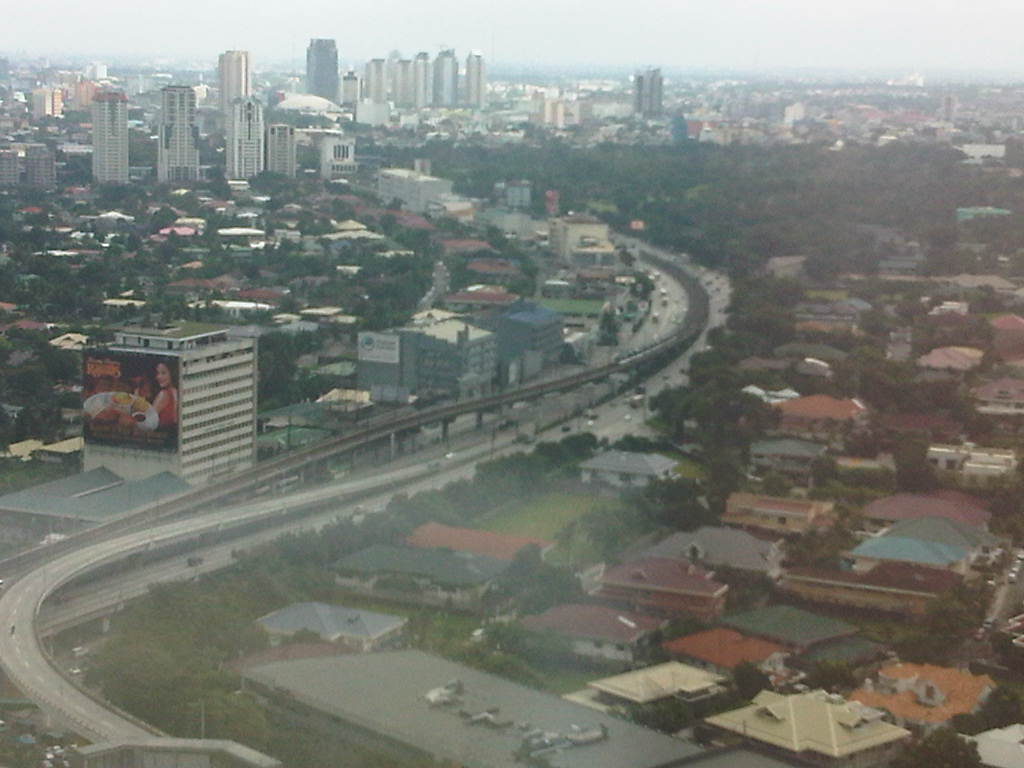 Photo taken from the 35F of the Robinsons-Equitable Tower shows light traffic along EDSA during a holiday. Traffic probably is similar during Sundays while such volumes may be observed on Saturdays only in the early mornings; before 9:00 or 10:00 AM when the shopping malls open.
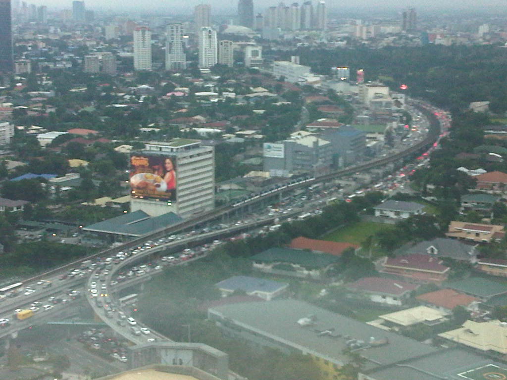 Photo taken at 5:44 pm showing traffic congestion on both directions (northbound and southbound) of EDSA including the overpasses at its intersection with Ortigas Ave. An MRT-3 train is visible in the middle of the photo.
 Photo taken at 6:16 pm with the headlights and taillights indicative of the traffic density during the early evening. Such congestion now usually extends past 8:00 pm with cases where EDSA is still congested near midnight. Such cases are more common now rather than exceptional.
–
NAIA Terminal 1 Arrival
Arriving at NAIA Terminal 1, I was curious to see if there have been significant improvements in the terminal as the arrival corridors and facilities would probably give visitors a first impression of Metro Manila and the country as well. Terminal 1 serves all other international carriers with flights to Manila with only Japanese airline All Nippon Airways using Terminal 3 for its flights. Domestic carriers Philippine Airlines and Cebu Pacific operate to and from Terminals 2 and 3, respectively.
 The corridors are definitely cleaner and neater than before (when Terminal 1 was heavily criticized as being one of the worst international airports in the world) and I think the tarps featuring tourist destinations around the Philippines help promote the country.
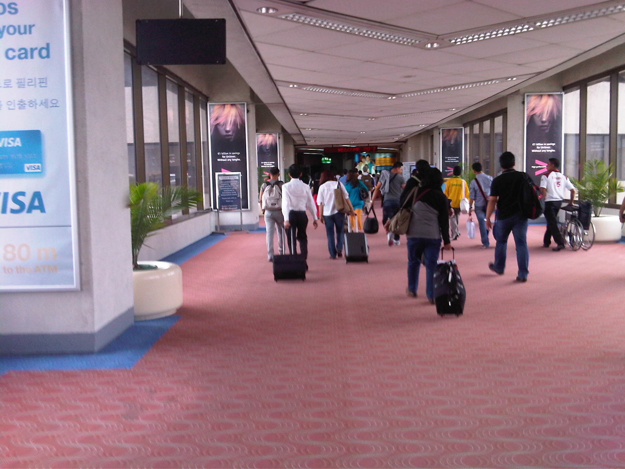 The corridors are spacious enough and the walk is not so long to require moving walkways or “walkalators.” There are staff and equipment at the end of the corridor scanning for indications of high body temperature usually associated with flu.
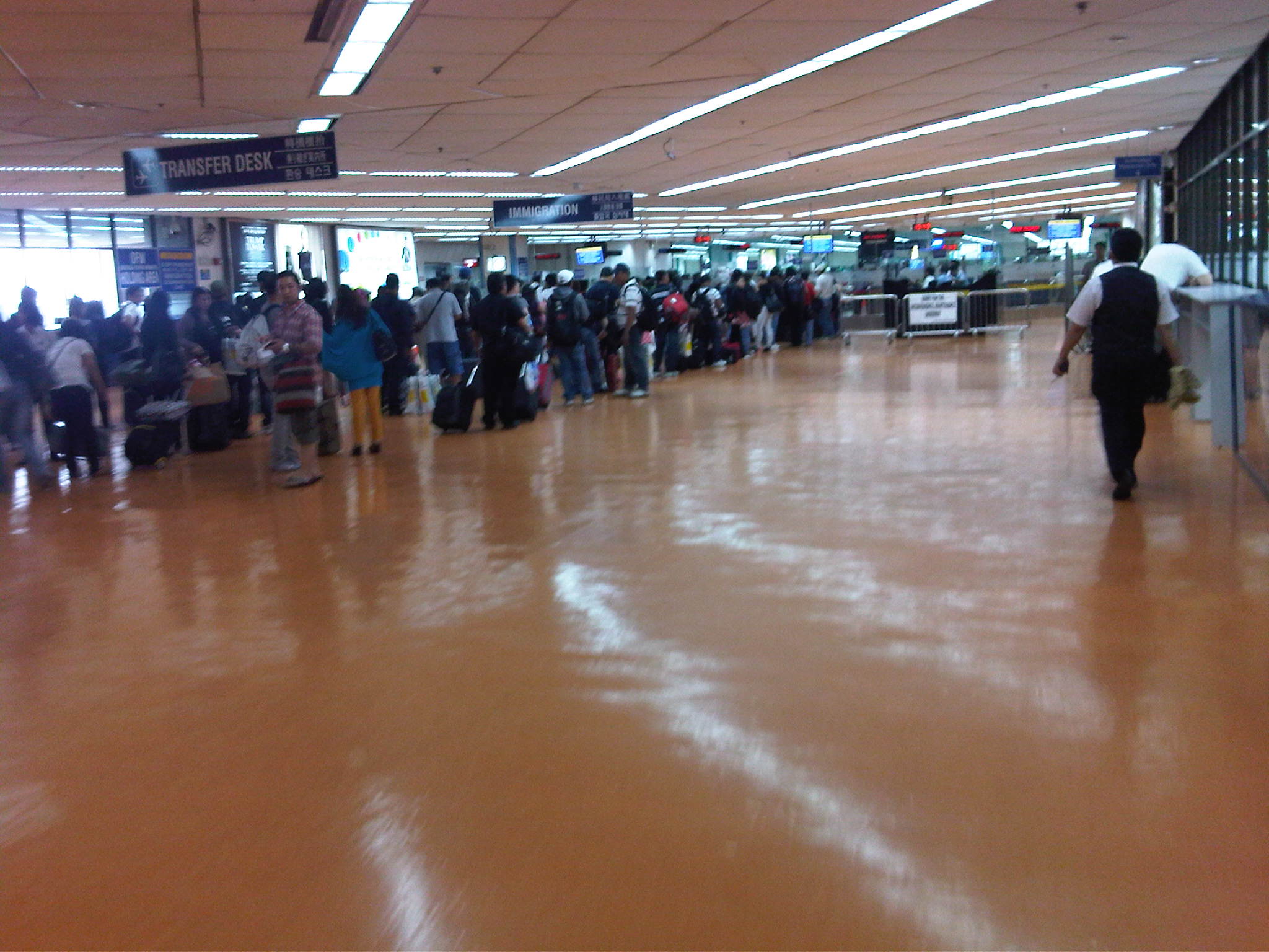 There are still long queues at the immigration counters despite additional booths and personnel posted at Terminal 1.
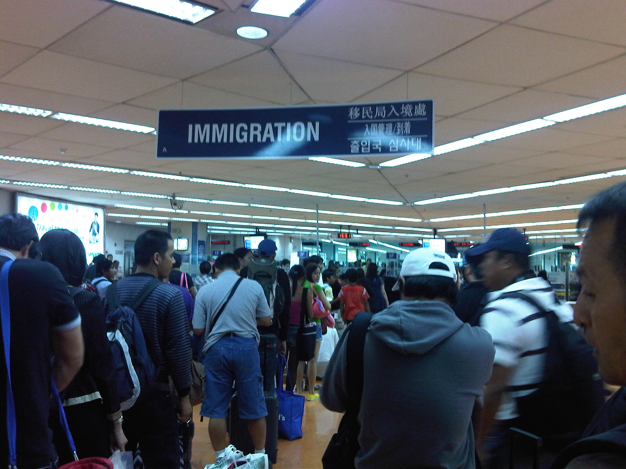 There are separate counters for Philippine passport holders and those bearing passports from other countries. Previously, there were special counters for Overseas Foreign Workers (OFW).
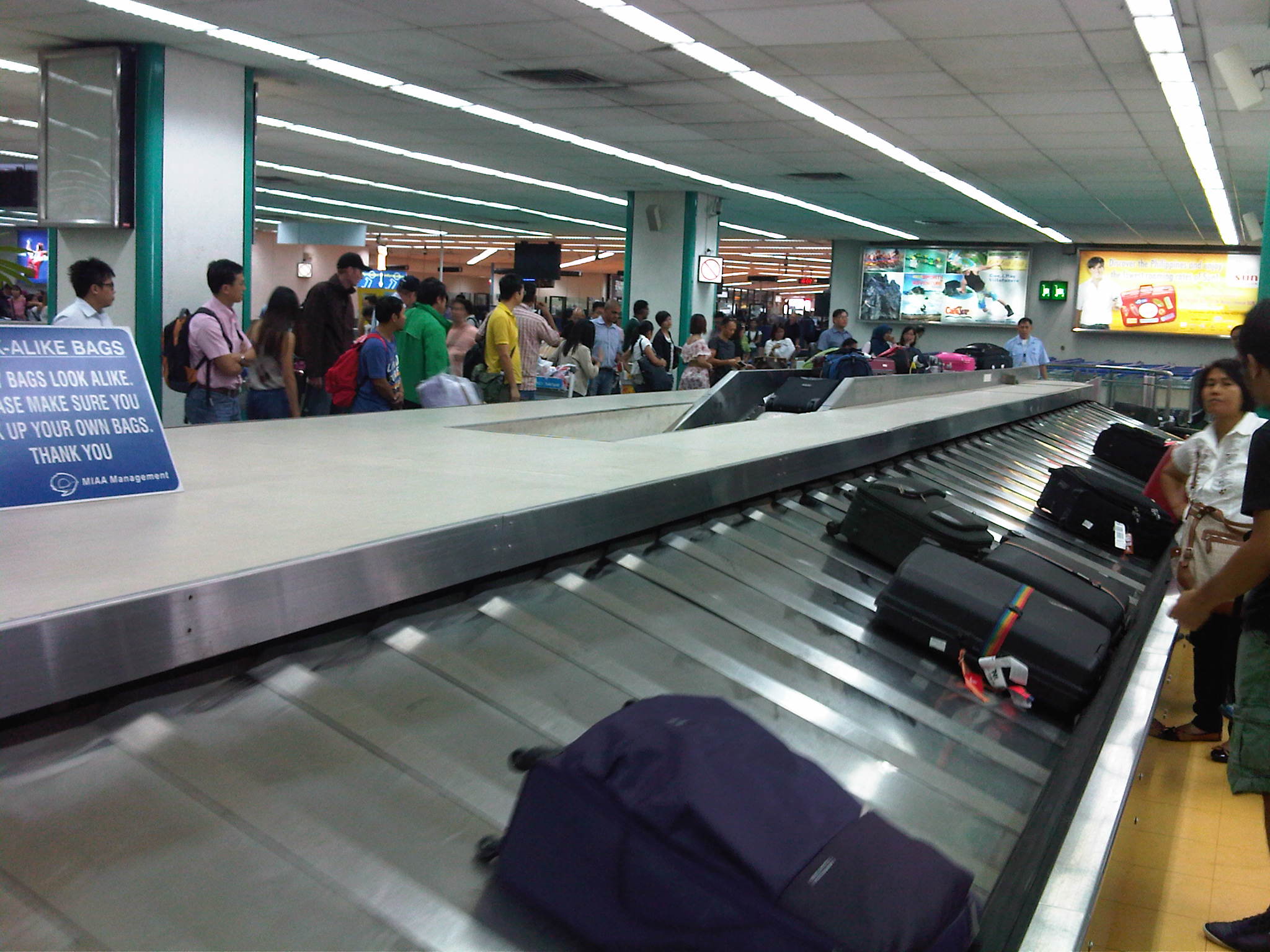 Checked-in luggage emerge and move along at the carousel for our flight.
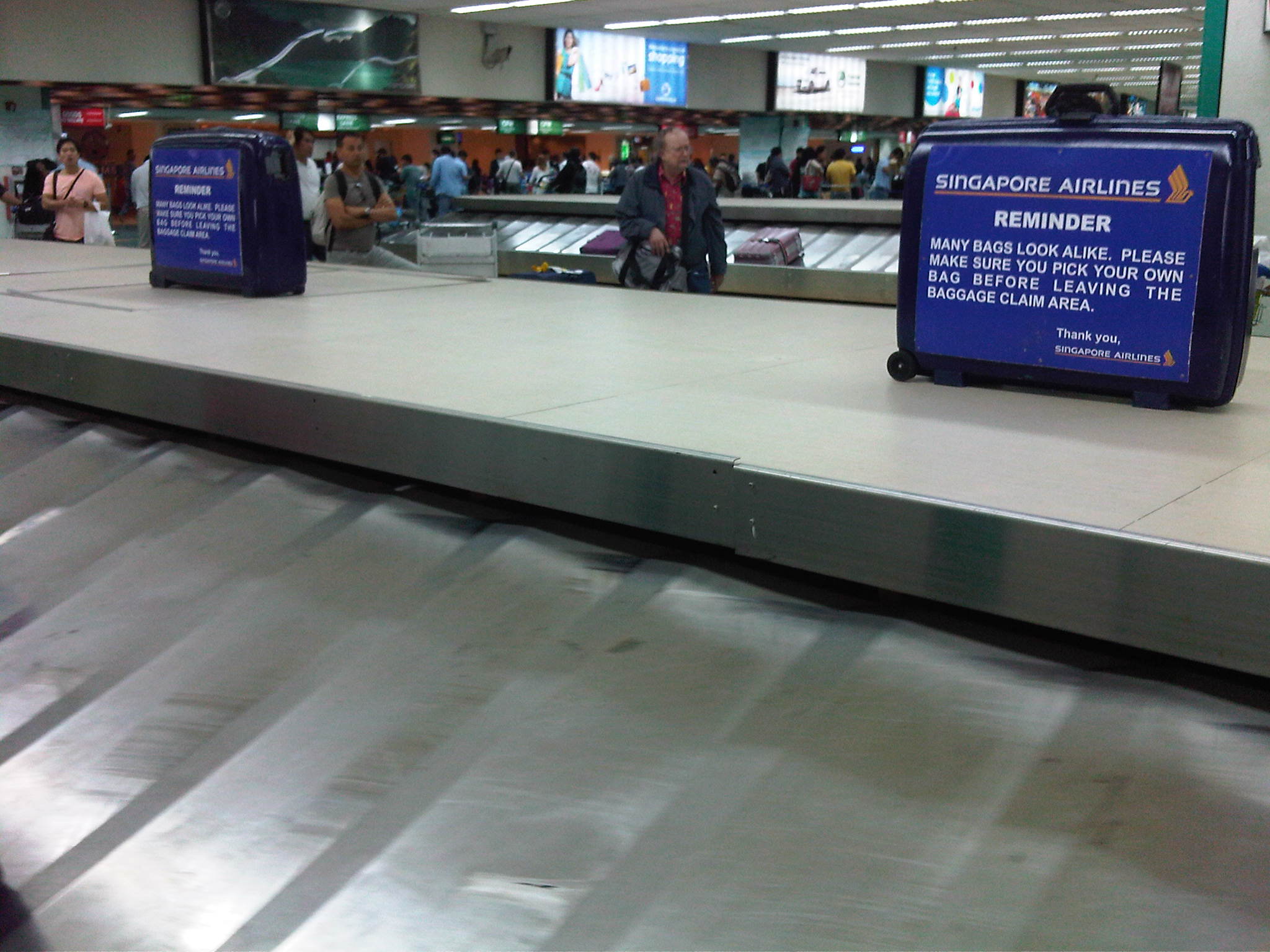 Singapore Airlines placed these signs on old luggage to caution passengers on picking up or identifying luggage from the carousel.
–
Flora at Changi Terminal 2
Changi Airport currently has four terminals including the Budget Terminal serving low-cost airliners particularly Tiger Airways and Cebu Pacific. Each terminal seem to have a unique design and collectively they are regarded as one of the best if not the best airport in the world. Terminal 2 has an indoor garden featuring orchids, ferns and palm trees.
I took a few photos of the plants at the Changi Airport Terminal 2 in Singapore. The orchids and other tropical plants provide a nice touch to the airport and seems to be an added attraction for visitors. I spotted a few tourists taking photos with the plants, particularly the orchids in the background. The orchids are endemic to Southeast Asia and I do remember some of them from my mother’s garden as well as others I’ve seen elsewhere including at the University.
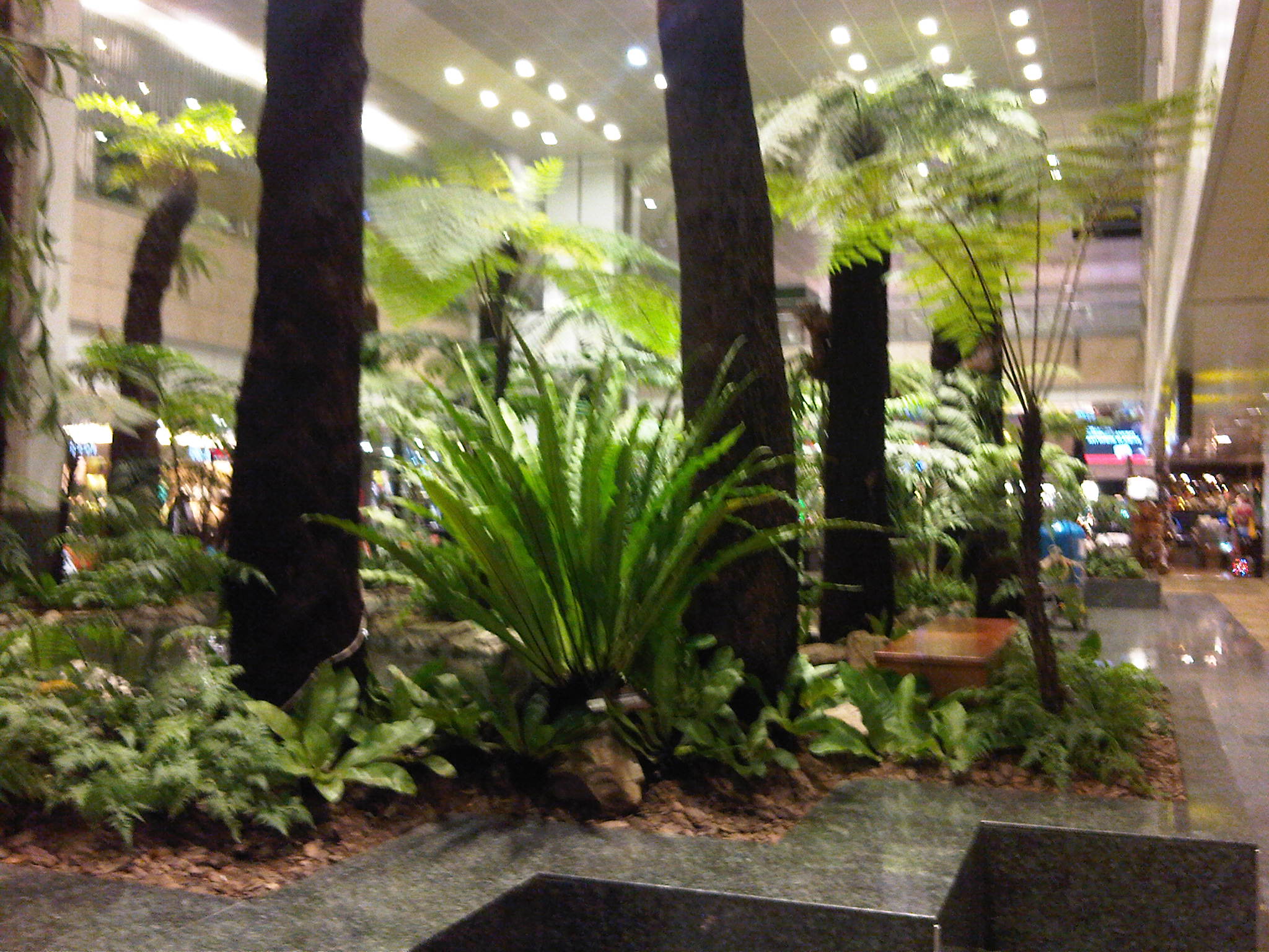 Ferns and palm trees in the middle of the airport
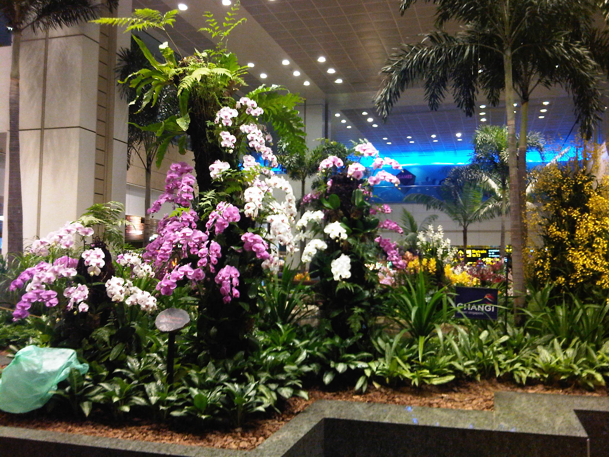 Orchids in full bloom – yes, they are all real and not made out of plastic or paper
 More orchids arranged among the palm trees and other flora in this indoor garden
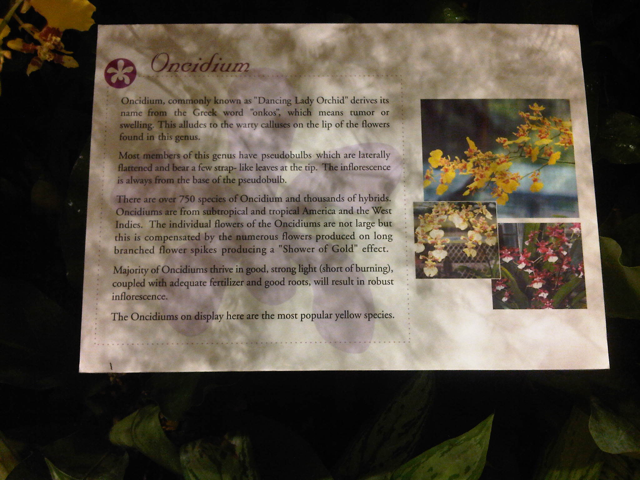 The airport also provided a description of each specie of the plants in the garden
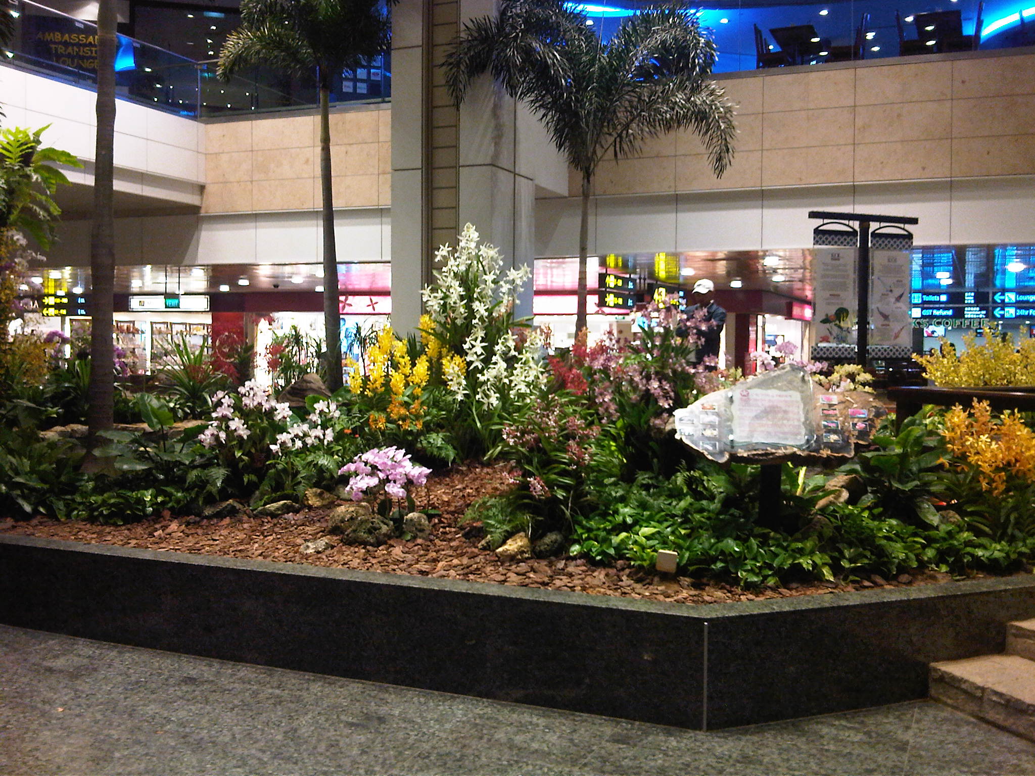 A garden full of flowers with the airport duty free shops in the background
 More of the “Dancing Lady” orchids at the garden
 Orchids of different colors help make the terminal “alive” and perhaps contribute to a more relaxed and pleasing environment indoors.
Perhaps Philippine airports should also consider having such gardens within the terminals to enhance the in-door environments. There are surely many plants and flowers that can be featured here including endemic ones like orchids, jasmine, and hibiscus varieties.
–
Professorial Chair 2012 presentations on Transportation
The Transportation Engineering Group of the Institute of Civil Engineering of the University of the Philippines Diliman held a special session for its Professorial Chair Lectures last August 10, 2012 at the Toyota Training Room of the National Center for Transportation Studies. Four lectures were delivered by ICE faculty members who are also Research and Extension Fellows at the NCTS. Following are a few photos taken during the colloquium.
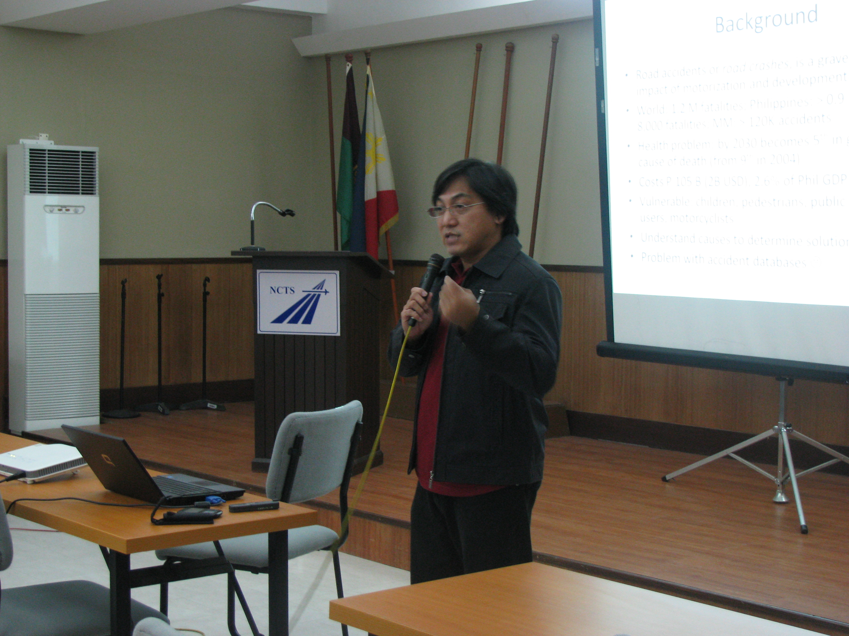 Dr. Sean Palmiano presenting on the Investigation of Road Crash Causal Factors in Metro Manila (DMCI Developers Professorial Chair)
 Dr. Karl Vergel presenting on the Design of Traffic Signal Timing and Traffic Impacts of the Re-Introduction of Traffic Signal Control at the Intersection of the University Avenue and Commonwealth Avenue (Maynilad Professorial Chair)
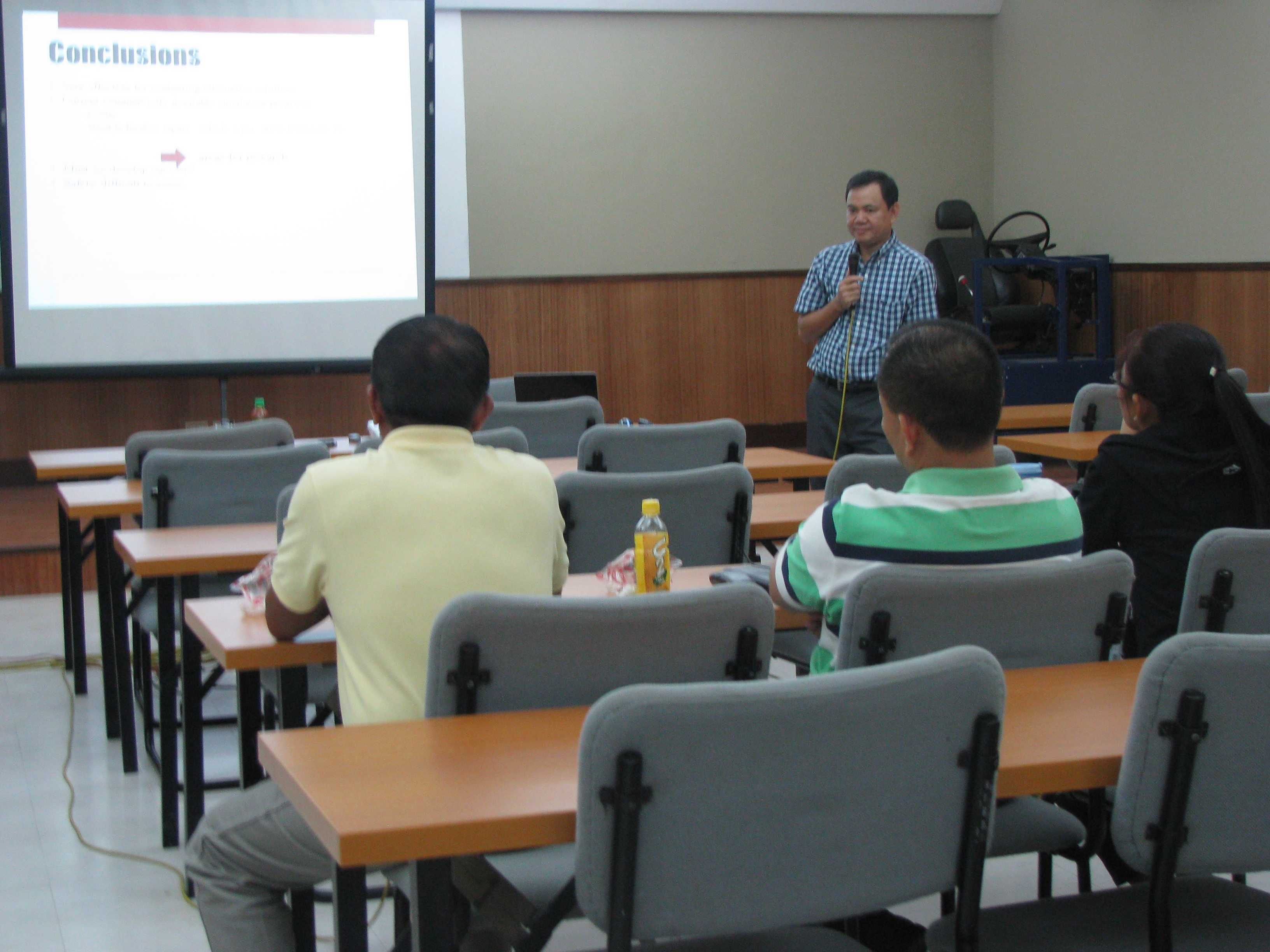 Dr. Ric Sigua presenting on Microscopic Simulation: A Tool for Evaluation of Traffic Schemes (Prof. Emeritus Norbert S. Vila Professorial Chair)
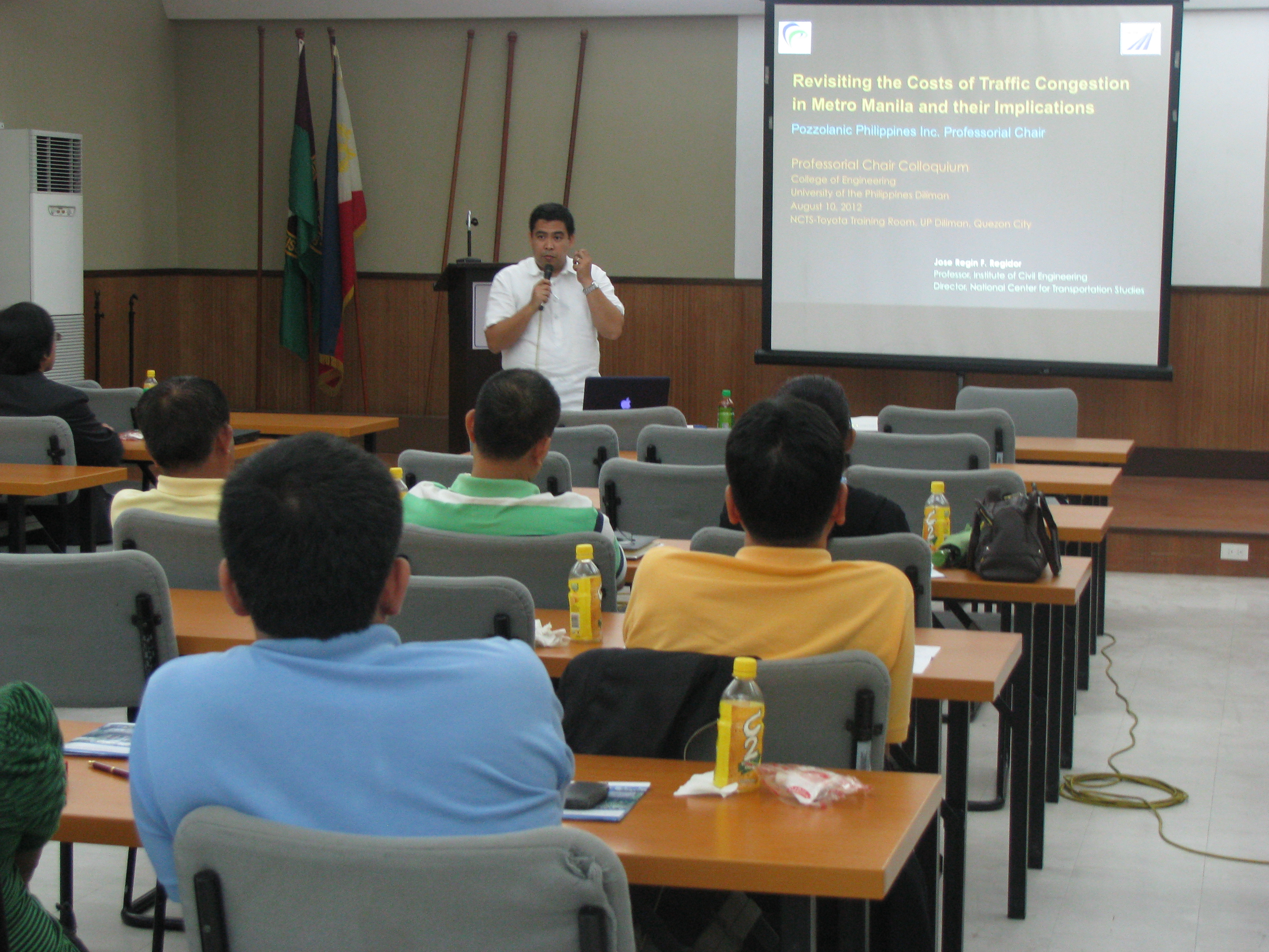 Dr. Regin Regidor presenting on Revisiting the Costs of Traffic Congestion in Metro Manila and their Implications (Pozzolanic Philippines, Inc. Professorial Chair)
 Audience consisting of various participants including those from the DPWH, DOTC and MMDA who were invited for the colloquium.
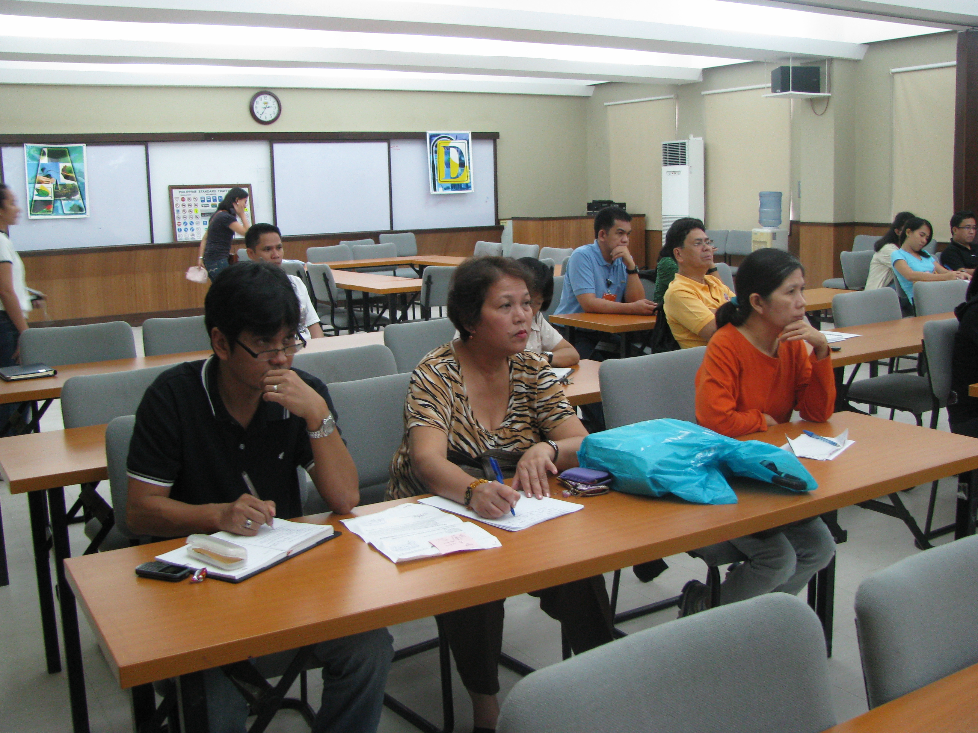 Graduate students and technical staff from the College of Engineering and the National Center for Transportation Studies also attended the lectures. Unfortunately, classes were suspended that week due to the monsoon rains that resulted in widespread flooding in Metro Manila so undergraduate students were not able to attend the colloquium.
The presentation files may be found in a previous post where links for downloading are provided. These may also be found in the NCTS website.
–
Update on the UP AGT Test Track construction
Visiting the site at the University of the Philippines Diliman (UPD) where a test track for the Department of Science and Technology’s (DOST) is currently being constructed, one wonders if this is a precursor of a transit system that might eventually replace the ubiquitous jeepneys plying several routes within the campus. There have been misleading stories about this “replacement” going around the internet and being passed on from one person to another. I am aware of both as I regularly see posts in some online discussion threads that make it appear as if the UP administration and DOST are in discussion for a mass transit system to replace the IKOT jeepneys. They are not in any such discussions that I am aware of considering I am a member of the UP Diliman Transportation Committee. Perhaps people are inspired by an existing system in Germany at the University of Dortmund. I caution the reader against making any sweeping conclusions as UP Diliman’s travel demand characteristics are quite different from that of the University of Dortmund’s.
I also get asked a lot about what will happen to the jeepneys once the “monorail” is operational. My response is always that nothing will happen to them because there simply won’t be a monorail. What is being constructed is the superstructure for the test track of an Automated Guideway Transit (AGT) prototype. Being a test track, its being operational means it can be used for research & development (R&D) for future systems (hopefully, homegrown) that can be constructed where they are needed and appropriate.
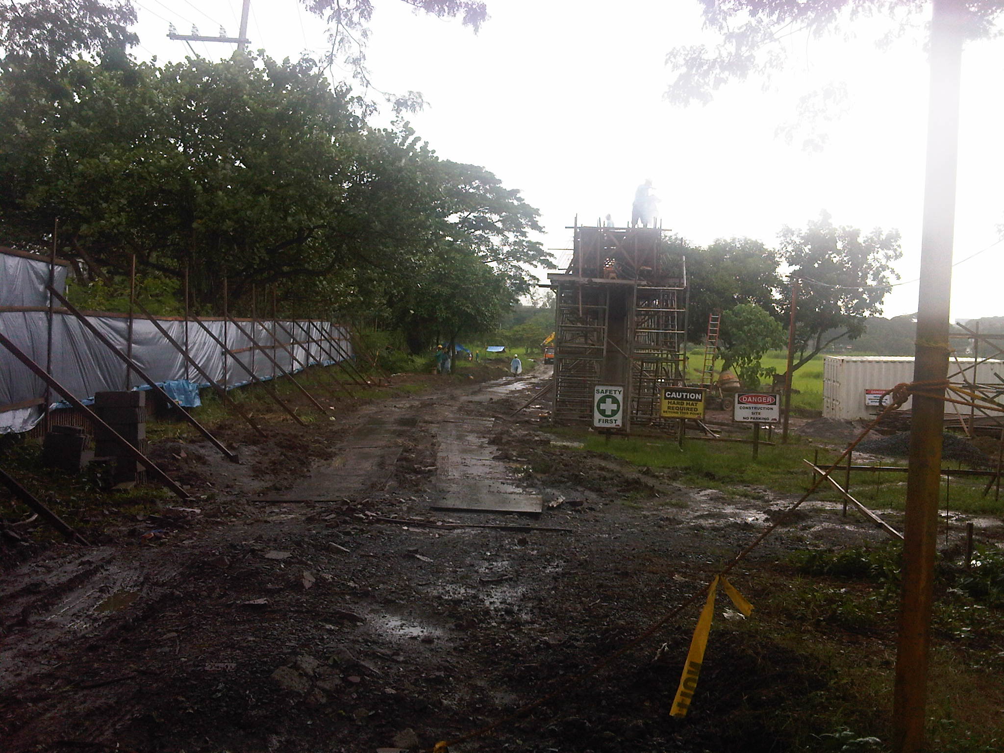 The site has been fenced off to minimize the appearance on-site of curious people (usiseros?). One such person even climbed a column to take photos of the construction work and posted these in the internet. As this is a construction site, such incidents are not supposed to happen mainly due to safety concerns.
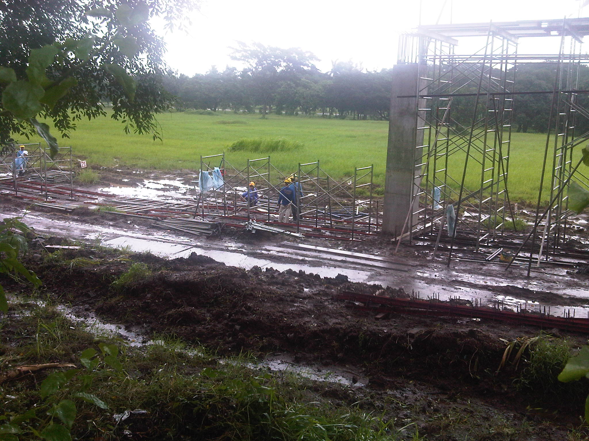 Construction work continues despite the wet weather. The week-long monsoon rains have rendered the ground muddy or mushy but workers are busy as if it were summer.
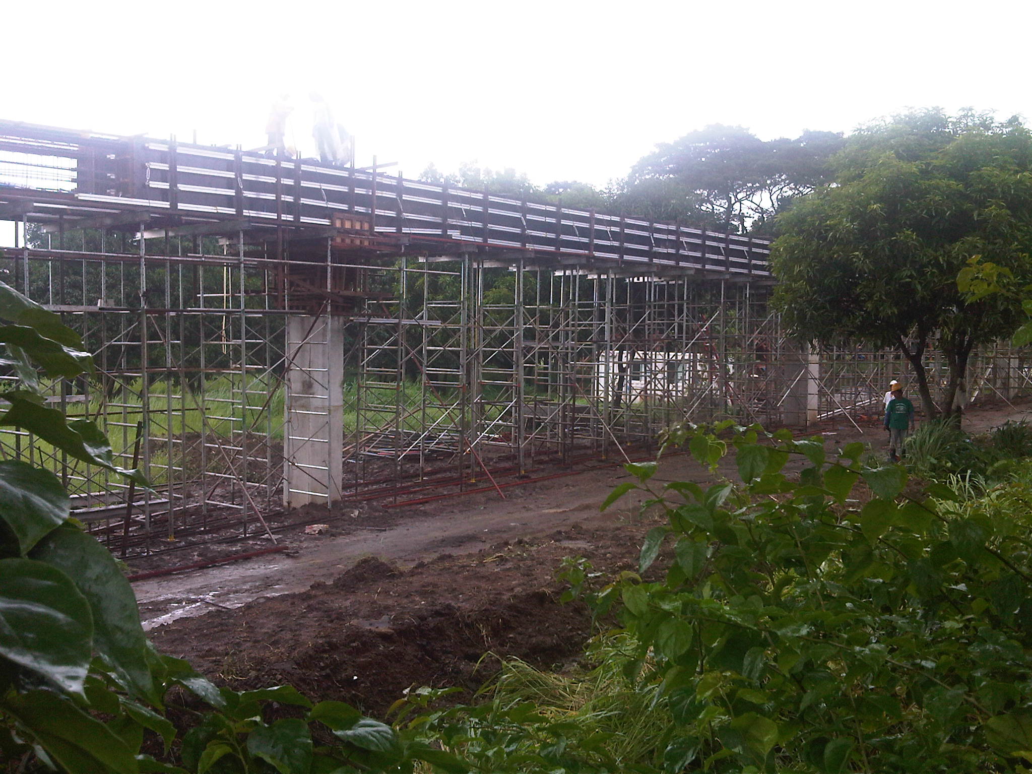 The columns for the elevated structure are all in place but in various stages of completion. Those along C.P. Garcia until the intersection with the University Avenue only have the reinforcing steel bars in place and awaiting the pouring of concrete.
 Construction materials are piled up on top of tarp-covered ground as workers take some time-out from their work.
The test track is supposed to be completed by October including the installation of power lines and a power station for the electric-powered vehicle. The DOST has also bidded out the assembly of the vehicle that will be used for the experiments. Hopefully, the vehicle will be ready by the time the test track is completed. It is expected that the AGT would have manned tests by late November or early December, in time for a demonstration before or on the day of UP Diliman’s Lantern Parade.
–

