
Roads to Naga City – Lucena and its bus terminal
The national highway to and from Lucena are generally in good condition and appear to be quite wide, wider than you usual national roads even within the city proper. This is perhaps due to the provision of paved shoulders usually with widths the same as the carriageway lanes. I was also quite surprised that even in populated areas, there are few encroachments along most segments. There are also fewer parked vehicles taking advantage of the availability of space along the roadside. In the city itself, most city roads are also narrow but most
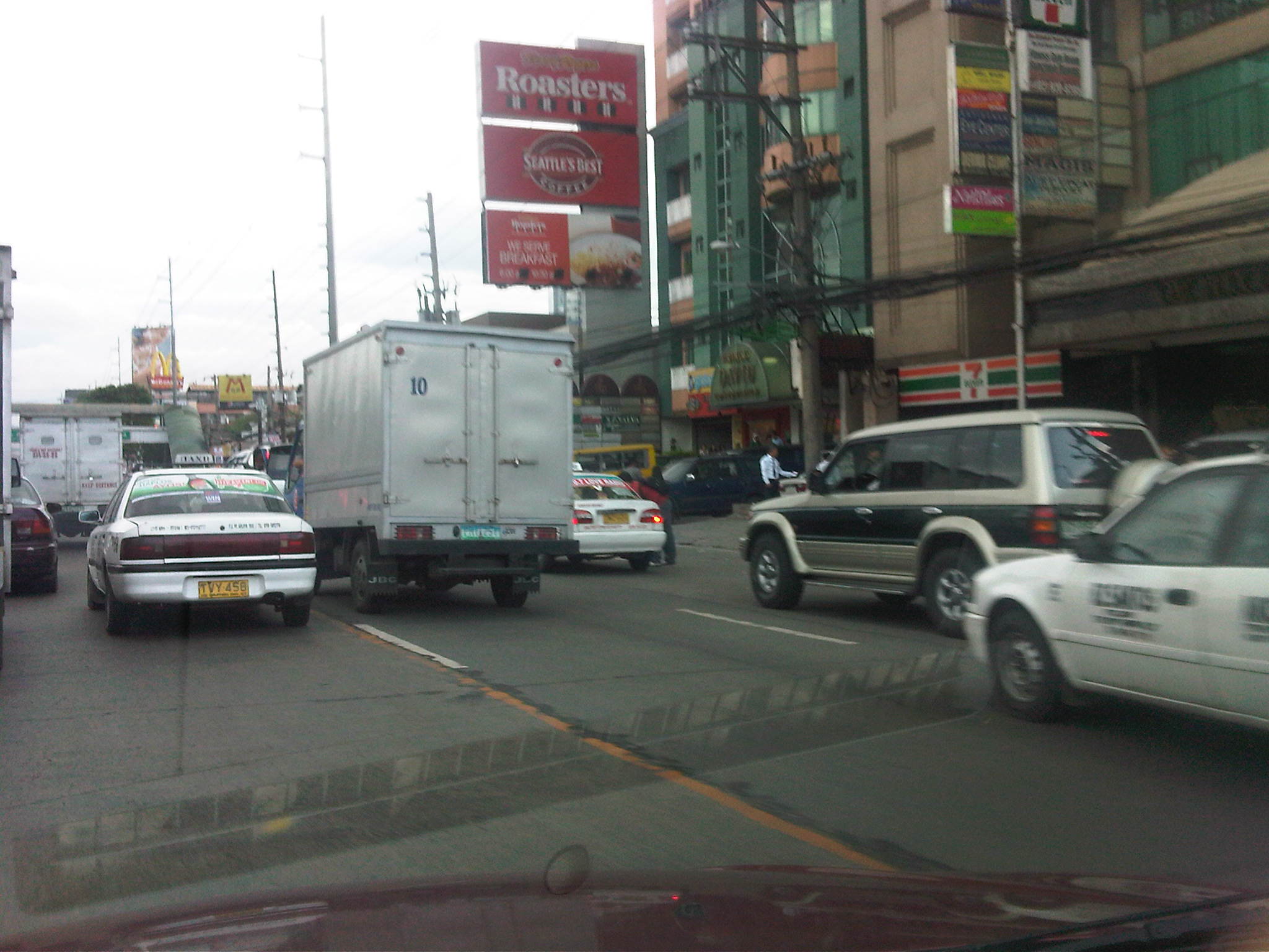
Upon reaching Lucena, we decided to make a stopover at the city’s central public transport terminal. The terminal, the largest in the province, is a very practical example of a centra facility that would allow for efficient services for travelers using various modes of transport including transfers among these modes. The terminal is located conveniently away from the city center and access roads are generous thereby minimizing the chance for congestion caused by public transport operations.

Typical highway section leading to Lucena from Tayabas – sections appear wide and there is generally little roadside friction due to few encroachments and parking.

Access roads to the public transport terminal are wide and there is low traffic even during peak periods. Mostly, traffic is comprised of buses, jeepneys and vans that also call on the terminal.

The terminal serves as a major stop for buses bound for Manila, towns in Quezon, the Bicol Region, and even those going to Mindanao via the eastern nautical highway. There is generous space for passengers and bus crews, including amenities such as toilets, stores, clinics, and eateries including some popular fast food restaurants.

Passengers and bus crews may wait at the benches or designated areas maintained by bus companies. The ample space can be perfect for some stretching after long rides.

Another view of the terminal with passengers loitering around.

The terminal serves jeepneys and vans that provide both local and long distance transport services. The photo above shows berths for jeepneys bound for Lucena city proper (left), and Pagbilao town (center). Travelers may also take vans bound for destinations in Laguna and Bicol.

The large terminal area also has more than enough space to serve as a general depot for many bus companies from where they can deploy their buses or where they can conduct maintenance checks or repairs.

Some internal roads are not maintained well and there are potholes on asphalt sections. Most internal roads are generally of good condition though there is a dearth in pavement markings and road signs.

Leaving Lucena, one is again greeted by generally good highways. My impression though, is that the quality of the road generally deteriorates as we travel further from the capital city. This, of course, is something that can be attributed to the DPWH district office in-charge of particular highway sections as well as the respective local governments (including the province) and especially congressmen who also have a say in the allocation and actual use of road funds.
Roads to Naga City – Tayabas
Tayabas was the former name of Quezon Province which was and is among the largest provinces in the country. Tayabas province was renamed to Quezon after its most famous son, the first President of the Commonwealth Republic when the country was under American rule. Eventually, the province was partitioned into two with towns forming the province of Aurora, which was named after Quezon’s better half. The former capitol of Tayabas was Unisan in the southern part of the province during the Spanish Period, with Tayabas becoming the capital during the American times. The capital is currently Lucena City, while the birthplace of Manuel Quezon, Baler, became capital of Aurora.
The highway sections from Lucban to Tayabas offers more of the same agricultural and forest scenes with the occasional human settlements along the road and often encroaching on the ROW. Because of the pleasant climate in these areas, flower farms may be found along the road.

Winding sections along the national highway include segments along the mountains with very narrow shoulders defined by open culverts for proper drainage.

There are many combinations of sag and crest vertical curves due to the terrain. The boundary between Lucban and Tayabas coincides with the well-defined vertical curves. Two structures (posts) located at either side of the road mark the boundary.

The national road goes through Tayabas and travelers would have to navigate their way inside the city. While there are directional signs, these are often lost among the visual noise of other signs.

A heritage house in Tayabas – being an old town, there are still many example of the bahay na bato, which were homes to the more prominent families in the Spanish and American Periods. These are very similar to structures in other old towns/cities such as Vigan, Manila, Cebu, Iloilo and Dapitan.

Streets in Tayabas are very much like the ones in Lucban with practically non-existent pedestrian facilities such as sidewalks and a propensity for on-street parking. Such effectively reduces the capacity of road but one-way streets are common in Tayabas, thereby compensating for this issue.

I am always intrigued by this old church along the national highway as you exit Tayabas city proper that looks like its shut and appears to be abandoned. I still don’t know what happened to the church and I’m aware of cases where places of worship such as churches are closed because of acts of desecration. In a way, it is supposed to be a form of punishment for the community for allowing such desecration to happen and the result is that penance, in part, is accomplished by instead going to church in the next town. In the older times, the next town would be quite far considering there were no modern roads or motor vehicles.

Long stretch of highway leading to Lucena – once the traveler leaves Tayabas city proper, he is again greeted with long stretches of road, mostly level rather than on rolling terrain. The highway sections are mostly excellent with pavements in condition and standard signs and markings. In populated areas, signs are often obscured by structures built or placed along the roadside.
Roads to Naga City – Lucban
The journey to Naga City via the eastern corridor from Quezon City to Rizal and the eastern towns of Laguna eventually led us to Quezon. For this post, I will feature mainly photos of roads in Lucban and will reserve shots of Tayabas, Lucena and the coastal roads of southeastern Quezon in future posts.
 Arch welcoming travelers to Lucban – the structure is quite simple compared to other arches I’ve seen along national roads. The section from Luisiana to Lucban also features good pavement complemented by standard signs and markings. The scenery is also nice with the highway being tree-lined and you can open you windows to take a breath of cool fresh air.
 Section leading to Lucban town proper has a good view of Mt. Banahaw. The mountain is famous for its mystical reputation. It is also well-known for being the headquarters of the New People’s Army’s Banahaw command.
 Another view of Mt. Banahaw from the national highway with a view of the countryside. Most towns along this stretch of the national highway are dependent on agriculture.
 This narrow street is actually part of the national road that’s well within Lucban town proper. There are no sidewalks, much on-street parking. and tricycles and motorcycles actively mingling with through traffic. Notice the bus already encroaching upon the lane for opposing traffic. Note, too, the two pedestrians (one is a child) walking along the carriageway with a tricycle right behind them.
 Narrow side street – Lucban is an old town and has many narrow streets that has changed very little in the past years. Since there are no significant traffic and a few have garages, many vehicles are just parked along the roads.
 Another side street in Lucban town leading to the old church and plaza. The town is structured similar to most old towns around the Philippines, with the center being the plaza that is surrounded by the church, the municipal hall and the marketplace.
 Close call – as if to demonstrate just how narrow the national road was, a truck and bus squeeze slowly past each other.
 After exiting the town proper, the traveler is again treated to rural scenes like farmers on horseback. While roads are generally of good condition, shoulders are practically just clear spaces along the roadside. Often, there are structures such as houses encroaching upon the ROW.

Many road sections between Lucban and Tayabas are on rolling terrain. This necessitates combinations of horizontal and vertical curves that can be quite hazardous to speeding motorists. Note that there are no shoulders and signs are usually lacking or obscured.
Next: Tayabas
Traffic going bananas
I’ve written about land use and parking along Katipunan Avenue, which is part of Metro Manila’s Circumferential Road 5. Katipunan extends southwards to Blue Ridge, St. Ignatius and White Plains (the latter subdivisions just across the street from Camp Aguinaldo) where there are also many establishments along either side of the road. Most of these establishments are restaurants that attract significant private vehicle traffic. Note that there are no public transport routes along Katipunan/C5 in the Blue Ridge, St. Ignatius and White Plains areas. As such, establishments are more likely to attract people with cars rather than those taking public utility vehicles.
Many of these establishments are on lots formerly occupied by residential buildings (i.e., houses) considering the predominant land use in the areas. These were eventually purchased and converted for commercial use, resulting in layouts that generally do not include adequate parking spaces. The consequence of shortcomings in parking have been the propensity for on-street parking such as shown in the following photo in the Blue Ridge area.
 On-street parking for a popular restaurant/cafe along Katipunan/C5 at Blue Ridge.
Such case and many others like it along Katipunan (and other Metro Manila or Philippine cities roads) are the result of both poor planning and lax enforcement of traffic rules and regulations in this country. Being a primary arterial, Katipunan/C5 should be clear of such unnecessary sources of roadside friction that effectively decreases road capacities while also increasing the risk of crashes as vehicles maneuver, or in some cases wrestle, for parking spaces.
Roadway subject to flooding
The outbound approach to the bridge along Marcos Highway was quite congested this morning due to the closure of the underpass leading to C5 located just in front of SM City Marikina. The section was closed to traffic due to flooding caused by Typhoon Pedring (International name: Nesat). Pedring’s rains caused the Marikina River to swell up and inundate significant areas along its banks including what looked like the lower level parking area of the mall. Traffic bound for C5 from Marikina, Pasig and the towns of Rizal had to be diverted to the Riverbanks road via the service road after the bridge. The result was traffic congestion as 6 lanes of traffic tried to squeeze into what was effectively 4 lanes of bridge including the bypass structure fronting SM that eventually merges into 3 lanes of road on the other end.
Following are a few photos I took while en route to the office this morning:

A gate bars access to the underpass connecting to a bridge leading to C5. The sign on the right states: “Roadway subject to FLOODING,” and is a permanent sign placed there to condition the mind of travelers about what may happen should there be inclement weather. This is supposed to be an example of a design where there’s no choice but to sacrifice according to the character of the area. Still, the question on many people’s minds probably is why were other designs that won’t be subject to flooding considered in the first place? Such would surely be worth it considering the frequency our climate and the probability of flooding?

Mud and muddy water on the underpass as seen from the bridge. Such is a scene reminiscent of the aftermath of Ondoy (International name: Ketsana) in 2009, exactly 2 years ago to the day.
 A peek into SM Marikina’s lower level environs show thick mud that settled on the service road and the mall’s lower parking area. The mall’s design already factored the anticipation of floods brought about by the swelling of the river during powerful typhoons such as Pedring and Ondoy. The mall was, after all, constructed on the flood plain, which is an unusual and uncommon location for such developments.

Garbage comprising mainly of plastic trapped on the SM screen fence. These were part of the flotsam and jetsam from the Marikina River. Such debris are evidence of the state of waste disposal and mismanagement in areas along the Marikina River. It is clear that people still have not learned from past experiences and government is partly to blame for this, particularly at the local level.
Roads to Naga City – Laguna
In the previous post, I showed photos of road sections in Rizal I took during a trip to Naga City. This is a continuation but this time featuring sections of roads in Laguna. There are only a few photos I took of Laguna roads during our trip to Naga as I have taken many others before during other trips including seminars in Caliraya and projects in Quezon. Following are a few pictures:
 Many sections in Laguna Province also have standard signs and markings but many signs are obscured by foliage and in this photo, banderitas from a past fiesta. Many sections along populated areas do not have shoulders mainly due to encroachment upon the road right of way.
 Gigantic pipes leading to the turbines of the Kalayaan Hydro Electric Power Plant – the national highway passes through a section where on one side you have a view of the power plant below and on the other are pipes feeding water from the reservoir above where the elevation produces head for the generation of power downstream.
 From the national road, one can get a nice view of Laguna De Bai. In some areas, however, the piles of garbage from makeshift dump sites are quite visible and presents the traveler with the sad state of waste management in coastal towns of the province.
 Many sections of national roads in the eastern part of Laguna have excellent pavements with asphalt providing a smooth, comfortable ride. These also have good drainage though I am not sure about lighting/illumination since I have not had the chance to travel along these road at night.
 Mountain sections though often do not have shoulders where vehicles may go to in cases of emergencies like breakdowns. Despite some steep sections where heavy vehicles like trucks and buses may slow down, there are no auxiliary or climbing lanes to allow for passing.
Next: Roads in Quezon
Roads to Naga City – via Rizal Province
A little more than two years ago before the onslaught of Ondoy (Ketsana), I had the opportunity of going to Naga City, Camarines Sur to talk before students of Civil Engineering in a regional conference. I took that opportunity for a road trip that allowed me to take photos of roads along a route that took us from Quezon City to Naga via Antipolo, Tanay, and other towns of Rizal. We proceeded through Pakil, Paete, Lumban and other towns of Laguna, as well as Luisiana, Lucban, Tayabas, Lucena and other towns of Quezon. We also took the zigzag roads of Quezon and Camarines Norte including the “Tatlong M” and “Bitukang Manok.”
Following are photos I took on the way to Naga City starting with a few along roads in the Province of Rizal.

Jeepneys and tricycles remain the most common modes of transport along highways although the latter are supposed to be banned from using national roads. Most national roads pass through towns so it is somewhat inevitable for tricycles to used them. Adding to the problem is the fact that most national roads do not have shoulders or space where tricycles or pedicabs (non-motorized version of tricycles) can pull off from the road to let traffic through.

Like most highways in the Philippines, arches greet and say farewell to travelers as they cross town boundaries. Above is a simple arch at Morong, Rizal.

Chevrons along curve section – most Rizal roads have standard signs and road markings. As far as I could remember, these were adequate rather than excessive. The DPWH only needs to maintain these and make sure signs are not vandalized or stolen (Yes, there are cases where they are taken as trophies!), or obstructed by flora.

Most road sections have good quality pavement complete with markings signs and barriers where applicable. This tree lined section is somewhere along the road from Tanay to Baras.

These roads often provide good sight distance allowing for drivers to ascertain whether they can successfully pass a slower moving vehicle. Despite the straight, level section in the photo above, however, pavement markings indicate a restriction for overtaking or passing. This is perhaps the result of road crash experience in the area. Note that such straight, level sections may have a negative effect on drivers as they may actually encourage speeding. The problem, of course, is how to enforce such regulations as indicated by pavement markings. Double yellows are strictly enforced in other countries where highway patrol are deployed strategically to enforce the rule and help curb the potential and actual crashes.

Bridges also have standard signs and markings. This one taken at the approach to a bridge in Tanay.

Many roads are used as solar dryers for products such as rice (palay not bigas), fish, and sticks (for barbecue, fishballs, etc.). While tolerated for highways with very low traffic, these are always hazards and often take up significant road space like what is shown in the photo above. A better set-up is found in other areas where shoulders are also paved and these are where farmers or fishermen lay out their products to dry rather than along the carriageway.
Next: Roads in Laguna
Bus involvement in road crashes
The LTFRB recently release lists of bus companies that are in the top ten . Versions of the list may be found in this article from the Philippine Daily Inquirer, The Manila Times, and The Philippine Star.
From the Inquirer:
“…The list is broken down into three categories—number of deaths, injuries and property damage—and is based on accident reports submitted by all public utility buses to the LTFRB. The lists published by the LTFRB cover the whole of 2010 and the first half of 2011.
Lists of the 10 most dangerous bus operators in Metro Manila:
Based on the number of deaths (passengers and bus personnel)
1. Admiral Transport
2. Nova Auto Transport
3. JAM Liner
4. Gassat Express
5. Joyselle Express
6. Philippine Corinthian Liner
7. Rainbow Express Inc.
8. Alberto Garating
9. Alps the Bus
10. EM Transit ServiceBased on the number of injured (passengers and bus personnel)
1. Admiral Transport
2. Nova Auto Transport
3. AM Liner
4. Gassat Express
5. Joyselle Express
6. Miami Transport
7. Pascual Liner
8. Philippine Corinthian Liner
9. Rainbow Express Inc.
10. CEM Transit ServiceBased on damage to property
1. Don Mariano Transit
2. Nova Auto Transport
3. Gassat Express
4. Miami Transport
5. Pascual Liner
6. Rainbow Express Inc.
7. Ropal Transport
8. A&B Liner
9. GELL Transport
10. CEM Transit Service”
The above are generally companies plying routes in Metro Manila. Meanwhile, the list mentioned in another article, this time from the Manila Times, identifies provincial bus companies that frequently got involved in road crashes:
“…Topping the LTFRB list is the Victory Liner, Inc. plying routes from Manila to Isabela, Bataan, Zambales and Benguet with 31 accidents from 2009 to 2011; 15 drivers died from these accidents.
Second-placing Vallacar Transit Corporation had 26 accidents resulting in the death of six of its drivers. Silver Shuttle and Tours, Inc. is third with 24 accidents and 5 driver deaths
Fourth in the list, United Land Transit and Bus Company has routes from Quezon, Leyte and Samar with 18 cases of accidents killing four of its drivers.
Philtranco came in fifth with routes from Luzon and Visayas with 15 accidents and three driver deaths followed by the Five Star Bus Company Inc. and Valisno Express that has 14 road accidents each…”
While the reports above mention few statistics, there are actually more detailed information with the LTFRB. Such data have been demanded from them by Congressional committees “investigating” public transport franchising. In one meeting the LTFRB mentioned that it is coordinating with the MMDA in compiling the number of traffic violations for each bus company based on the MMDA’s records. Their preliminary results have shown that bus companies have been involved in thousands of violations! Perhaps these should be proof of the aggressiveness or recklessness of drivers in general? And I dare ask if these can be used to weed out public transport drivers who should have no right conveying the general public?
I just wonder what would be the statistics for PUJs, tricycles, trucks and private vehicles. These would be interesting to analyze in order for us to formulate better strategies and tactics for curbing road crash incidence, fatalities and injuries.
UP’s official pronouncement on the proposed AGT
I wrote about the proposal for a transit system at UP Diliman in a couple of posts where in one I included a figure of what was being put forward as a possible route for a loop at the Diliman campus. In another post, I included photos of the test track that was constructed at the DOST compound in Bicutan and featured a prototype vehicle that was more of a “confidence builder” than a viable transit vehicle. In the posts, I already articulated that a transit system such as an AGT or a monorail would most likely be not viable for an area like UP Diliman considering the limited demand and the prospect of having high maintenance costs. These are aside from the issues pertaining to social acceptability and other impacts of such a system on the campus. Perhaps an AGT or a monorail would be feasible elsewhere like how they are currently being used in CBDs or airports, where the demand would be enough to at least allow for decent revenues.
I’ve read a few articles including one that appeared a few days ago where it seemed to me that the writers were not really knowledgeable of what was going to be the collaboration between UP and DOST in as far as the transit prototype was concerned. Articles have even gone to the extent of saying farewell to the Ikot jeepneys as the primary mode of public transport when going around the campus. All these are mostly theoretical at best considering that perhaps road-based transport is still the best option for UP Diliman. We only need to ensure that such transport will be of the environmentally sustainable kind.
Meanwhile, UP’s official statement regarding what will really be constructed at the Diliman campus may be found at the university’s website. It is clear from the statement that a test track will be built and that a prototype will be tested to determine whether local designs actually work. This perhaps will be the basis for determining whether the system can be replicated elsewhere, even considering the prospects of scaling up where such transit may be applicable. Studies will also be able to validate the costs of a system since it is being touted as something that should be less costly than other systems that are already in operation elsewhere (i.e., other countries). For what its worth, a locally developed, cost-effective system will be a welcome option for many Philippine cities that badly need a modern public transport system.
Katipunan parking predicament
Developments along Katipunan Avenue in Quezon City are good examples of fragmented land use and transport planning in Philippine cities. The developments, particularly the high rise condominiums have been the subject of much opposition from residents of subdivisions in the area as well as two major institutions of higher learning that have defined the stretch of Katipunan that has been developed in the 15 years. I mention 15 years because this is the period during which most of the high density developments along Katipunan have been constructed, apparently with the blessings of city hall. It is also in the last decade that schemes such as road widening and the U-turns were implemented.

On-street parking along Katipunan at lanes that used to be part of what was a west service road. In many cases, onstreet parking has been the result of a violation of a very basic provision of the National Building Code, which prescribes the minimum number of parking slots for establishments such as restaurants, shops, banks and offices. Despite being quite outdated and disconnected with more progressive parking generation principles, the NBC should have been a basis for the local government to assess whether minimum guidelines are satisfied, and perhaps impose penalties on those who are not able to comply such provisions. This is a fundamental case where individuals (owners of parked vehicles) impose external costs (e.g., congestion and crash risk) upon the general public.

Another look at onstreet parking just beneath the pedestrian overpass across from Ateneo’s Gate 2 – restaurants along Katipunan are major traffic generators and despite the presence of public transport (jeepneys and tricycles) a significant number of trips generated by these establishments use private vehicles including cars, vans and SUVs. Katipunan’s pedestrian facilities are inadequate as there are practically no sidewalks, thereby forcing people to walk along the road. This exposes many and particulrly students to risks like getting sideswiped by vehicles driven by reckless drivers.

Waiting vehicles effectively occupying 2 lanes of Katipunan – many employ drivers who can stay with the vehicles while the occupants eat, shop or transact at establishments. In most cases, standing vehicles are practically parked vehicles as they occupy road space. High-rise residential condominiums along Katipunan may have complied with minimum parking requirements stipulated in the NBC but their trip generation characteristics considering the commercial establishments located at the same buildings surely require many more parking spaces than what are available.

Congestion along Katipunan’s southbound side – may be caused by onstreet parking, standing (waiting), or vehicle maneuvers with respect to the limited parking slots fronting most establishments along the road. One tutorial center located near a U-turn slot, for example, generates significant vehicle traffic that it affects both U-turn and through traffic. Meanwhile, traffic enforcers seem either ineffective or helpless in their efforts to manage traffic, including preventing vehicles from taking 2 lanes of Katipunan.

Standing/waiting vehicles in front of a new development along Katipunan – the new building hosts several establishments including a major bank, a book shop, a popular gym, and several restaurants or cafes. Despite the potential for vehicle attraction, only a few parking spaces were provided, leaving all other vehicles and their drivers on their own to find parking spaces or just occupy road space in front of the building. The footbridge across Ateneo’s Gate 3 has been extended to the building but this obviously has marginal impact in reducing vehicle generation and parking demand.

Another photo showing the parking situation in front of the new building – while traffic is generally a manifestation of economic activity, one opinion is that many developers are irresponsible by designing buildings that have inadequate parking and resulting in the general public bearing the burden of traffic externalities. Add to this local governments that turn a blind eye on such discrepancies in design (who reviewed the design that obviously violated the building code?) only to be on the receiving end of complaints. In some cases, LGUs probably will be forced to shoulder costs of providing solutions that developers should have covered in the first place if they were responsible enough or made responsible for mitigating negative impacts of their projects.
In the end, it is inevitable that we need to address the root of the problem, which pertains to land use planning and the zoning policies LGUs are implementing. Consistency is one thing and being circumspect about established guidelines is another. Sustainable development, after all, does not pertain to continuous transformation from low to high density development but more about balancing elements that would preserve the character of neighborhoods and communities, particularly and most importantly to ensure that quality of life is not compromised.
