
On guerilla tactics in urbanism – guerilla crosswalks
I am sharing this article on guerilla crosswalks in the US. It is interesting as communities or groups concerned with road safety decided to put up interventions (in this case crosswalks) in order to address safety concerns pertaining to pedestrian ROW along roads. In most if not all countries, pedestrians are limited where they may cross and there are jaywalking laws and penalties that are now being regarded as car-centric policies that need to be revised to favor pedestrians more than motor vehicles.
Zipper, D. (December 1, 2022) “The Case for Guerrilla Crosswalks,” Bloomberg CityLab, https://www.bloomberg.com/news/articles/2022-12-01/when-crosswalks-go-rogue [Last accessed: 12/10/2022]
To quote from the article:
“Such acts of unsanctioned “tactical urbanism” are of a kin to many other DIY street interventions, such as pop-up bike lanes. But they are not without risks. Affluent communities could have more residents willing to volunteer time and resources, for example, even though pedestrian deaths are concentrated in low-income neighborhoods. “The locations identified by guerrilla crosswalk activists may or may not coincide with where the planners and engineers have identified as highest need,” said Sam Zimbabwe, the former director of Seattle DOT.
But in Los Angeles, the Crosswalk Collective spokesperson said that the group is “always mindful of who has access to safety installations and who doesn’t,” adding that all its crosswalks to date have been sited in low- and moderate-income neighborhoods of Central and East Los Angeles.
Zimbabwe also noted the limited benefits of paint on faster roads (which the Federal Highway Administration has documented): “Particularly on multilane arterials, only marking a crosswalk without deploying other tools does not address the ‘multiple threat’ problem, where one driver stops but the driver in another lane does not.“ (The Crosswalk Collective spokesperson agreed, saying that the group rejects proposed locations due to safety concerns “all the time.”)
But in the right setting, unauthorized street infrastructure additions can lead to one of two outcomes — and both are constructive. One possibility is that the city removes it, in which case media attention and resident backlash put pressure on local officials to be more responsive to safety requests. (That coverage may also compel more residents to join street safety groups).
The other option is that city officials take the hint and accept what residents have built. Eight years ago, Seattle transportation planner Dongho Chang won the enduring appreciation of local cyclists when he responded to a pop-up bike lane first by thanking activists for their passion, and then by making the bike lane permanent. Now working with the Washington State Department of Transportation, Chang does not share Seattle DOT’s rigid opposition to guerrilla crosswalks. “It would be good to acknowledge the effort that was done by the residents,” he said. “If there is a way to keep the crosswalk, it would be ideal to try to do that.”“
–
This is, of course, in the US where such tactical urbanism might be in vogue in certain cities and communities. Would such be allowed or encouraged in the Philippines? Actually, there are already many cases where tactical urbanism has been applied and usually at the community or barangay level. Prior to the DPWH putting in rumble strips at the approaches of schools, junctions and other locations perceived to be accident or crash prone, people have devised ways to slow down traffic in favor of pedestrian crossings. These include laying down old rubber tires cut and stretched to become humps. There are also barriers laid out to form something like an obstacle course; forcing vehicles to zig-zag instead of going straight along critical sections. These have allowed schoolchildren to cross safe in school zones and pedestrians crossing safely at intersections.
–
On intersection treatments for bicycles
With the increasing popularity of bicycles as a mode of transport particularly for commuting (e.g., bike-to-work, bike-to-school), we should be redesigning our intersections to include elements essential for the safety of all users, whether on motorized or non-motorized modes. Here is a short but very informative article on how a simple intersection treatment can significantly improve safety for everyone especially cyclists and pedestrians:
Grief, N. (December 2, 2022) “How Green Paint Can Save Cyclists’ Lives,” Bicycling.com, https://www.bicycling.com/news/a42124210/bike-boxes-intersections/ [Last accessed: 12/3/2022]
To quote from the article:
“A bike box, on the other hand, seems to be the ideal middle ground and the option of the three that these researchers recommend. Cyclists feel more comfortable when compared to the free-for-all of a mixing zone because they have a designated area to be and they’re out ahead of vehicles, but according to the eye movement analysis, they remain alert and watchful for vehicles.”
Here are a couple of drawings showing bike boxes at intersections from the recent Bike Lanes Master Plan for Metro Manila, Metro Cebu and Metro Davao that was developed by DOTr with assistance from the UNDP:
 Bike boxes on a typical three-leg intersection (DOTr and UNDP, 2022)
 Bike boxes on a typical four-leg intersection (DOTr and UNDP, 2022)
The preceding drawings adhere to the DPWH design guidelines that mainly follow AASHTO Guidelines. Of course, there are other design references such as NACTO and the manuals of other countries (e.g., Netherlands, Australia, Singapore, etc.) were the best practice designs can be adopted for local applications.
–
Departure via Mactan Cebu International Airport Terminal 2 – Part 1
The MCIA has two terminals with the newer Terminal 2 being lauded as one of the best designed terminals in the country. It has been recognized internationally, too. And this is mainly due to the architecture of the new terminal.
 Approach ramp to the departure level of MCIA Terminal 2
 Departure level driveway – the area looks spacious but you wonder how it is during the peak season.
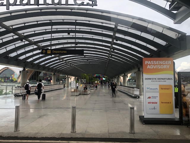 The view upon alighting from the vehicle that took us to the airport – note the advisory stating Cebu Pacific departures are via the old Terminal 1.
 The walkway leading to the terminal building is very spacious.
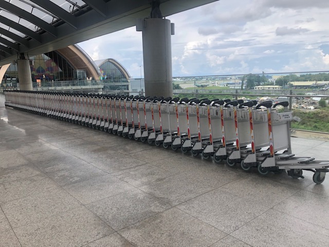 Passengers may use the baggage trolley for their convenience in hauling their luggage.
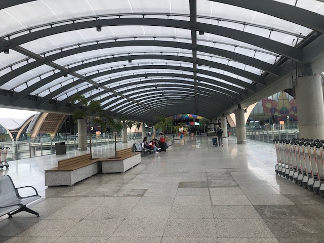 There are seats for travelers and their well-wishers.
 One of the kiosks along the corridor leading to the terminal building
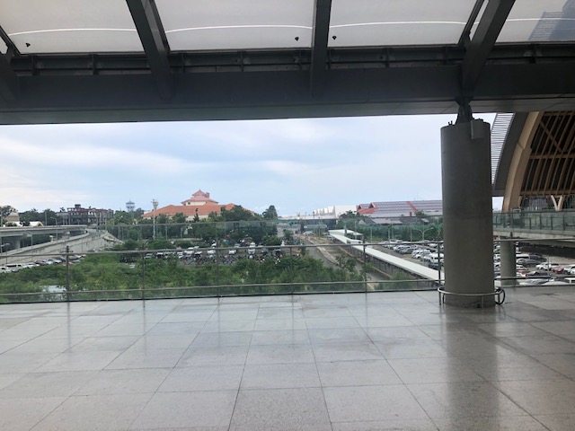 The view from the walkway shows the Waterfront Hotel with its tiled roofs and the older MCIA Terminal 1 building (at right in the photo).
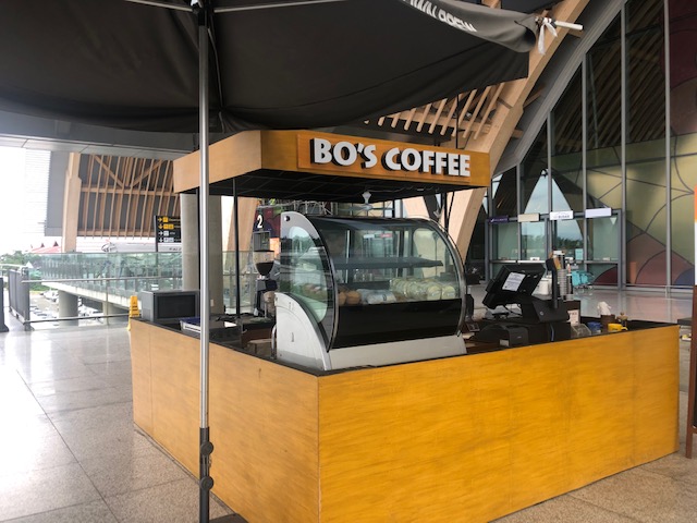 A local coffee shop operates out of one of the outdoor kiosks. These kiosks serve both travelers and well-wishers.
 Inside, a popular souvenir shop welcomes travelers.
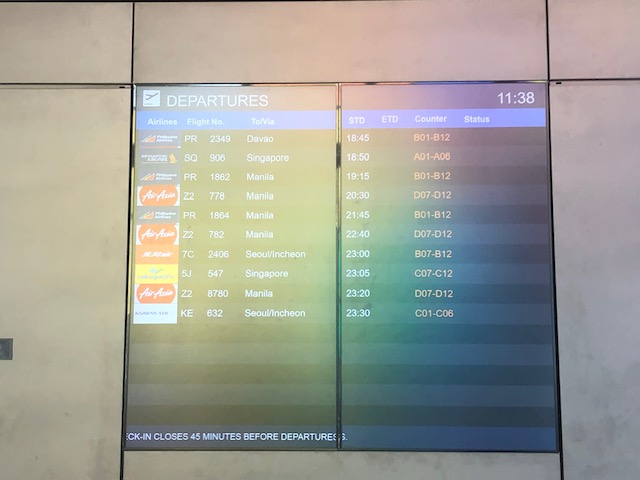 Schedule of departures are shown on one of the screens inside the terminal building.
 Info booths of some of the airlines using Terminal 2
 The Terminal 2 building offers very impressive architectural details.
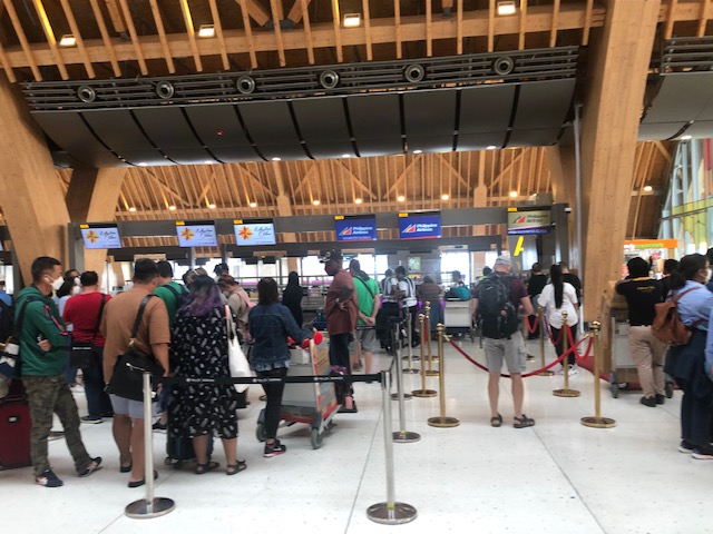 There were long lines not because the airport is crowded but because there were few check-in counters open. Even those who have checked-in online and were to drop-off their bags were not spared the queues.
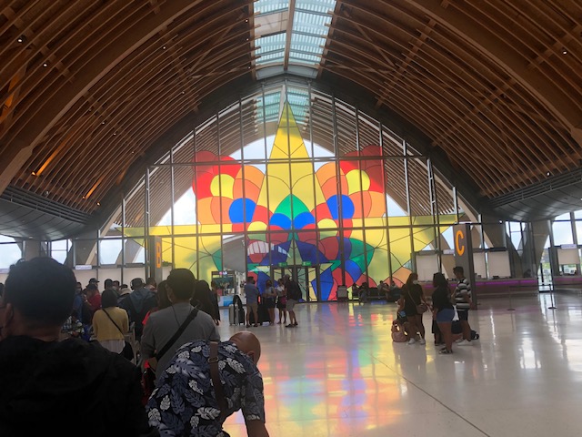 Stained glass windows featuring what appears to be a giant parol (Christmas lantern).
 A view of the other check-in counters at the spacious MCIA Terminal 2
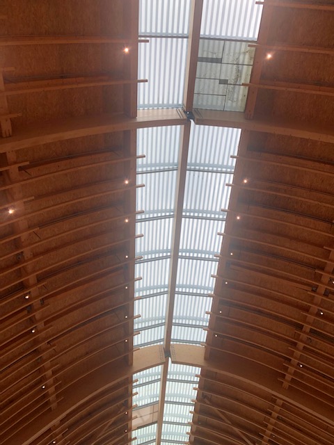 I took this photo of the ceiling to show the incorporation of natural lighting elements that allow for less power consumption for lighting particularly during daytime. This is one of the eco-friendly features of the building.
 Another view of the long queues for PAL after we finished checking-in.
 Airline service and information counters at the terminal – these are for Air Busan and Korean Air. An Air Busan plane figured in a crash recently when it overshot the runway upon landing at the MCIA in bad weather.
 Another view of the ceiling and roof
 Guidance for passengers are posted at the check-in counters. These include info on items that are not allowed in the check in bags, what are prohibited and will be seized at the airport, and what are allowed only in check in bags. The scale readout is working and can be seen on the counter. Typical luggage limit for domestic passengers range from 20 to 25kg depending on the airline.
Part 2 is coming soon!
–
Traffic and air quality
Along one of my commuting routes, I couldn’t help but take a photo of what lied ahead as our vehicle was crawling along Marcos Highway in Antipolo. The following photo pretty much captures the relationship between transportation and the environment; the latter in terms of air quality and the former in the form of our congested roads.
 Smoggy Metro Manila in the horizon as vehicles are crawl along Marcos Highway towards Masinag Junction
With traffic practically back or even worse than pre-pandemic levels, one cannot help but think about what could have been if government planned and executed during the time of the lockdowns in preparation for the eventual return to workplaces and schools by most people. The peak of the pandemic when total lockdowns were implemented was supposed to provide the opportunity to make the drastic changes required of transportation. You cannot find a better time for a reboot and yet here we are and again struggling with our daily commutes. We can just hope that other cities and municipalities will not go the way of Metro Manila.
–
On emergency vehicles, speeds and road widths
I recall an online discussion about how roads need to be wide to accommodate emergency vehicles such as fire trucks/engines, ambulances and police vehicles. There are also videos shared on social media about how, with wide roads, motorists could move their vehicles to the sides to give way to emergency vehicles. These are used to support the argument that we need wide roads and that speeding for emergency vehicles is justified because of their purpose. The following article attempts to make a counter-argument:
Lewis, M. (November 21, 2022) “Ambulances vs. Pedestrians,” Planetizen, https://www.planetizen.com/blogs/119785-ambulances-vs-pedestrians [Last accessed: 11/24/2022]
To quote from the article:
“the “emergency response” argument in favor of wide streets only makes sense if the risk of death from a too-slow ambulance outweighs the risk of death from a speeding car.”
Certainly, the data on road crashes due to speeding should support the perception that there’s a higher risk of death from speeding vehicles compared to the risk of dying in relation to the emergency that’s supposedly being responded to. And in our country, perhaps this counter-argument is valid considering the “wang-wang” type of emergency vehicles moving about.
–
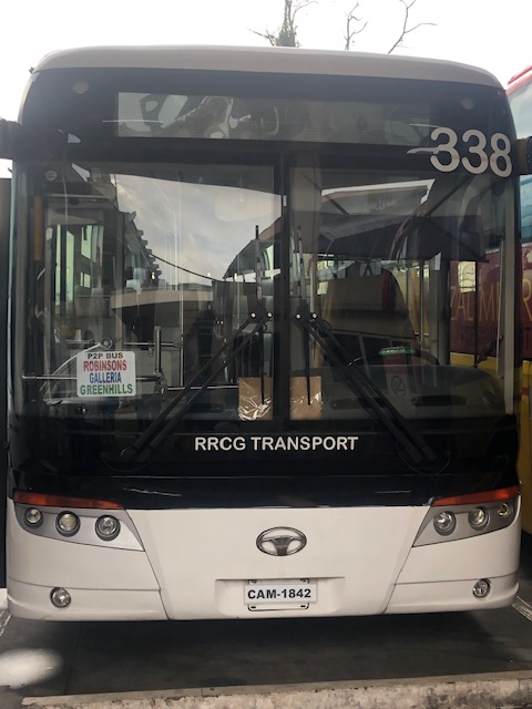
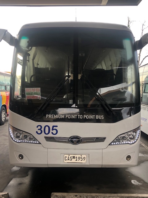
Commuting from/to Antipolo via the public transport terminal at Robinsons Antipolo
I was at the Robinsons Antipolo public transport terminal to take a P2P bus to Ortigas. I took a few photos before boarding the bus. The bus no longer terminates at Robinsons Galleria but instead goes to Greenhills. This is very convenient for people who need to go to Virra Mall or somewhere in its vicinity (e.g., Cardinal Santos Medical Center, LSGH, etc.).
Then there are the buses plying the Antipolo-Cubao route via Sumulong Highway-Marcos Highway-Aurora Boulevard. These are regular aircon buses (not P2P) operated by various companies including G-Liner, RRCG, Jayross, etc. Below are photos of Diamond Star buses loading passengers bound for Cubao.
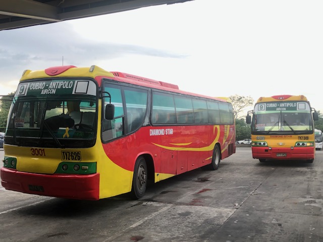
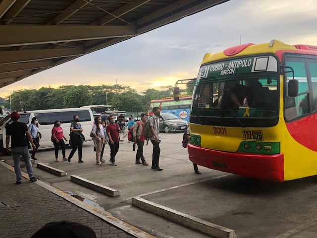
The lines can be very long depending on the time in the morning but I guess the assurance of a seat makes it worthwhile to go to the terminal rather than wait for the bus along its route. Passengers loads are practically back to pre-pandemic levels and with some jeepneys back, that means competition for the buses.
–
Old rail timetable to Antipolo
I found this on the internet – a timetable or schedule for trains bound for what are now destinations in Rizal (e.g., Antipolo, Taytay, San Mateo and Montalban). Pasig and Marikina used to be part of Rizal province with the capital at Pasig (thus, Kapitolyo).
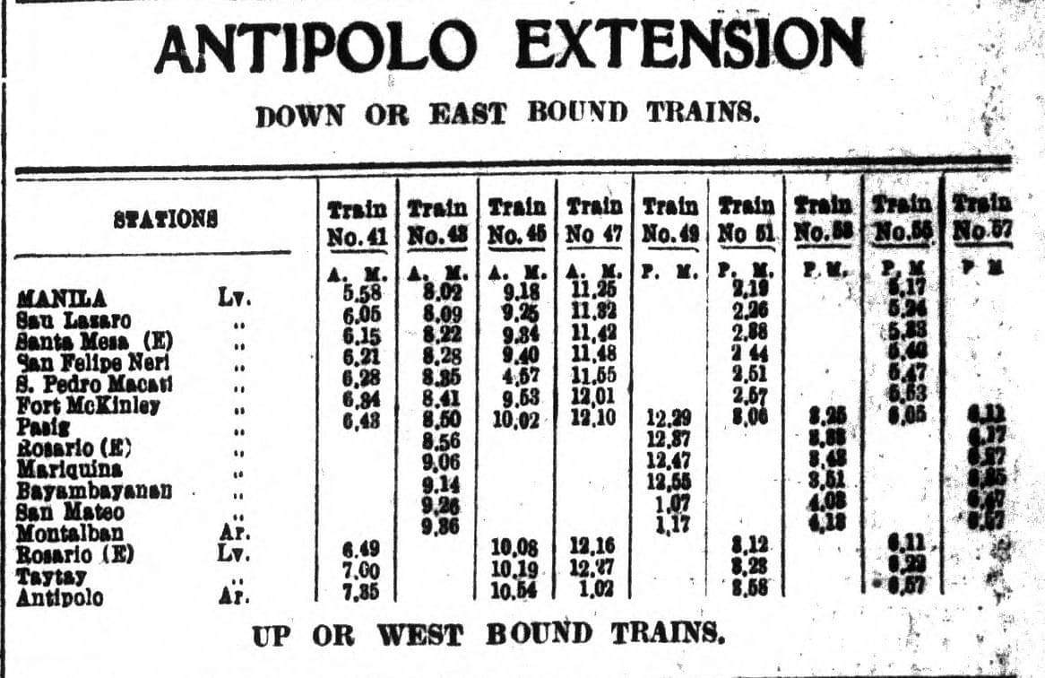
From the schedule, one can see that the main line was between Manila and Pasig (Rosario). From Rosarion, the line branched out towards either Antipolo or Montalban (now Rodriguez). Certain trains like Nos. 41, 45, 47, 51 and 56 terminated in Antipolo while others at Montalban. Again, one cannot help but wonder what if these lines were sustained and still operational (of course, upgraded) today. Commuting would have been different for many of us residing in Rizal and along these lines.
–
The return of carmaggedon and the illusion of low vehicle ownership
Traffic seems to be back to pre-pandemic levels in the Metro Manila and its adjacent provinces. You can experience this along major roads like Commonwealth Avenue, C-5 and yes, EDSA. The number of vehicles on the roads including motorcycles defy what is supposed to be low motor vehicle ownership in Metro Manila (as claimed by DOTr and JICA in the MUCEP report and echoed by groups who cite the report as if it is flawless).
 Intense traffic congestion along C5/Katipunan Avenue. The photo shows traffic on the C5/Katipunan flyover’s northbound side and towards the direction of Ateneo, Miriam and UP Diliman.
The reality appears to be that more households actually own motor vehicles and the inefficiencies and unattractiveness of public transport continues to convince people to take private transportation, including motorcycles, over public transport options. The inconvenient truth according to one senior transport expert is that while cycling has gained ground, the numbers are minuscule compared with those taking either private or public motorized transport. Yes, carmaggedon is back and looks here to stay for a while longer until the so-called game changers like the MM subway and Line 7 are operational. Will they change the commuting behavior or are these too late in as far as solutions are concerned?
–
What are closed and what are open at NAIA Terminal 3 – international wing
I was able to take a few photos around the pre-departure area of NAIA Terminal 3 before our flight got cancelled. The shops, restaurants and cafes are mostly open including the Duty Free Philippines shop, Bo’s Coffee, and a variety of souvenir shops and eateries in the area. In fact, you can see from the couple of photos I am sharing that practically the whole length of the international wing has a shop or restaurant/eatery on one side. The other side would be the boarding gates and seats for departing passengers.
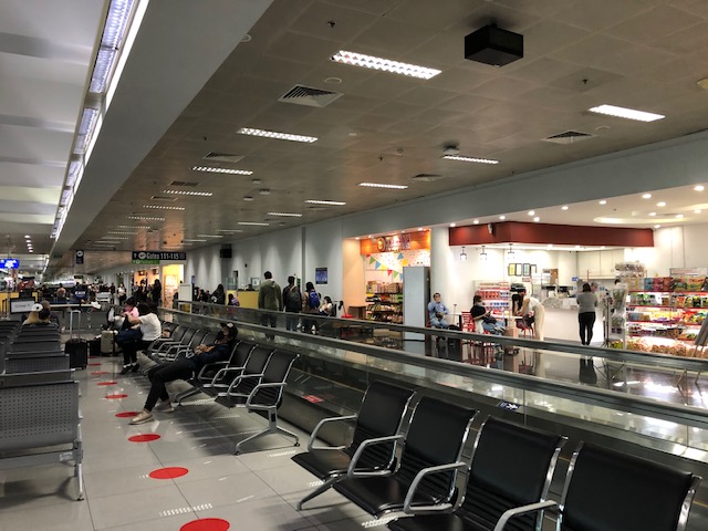
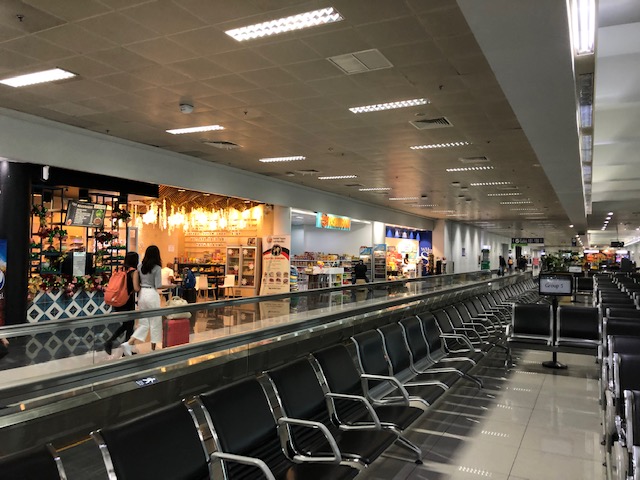
The travel certainly won’t have an excuse for getting hungry as I guess there will be something for everyone whether you want a drink, a snack, a light meal or a heavy one. The souvenir shops are also a mix of the usual items like delicacies, local crafts, shirts, keychains, ref magnets and the like. If you want something more fancy for souvenirs, there is a Narda’s store here. There are a couple of WHSmith stores for those looking for something to read or even some quick souvenir shopping.
–
On a canceled trip due to a typhoon
I was supposed to be traveling with my family to Singapore over the Undas long weekend. That did not push through due to the circumstances brought about by Typhoon Paeng. What could have been our daughter’s first travel abroad did not materialize and we were left with sunk costs from the tickets we had already bought online for Universal Studios and the Singapore Zoo. We also had to cancel meet-ups with friends in Singapore.
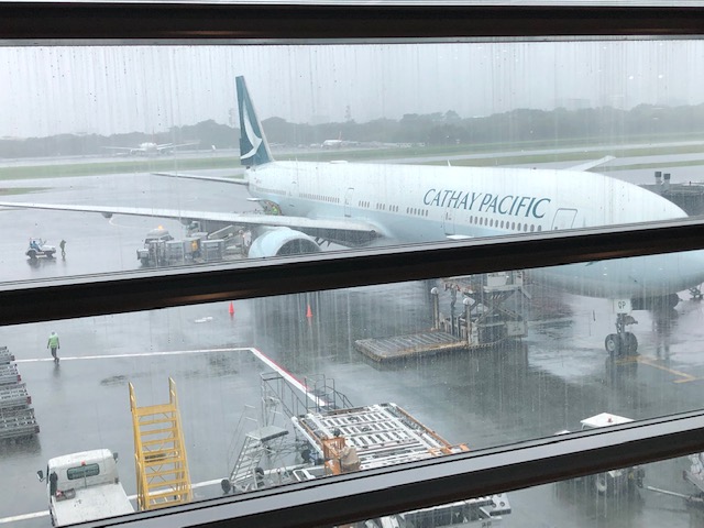 This Cathay Pacific plane landed safely before noon and later departed for Hong Kong without incident.
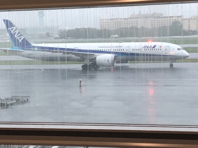 An earlier ANA flight arrived and departed without incident. This one arrived mid afternoon but was similarly grounded due to the typhoon.
The airport announced all flights were canceled just before 6:30 PM. This was a late announcement that some airlines were waiting for. Cebu Pacific apparently had advance information as they canceled all their international flights one after the other around 6:00PM (probably to manage the crowds that would file out of the departure area to reclaim their luggage). We were disappointed that Singapore Airlines did not act immediately and decisively on the matter. We were expecting at least an announcement of when we could expect to be on the next flight. For an airline of their stature, I was also expecting that they could have made arrangements for accommodations due to the great inconvenience brought upon passengers. That was the least they could do if they intended to put us in the next available flight (planes were cleared to operate at 10:00PM that night). Apparently, the typhoon (and its implied acts of nature/acts of God aspect) was also a convenient excuse for the airline (and others, too) to practically abandon their passengers. [Note: A pilot friend intimated that these decisions and behavior by airlines are partly due to policies and actions of the previous administration/government of the Philippines where all the blame was put on airlines for cancellations and they were penalized for acting independently or ahead of government announcements.]
Of course, we later received a series of emails from the airline informing us that we were rebooked to flights the following day. I say ‘flights’ here because these the first email informed us of a flight at 10:00AM. A subsequent email then said we were to be in a 12:00 flight. A third then said that we were to be on a 2:00 PM flight. We got to read these emails around 7:00 AM the following day as they were sent overnight when we were already occupied in finding accommodations during inclement weather. Flabbergasted, we decided to request a refund instead of re-booking and rescheduling our trip. It was already difficult to reschedule as there weren’t any weekends long enough remaining this 2022 and this Undas was the ideal time for a getaway. We’ll try again another time.
–
