
Coastal Expressway
One of the shortest tollways in the Philippines is the Coastal Expressway, which was actually a free road in the 1990’s (then known as the Coastal Road). It now connects to a longer segment that is the Cavite Toll Expressway (CaviTEx). Following are photos taken during a recon survey of an area along the expressway in relation to a traffic impact study we were conducting for a major development.
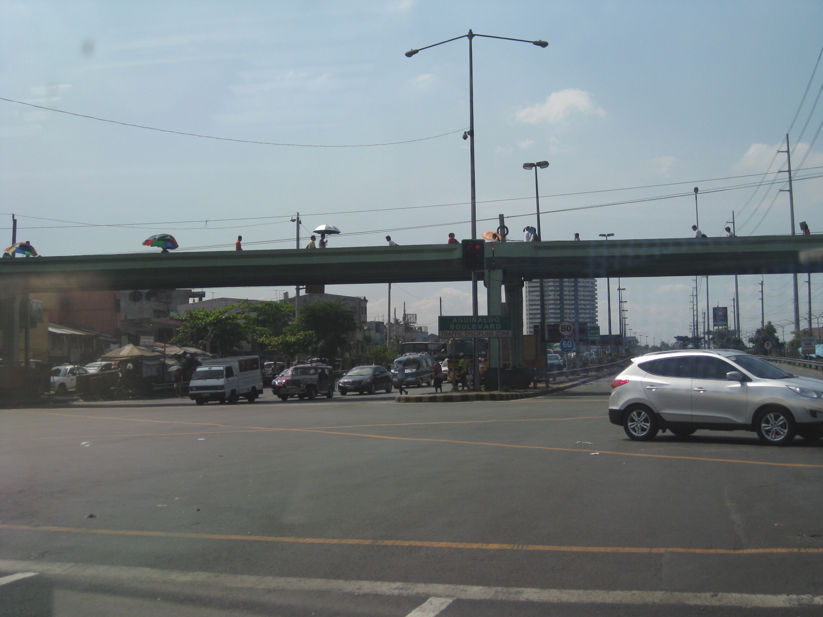 The Coastal Expressway essentially starts from the intersection of Roxas Boulevard and the Airport Road in Pasay City
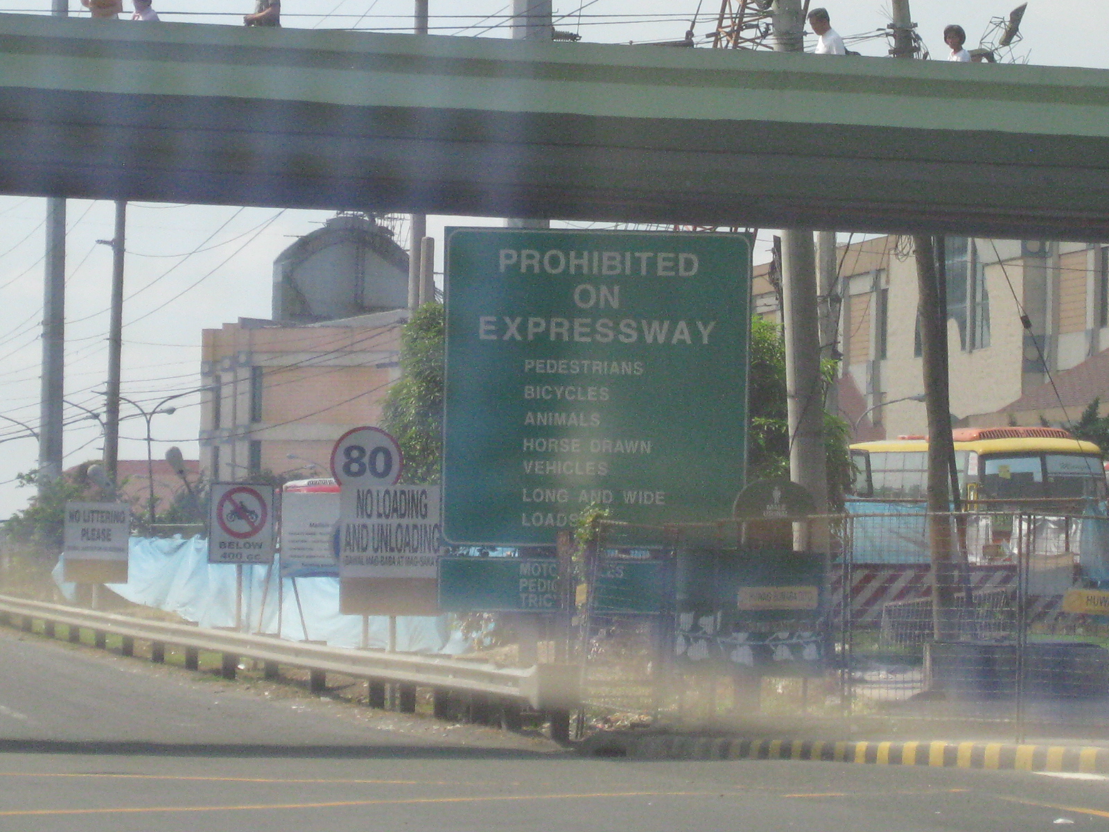 There seems to be so many signs on this corner leading to the entrance to the expressway. This is an example of what not to do in as far as signage are concerned.
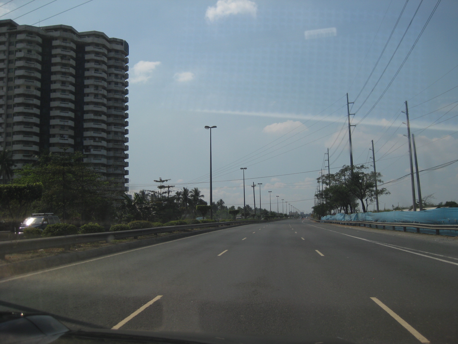 From the intersection, it is practically free flowing traffic leading to the toll plaza. On one side of the expressway are residential/office condominium developments and on the other side are undeveloped or under-developed reclamation areas.
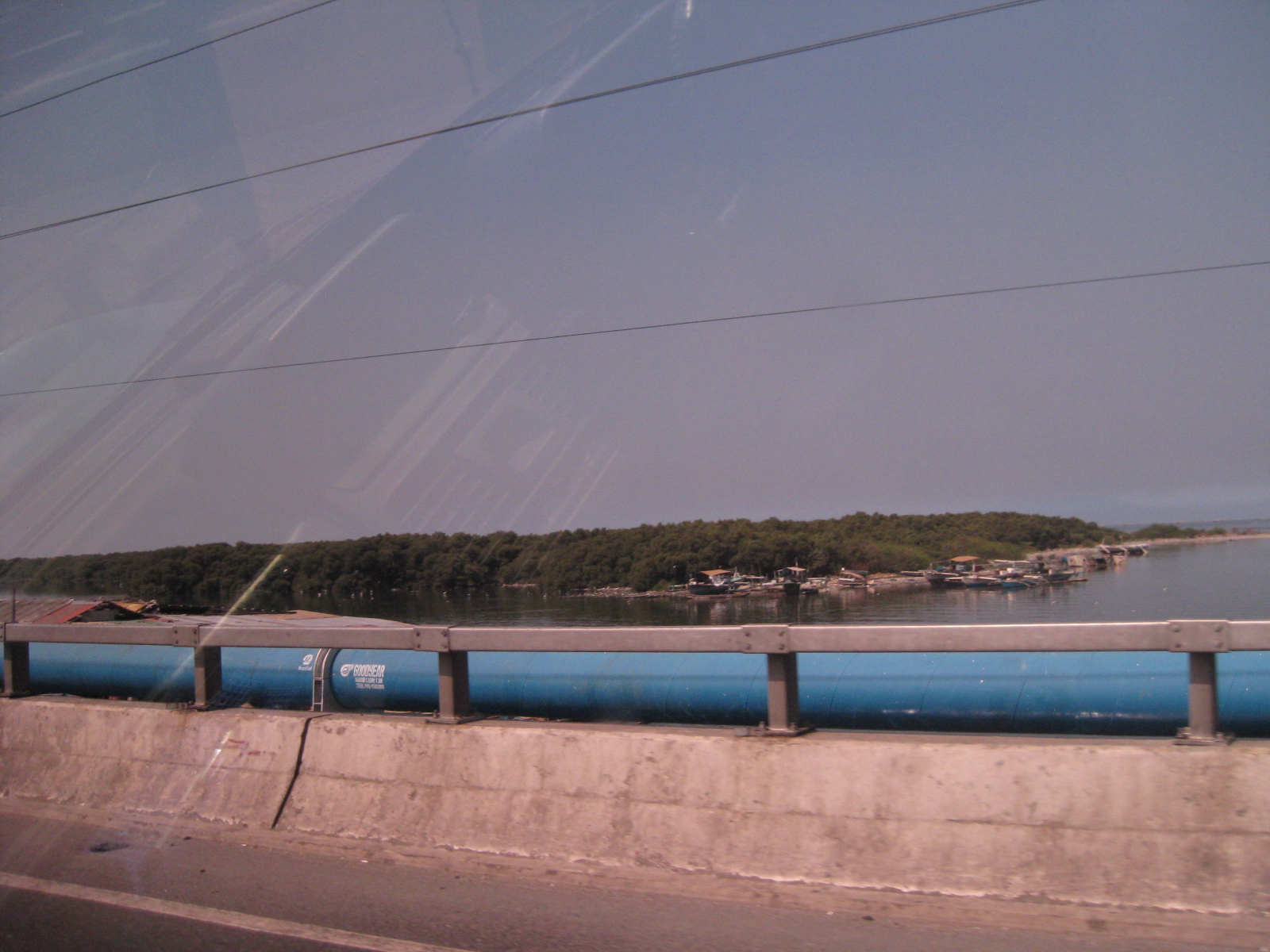 The photo shows one of several small islands from across the tollway that is host to mangrove forests. These growths in turn host an entire eco-system that includes migratory birds, which makes the area a popular site for conservationists, environmentalists and bird-watching enthusiasts.
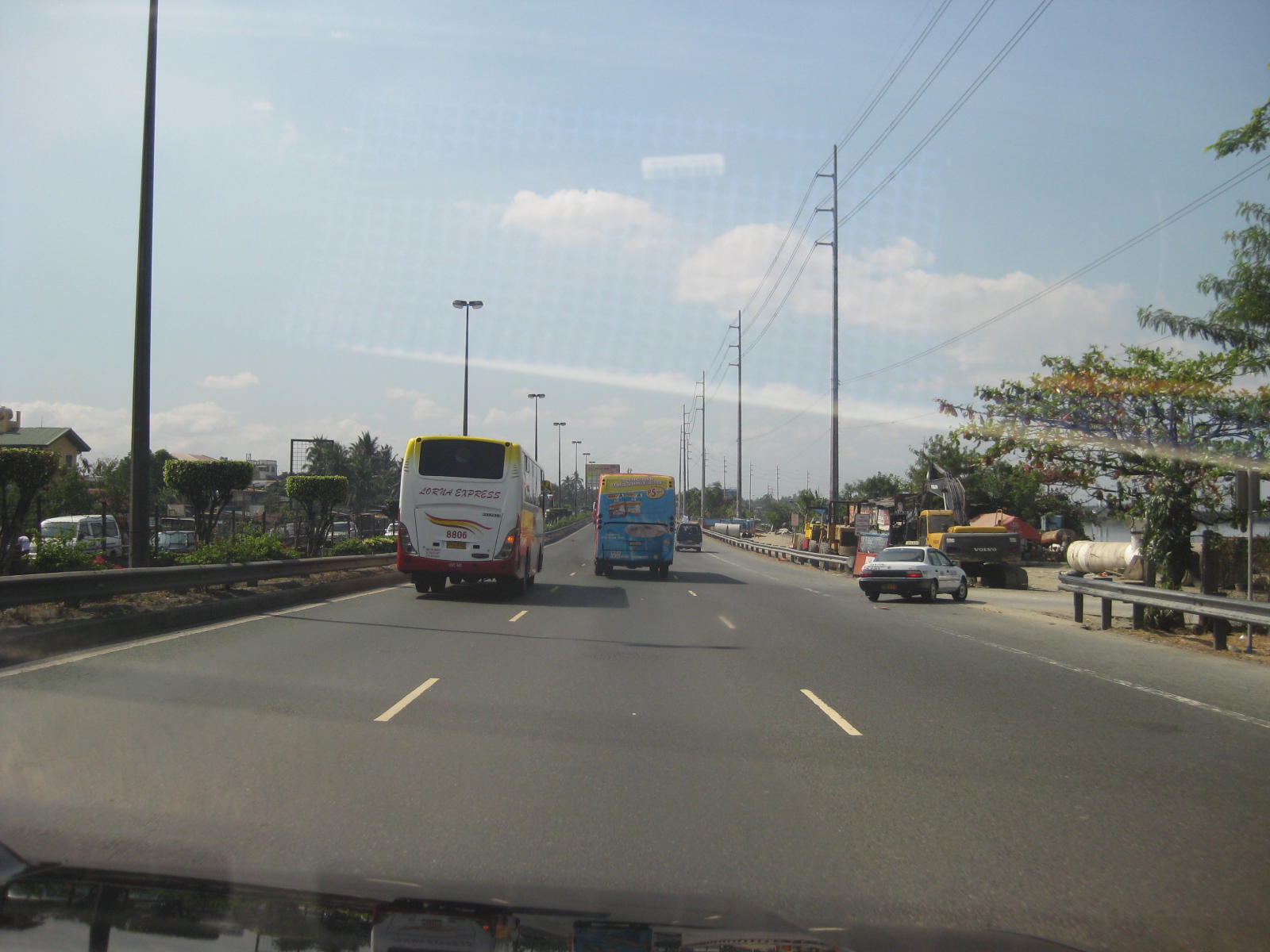 Many provincial buses use the tollway from terminals and stations in Pasay and Manila. This is because the tollway provides a direct access to the province of Cavite where many people who work or study in Metro Manila reside.
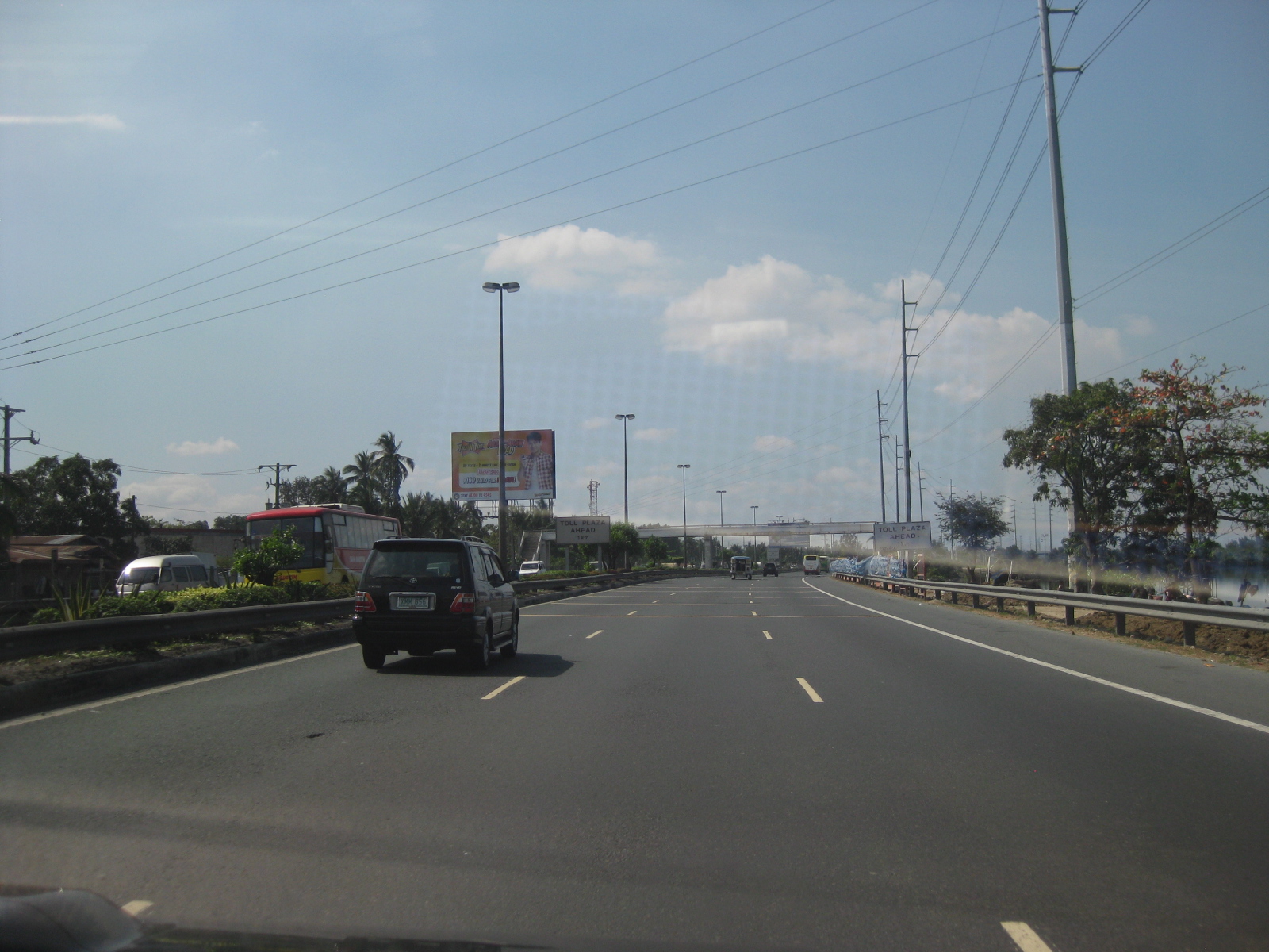 The tollway has 3 lanes per direction with standard shoulders on either side of the carriageway. The is also a median separating the opposing flows of traffic.
 Signs advise for the reduction of speeds as vehicles approach the only toll plaza along at the time along the route to Cavite. There is a minor toll facility along a feeder road to the tollway along the northbound side but it seems more an accommodation rather than a full-fledged tollgate.
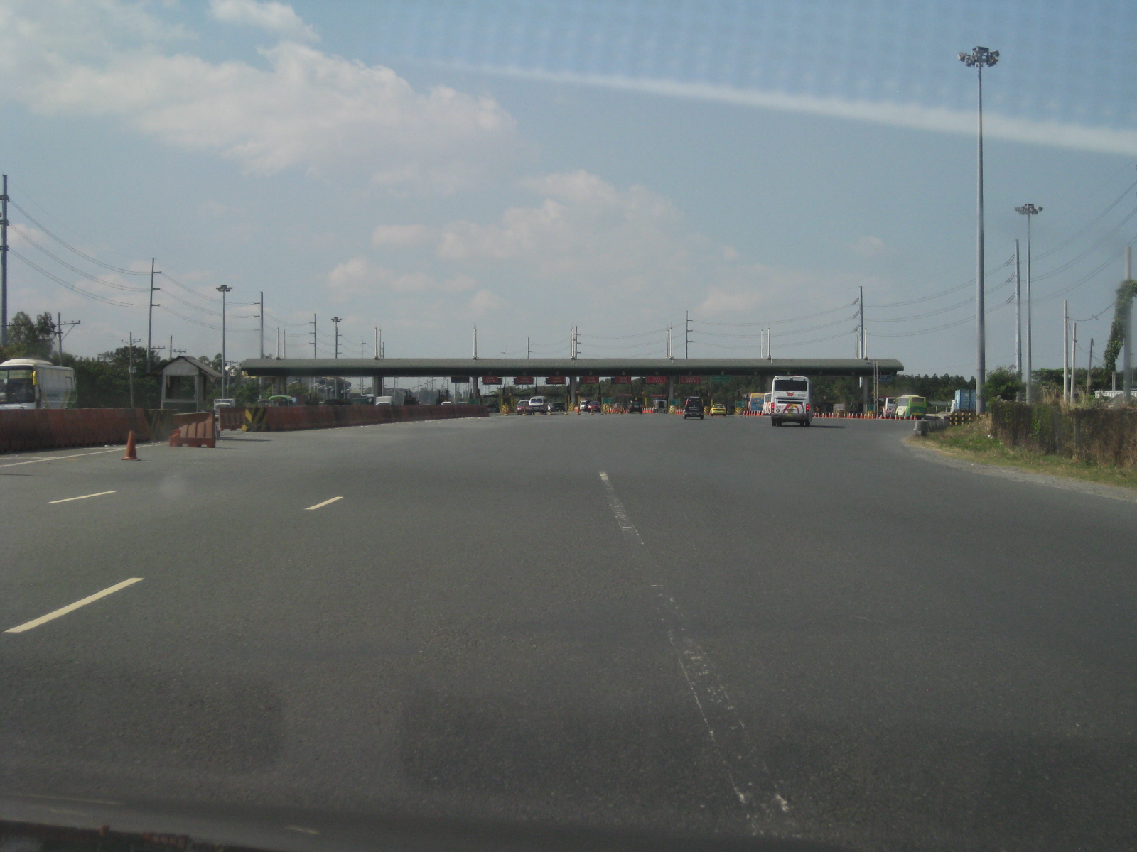 The Coastal Expressway toll plaza – traffic during the time of travel was light despite it being a weekday. However, traffic can be quite horrendous during peak periods and queues particularly long at the toll plaza. There are no electronic toll collection systems in place yet so all transactions are manual. The highway section widens at the plaza for the multiple booths to be able to accommodate vehicle arrivals.
 Typical toll booth along the expressway
 Traffic cones help guide motorists from the toll plaza who will eventually transition back to a three-lane section.
 Sign indicating the boundary between Metro Manila and the Province of Cavite
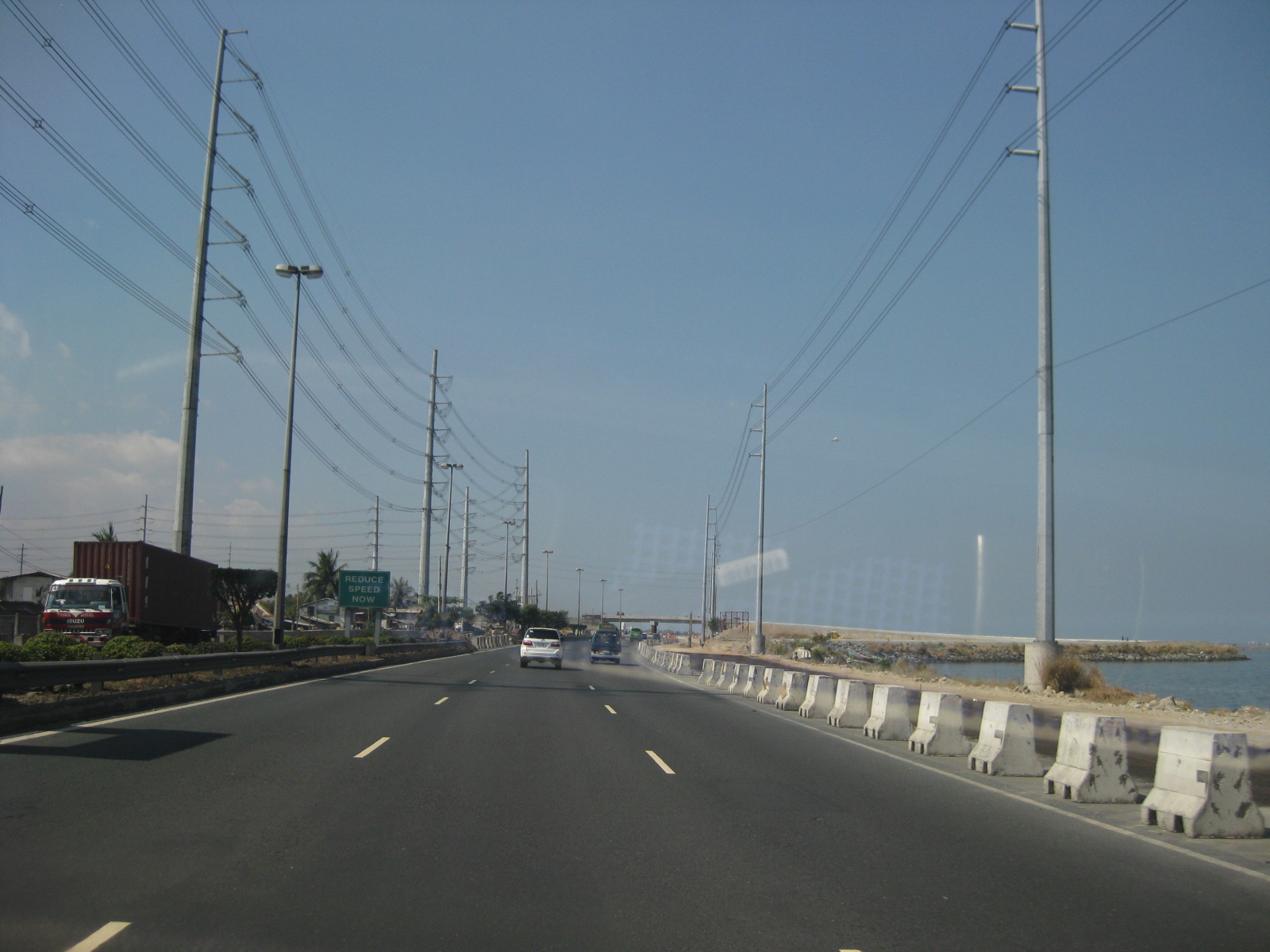 Nearing the then end of the expressway in Bacoor, Cavite, one could already see the ongoing interchange construction and the unfinished section of CaviTEx.
 Construction works for the approach to the overpass for what is now the Bacoor Exit. Vehicles now take the rightmost lanes to turn left towards Bacoor using the overpass that can already be seen in the photo. Vehicles proceeding towards Kawit should proceed along the tollway
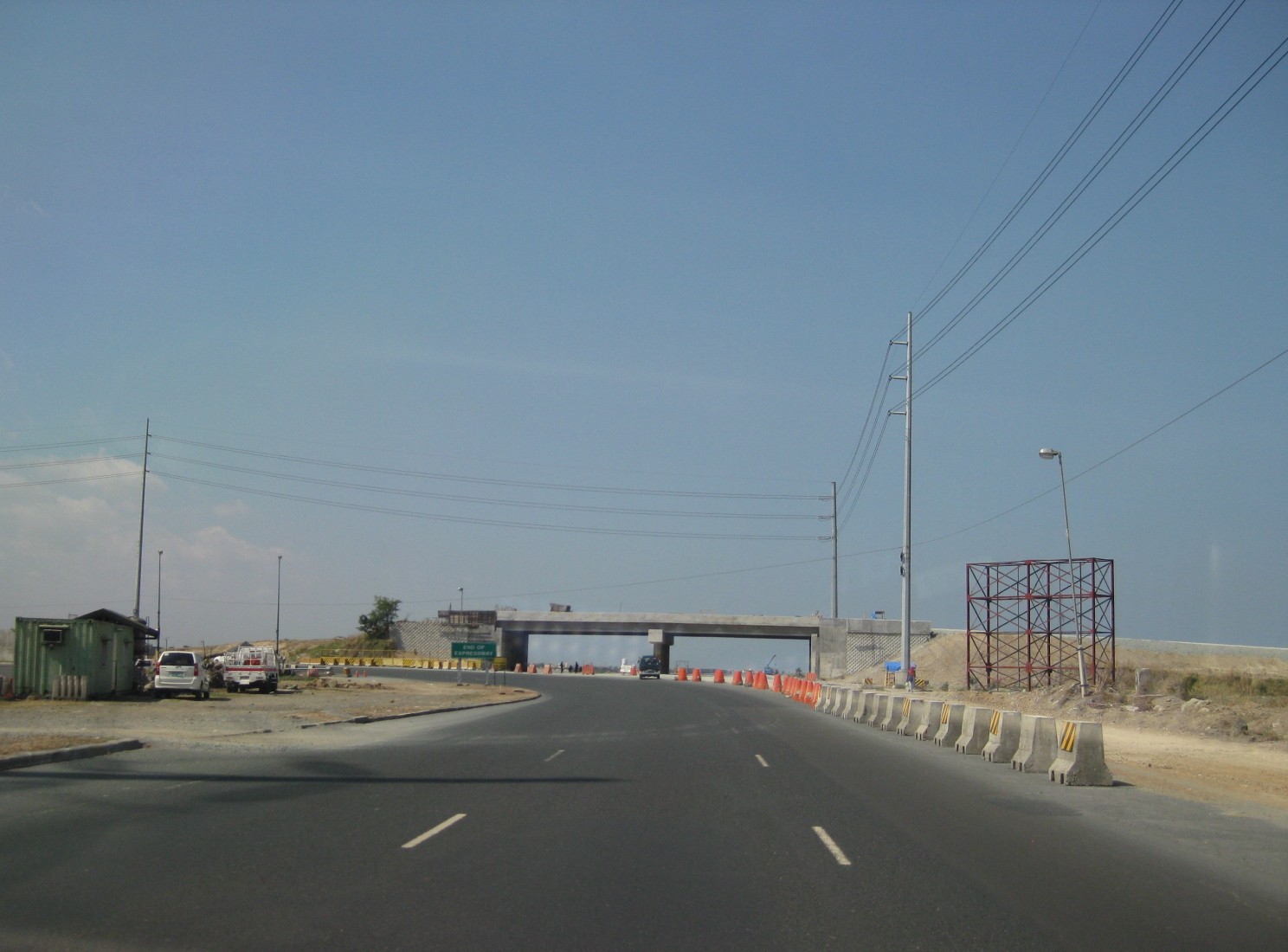 At the time these photos were taken, the CaviTEx was not yet completed and the Coastal Expressway ended at Bacoor. The curve leads motorists to Bacoor town proper.
 A peak at the then unfinished section of Cavitex including the uncompleted overpass
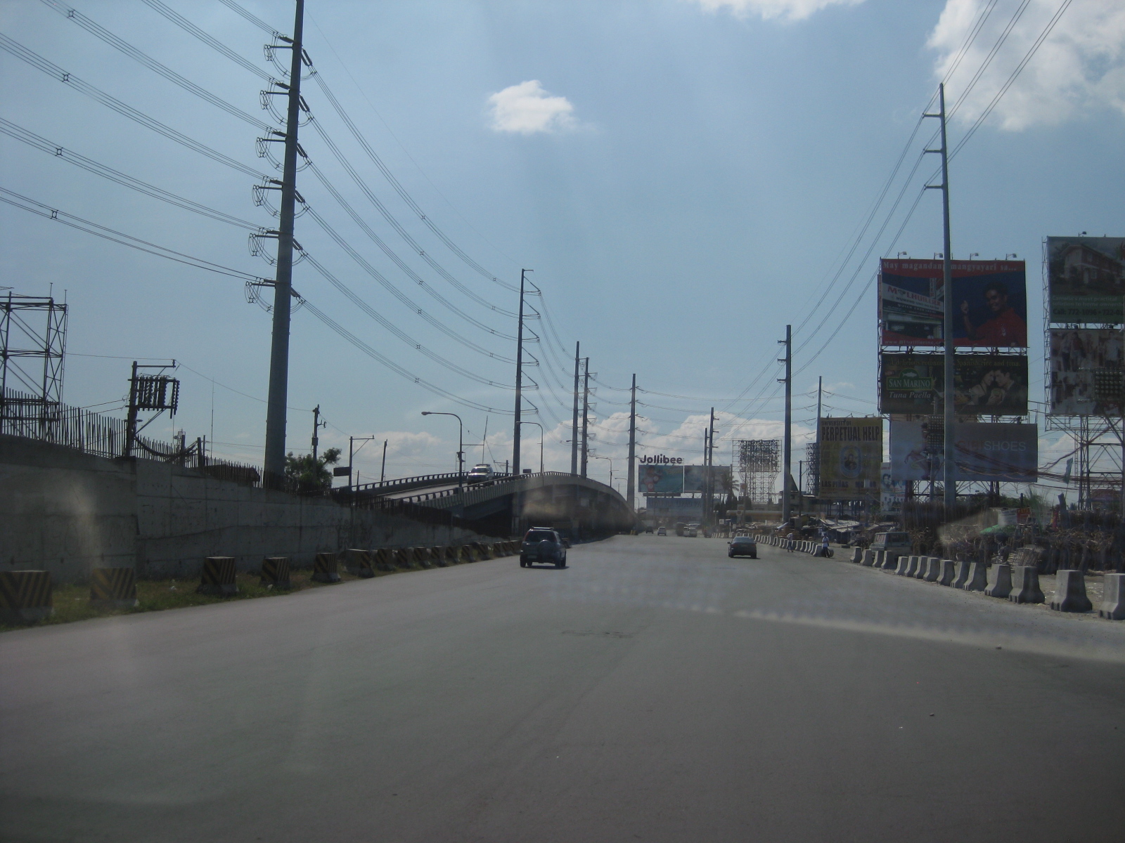 Turning towards Bacoor, motorists are greeted by another overpass on the opposing direction that leads travelers from the Alabang-Zapote Road (from Muntinlupa) or the Aguinaldo Highway towards the Coastal Expressway. Travelers wanting to proceed to Las Pinas via Quirino Avenue may turn beneath the flyover.
 17Overpass from Aguinaldo Highway to the Coastal Expressway. Our vehicle’s trajectory led us to Quirino Avenue, which eventually connects to the C5 Extension
 To go to Alabang via the Alabang-Zapote Road, motorists should stay on the left side of the road. To go to the Aguinaldo Highway, one must keep to the right.
–
Another look at NAIA T3 – departure
With the recent withdrawal of charges by PIATCO, the full operations of NAIA’s Terminal 3 should be underway. Until now, the operations of the terminal has been at best limited despite the increasing number of flights being handled by the terminal with the continuing growth of Cebu Pacific and the addition of Japan’s All Nippon Airways (ANA) to the few airlines that have made Terminal 3 their home in the Manila. With plans for the much maligned Terminal 1 to be renovated and the impasse on what to do at Clark, it is expected that more international flights will be handled at T3. Following are photos of the Terminal 3 North Wing departure area from a recent trip. The North Wing handles the domestic flights while the South is for international operations.
 Departure area along the linear Terminal 3’s North Wing
 There are already many passengers taking the early morning flights. This photo was taken at around 4AM and shows shops to the right along the corridor and the seats lined up along the left. The walkalator or conveyor was not functioning just like at the other wing (I am unsure of the reasons but this was probably to reduce operations and maintenance costs.).
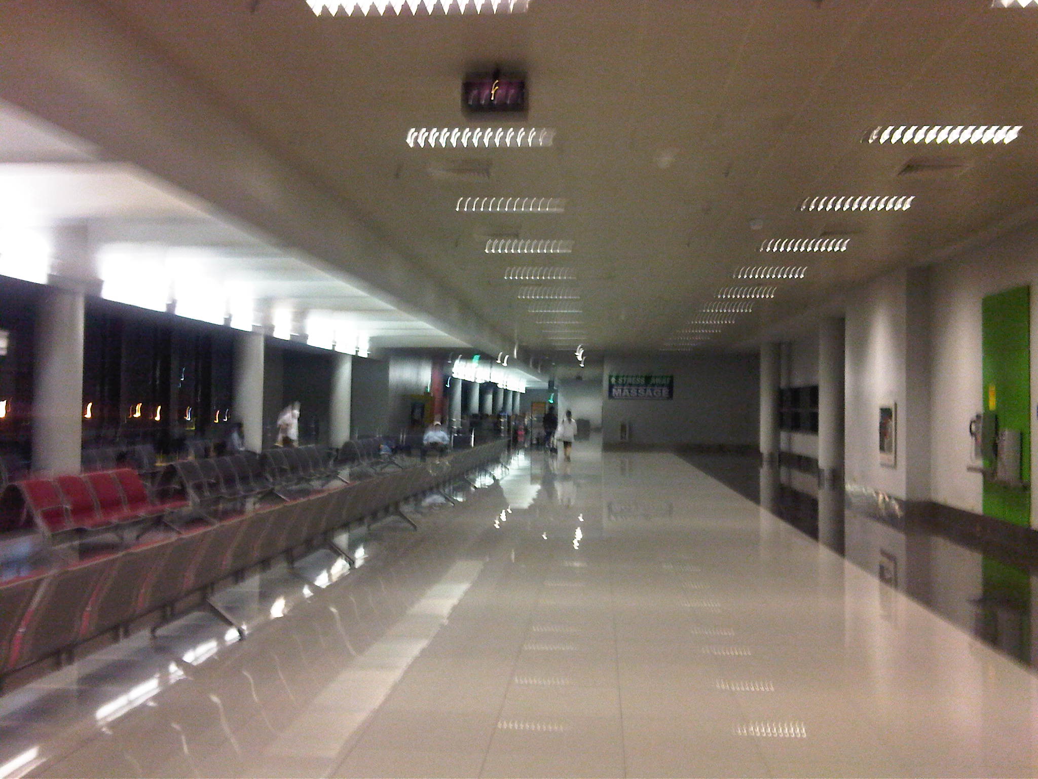 Our gate was at the end of the wing and there were few people when I arrived at the area. Other passengers can be seen napping across several seats as they wait for their flights to be called.
I guess its clear from the photos that Terminal 3 is clean and orderly though many facilities like the moving walkways are not currently operational and there is still the issue regarding the non-operation of the multi-storey car park for the terminal. Hopefully, such issues are eventually resolved and the full operation of the airport for international flights is indeed something to look forward to.
–
Revisiting the Bacolod-Silay Airport
I was able to finally use the Bacolod/Silay Airport located in Silay City, Negros Occidental. The last time I was in Bacolod was in 2000 and the airport was still located in Bacolod City and just a few minutes from City Hall and the Provincial Capitol site.
The old airport had many issues pertaining to limitations of the old site. Primary among these was that the old airport could not be expanded to be able to handle more passengers and larger aircraft. One end of the old runway faces the sea while the other faced the city. At one time, a hotel was even constructed at the latter end and along the flight path of aircraft taking off or landing from that end. The old airport had to cease operation and there was a controversy as to the approval of the building construction against the land use regulations for a aerodrome. For airports, there are imaginary surfaces projecting from the runway that defines the area that should be clear from obstructions. The hotel had to give way by removing several floors to comply with the airport requirements.
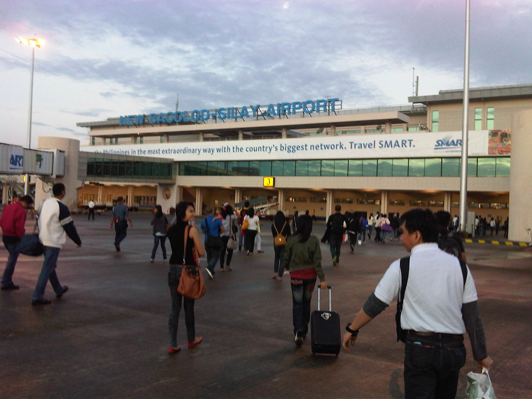 Arriving at the airport, passengers deplaned via the front and rear doors of the aircraft and unto the tarmac where people moved towards the arrival area of the airport.
 The arrival area was located at the ground level of the terminal.
 Baggage claim carousel at the arrival area of Bacolod-Silay Airport.
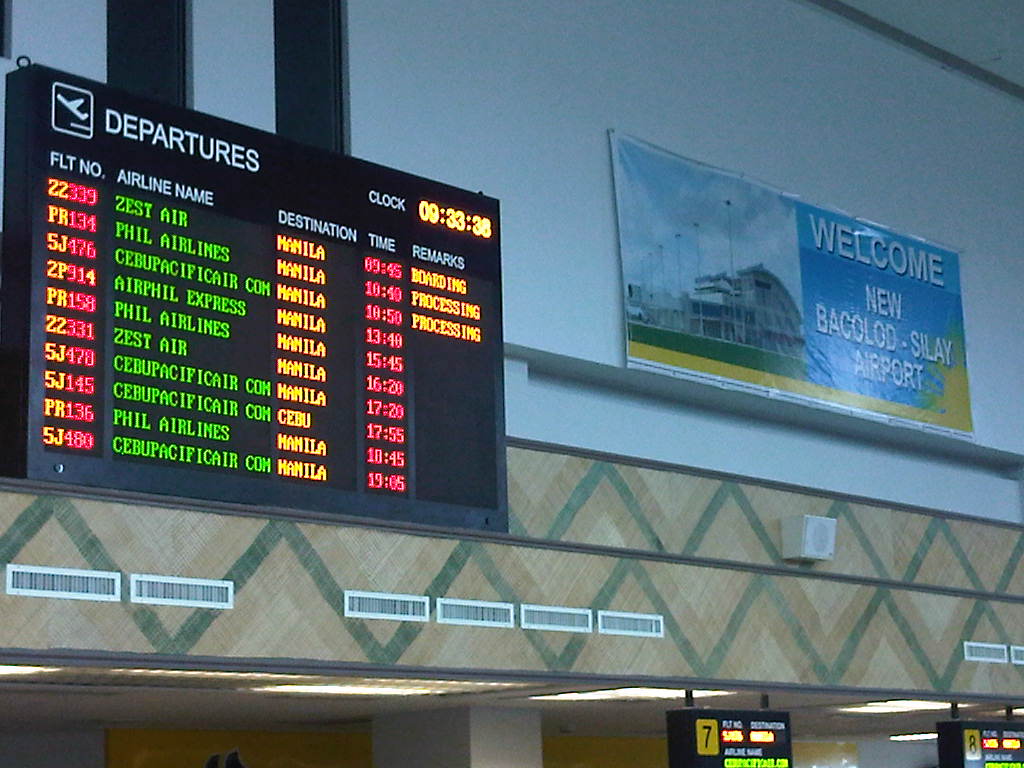 Flight departure information board above the check-in counters at the airport.
 Queuing at the check-in counters at the airport – the security check may be seen to the right of the photo. Each airline serving the airport is assigned counter spaces. Shown in the photo are the counters for Cebu Pacific.
 Terminal fee counter and escalator and stairs to the departure level. Domestic flight passengers are charged PhP 200 each to cover airport maintenance and security
 Escalator and stairs for access to the departure level. Persons with disabilities and others who may have difficulty using these facilities may use the elevator located to the right of the escalator (visible in the photo).
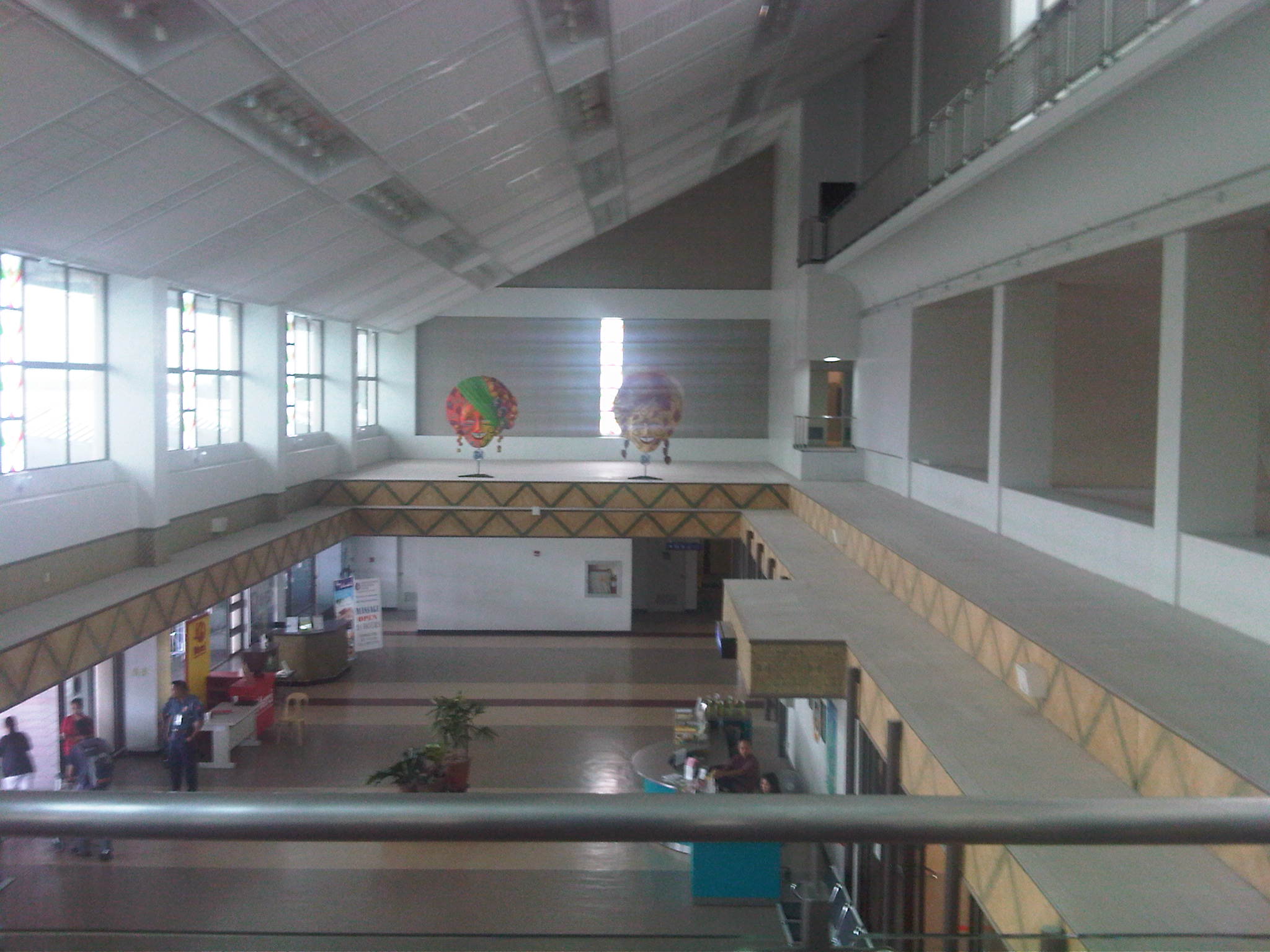 The arrival concourse is visible from the departure level corridor prior to the final security check for the lounge. At the far end are two giant masks – Bacolod celebrates an annual Masskara Festival
 The airport’s departure lounge is significantly smaller than Iloilo’s. Note that there are only 2 gates for Bacolod-Silay compared to 3 for Iloilo.
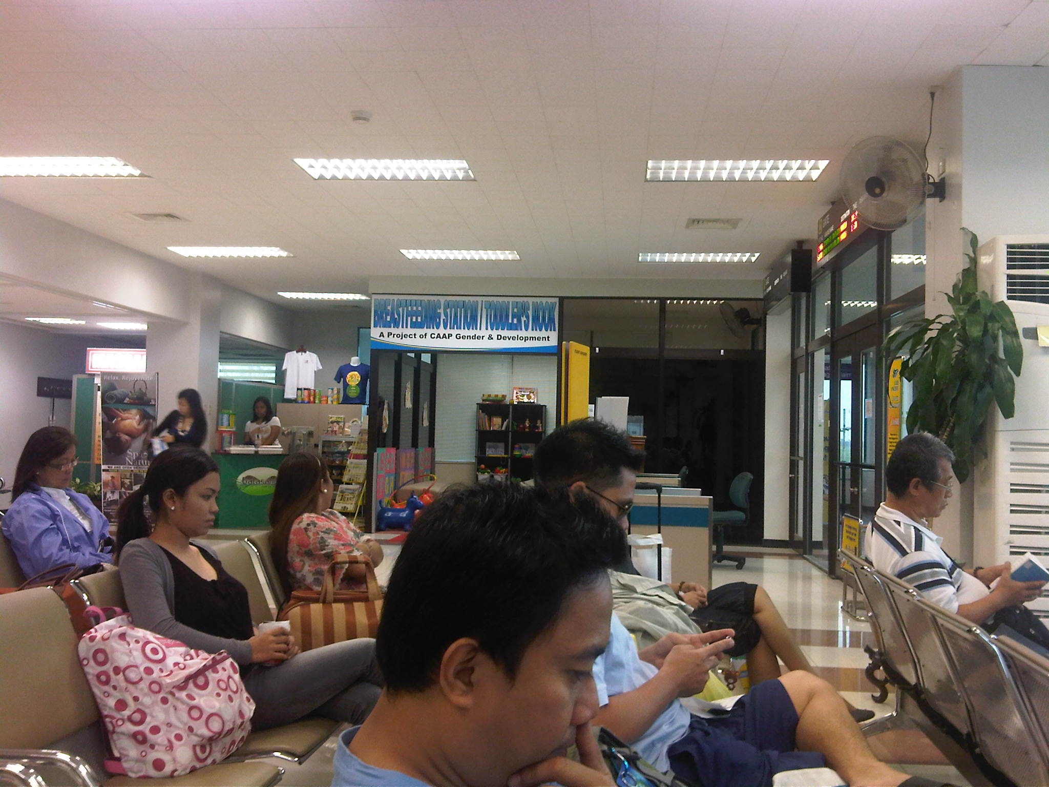 There are concessionaires inside the departure lounge but the better ones appear to be outside the lounge including one operated by Merci’s. There is a Bongbong’s pasalubong center at the entrance to the airport complex.
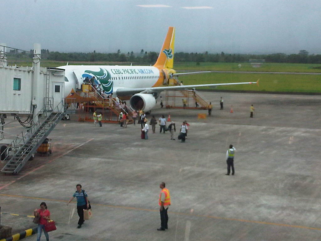 Cebu Pacific flights do not use the air bridge assigned to their gate (cost reduction?) and instead required passengers to board or alight from the aircraft using their fabricated stairs. This approach reduces the aircraft boarding and alighting times for the airline, thereby reducing delays to flights.
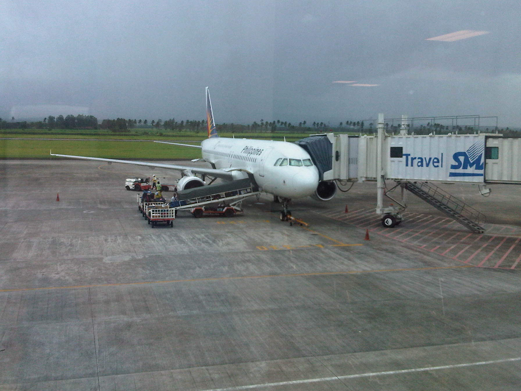 Meanwhile, Philippine Airlines utilizes the airbridge from the terminal gate as shown in the photo.
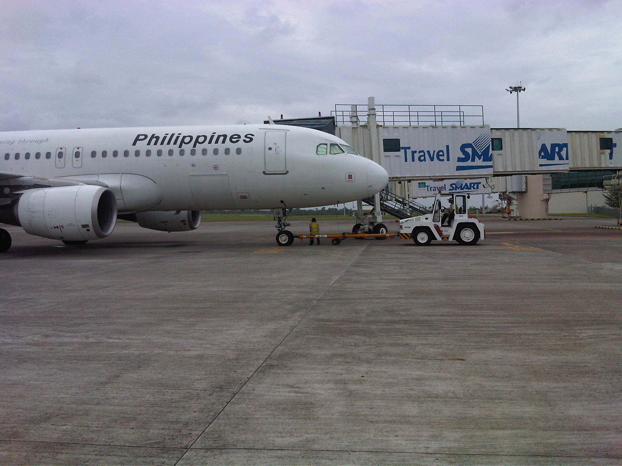 PAL A320 preparing to be towed away from the air bridge in preparation for taxiing towards the runway.
 Passengers walking at the tarmac to board the aircraft from two staircases at the front and rear doors.
I still have reservations with regards to how Cebu Pacific and airports such as Bacolod/Silay are treating passengers. It seems inappropriate to inconvenience passengers considering the availability of facilities at the airport even if there are attempts to justify this practice via reasons of faster enplaning and deplaning (loading or unloading of passengers). Perhaps the cost considerations are really significant enough to justify such operations. A similar practice is being employed anyway at other airports that do not have the air bridges such as Changi’s (Singapore) modern Budget Terminal.
–
Advisory
The photos featured in this blog are free and will continue to be free since I do not have any intentions to gain profit from this hobby of mine. All the photos do not have watermarks that could obscure features of interest in the photos. Most if not all the photos are originals taken by me or my staff when we are out in the field or simply traveling from one place to another. And so I cannot assure the quality of many photos.
For those doing research on the internet and especially for school projects or papers, I would urge you to do the right thing and properly acknowledge where you got the photos. I am very aware of a lot of people taking images from the internet and passing them off as if it were their own. While there is little I can do to prevent that, I think it is my responsibility as a member of the academe to make this advisory on such matters of intellectual property and integrity.
Thank you for your attention and read on!
Marcos (Highway) pa rin!
The traffic conditions along Marcos Highway along sections within Antipolo, Cainta, Marikina and Pasig have worsened the past two weeks due to the ongoing roadworks that have resulted in traffic jams very early in the morning (e.g., congestion at 5:30 AM) and until late at night. This, as the contractor appears to be rushing to meet the March 2012 deadline indicated in the DPWH project postings along the highway. So much for so-called traffic management along construction sites! I believe that MMDA and local government enforcers are not at all helpless in trying to alleviate congestion. I think they are not doing their jobs and they are not trying hard enough given the requirements to enable smoother flow along affected sections. Meanwhile, the contractor should also be held accountable for the congestion as valuable time is lost for many using the highway. Gumawa pa ng traffic management plan at nag-post pa sa DPWH website eh di naman pala masusunod!
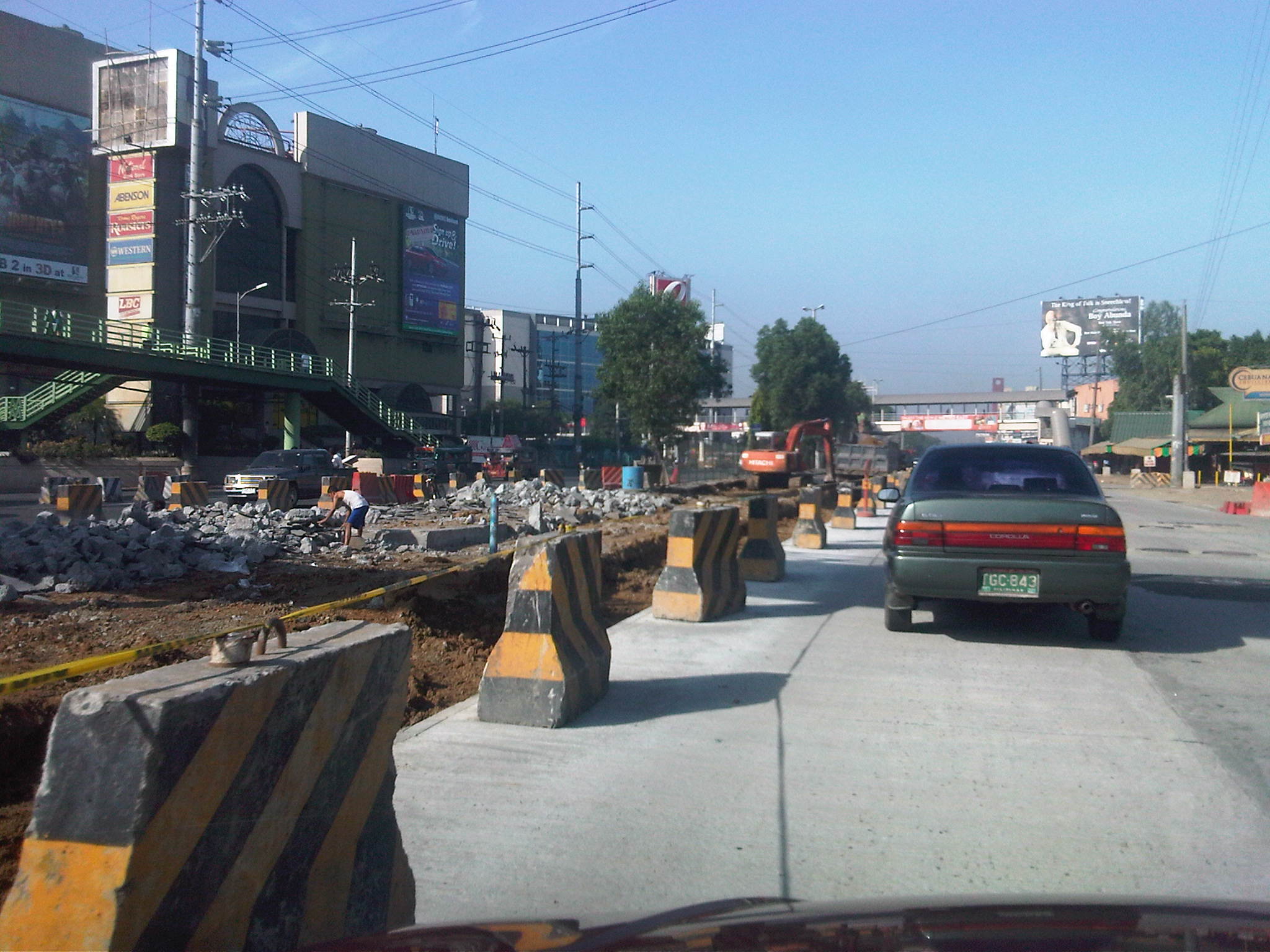

While the quality of work for the pavement is not suspect (considering the contractor has done a splendid job replacing the entire pavements along the highway to ensure that the base and sub-base layers are also replaced), much is to be desired regarding the way certain sections are being selected for rehabilitation. I’m sure that most if not all motorists are inconvenienced by the challenging obstacle course comprised of excavations, fills and concrete barriers. Of course, we can just be hopeful that the project will finally be completed this summer and we will ultimately benefit in the improvements along Marcos Highway.
–
Motorcycle lanes along EDSA?
The MMDA is implementing a one-week dry run of its motorcycle lane scheme along EDSA starting today, February 14. The scheme is the same as that implemented along Commonwealth Avenue where motorcycles are assigned to use only one lane of a road – in the case of EDSA the 4th lane from the curbside. To guide riders and drivers of other motor vehicles, the MMDA used alternating white and line blue pavement markings for the motorcycle lane similar to what was done along Commonwealth.
Following are photos taken last week along EDSA and a few observations on the traffic conditions with respect to the motorcycle lane scheme.
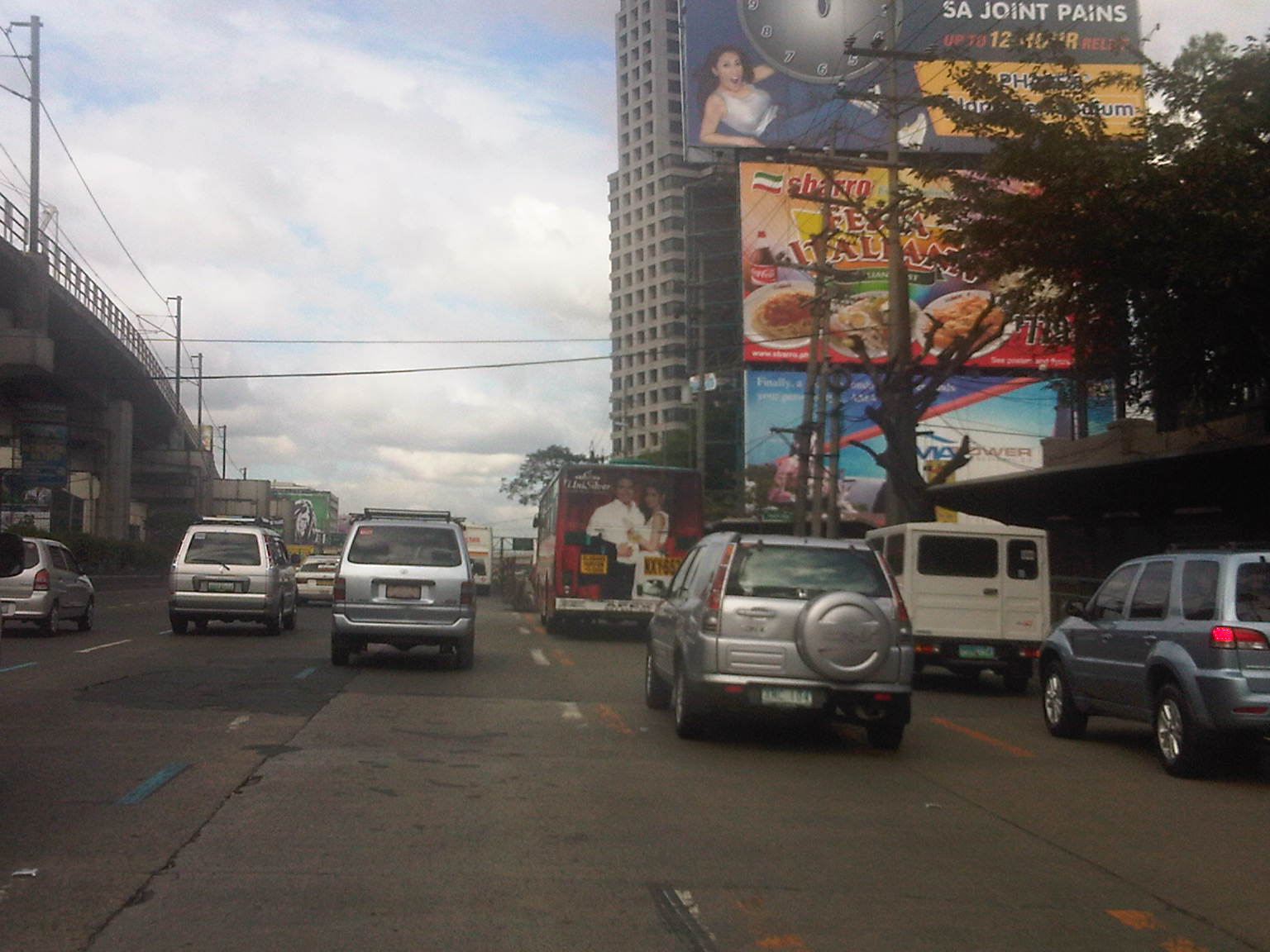 Light blue lane markings can be seen designating the 4th lane from the curbside for motorcycles. The yellow markings are for the two outermost lanes that are designated as bus lanes. While bus lanes are supposed to be for the exclusive use of buses, many private vehicles use the lanes throughout the day and are not apprehended by traffic enforcers for this encroachment.
 Sign for the motorcycle lane already installed along EDSA before the MRT Santolan Station as of February 9 – this photo was taken around 3 PM (not yet the afternoon peak period).
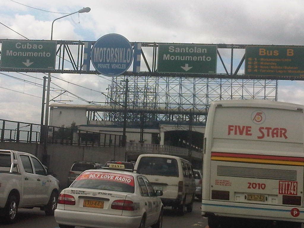 Close-up of sign for the motorcycle lane but with “fine print” indicating that the same lane may be used by private vehicles – herein lies the problem as private vehicles are sure to mix it up with motorcycles, with the high likelihood that riders will revert to lane splitting or using other lanes. This will be an enforcement nightmare.
 Motorcycle lane sign installed on pedestrian overpass between Aurora Blvd. and Kamias. Notice the provincial bus encroaching upon the adjacent lane designated for private vehicles.
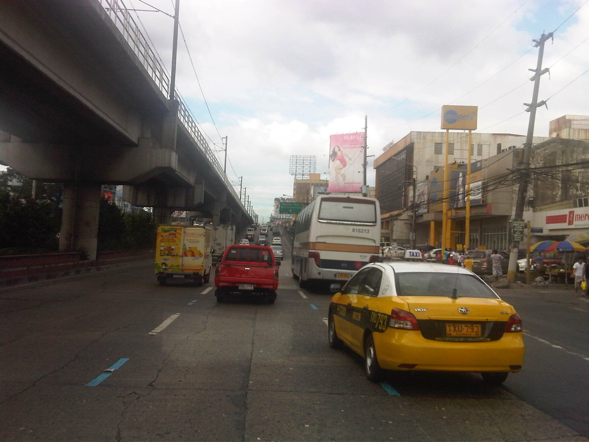 Motorcycle lane prior to the Kamias-East Avenue overpass along EDSA.
 The middle lane is designated as the motorcycle lane along the overpass
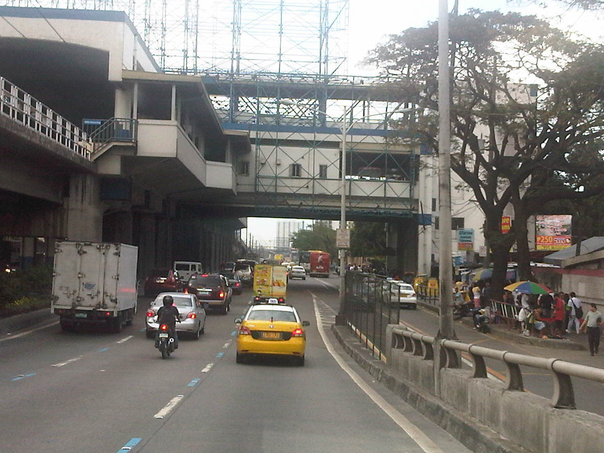 Motorcycle lane along EDSA beneath the EDSA-MRT GMA Station
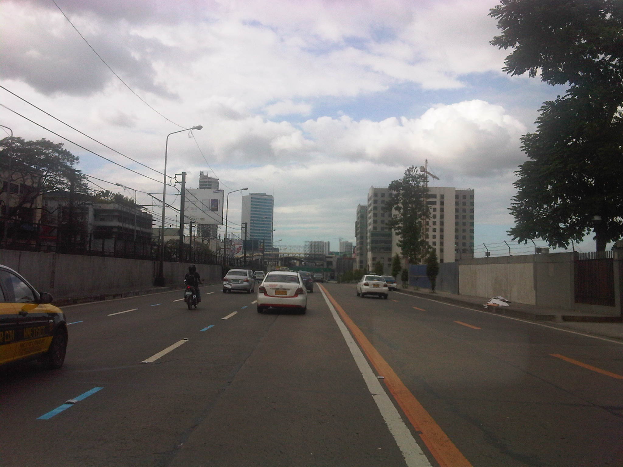 Bus and motorcycle lanes along EDSA past the the MRT GMA Station. Traffic is typically light along this stretch as many vehicles turn towards East Avenue or Timog Avenue.
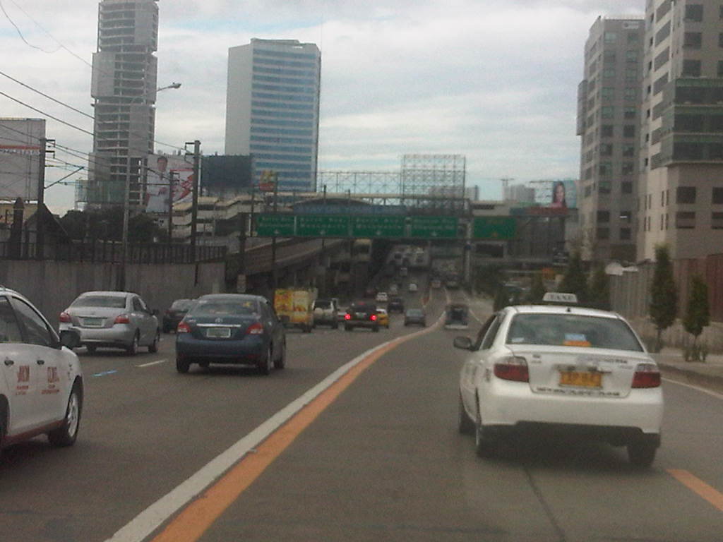 Typical light traffic between East Ave. and Quezon Ave. along EDSA northbound
 Motorcycle lane ascends the flyover crossing the junction with Quezon Avenue – the lane is again the middle of three lanes. That’s the EDSA-MRT Quezon Avenue station on the left and downstream in the photo and the Centris mall on the right.
If the implementation of the motorcycle lane scheme along Commonwealth is to be the basis for assessing the likelihood for success along EDSA, I believe that we can be expect significant behavioral changes along EDSA. For one, motorcycle riders along Commonwealth have been generally diligent in following the scheme. This can also be expected for most riders using EDSA should the MMDA be strict, firm and fair with their enforcement duties. Meanwhile, drivers of private vehicles have been becoming more aware and respectful of motorcyclists rights of way along Commonwealth and we are hopeful that such will eventually be the case along EDSA, although both enforcement and management will be much more challenging due to the sheer volume of vehicles involved and the more restricted space for traffic flow. It is to be expected that there will be many stubborn private vehicle drivers who even without the motorcycle lane are already encroaching on the bus lanes. Even more challenging will be the behavioral change required of buses given their propensity for reckless driving. I wanted to emphasize behavioral change here because I strongly believe that this is a critical factor for the improvement of traffic and transport in Metro Manila where many issues have roots on driver, rider and pedestrian behavior.
–
Gapan-San Fernando-Olongapo Road: Lubao bypass road
The Gapan-San Fernando-Olongapo Road was often congested along sections passing through populated areas of towns along the highway. Among the busiest (and most congested) was the section in Lubao. This necessitated the eventual construction of a bypass road for travelers to be able to reduce delays caused by various elements including local traffic (e.g., tricycles and pedicabs). The following photos describe the bypass road and the traffic using it.
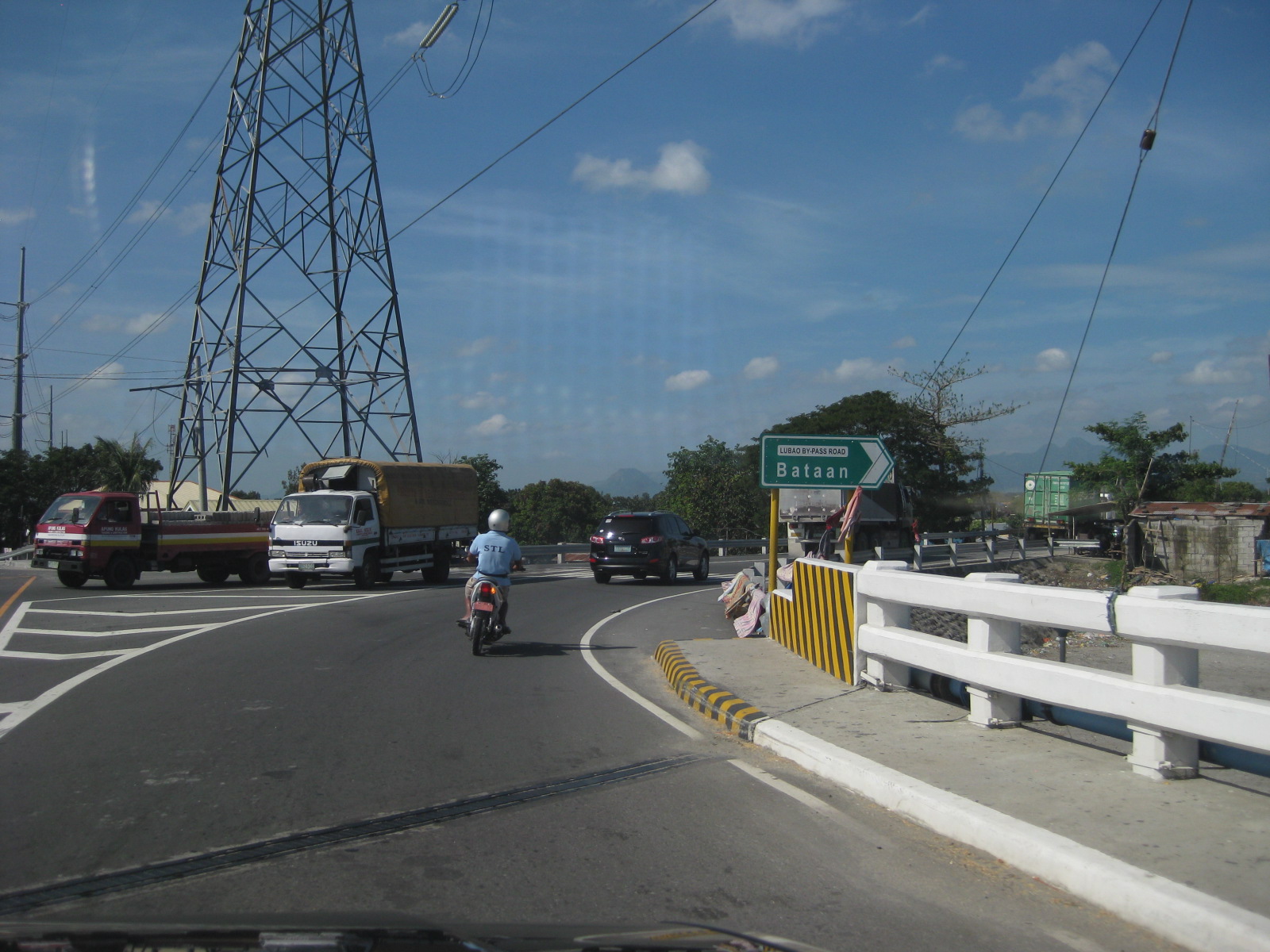 The bypass road is easily identified with the conspicuous signage and lane markings. The junction is right after this bridge.
 The pavement markings along the bypass road is inadequate and appears to be inappropriate given the carriageway width. There are also many people crossing the highway at various points.
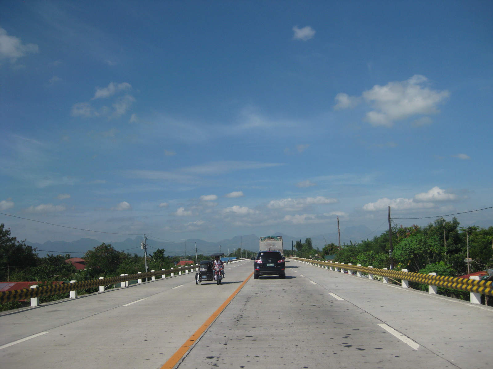 The bypass road should have been a two-lane, two-way highway with shoulders at either side of the road. The yellow line in the middle of the road may be appropriate to advise against overtaking or passing but the white broken lines should be replaced by solid lines to delineate the shoulders from the traveled way. Yup, that’s a tricycle along a national road.
 The highway is elevated probably to prevent flooding (of which the area has lots of experience including the times when lahar was a severe problem in the area). As such, travelers can see the rooftops of a lot of most houses along the highway.
 The bypass road narrows to 3 lanes at certain sections.
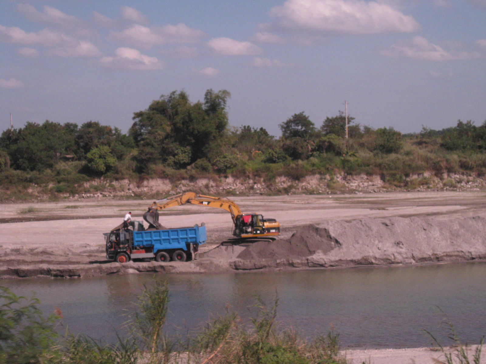 Scene along the highway sections along which is a river. Quarrying for construction materials like sand is quite common and a major source of revenue for many Pampanga towns. Such activities have also been controversial due to the fees charged by the local governments, particularly how these are divided among towns and where these are used.
 The space provided along the single lane direction is obviously inadequate considering that trucks tend to encroach upon the opposing traffic lane.
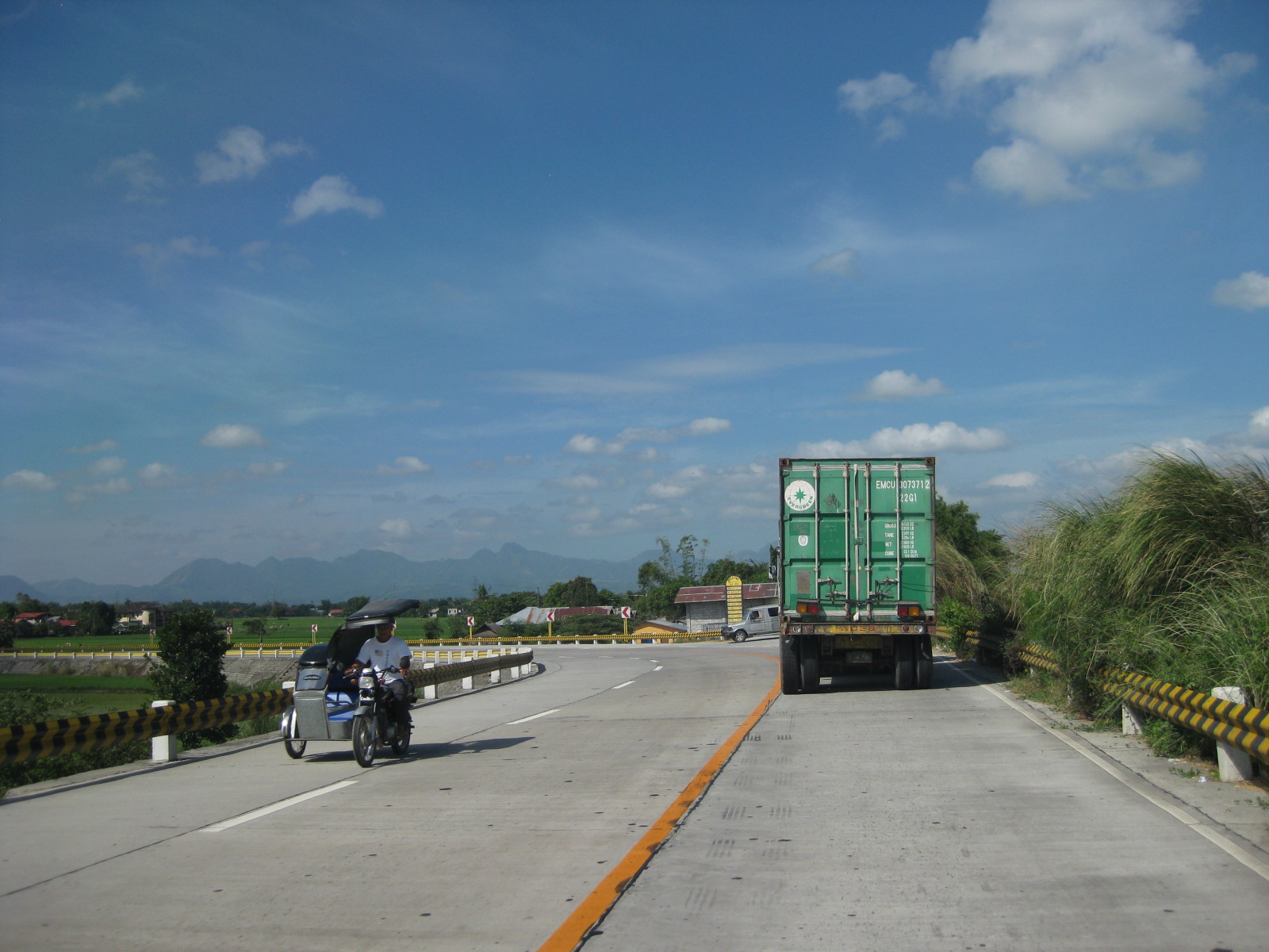 The 3-lane section approaching a junction. There were no signs or rumble strips to warn drivers about the presence of a junction.
 There are no signs to inform motorists of the presence of this junction at a curved section where the 3-lane road transitions into 4 lanes. This is actually an unsafe location for a junction and requires both geometric and traffic engineering interventions to prevent crashes from occurring.
 The chevron signs indicating the curvature of the road section are quite few. Perhaps the highway engineers became too conscious of the controversies elsewhere where there seems to be an abundance and propensity for such signs. The embankment for the highway is visible from the photo.
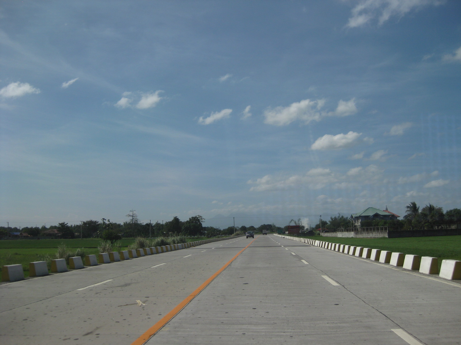 Lower section of the bypass road with concrete barriers apparently designed for waters to flow through. Notice that the section is not as elevated as the previous ones judging from the rice plantations on either side of the road.
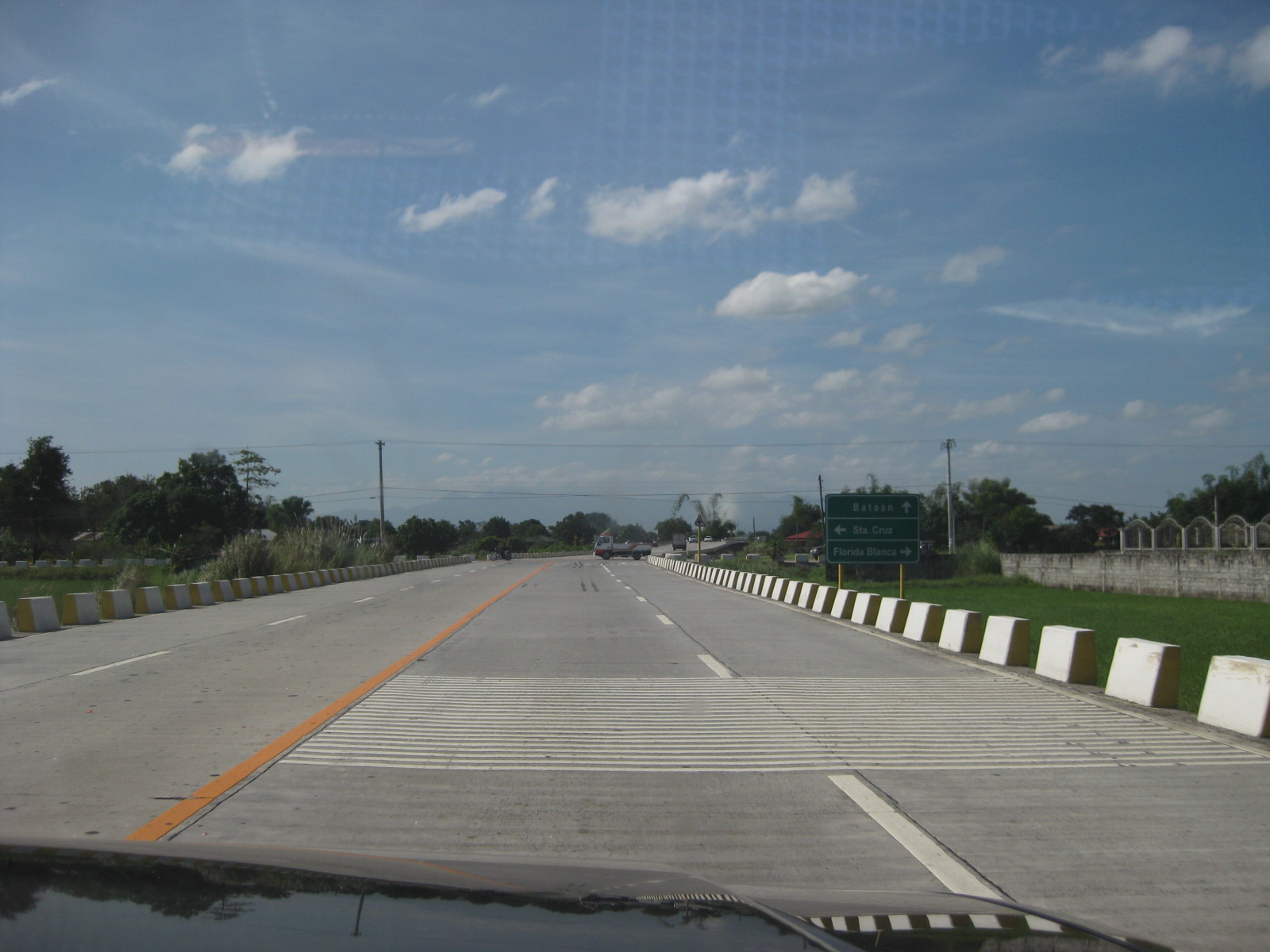 Rumble strips along the highway to warn the driver of a hazardous section
 13Curved section with signs that seem to be too small considering the speed limits (40 kph). Meanwhile, there is a single chevron sign on the other side of the road.
 Straight, level section is quite tempting for speeding. Such designs actually encourage speeding, and many vehicles we observed (including ours) exceeded the 40 kph speed limit.
 Traffic along the highway is quite light even during the peak periods – further proof that 2 lanes are enough for the bypass.
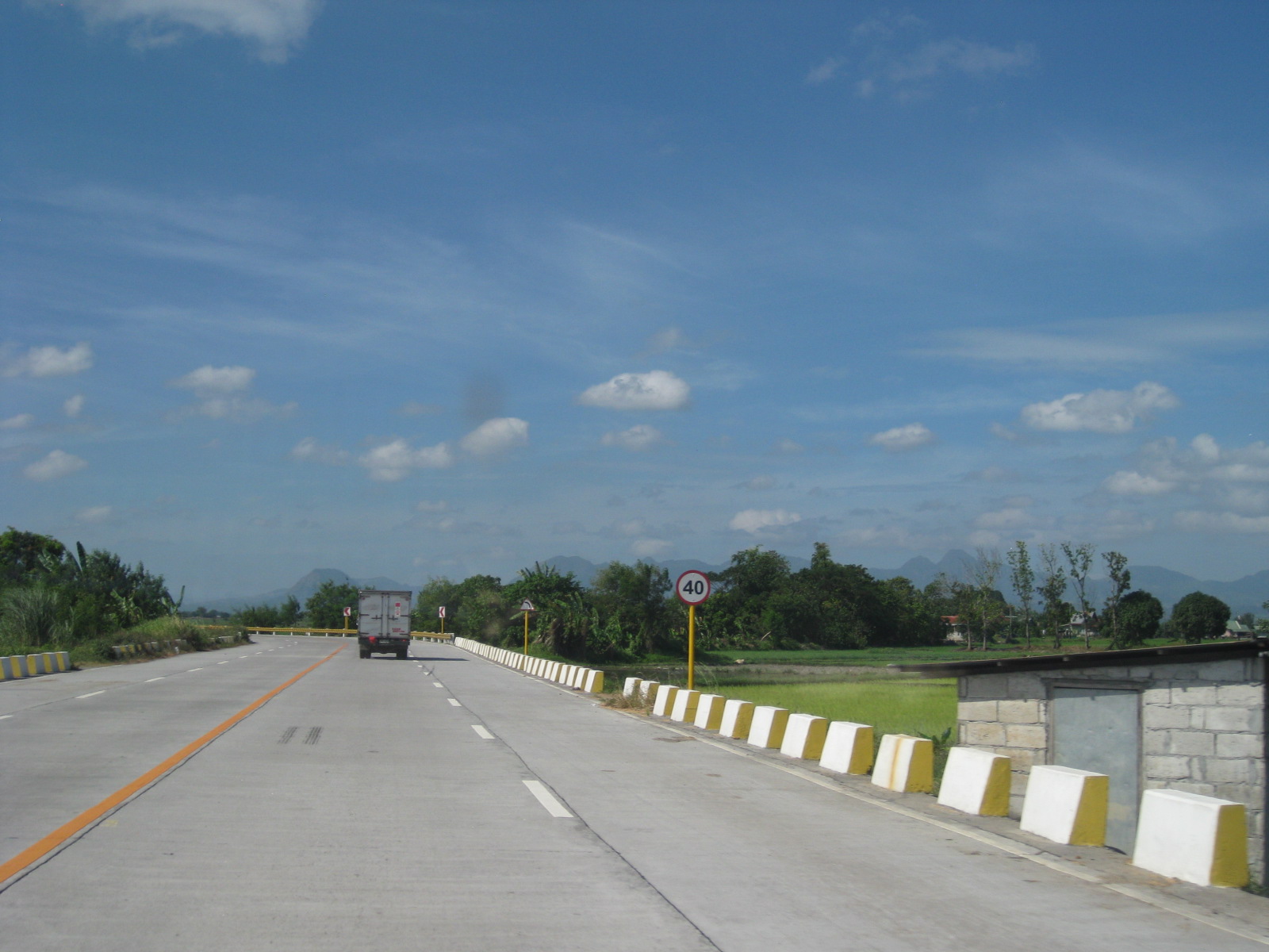 The concrete barriers do not seem sufficient or able to stop large trucks should these be involved in crashes where vehicles are run off the road.
 Aside from tricycles, there is a significant motorcycle traffic along the bypass road.
 I think sharp curves like this section requires more chevron than what was installed along the highway.
 Straight, level section approaching the west junction with the Gapan-San Fernando-Olongapo highway. The tall electric pole marks the junction.
 Closer to the junction, the electric pole looms and become more conspicuous to travelers.
 Power line pole in the middle of an island that’s part of the channelization for the bypass road’s intersection with the GSO Highway.
It is clear that the Lubao bypass road has benefited many motorists often hindered by congestion along the GSO road. However, given the opportunity to design a safe highway, it seems that many elements were not satisfied in terms of safety. As such, the bypass road presents us with a high potential for road crashes at present and when traffic eventually increases over time. There are, of course, options that can be implemented to improve the situation along the bypass road and its junctions with the GSO Highway.
–
School traffic generation – Part 2
It’s been quite sometime since I wrote Part 1 on school traffic generation. I had been unable to get a few photos to describe congestion in another area where school trip generation frequently causes severe traffic congestion. This is along Ortigas Avenue in the Greenhills where another private school generates so many vehicle trips that it is able to clog both sides of the road almost every weekday of the school year. This is the case of La Salle Greenhills (LSGH), which, like Ateneo along Katipunan causes so much negative externalities with respect to traffic along a major thoroughfare.
The problem with La Salle Greenhills is more severe considering it has very limited space in its campus to be able to accommodate parking, unlike Ateneo, which has a sprawling campus (sadly, its being occupied by more cars these days). The result has been cars occupying the curbside lanes along either side of Ortigas Avenue and cars parked on the sidewalks (I have to get photos of these.). This has caused a lot of congestion during the weekdays and has so far been unaddressed by local authorities who seem to be helpless despite the fact that they only need to enforce general traffic rules to rid the streets of parked and standing vehicles. The solution is quite simple but very difficult to implement considering authorities will be up against LSGH. But then, the majority here are not LSGH constituents but the general public who are inconvenienced on a regular basis.
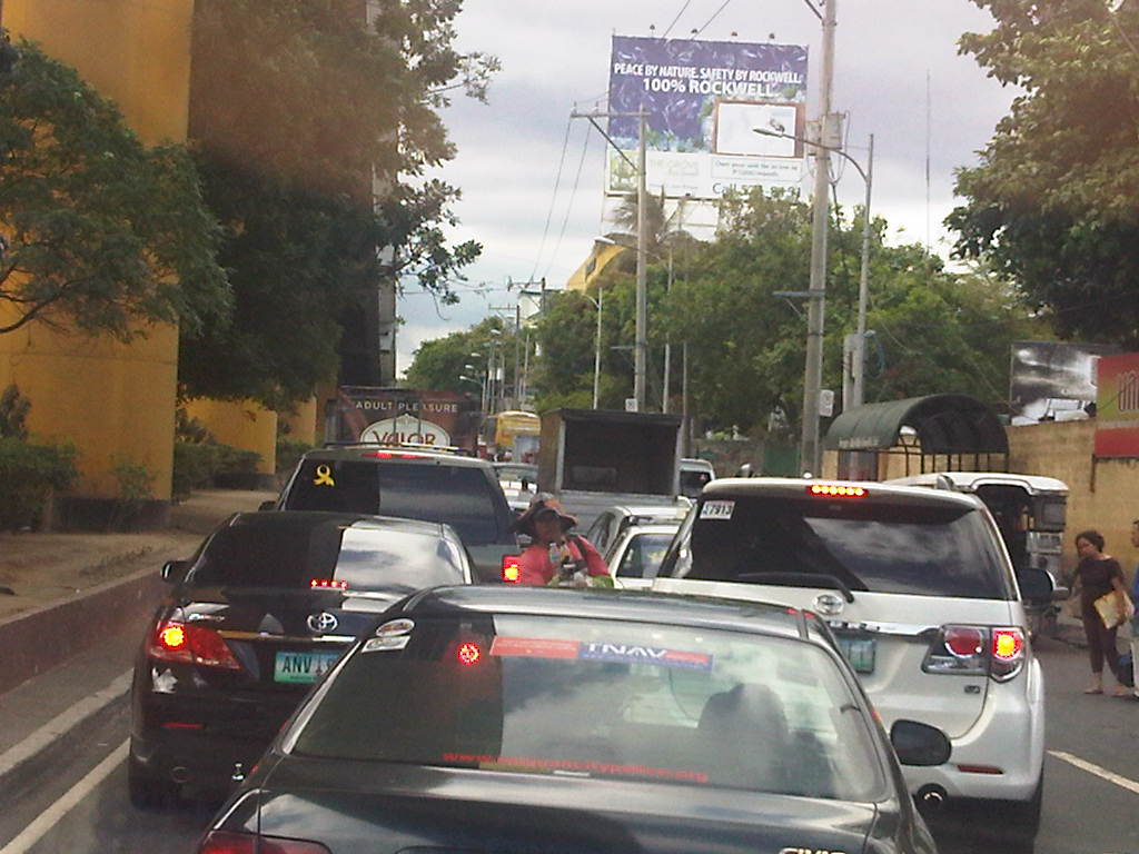 It took us some time to cover less than 400 meters from the EDSA-Ortigas intersection to the median opening to turn left into the DOTC driveway on the other side of Ortigas Ave.
 At this point, the three lanes from the intersection narrows to 2 lanes, necessitating some jostling for position among the vehicles.
 There are 3 median openings (one after the other) under the San Juan-bound overpass from EDSA-Ortigas. One slot is a U-turn slot for vehicles returning to EDSA-Ortigas, while the second is for vehicles turning back to LSGH or the Greenhills shopping district. Another opening is right after the second slot and is for vehicle turning left towards the DOTC main office.
Yes, that’s right – the DOTC main office is located in the area and LTO officers are regularly in the area due to meetings of their officials. It’s a wonder how these seem to be blind to the congestion on the ground. Perhaps the current Secretary should look into this as a test of his commitment to solving transport problems?
–
EVA and PCA stand on the ADB’s eTrike initiative
The Electric Vehicle Alliance (EVA) and the Partnership for Clean Air (PCA) wrote to the ADB regarding the proposed “reallocation of USD 110 million away from the original stipulation in the approved Country Investment Plan of the Philippines with respect to the Clean Technology Fund (CTF).” The amount will pay for the purchase of about 100,000 electric tricycles, with the intention of having these replace conventional ones currently operating in many Philippine cities and towns. Following is the letter from the EVA and PCA:
Warm greetings!We wish to inform you that the Electric Vehicle Alliance (EVA) represents a broad assembly of private sector organizations involved in vehicle manufacturing and assembly, fleet operations, battery solutions, electricity provision and after-sales servicing, academic institutions, government officials and civil society groups. EVA is spearheading the transition of the country towards a low emission transport regime, particularly through the sustained deployment of electric vehicles.We wish to inform you that, in principle, EVA supports the aims enunciated by the eTrikes proposal that your office is currently evaluating. We urge your office, however, to postpone decisions over the requested reallocation of USD110 million away from the original stipulaton in the approved Country Investment Plan of the Philippines with respect to the Clean Technology Fund.
We believe further deliberation is warranted in order to correct what may be flaws in the proposal as designed and which can help ensure the genuinely transformational utilization of the CTF.
Among many other reasons, the following deserves serious scrutiny:
1) Country ownership: As documents from the Philippine government will demonstrate, country ownership of the initiative is far from certain. We attach, as an example, a document from the Department of Energy expressly stipulating that this is largely an ADB-driven initiative, a fact that is the subject of public debate at present.
In addition, as the the lead agency that determines climate change policy and operational coherence with regard to Philippine mitigatory and adaptation measures, there has been no formal involvement of the Climate Change Commission in the crafting, much less finalization, of the said proposal. The eTrikes initiative remains under intensive discussion at the National Economic and Development Authority (the Philippine planning authority) as to whether or not it will be included in the Investments Coordination Committee of the country.
2) Lack of government consultations with the private sector, civil society and academe. The Department of Energy itself has stated that it has not undertaken formal consultations with stakeholders to the enterprise, particularly the transport sector and the banking sector. (Using subsidized credit from the CTF the eTrikes project may potentially crowd out commercial banks intent on opening lending windows for e-vehicle financing) and, particularly, the renewable energy industry from whose sector the USD110 million is going to be diverted. No member of the renewable energy industry, in fact, has been consulted over the reallocation of the funds.
3) Design flaws. Unless corrected – which is also the purpose behind the need for quality undertaking of consultations – huge gaps in the project design are likely to have an adverse impact on the long-term success of the transition to low carbon transport in the Philippines. For instance:
* No feasibility study has been presented to sectors that stand to gain from, or be adversely impacted by, the eTrikes proposal. We believe such a brief should actually be the basis for consultations that the Philippine government is obliged to undertake.
* The project unbundles the undertaking into four operational clusters that will be bidded out: motor and controller; battery supply; charging station and chassis/body. It is uncertain if there is a fifth cluster on after-sales service, specifically because is no bidding process for the assembly stage of the operations. This last point particularly invites sticky warranty and legal issues – if there is no aggregator of the different clusters of the project, the question is who will assume liabilities? We hope it is not the Philippine government.
Furthermore, haphazard unbundling may also involve questionable transactions down the road given the size of the undertaking. (A single firm that does not undergo bidding may end up assembling 100,000 E-Trikes that, as the project proponent states, will be given away to “beneficiaries”).
We can identify further concerns but suffice it to say, from the examples cited above, a postponement of decisions by the CTF board is warranted.
We would be pleased to share with you further details about issues that will arise if decisions are made with undue haste.
Thank you for your attention.
Signed,Mr. Rene Pineda Jr.President, Partnership for Clean Air, Inc. (PCA)Convenor, Electric Vehicle Alliance (EVA)EVA Members:
Danilo Villas – AMMEO; David Garcia – Atin ‘To; Michael Alunan – Atin ‘To; Atty. Glynda Bathan – CAI-Asia; Bert Fabian – CAI-Asia; Alvin Mejia – CAI-Asia; Dir. Gregorio Tangonan – COMSTE; John Sognco- COMSTE; Engr. Jean Rosete – EMB-DENR; Asec. Cora Davis – DENR; Manny Sabater – DENR; Dir. Zenaida Mendoza – DOE; Arnel Garcia – DOE; Lourdes Capricho – DOE; Dr. Manuel Biona- DLSU; Rey Esguerra – DOST; Cynthia Lazo – DOT; Engr. Terry Galvante Jr. – DOTC; Art Valdez – former DOTC Undersecretary; Yuri Sarmiento – e-jeepney; Sec. Bebet Gozun – Office of the Phil. President; Yvonne Castro – EVAP; Red Constantino – iCSC; Efren Cruz – FPAD; Engr. June Yasol – JAYAREC; Ma. Theresa Calo – Mandaluyong City Office; Rannie De leon – Mandaluyong City Office; Anthony Agoncillo – Meralco; Mack Dizon – Meralco; Melinda Derpo – Meralco; Frank Collantes – Meralco; Jufaleh Constable – Meralco; Annie Reodica – Meralco; Victor Baylosis – Meralco; Carlo Nombres – Meralco; Tessa Oliva – Miriam P.E.A.C.E.; Raquel Naciongayo – MMASBA; Arnold Sarmiento – Motolite; Rhene Borja – Motolite; Abelardo Mendoza – Motolite; Rommel Juan – MVPMAP; Bong Cruz – MVPMAP; Ferdie Raquelsantos – MD Juan Enterprises; John Marasigan – PhUV; John Lee – PhUV; Rene Pineda – PCA; Vicky Segovia – PCA; Aileen Tepace – PCA; Alberto Suansing – SOPI; Jose Regin Regidor – UP-NCTS; Atty. Gia Ibay – WWF; Denise Galvez – WWF; Vince Perez – WWF; Lory Tan – WWF; Elsie de Veyra – ZWRMP
The statement is a clear expression of the stand taken by stakeholders in the e-trike saga. It is also clear that many if not most stakeholders have not been consulted in the rush towards the deployment of 100,000 electric tricycles. While the ADB and the DOE may have meant well in pushing for electric tricycles to replace the conventional ones, railroading e-trikes will cost the fledgling local industries a lot considering the possibility that the electric vehicles will all be imported from China. It should be noted, however, that there has really been little or no success at this stage since the e-trikes that have been donated have only added to the current fleets comprising of legitimate and colorum tricycles. Perhaps in the haste or excitement associated with the potential positive impacts of e-trikes (e.g., low emission transport) on the environment, the bigger picture concerning issues on public transport in Philippine cities and towns has been disregarded. But then this might be understandable since the approach appears to be still mostly from the energy perspective rather than transport’s. It should be emphasized again that the DOTC, as the lead transport agency with a mandate to draw up policy concerning transport in the country, should be active in the discussions and present a clear road map for what transport should be in terms of hierarchy and taking into consideration the relationship between demand and supply. Then perhaps the direction we are taking in relation to low emission transport such as electric vehicles will be a clearer and, not to mention, a straighter one.
–
Weekday EDSA
I chanced upon an uncongested EDSA one day during noontime along the northbound direction. I was traveling from the airport and saw that my usual route along C5 was very congested. I decided to take EDSA instead considering it was noontime and there would probably be less vehicles along the highway during that time of day. I was right and the following photos speak for themselves in as far as describing traffic between 12:00 NN and 1:00 PM.
 Section past Orense Street and the MMDA headquarters
 Section approaching Guadalupe
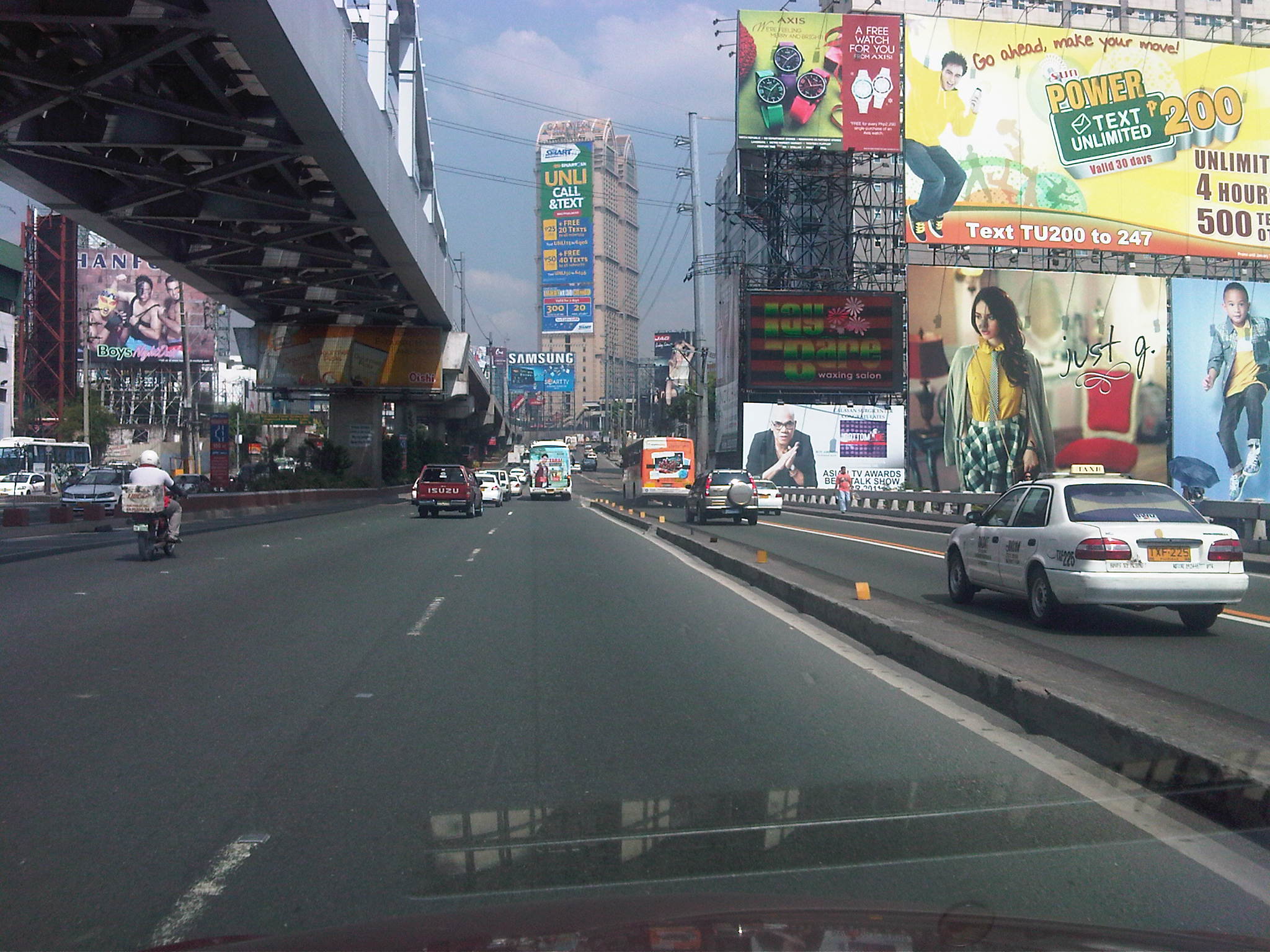 Guadalupe Bridge, crossing the Pasig River, the MRT 3 runs along the steel bridge above
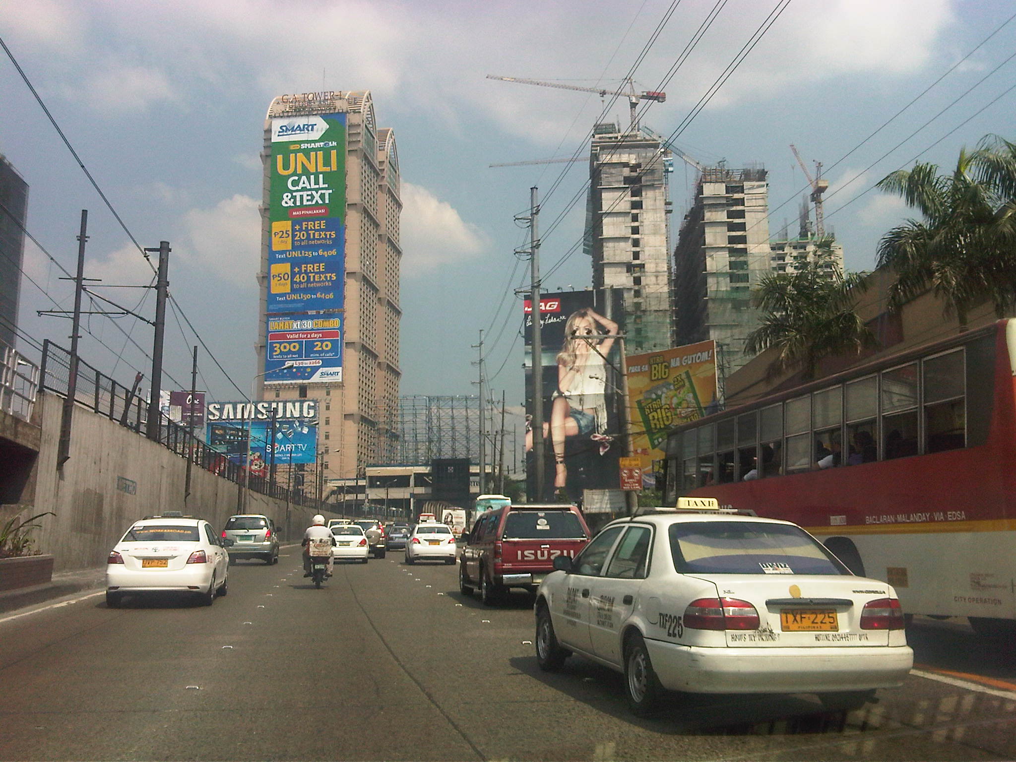 Approaching A. Bonifacio/Renaissance, in the background is the G.A. Tower, the Boni MRT Station and condos under construction including SMDC’s Jazz
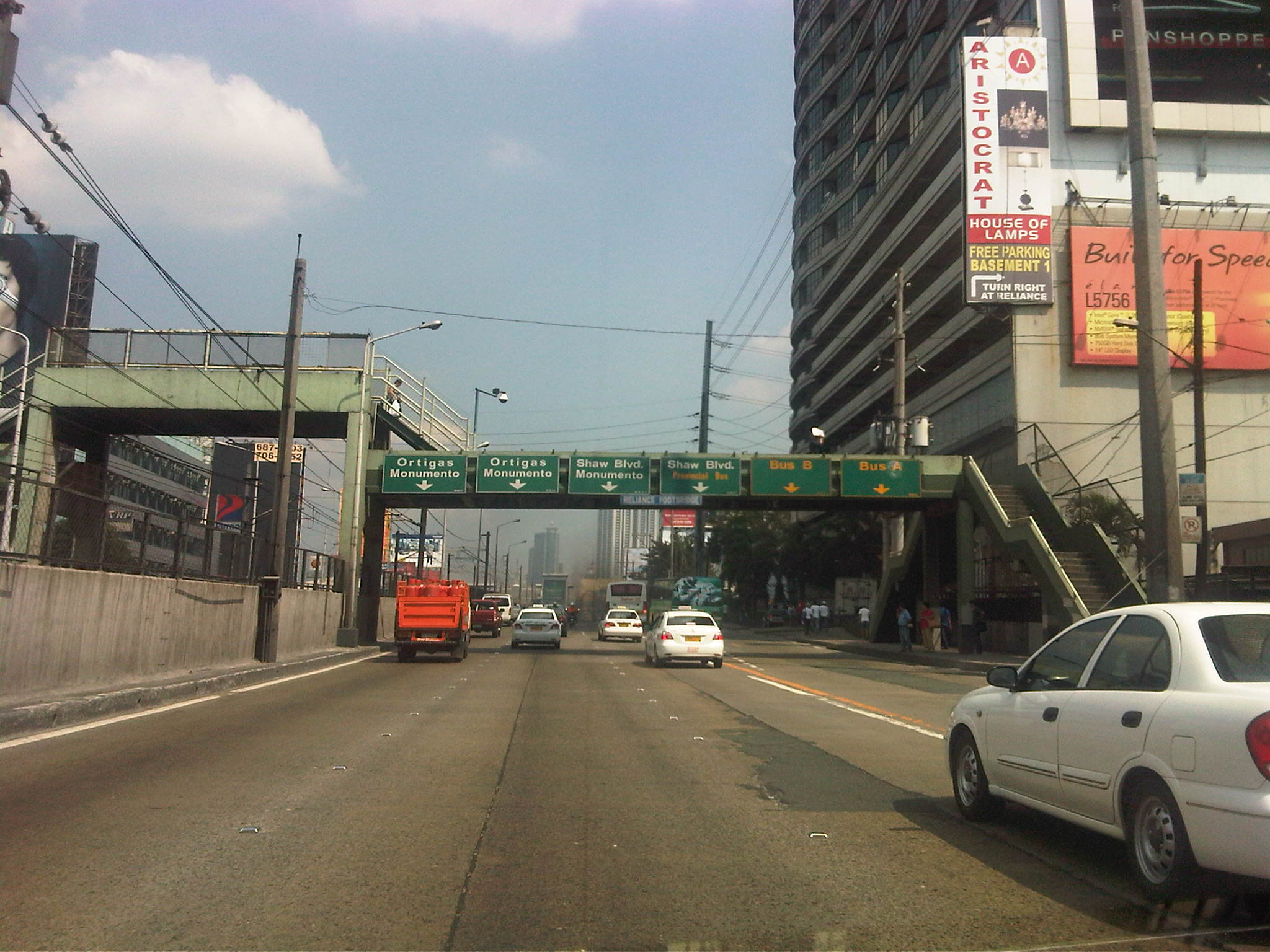 Section across the Renaissance Tower where many FM radio stations are based
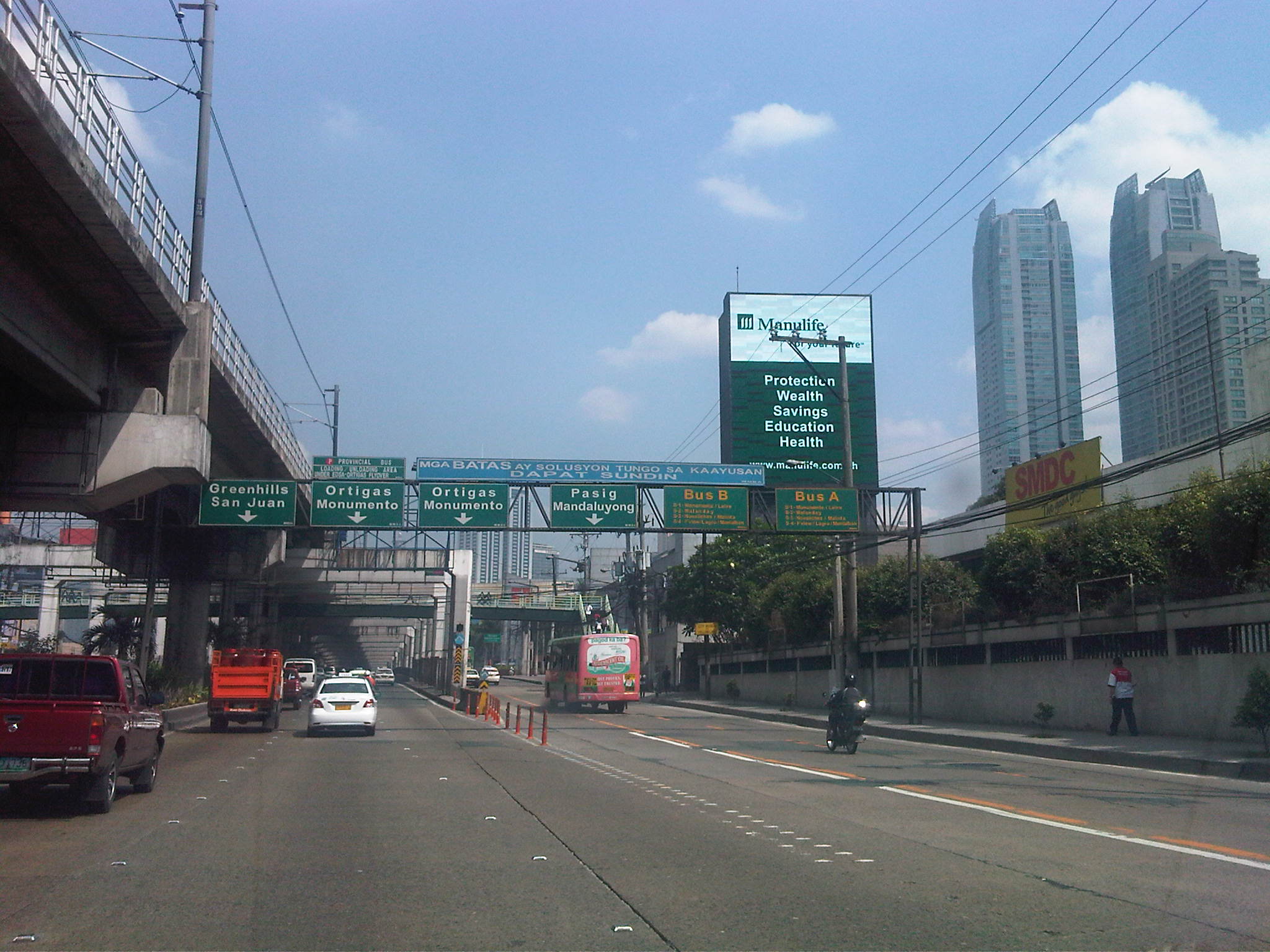 Section past Robinsons Cybergate Mall
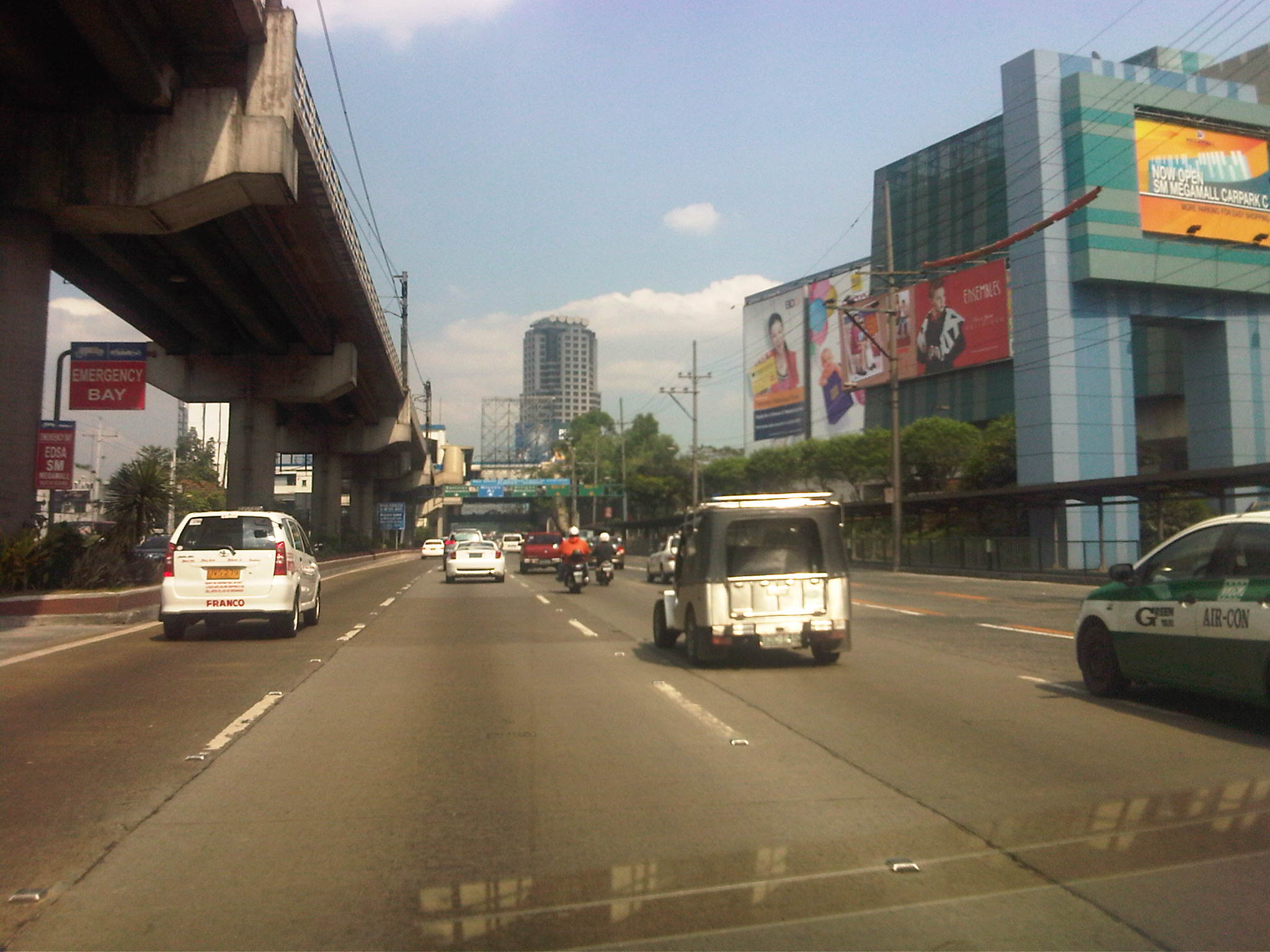 Section across the SM Megamall and approaching the ADB
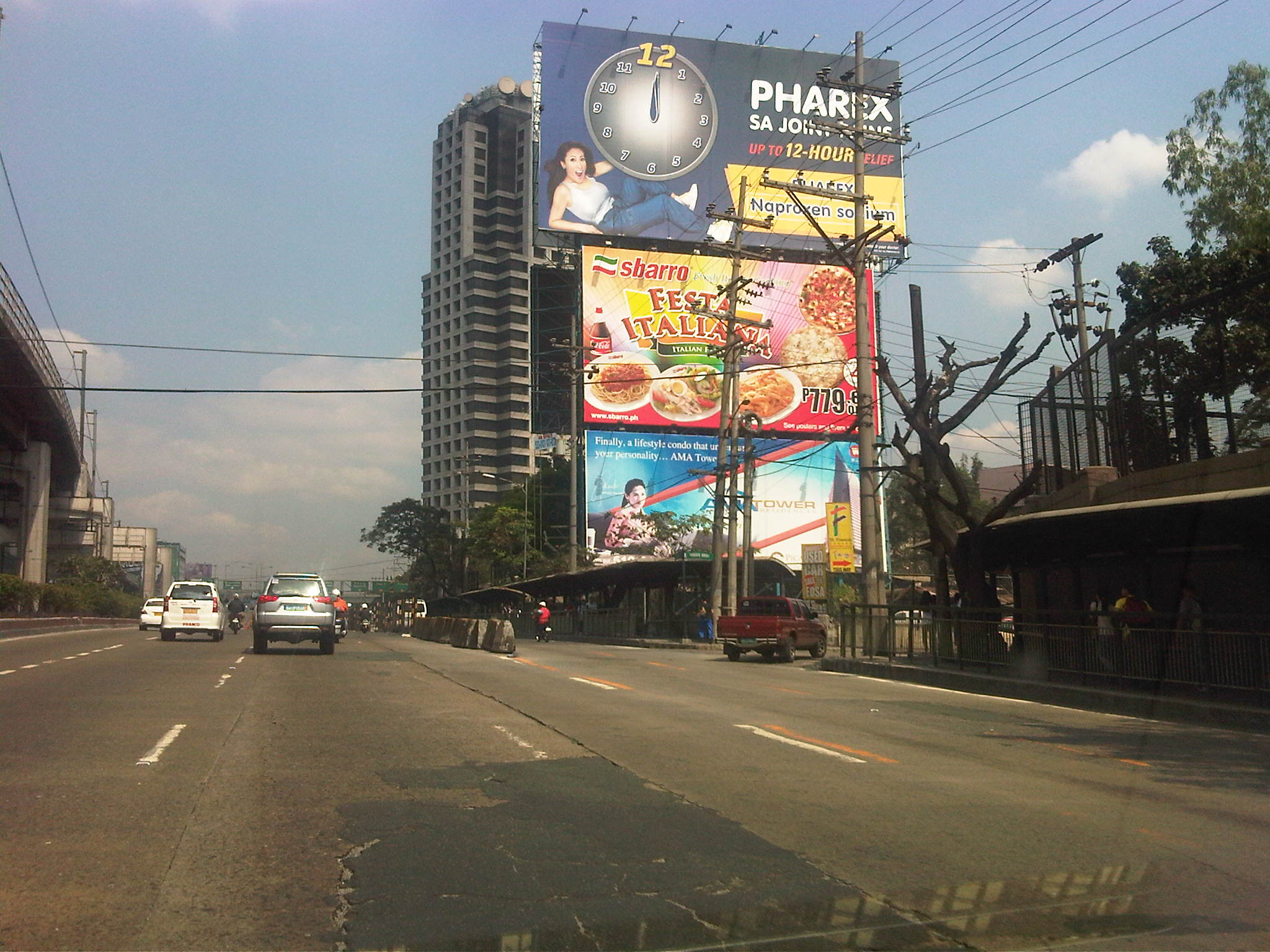 Section across the ADB and approaching Ortigas Ave. One of Galleria’s buildings is seen behind the giant billboards. The MRT
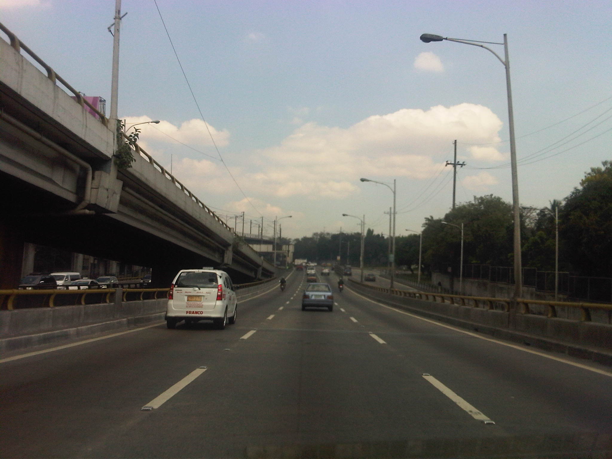 Section descending the Ortigas Flyover and across from Corinthian Gardens
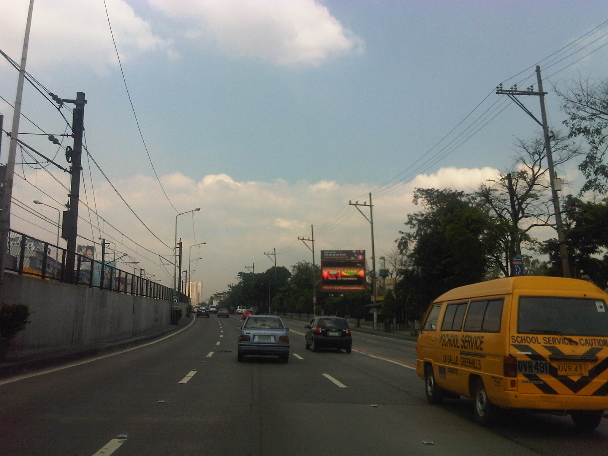 Section across Camp Aguinaldo (between the Aguinaldo and Crame) and approaching the Camp’s EDSA gate
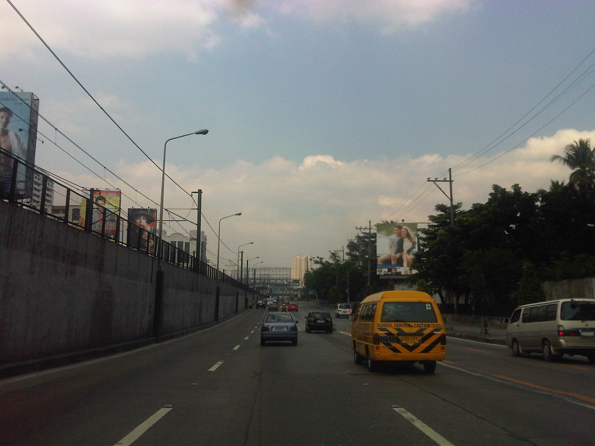 Section approaching Boni Serrano Avenue
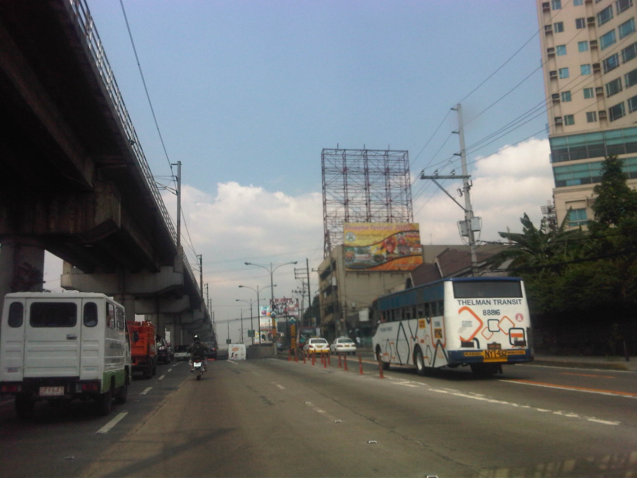 Section approaching the EDSA underpass crossing P. Tuazon and approaching the Cubao commercial center
 Section past the Cubao commercial center and across from several provincial bus terminals lined up along EDSA northbound
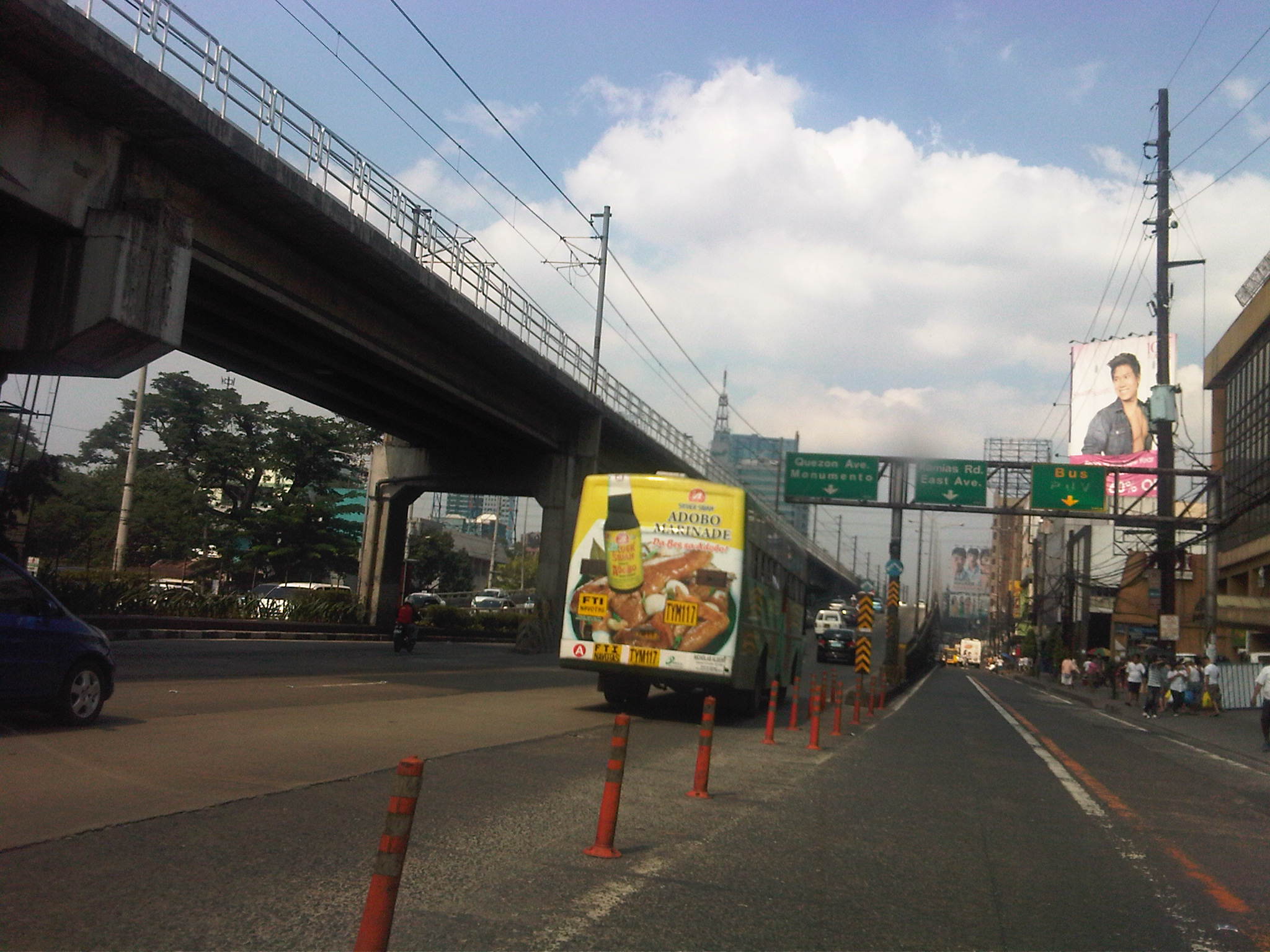 Section approaching Kamias – taking the flyover means I won’t be able to turn towards East Avenue so we shifted towards the outer lanes
Now, if only EDSA and the other main arteries of Metro Manila could be like this more frequently…
–

