
Dominant trips during the day
I read this post on social media stating:
“The work commute is statistically the longest and least frequent type of journey we make in a day. Yet it dominates transport planning.Now more than ever, cities must build cycle networks to support recurring local trips: to the corner store, café, community center, or school.”
I am not sure about the context of the word “dominate” as it is used in the statement but this originates from the Dutch so perhaps there is a difference, even slight, between their case and ours. I would like to add though that aside from “going home” trips, the most dominant in the Philippine context are “to work” and “to school”. And dominant here covers frequency and distance traveled. Consequential are travel times as these are affected by the quantity and quality of facilities and services available to commuters.
I think there should also be restructuring of how surveys are conducted to capture these more frequent trips. Typical surveys like JICA’s usually ask only about the main trips during the day so those will have responses of “to work”, “to school” or “to home”. For the metro level, maybe that’s okay but at the local levels, LGUs would have to make their own surveys in order for data to support initiatives for local transport, most especially active transport. A possible starting point would be the trip chains collected that appear to be a single trips with “original origins” and “final destinations”. These can be separated or disaggregated into individual trips made by different modes rather than be defined or associated with a single (main) mode of transport. That surely would expand the data set and redefine the mode shares usually reported.
–
A bigger picture for the ‘new normal’
Here’s something different thought not totally unrelated to transportation. The article is about the emergence of super typhoons and their aftermaths:
Niiler, E. (November 4, 2020) What Is a Super Typhoon, and Why Are They So Dangerous? Wired. https://www.wired.com/story/what-is-a-super-typhoon-and-why-are-they-so-dangerous/?bxid=5bd6761b3f92a41245dde413&cndid=37243643&esrc=AUTO_OTHER&mbid=CRMWIR092120&source=EDT_WIR_NEWSLETTER_0_DAILY_ZZ&utm_brand=wired&utm_campaign=aud-dev&utm_mailing=WIR_Daily_110420&utm_medium=email&utm_source=nl&utm_term=list2_p2
With the typical influx of typhoons (i.e., during the wet season there are months that can be referred to as ‘typhoon season’) and the prospects of super typhoons becoming more regular, there is now a need to review infrastructure, building guidelines and standards for cities and municipalities to become more resilient vs. these phenomena. Not long ago, disaster resilience became part of the agenda for infrastructure development; including maintenance and retrofitting vs. the anticipated calamities from typhoons, earthquakes and volcanic eruption that are experienced in many parts of the country. Perhaps the transportation system can be structured to be more disaster-resistant. And, if these phenomena happen, the transportation system can survive and serve for relief operations.
–
New WHO publication on transport in the context of COVID-19
I’m just sharing the new publication from the United Nations (UN) World Health Organization (WHO) – Supporting healthy urban transport and mobility in the context of COVID-19:
https://www.who.int/publications/i/item/9789240012554
The brief document contains recommendations for travelers and transport service providers. It is a compact, concise reference for everyone as we continue to deal with the impacts of COVID-19.
What if Rizal today was the same province it was back in the day?
I write this as a super typhoon is bearing down on us this 1st of November. I found this map on the internet without attribution to the original source. It shows a still-born Metro Manila with only four local government units: Manila, Quezon City, Pasay City and San Juan.
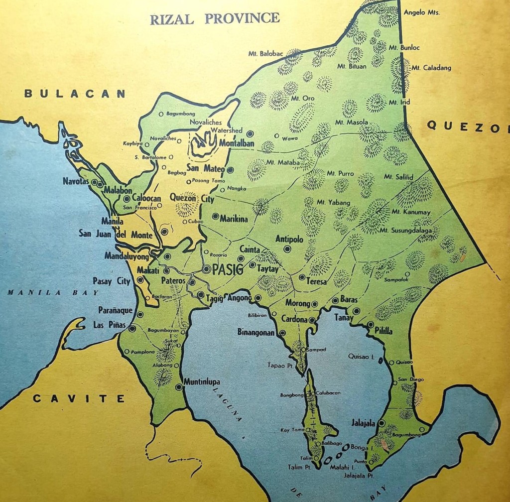
What if instead of the Metro Manila we have now, Rizal retained the towns (that eventually became cities) that were transferred to what became the National Capital Region (NCR)? These are Navotas, Malabon, Caloocan, Marikina, Pasig, Pateros, Mandaluyong, Makati, Taguig, Paranaque, Las Pinas and Muntinlupa. Valenzuela was taken from Bulacan Province. Pasig was the capital of the province (Yes, that’s why there is Capitolyo and the Rizal Provincial Capitol used to be in Pasig where you now have Capitol Commons. Surely, the political landscape could have been different though one could argue that certain families would have still held sway in cities/towns where they have their routes. Imagine, the governorship of the province would have been a coveted post but not by the the current holders but likely by personalities from the more progressive and densely populated cities. Governance would have been different, too, as Rizal would have both highly urbanized and rural areas. Perhaps certain undesirable politicians could not have emerged due to the dynamics of a province with highly urbanized cities? What’s your take on this “what if”?
–
On making jaywalking legal
Road safety experts and advocates have been calling for more people-friendly streets through design, policy and awareness initiatives embodied in what are usually referred to as 3 E’s – engineering, eduction and enforcement. Among the more contentious issues of road safety is jaywalking, which is defined as a pedestrian walking into or crossing a road while there are designated places or facilities for doing so. Jaywalking is a crime in most cities though enforcement can be lax in many. But while most technical and non-technical advocates of road safety agree that a more people-friendly or people-oriented environment along roads can be attained by decriminalizing jaywalking, the resistance to such a proposal mainly comes from the government and enforcement agencies. It is a bit surprising because even with studies and best practices showing better designs and policies coupled with IECs, the notion of pedestrians crossing the roads anywhere while not castigating motorists deliberately running down or swiping at the pedestrians seem unfathomable or difficult to understand for many administrators or enforcers.
Here is a nice article that argues for decriminalizing jaywalking:
Schmitt, A. and Brown, C.T. (October 16, 2020) “9 Reasons to Eliminate Jaywalking Laws Now,” Bloomberg CityLab, https://www.bloomberg.com/news/articles/2020-10-16/jaywalking-laws-don-t-make-streets-safer.
Of course, there’s another angle or perspective there in the article since it was written from the context of the current situation in the US. All the reasons, however, are valid and should be taken up seriously in a country like the Philippines where there is also a push for more people-friendly transportation that includes our roads and all its users.
–
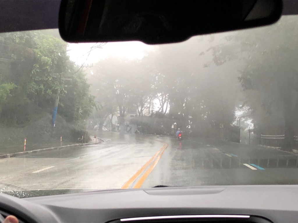
Rainy days ahead
It’s that time of year again when it rains a lot. This year’s typhoon season has moved again to the latter part (last quarter) of the year. It used to be that we had typhoons lining up as early as June with the peak arrivals around August to September. This year, the bunch of them seem to be arriving in October and probably Novembers. These are the ones that usually cross the main island of Luzon through the Bicol Region. Typhoons in November tend to cross the Visayan Islands (central Philippines). Meanwhile, in December they tend to go through the southern island of Mindanao. The rains usually make roads slippery and risky to many travelers especially if the driver or rider choose to be reckless or less cautious. Floods cause congestion and wreak havoc to commuters who might get stranded due to the stoppage of traffic and transport services when roads are impassable to vehicles.
 Model storm tracks for the Western Pacific from the National Oceanic and Atmospheric Administration (NOAA) of the US.
The model storm tracks suggest a number of typhoons may be forming in the Pacific Ocean and cross the Philippines from this week onwards. Of course, these are still just models that are generated from the data obtained from various sources using tools such as weather satellites and on-the-ground weather stations. Many of these typhoons might never materialize. One thing positive for sure is that these occurrences will bring more water and recharge depleted reservoirs to get us through the next dry season.
–
Research topics in the time of Covid-19, Part 1
It’s that time of year again when I usually write about research topics. I am tempted to share the updated research agenda our group prepared for our students at UP but perhaps a quick list would do for now. I guess the most relevant topics are those related to the Covid-19 pandemic including those about transport during the lockdown and post-ECQ. Here are some initial ideas about such relevant topics to take on:
- Public transport supply and demand, operations – there are many topics that can be developed under this including those relating supply and demand. For example, it would be interesting to have a research assessing the supply of public transport modes with respect to the demand from the lockdown (ECQ to MECQ) to its easing (GCQ to MGCQ). Included here would be topics tackling the attempts at rationalizing transport routes (e.g., the introduction of bus services where there was none before, the continuing restriction for conventional/traditional jeepneys, etc.). For those into transport economics and finance and even policy, perhaps the service contracting scheme can be studied further and its different aspects meticulously and objectively examined. What are its limitations? What are the critical assumptions that need to be realized for it to be most effective and not abused or mismanaged?
- Traffic engineering and management – there were suddenly many issues pertaining to this during the lockdowns. Among these were traffic management in the vicinity of checkpoints where queuing theory among other principles could have been applied in order to reduce congestion.
- Active transportation – the DPWH already came out with guidelines for bike lanes along national roads. These will surely be used as reference by local government units (LGU) as they are obliged by a DILG memo to develop facilities for active transportation. Active transport here refers mainly to walking and cycling but in other cases have come to include the use of personal mobility devices (PMD). Much research is to be done for designs, users’ preferences, behavior in traffic, safety and other topics such as those relating active transport with public transport (e.g., as a last mile/kilometer mode for most people).
- Level of service (LOS) – I had a nice, brief exchange about LOS and the notion that it is outdated. I believe it is not and many who parrot the notion lacks a deeper understanding not just of LOS but the principles, assumptions and data that goes into transportation and traffic analysis. Perhaps a multi-modal LOS criteria can be developed for the Philippines? If so, what parameters or measures can be used to describe our own LOS? What modes and facilities will be evaluated according to this? And how can solutions be developed with respect to such.
Of course, there are just so many of the traditional topics to take on. There will always be a backlog regarding these topics. In the sequel to this article, I will try to identify other topics for transportation research that can be considered as well as recall “old” topics that are still necessary regardless of the pandemic.
–
Pedestrians first!
The Institute for Transportation & Development Policy (ITDP) released a new tool for assessing walkability and presents good practice examples from many cities around the world. The tool can be used to assess and/or compare your city, a neighborhood or a street with others. Here is the link to the ITDP’s tool:
https://pedestriansfirst.itdp.org

There is an introductory article that came out recently from Planetizen about this tool:
Litman, T. (October 16, 2020) ‘Pedestrians First’ Measures Walkability for Babies, Toddlers, Caregivers, Everyone. Planetizen. https://www.planetizen.com/node/110876?utm_source=newswire&utm_medium=email&utm_campaign=news-10192020&mc_cid=1736ec624f&mc_eid=9ccfe464b1
–
On personal mobility devices (PMD)
Personal mobility devices (PMD) are in the news now as the Land Transportation Office (LTO) issued a statement calling for their users to be required to get a license. Apparently, the agency is interpreting the law for people operating motor vehicles as something that extends to users of all powered vehicles. This may be an example of the law not being apt or suitable for the times and not considering the specifications or operating characteristics of these vehicles. Thus, this issue emphasizes the need to update policies and regulations and perhaps re-formulate them to be less car-oriented or biased vs. active transport as well as this emergence of PMDs as another mode choice for travelers.
I took the following photos while conversing with one of the project research staff at our center who uses an electric PMD for his commute between UP and his home in the Cubao district. He related that he alternates between this and his motorcycle. When asked if he felt safe using the PMD, he said it was the same as when he rides a motorcycle as he also wears a helmet and protective pads when using the PMD.

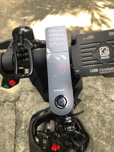

I’ve seen a few PMD users along my commute and for most I thought they practiced safe riding. There were some though who seem to fancy themselves as stunt riders. These are the ones who endanger not only themselves but other road users with their reckless behavior on the roads. They are not different from other so-called “kamote” drivers or riders (with all due respect to the kamote or sweet potato). Like any road user, these should also be apprehended and penalized for unsafe behavior that endangers others.
–
On the safety of transit use during the pandemic
Here is another quick share of an article that reports on a study showing that there is no direct correlation between COVID-19 and public transportation use:
editor@aashto.org (October 2, 2020) Study: No Direct Correlation Between COVID-19, Transit System Use. AASHTO Journal. https://aashtojournal.org/2020/10/02/study-no-direct-correlation-between-covid-19-transit-system-use/
Such articles and the study (there is a link in the article for the report) support the notion that public transportation can be made safe for use by commuters during the pandemic. The report is a compilation of best practices around the world that can be replicated here, for example, in order to assure the riding public that public transport (can be) is safe. Needless to say, car use is still less preferred and other findings have also supported active transport whenever applicable. This reference is both relevant and timely given the new pronouncement (or was it a proposal?) from the Philippines’ Department of Transportation (DOTr) to implement what they termed as “one seat apart” seating in public utility vehicles in order to increase the capacity of public transport in the country. The department has limited the number of road public transport vehicles and the current physical distancing requirements have reduced vehicle capacities to 20-30% of their seating capacities. It is worse for rail transit as designated spaces/seats in trains translated to capacities less than 10% of pre-lockdown numbers.
–
